I did a solo section hike on the Pacific Crest Trail, beginning at Mount Laguna and ending at the Boulder Oaks Campground near the I-8 freeway, hiking nineteen miles and several thousand feet down the mountain. I had done this same hike once before, twenty years earlier, and the photos I took were on film. The prints can be found in a box in my home, I’m sure, but getting them onto this website was looking unlikely. I’d have to find them first! Luckily, I had a multi-day hike planned up in the Sierra the next week, so I decided that it would be easier (and more fun) to re-do this section as a training hike. If I survived nineteen miles today, I would be fine on the long trip, I figured.
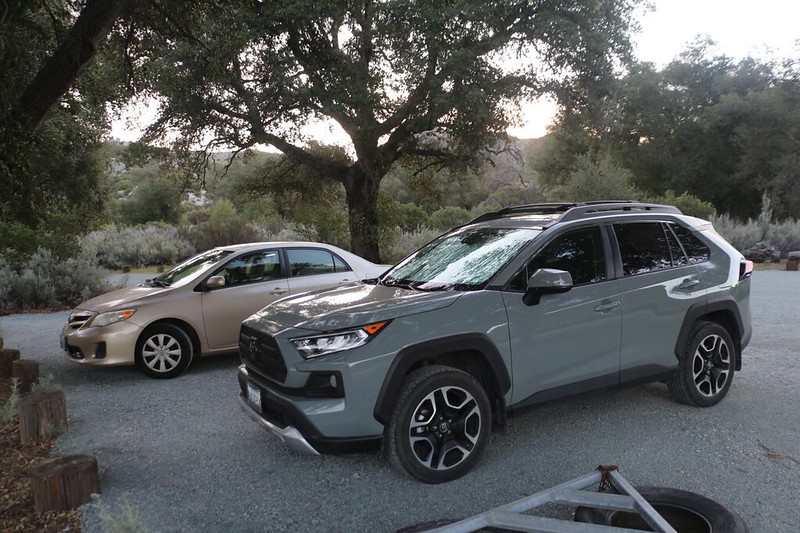
I made my plans and conscripted Vicki into helping me with a car shuttle. The trailhead was less than an hour from our home in San Diego, so the two of us drove out to the terminus, where I left my car, and then she drove me up to the top of the mountain and dropped me off. I would do this section southbound, partly because I would meet more newly-started PCT Thru-hikers (all heading north) but also because it was mostly downhill! An easy hike, but very long.
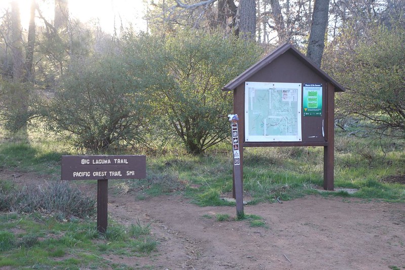
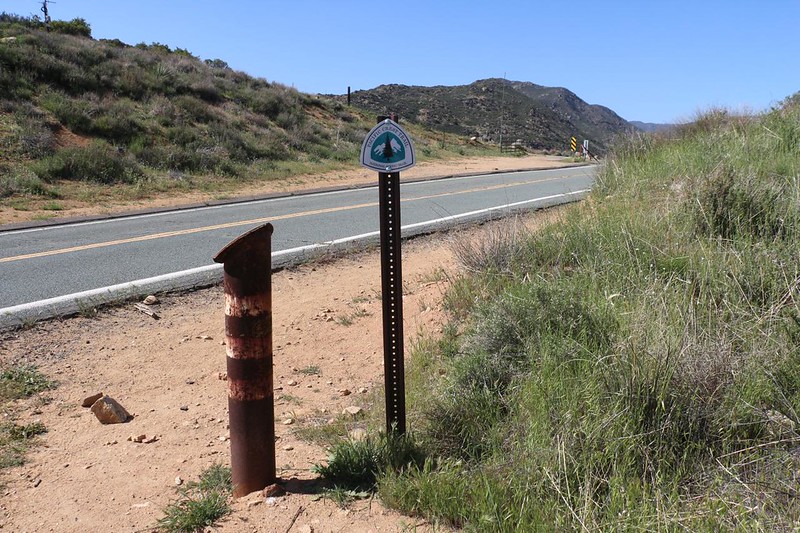
I waved goodbye to Vicki and started hiking on the Big Laguna Trail. This trail led from Highway S-1 toward Monument Peak and the Pacific Crest Trail. Vicki and I had already hiked to the peak back in 2011 from further north, so, after a fast half mile of hiking, I simply turned right at the PCT junction.
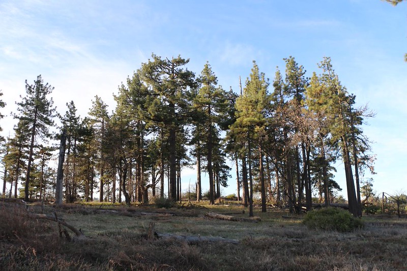
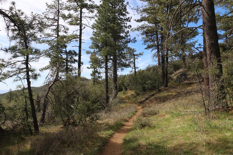
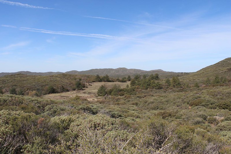
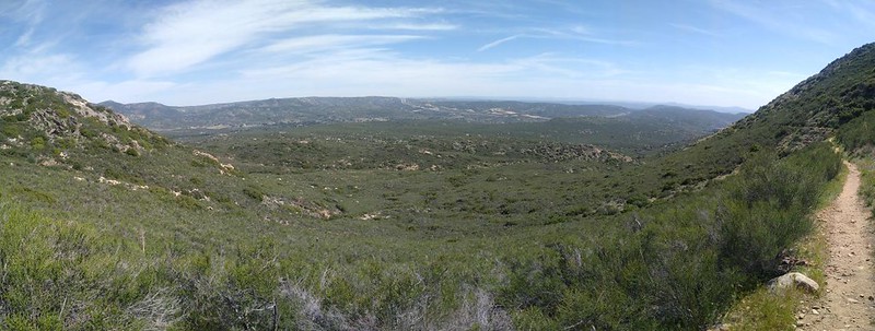
The next six miles of trail stayed fairly level, at roughly 6000 feet elevation, and meandered through a pleasant pine forest. This area hadn’t burned back in 2003 when the Cedar Fire tore through much of the San Diego mountains. That area would be experienced by the northbound hikers soon enough. Even after twenty years, it had yet to recover.
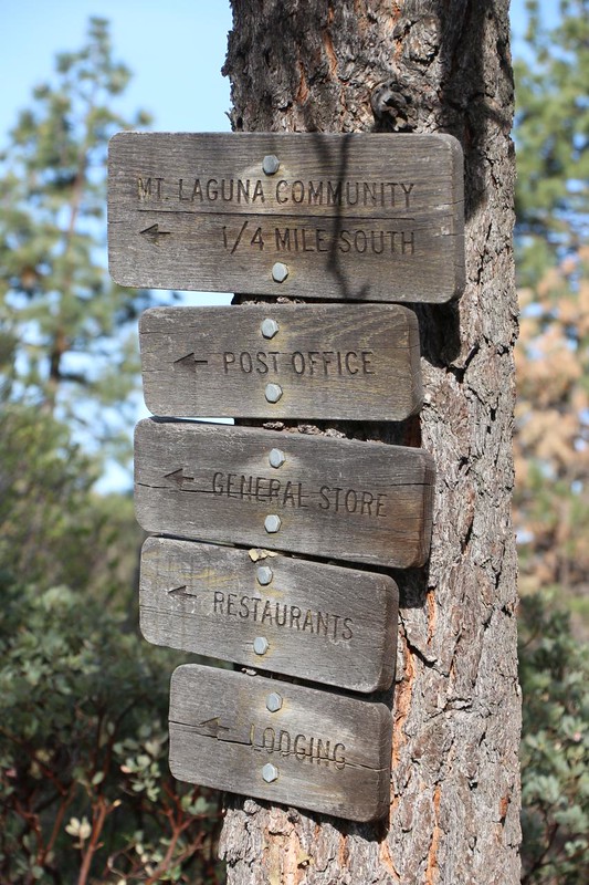
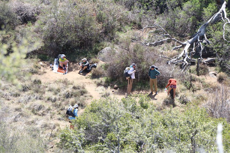
As I walked, I met quite a few Thru-Hikers along the way. Some of them wanted to head into the town of Mount Laguna. There was a post office and a general store. This was only PCT Mile 45, so if the hikers needed anything this soon, it was probably due to improper preparation. But the weather can also change the gear you need. A post office can solve many difficulties, provided you have folks at home to help you.

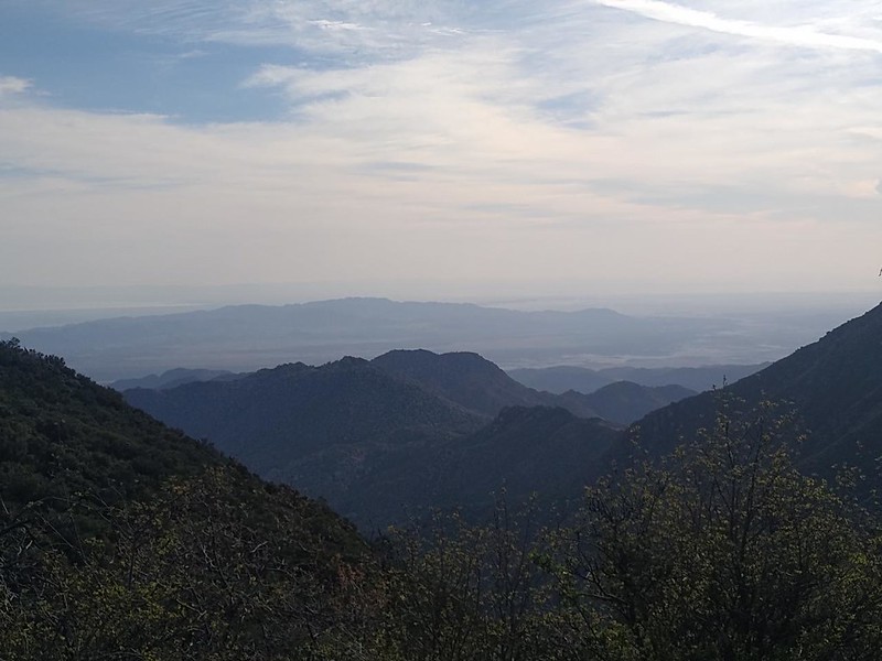
The trail merged with the “Desert View Trail” which looped in from the highway. It passed near Stephenson Peak, where there were excellent views to the east over the Anza-Borrego Desert. It was a bit hazy that morning, or else the Salton Sea would have been visible in the distance. I hiked on, and came upon the fabled Laguna Water Fountain, which had so much pressure that it shot water ten feet into the air. I’m glad I didn’t stick my face over it before testing! This was near the Burnt Rancheria Campground, which many hikers and families frequent.

GoPro video of the water fountain spraying ridiculously high

When driving on the highway, I had always seen a hand-painted sign pointing to “Thing Valley Road” and on this hike I finally got to look down into that mysterious valley. No, I didn’t see the “Thing” and I’m not entirely sure that I want to. But what is it, anyhow? I may never find out, as a quick Google search yielded nothing interesting, Thing-Wise.
A short time after that, the Desert View Trail peeled off, headed for Mount Laguna. I took a boot-off break at the intersection, and cooled my sweaty feet. I met several Thru-hikers there, and most of them made their way toward town. Others planned to visit the town of Julian, instead, but that was another day or so further north. I wished them well, and told them all to take care of their feet. Like I was doing, of course.
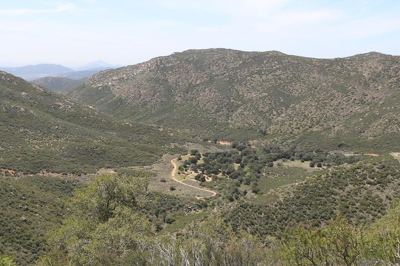
After that, the trail emerged from the forest and I got a good look south and west over the chaparral and rolling land. Horse Meadow and the Morris Ranch were showing on my GPS map. At this point, I still had phone signal (there must have been a cell tower in Mount Laguna) and I sent off a text to Vicki telling her that all was well. After this, I expected to be out of range for many miles, until I neared the freeway.

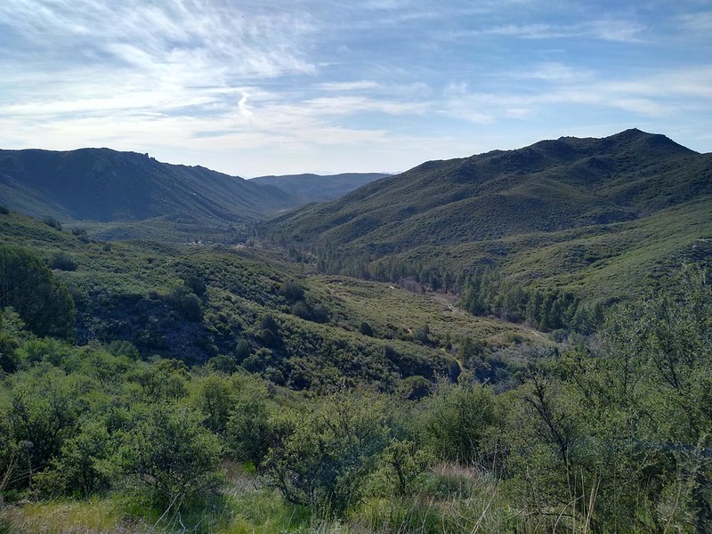
The trail dropped down into Long Canyon, which still had water flowing, even in this dry year of 2022. I met with a whole bunch of NOBO (northbound) hikers hanging out there. They were climbing, so they took longer breaks than I did. And drank more water, too. I was carrying over three liters (plus a can of soda for lunch!), so I didn’t expect to be filtering any along the way.

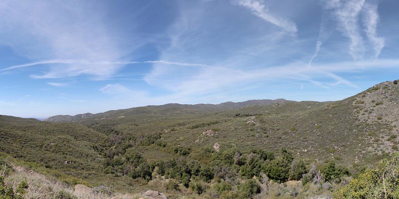
As usual, the PCT doesn’t like to stay in one spot for long. It ascended, crossed a ridge, and headed back down into Fred Canyon. I took a another boot-off break down there under a shady oak, with a steady breeze to dry my socks. Checking the GPS, it looked as if I was about halfway done with my hike. Good time for a long break! I even ate some lunch and drank my soda. I wasn’t tired yet, but I knew that I had a long way yet to go that day.

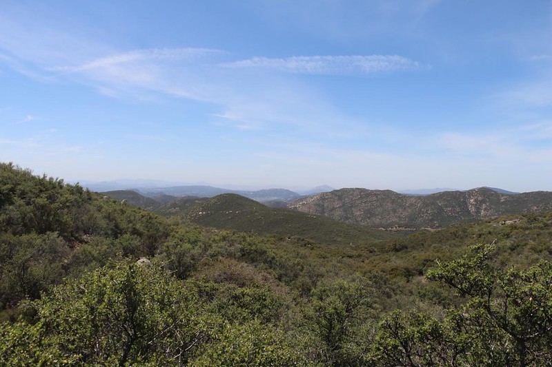
The trail climbed up again, or maybe it was the canyon that went down, but pretty soon I had views all the way south to Mexico. I even saw Lake Morena in the far distance. The trail went directly next to that lake, too, as Vicki and I discovered back in 2017, when we backpacked in and stayed overnight in the campground there. Good times. Thank Heavens I wasn’t hiking all that way today!

After another few miles of hiking through the chaparral, I gradually drew near to Kitchen Creek Road, which headed north toward the higher mountains. I crested a final ridge, and down below me was the Cibbets Flat Campground, just off the road. When I had hiked here twenty years ago, we camped in that campground the first day, then hiked onward to the freeway on the second day. But I was going to do it all in one shot, whether my hot feet liked it or not. I noticed that the trail stayed near the ridgeline, with Kitchen Creek on the right, and Fred Canyon on the left. The trail looked like it was staying on the Fred-ward side, for now.

When I arrived at the saddle between the canyons, there was a family camped there in a big truck with a shade awning. I realized right away that these folks must be PCT Trail Angels, here to distribute “Trail Magic” to the new Thru-Hikers! I stopped and said hello, and met a couple of hikers, plus the family of Angels. Everybody was having a great time. They handed me a light beer and some corn chips, and I happily sat down for an enjoyable break, with good conversation. These folks had hiked a lot of the trail themselves, and they knew that, at PCT Mile 32, these tenderfoot hikers really could use a boost in spirits. It takes time to to get accustomed to Trail Life, and a bit of positive reinforcement can go a long, long way.

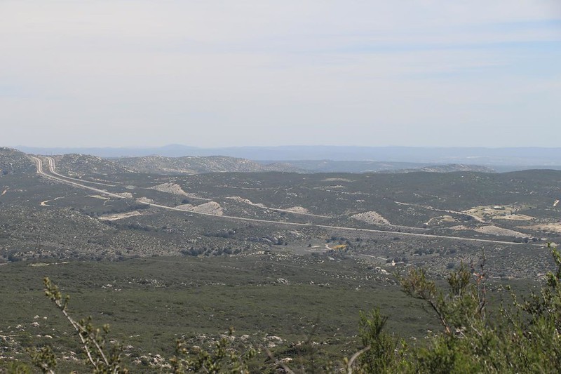
I still had about seven miles left to hike, so I couldn’t sit around all afternoon drinking beer. I thanked the Angels and continued onward. The trail stayed high up on the side of Fred Canyon, and yielded fine views of Interstate 8 heading off into the east. I checked my phone and I had signal again, so I sent a text back home. Then I kept on hiking, taking photos and enjoying a beautiful Spring day in Southern California.

The trail headed south around the ridge, and eventually doubled back to cross Kitchen Creek Road. This time the trail headed directly into the valley where Kitchen Creek was flowing. I saw it down below, and the flow was slow. But it was water, and there were people enjoying it, filtering it, drinking it, and cooling off in it. As it should be.

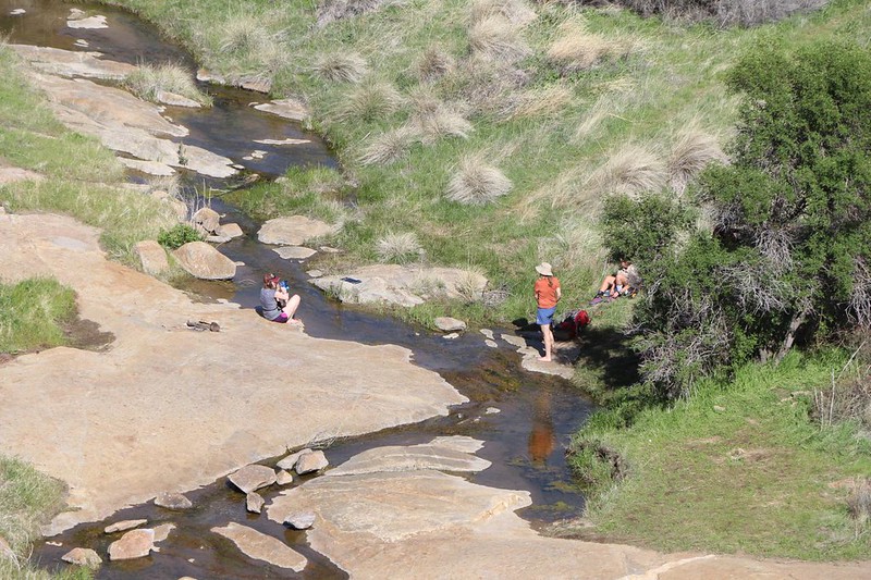
I didn’t stop for any of that. I still had miles to hike, and the afternoon was getting on. So I continued down the trail, which stayed high above the creek. I had a strong feeling that some of the hikers I saw down by the water were planning on camping nearby, and I didn’t blame them one bit. Why rush? The PCT was the trek of a lifetime, and enjoying nature’s beauty was a large part of why they were here. I felt the same way, except I was hungry and wanted to get home to dinner that night.


The trail came out above the canyon and the creek disappeared into a cleft in the rock. I saw the freeway down below me, and Cottonwood Meadow across the way. I saw the overpass where both the creek and the trail went under the road, but it was still another very long mile away. I decided to take one last break up there to rest my feet and take in the view. There was a mellow breeze blowing, and the sun felt good. I took off my shoes to air things out and checked my left heel for blisters. I’d been feeling a “hot spot” for the last half mile or so. I didn’t see a blister, but I had a feeling that I’d have one tomorrow. Oh well. I hoped it would make a good callous by next week, when I began my multi-day trek. Then I wouldn’t have to worry at all.

I put my shoes back on and donned my backpack. This was the last huzzah of the hike. It didn’t take very long before I was hiking underneath the high overpass, with Kitchen Creek somewhere nearby in the trees. It wasn’t flowing strong, I knew, but I never could have heard it over the sound of all that traffic up above.

The trail popped out on Old Highway 80, the original east-west road out of San Diego, back in the pre-freeway era. It was one of those solid cement two-lane highways that were built to last. The trail followed along on the shoulder, and after a half mile or so I arrived at the Boulder Oaks Campground. My car was sitting there in the shade of some big old oaks, and it was a welcome sight.

Nineteen miles was a long walk for me, especially considering the lack of hiking I’d been doing all Winter. But I survived. My feet and legs were tired, and I was probably a bit dehydrated, but I could cure that. I popped open a can of soda I’d left in the car, and munched from a bag of salty chips. Ahhh! This is the good life. Now all I had to do was get back home and finish packing for the next adventure. I had a whole season of hikes planned, and it was time to get cracking.
The rest of the trip’s photos and videos can be found on my Flickr Page.
For an interactive topographic map of our hike, including GPS Tracks, please see my CalTopo Page.
