On this fourth and final day of my solo trek, southbound on the Pacific Crest Trail from Kennedy Meadows, I hiked within the Owens Peak Wilderness, from Joshua Tree Spring to Walker Pass, where I met my wife on the trail; she had come to pick me up and was dressed in her Easter Sunday finery.
The day after a storm is almost always cold, and that morning was no exception. I kept my legs inside my sleeping bag while I cooked up some tasty “hot” oatmeal, using the uranium-tainted water from Joshua Tree Spring. And I have to admit that it warmed me right up. It was still dark at that hour, and I could have sworn I saw the telltale glow of Cerenkov Radiation in the nearby trough of water! Ha ha! But seriously, the oatmeal tasted fine, and I’m still alive now, so all is well. I finished packing everything and started hiking in the dark. I had a lady to meet!


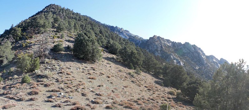
The moon was still in the sky to the west when I climbed up and out of the pines in the valley. The PCT continued uphill toward the southeast, toward a saddle near Owens Peak. It was cold and it felt good to generate some heat in my legs. I paused occasionally to take in the views as the morning light increased. I checked the map, and it was three solid miles and almost 2000 feet of climbing to reach that saddle. No wonder it was taking so long!


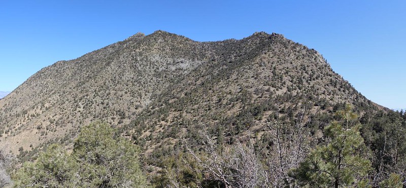
At 8am, two and a half hours later, I topped out at the saddle above Cow Canyon. The trail crossed over to the east side of the Pacific Crest. The sun was shining, and it looked like a fine day was in store. I took off my backpack, then aired out my sweaty socks, sitting in the sunshine. Directly across the saddle was Owens Peak, namesake of the Owens Valley, and I couldn’t help but see its long southeast ridge, made of solid granite. Now I understood why this land had been designated as the Owens Peak Wilderness. I didn’t stay there long, however. I checked my phone for signal (now that I had a good view to the east), and several text messages arrived. One of them showed that Vicki was well on her way up here, and that meant that I really needed to get moving. So back on went my shoes.

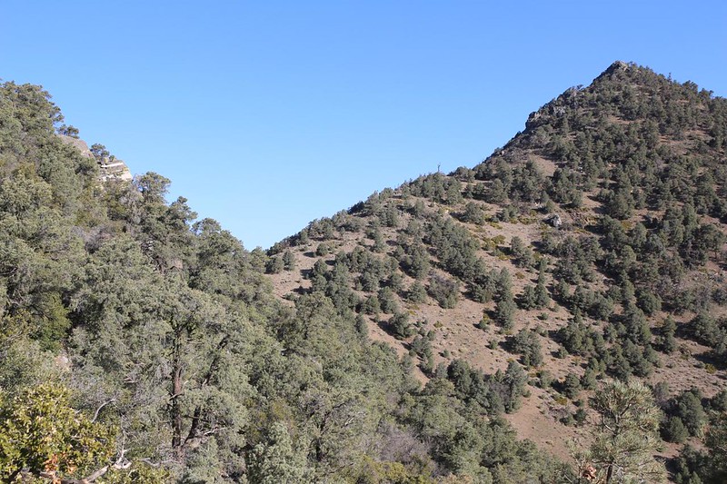
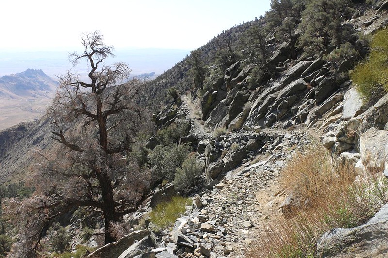
The slope of the PCT grew much easier, although it continued to climb a bit as it traversed along this massive ridge heading south. The trail became much more fun. It was often perched right on the edge of a cliff, as if they hacked the trail out of solid rock, and the views were excellent. Down below me was Indian Wells Canyon, and it was truly impressive as it dropped away into the ultra-dry Mojave Desert. The city of Ridgecrest was somewhere out there in the early morning haze, and so were Highways 14 and 395, the main roads leading north out of L.A. toward the Eastern Sierra.


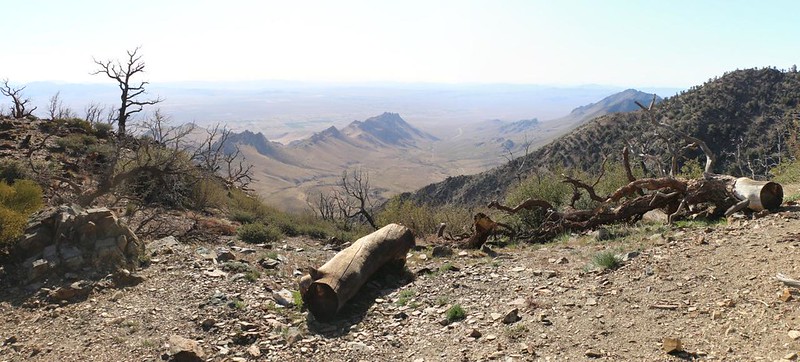
Eventually, a perfect log appeared on the side of the trail, complete with a perfect view. I really had no choice but to sit down and relax for a while. I texted Vicki that I still had a long way to hike, and I hoped she’d be OK with waiting. I didn’t get a response right away, so I figured that she must be either still driving or over the top of Walker Pass, on the west side where there was no cell signal. But I didn’t wait around too long. I put my shoes back on and kept hiking.
There was a whole lot more of this excellent, cliff-hanging trail in my future. I had reached the day’s high point by then, and the trail began descending, ever so slightly. And the views stayed great. I really liked this section of trail.

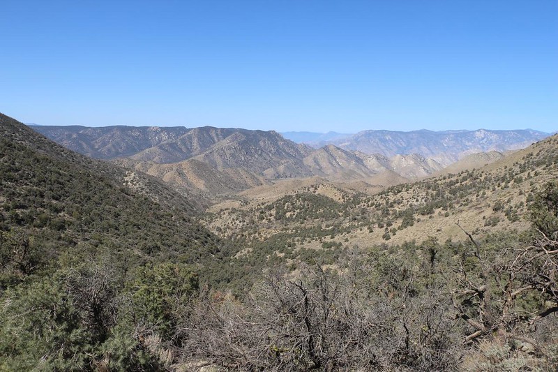
One ridge jutted out to the left, and there was a small campsite directly on a bare saddle. Vegetation was in short supply here in the rain-shadow of the Sierra Nevada, but it sure looked like a great spot to have some lunch. By this point, my GPS said that I was halfway to the Pass, and Vicki had replied to tell me that she was already there. Oh well. I couldn’t change that, so I didn’t try. She knows how to enjoy herself. Meanwhile. my feet and tummy were in need of attention, so I sat down for a good long break. It was 10am, and I had been hiking for four and a half hours. Time for a rest. I read my book a tiny bit while eating some lunch, but mostly I just looked around at the view. Thus far, I hadn’t seen a single person on the trail.


As the trail traversed around Mount Jenkins, it eventually crossed the crest to the western side. Once again, my cell phone signal was gone. But that was OK. The trail flattened out a bit as it passed by Morris Peak, and then began the longer drop toward the pass.

Video of a flock of crows circling in a hot thermal above Morris Peak
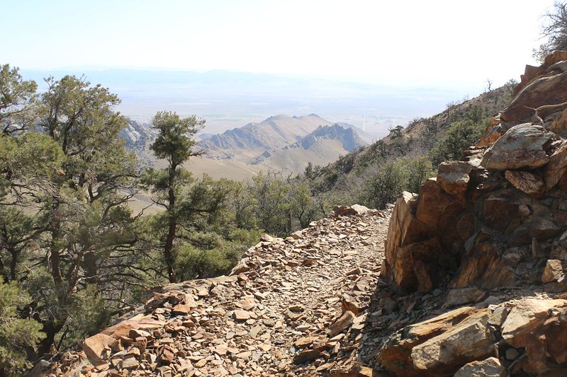
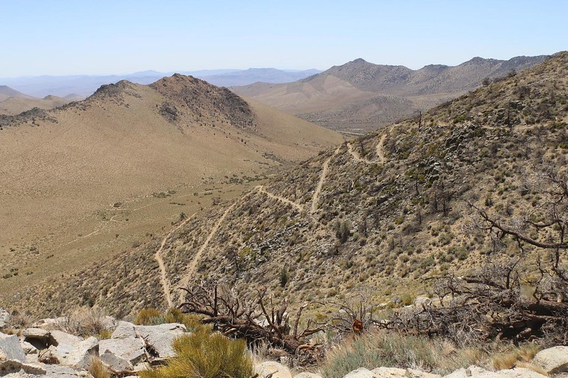
Two and a half miles later, the PCT popped back onto the east side again. Suddenly I had cell phone signal, and I could see Highway 178 (Walker Pass Road) off in the distance, down a long, dry valley. The PCT was the main feature in the valley from that perspective. I could see it making a series of switchbacks on a hillside, then curving around the mountain toward the pass. Only a few miles left! My feet hurried onward.

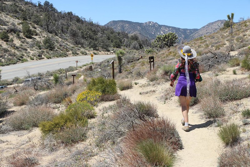
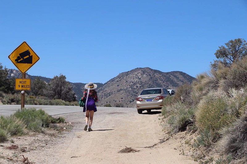
When I texted Vicki to have fun reading in the car while she waited for me, she simply replied “NO.” That made me think that she might be hiking up the trail to meet me. And that’s why I wasn’t surprised to see her off in the distance, sitting on a pile of boulders, when I came around the corner. But I was certainly very pleased. I shouted out a “Yoo hoo!” and she turned to see me. Then she stood up and headed my way as I rushed down the trail. Yes, it was good to see her again. Four days of solo hiking were fun enough, but I have to admit that I would prefer to hike with a partner. As she got closer, I realized that she was wearing a dress! And then I remembered that today was Easter Sunday, and it all made sense. She looked great, and I told her so.


After that, the two of us hiked together down the final half mile of trail to the pass. It was a very gentle grade, and a nice way to end a 52 mile hiking trek on the PCT. I was glad that I came here in the early Spring, in April, as this section of the trail can get roasting hot later on in the season. All those Joshua Trees and desert plants weren’t growing there for no reason. This was the Mojave Desert, and in Summer it would be well over one hundred degrees out here. No thanks!

This hike also finished off PCT California Section G for me as a “section hiker” and I probably wouldn’t hike this stretch again. The next 85 miles south of here, Section E, was another story. I had thought about hiking it this year, but it’s an even drier and windier section than the one I just finished. Maybe I’d try it some day, after a good rainy season, so there would be more water, green grass, and wildflowers. Why suffer, when I could enjoy the beauty, instead?

We got in the car and headed toward home. It was only a bit after noon, so we decided to head into Ridgecrest on the way, to get some fast food for lunch. I was all in favor of that! And I did the driving this time. I promised Vicki that if she was willing to help me on this hike that I would do the driving on the way up and on the way back. And she held me to it, but relented when we hit a big pile of traffic on the way into L.A., because I really don’t like it. And then I took over afterward. We had a good drive, and it was nice to be back home again with Vicki. And it was a Happy Easter, too!
For a topographic map of the hike see my CalTopo Page
For LOTS more photos of the trek see my Flickr Page
 << Back to Day 3

