On the sixth day of our nine day backpacking trek, we hiked south on the Pacific Crest Trail from Castle Pass to Woody Pass, and summited the Washington State PCT Highpoint, which had stunningly clear views. All told, we hiked about eight miles and climbed 1600 feet, making it a less-than-easy day for us (yes, we’re wimpy hikers).
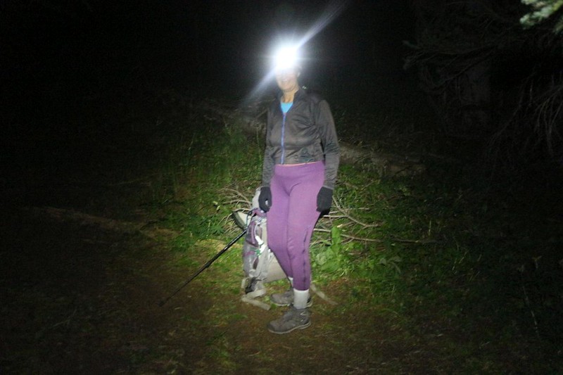
We woke up super early, before our alarm went off at 3am, and packed up swiftly in the dark. Each of us carried one of our no-cook breakfasts, and ate it on the trail as we hiked, to save time. Our plan was to get as much of the four mile uphill section done as possible, while it was still cool and shady. Vicki hikes better at lower temperatures.

A lovely sunrise happened as we made our way along the first section of trail, which was mostly forested. It traversed along the north side of Blizzard Peak, and every so often we were treated to excellent views out to the west. Castle Peak appeared as we neared Hopkins Pass, the midpoint of the long climb.


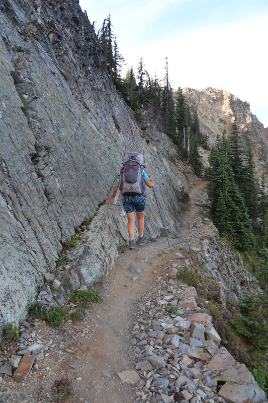
Upon arrival at the pass, we took a short break and fueled up with some snack. It was time to begin the steeper climb, up onto Lakeview Ridge. Vicki removed her extra layers in preparation for higher exertion, and then we were ready. We followed the steep trail up onto the east-west section of the ridge, and then our views got better. Vicki may not like climbing, but there was no doubt that it was great for seeing the mountains.


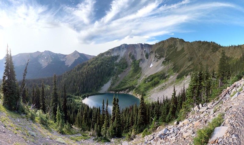
On this section, we were treated to views back north, toward Castle Pass where we started, and also to the Canadian Border, where we hiked yesterday. It was still early, so it was good to see how far we already came. On the other side of the ridge was Hopkins Lake, a lovely round pond in a steep-sided bowl. We met one of the hikers we’d spoken with yesterday, a girl whose trail name was “Flying Sombrero,” as she arrived from her campsite at Hopkins Lake. She was heading home to Mexico after completing the entire 2650 miles of PCT. We wished her well, and Vicki even sang a Mexican song for her. She laughed as she “flew” past us!


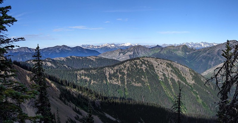
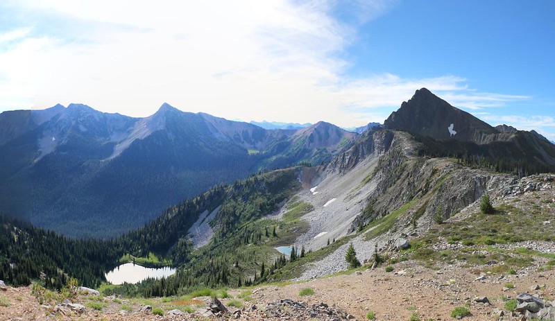
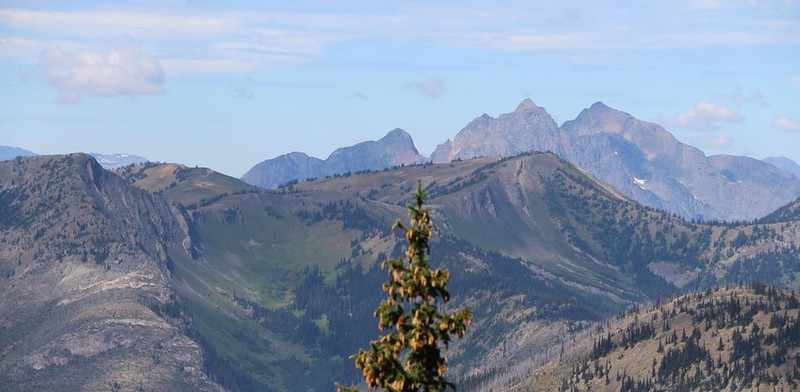
We eventually turned the corner and continued south on Lakeview Ridge. Hopkins Lake was still below us, and the Devils Stairway was up ahead. Off to the west was a wonderful view of Mount Baker and other snowcapped peaks in the North Cascades. The views were stunningly clear this early in the morning, before the afternoon haze had a chance to develop.


Soon enough, it was time to climb the Devils Stairway, a set of extra-steep switchbacks which marked the final half mile of trail on the way to the PCT Highpoint. It was already getting warm and sunny, and Vicki was less than amused. We were lucky that there were a few high clouds partially blocking the sun’s rays, but she still had to use her water sprayer to keep herself cool. That thing really works!


We arrived at the highpoint, and took off our packs for a well-deserved break. I took way too many photos, as always. The views up there were great. We met a nice PCT hiker who was finished with her thru-hike and was also heading south. She took some photos of the two of us, which was nice. We don’t get very many like that, but we try to do at least one on every trek. When they are really good I have them printed in 8×10 format and hang them in the hall at home.


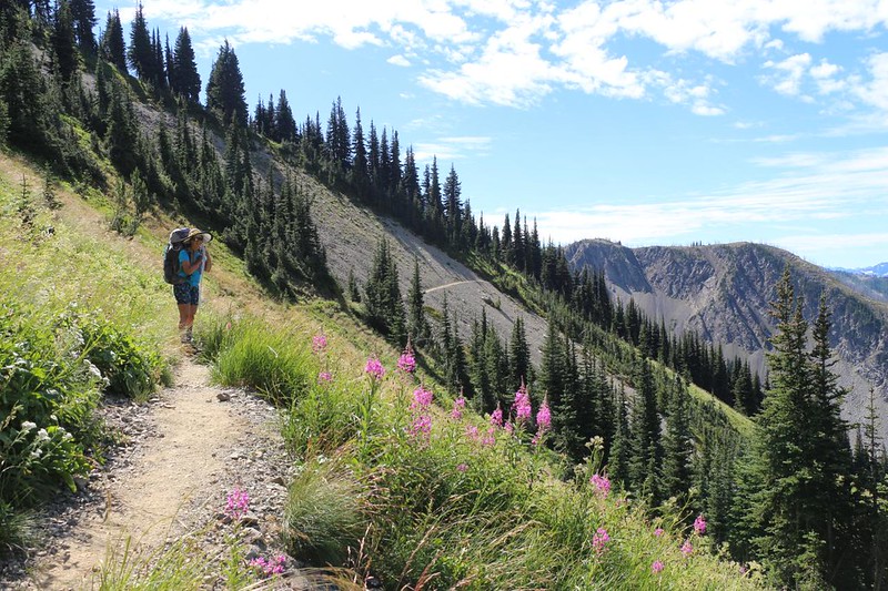
It was still too early for lunch, so we continued onward. We only had two and a half miles to go to reach Woody Pass, and most of it was downhill. Vicki was in hiker’s heaven. Meanwhile, we were still way up on top of the ridge, and enjoying as much of the view as possible.


A mile or so later, Vicki’s energy finally ran out. We sat on the side of the trail and got out our lunch. Afterward, she decided to take a quick nap. It was the only way to get her mojo back.


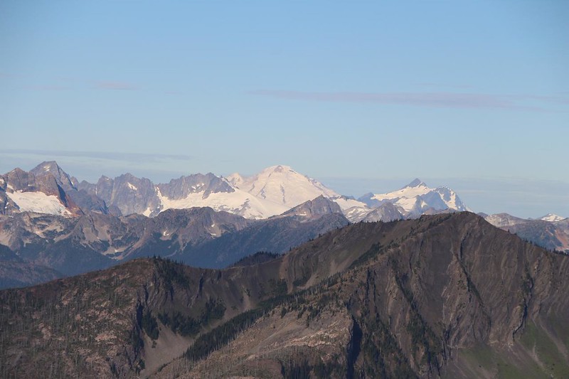
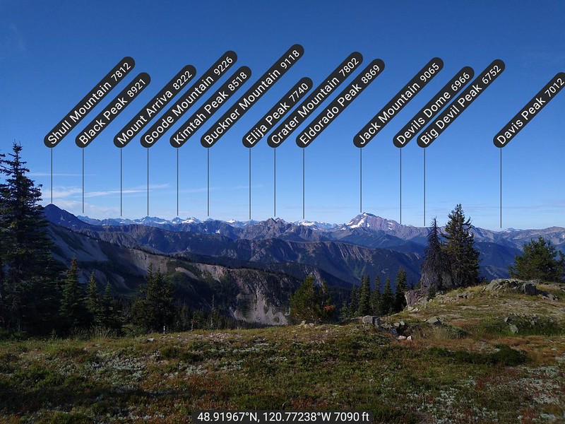
I got out my PeakFinder App on my phone as we neared Woody Pass. This would be my last chance for photos of both Desolation Peak and Hozomeen Mountain. These are both famous in a literary sense, in that the beat poet and novelist Jack Kerouac wrote one of his novels about a Summer he spent as a fire lookout on Desolation Peak.

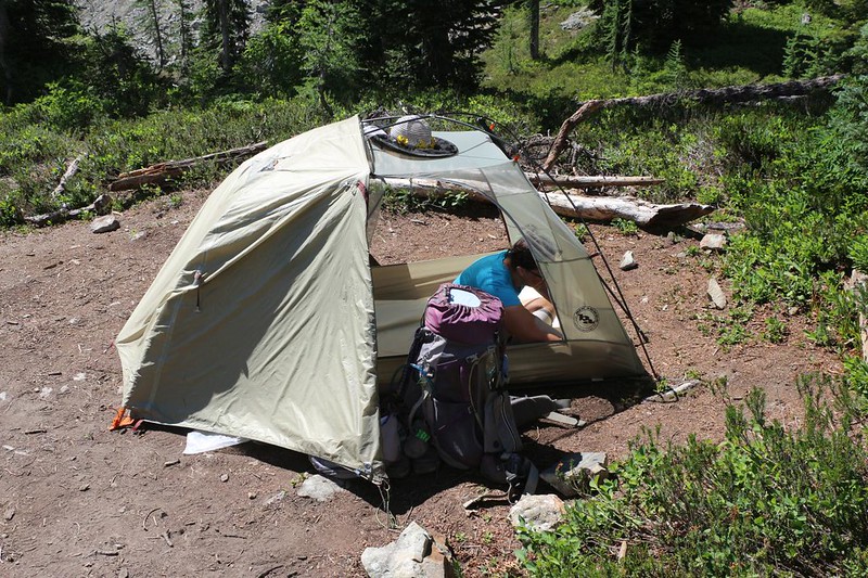
Before we knew it, we arrived at Woody Pass. This was where we crossed the Pacific Crest and entered the Okanogan National Forest. We stopped for a boot-off break by the big snowbank. We knew that we would be camping nearby. Did Vicki want the same spot as last time, right near the pass itself? Or would she rather try one of the lower, larger campsites we’d seen three days ago? She decided to try the lower spots, mostly because the high spot was right next to the trail, which isn’t quite proper. Also, it would make tomorrow’s hike a bit shorter.


The lower campsite was also closer to the water source. It meant that I wouldn’t have to climb back up the hill with two gallons of heavy water like I did last time. So we headed down the slope. There were several spots along the way, and we finally chose the lowest one. We noticed that there were cumulus clouds building up, so we made sure that our spot would drain if it rained. Nobody wants to camp in a puddle.

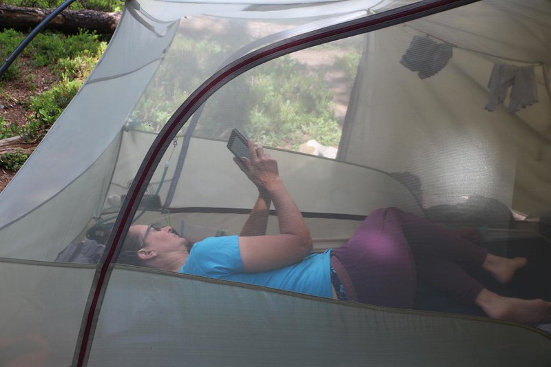
Mostly we just chilled out all afternoon. We had no real desire to hike onward. Besides, if we got back to the car too early, we would still have to wait for our motel reservation in Mazama. There was no point in hurrying. Meanwhile, the clouds kept building ominously to the southeast. We heard thunder booming in the distance, and could see virga streaming down underneath the distant dark clouds. When one of them leaned over in our direction, we decided to close up the top tarp of the tent, and get our gear under the vestibules, just in case. And we were correct! Before too long, the sky grew dark and it began to sprinkle on the tent. But we were safe and snug inside! We love that feeling. Let it rain! We didn’t care.

Like all such afternoon thunderstorms in the high mountains, it shrank away to nothing as the sun went down, since the sun’s heat was what put the energy into the clouds to begin with. Afterward, the world smelled of petrichor, and everything was washed clean. We went back outside and ate some dinner, with a great view over the Rock Creek valley.
Tomorrow we had an easy day planned, mostly downhill, so we decided to sleep in. No pesky alarms for us! We wouldn’t have quite as many great views as we had today, but we would get a few. We were looking forward to it.
For a topographic map of the hike see my CalTopo Page
For LOTS more photos of the trek see my Flickr Page
 << Back to Day 5 Onward to Day 7 >>