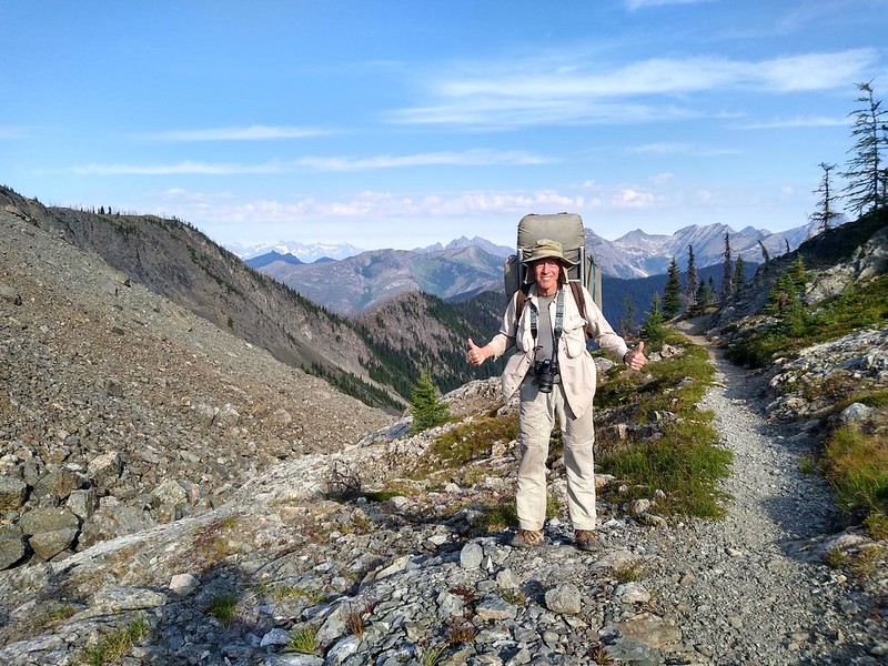
On the fourth day of our trek, we backpacked north on the Pacific Crest Trail from Woody Pass to Castle Pass, and took a long break at the PCT highpoint (in Washington State), which had killer views. All told, we hiked 7.5 miles while climbing an easy 500 feet and dropping down an even easier 1600 feet. It was a welcome change from yesterday’s big ascent.

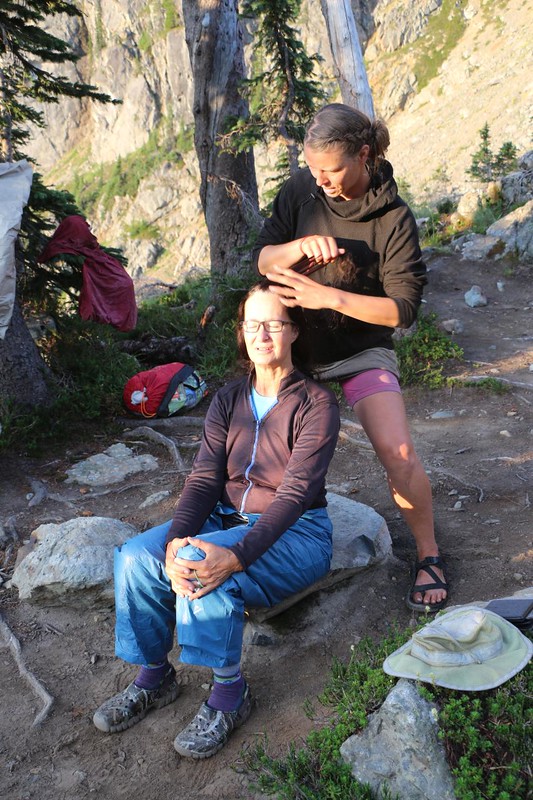
We woke up after first light, sleeping in a little, and cooked up a proper freeze-dried breakfast meal. We sat and ate it, looking out at the Rock Creek Valley. While we were packing, we met a nice couple who were hiking the Pacific Northwest Trail, which co-ran with the PCT for ten miles or so. Vicki commented to hiker “Z” that she loved Z’s braid, and before we knew it, Z was braiding Vicki’s hair! And it came out really nice. I hate to admit it, but my lack of braiding skills became a topic of our conversation. Sigh. I did my best to change the subject back to hiking.

We finished packing and headed north over Woody Pass, which still had a bit of residual snow from last Winter. The PNW had a huge snow year in 2022. As we crested the pass, we were treated to a new and awesome view to the north and west. We could easily see peaks in Canada from there.


The first section traversed along the northern side of Three Fools Peak. We liked that name, and wondered who the three fools were, and what they did that was so foolish. The trail itself was nearly horizontal, and was mostly in the shade, so the hiking was fast and easy. And the views west were excellent.


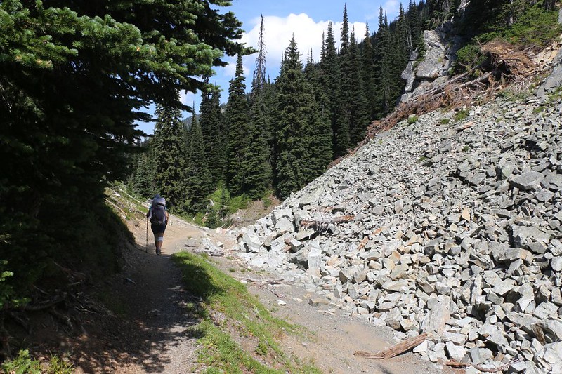
Then the trail began to rise, albeit slowly, on its way to Lakeview Ridge, the long northern ridge of Three Fools Peak. We hiked across a large scree field, which we were glad to discover was a lot more stable than it looked, and then the trail began climbing in earnest.


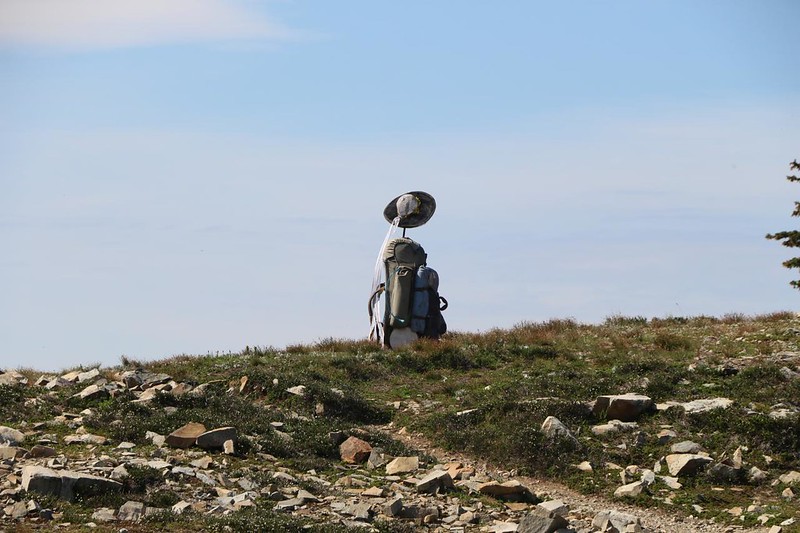
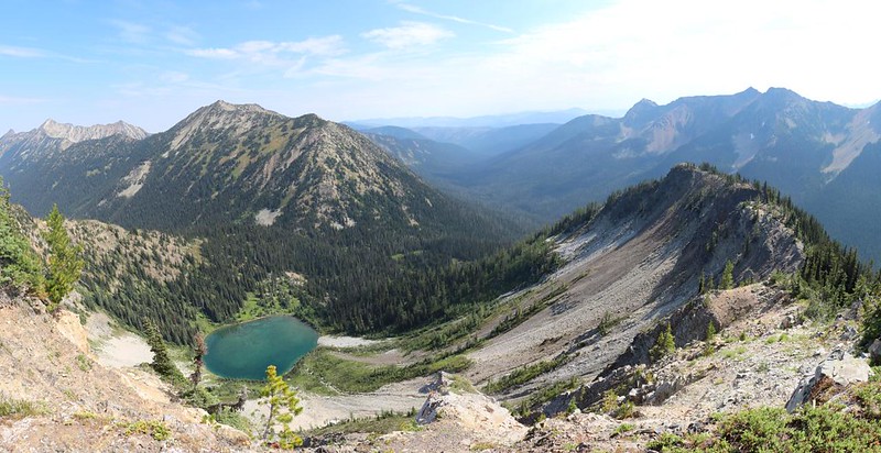
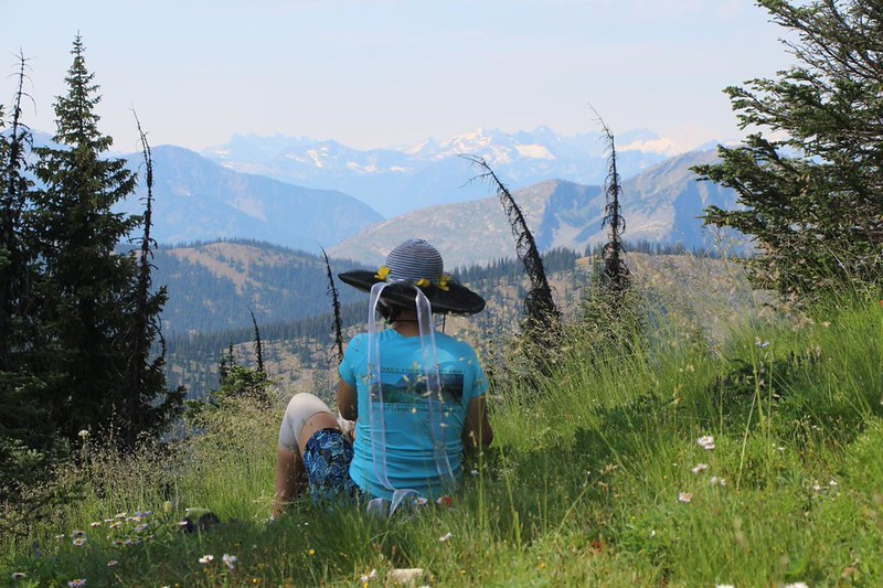
We made it to the viewpoint and decided to take a big break. We met a family up there whose son was just finishing his thru-hike of the entire PCT. He did it in less than 90 days, a true accomplishment. They wanted to join him on this last section but couldn’t keep up with him, so they waited while he slack-packed to the border and back. We set down our packs and wandered around the high point, taking photos. We found out why it was called Lakeview Ridge, as there were two small ponds down below on the east side. Very pretty. And the views from up there were truly expansive, in all directions.


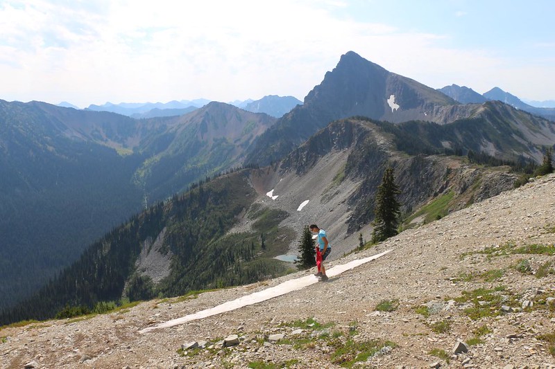
Eventually we had to leave. Vicki was happy knowing that the rest of the day was going to be a downhill hike. I warned her that the next section was downhill, but it might be steep. It was called the Devils Stairway, and that name sounded quite ominous. It turned out to be just a bunch of switchbacks, several of which were quite exposed. I could see that it might be dangerous in late Spring when snow still lingered on the trail, but it was all gone now.


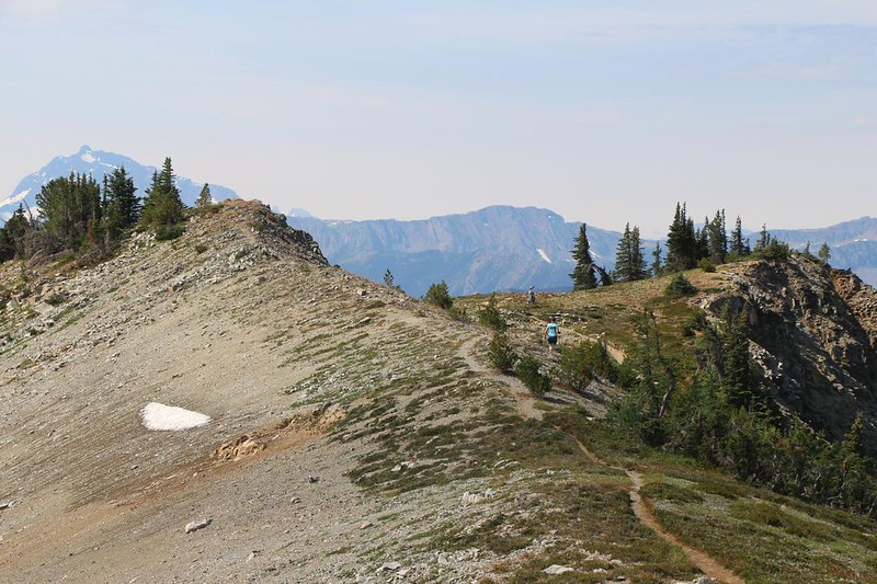
We hiked a little further on the ridge, and realized that this would be a great place to eat lunch. We probably should have done it back on the high point, but it was too late now. And the views from here were still stunning.


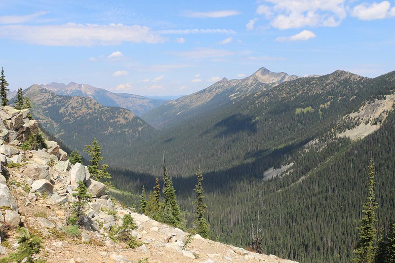
The ridge turned east, and we were granted a view north, down into the valley containing the Castle Fork of Three Fools Creek. Castle Pass, our destination, was directly before us. And Canada, tomorrow’s destination was a few miles further down the next valley. We were almost there! As we hiked, we also had stunning views down into the bowl containing Hopkins Lake. The trail got quite exposed along there, and Vicki would have overheated if we had been hiking in the other direction, uphill. Eventually, we reached Hopkins Pass at the terminus of Lakeview Ridge. There was a side trail to the lake, which supposedly had a lot of campsites, but this didn’t fit within our seven-mile-per-day hiking parameters. We took a look at Hopkins Pass, but we kept on hiking.

We still had two and a half miles left to hike, and we wanted to get it over with. Especially when we discovered that essentially all of it was within a forested hillside, on the northern slope of Blizzard Peak. There weren’t many views, but at least it was all downhill!


We arrived at Castle Pass and put down our backpacks. There was a large campsite here, and a pleasant grassy meadow. We wandered around, searching for the best campsite. And why not? We were going to be staying here for two nights, as tomorrow our plan was to dayhike four miles to the border, and back. Vicki found a spot back behind some greenery. It had a bit of a slope, but it also had privacy. I went back and carried the packs to the site, and then we set up camp.


The only downside to camping at Castle Pass was that it was on a high point, and had no water. I wasn’t too worried, as my PCT app mentioned some a bit further north. Vicki also wanted to do some laundry, so we packed the water filtration gear and the dead clothing into Vicki’s empty backpack, and we headed down the trail. We ended up having to hike over a half mile, but eventually we found a nice spot with a flowing creek. I collected water while Vicki soaped the clothing, and then I wrung them out, as I can squeeze harder. Our chores done, we put everything back in the pack and headed uphill to camp. We strung our laundry line between two trees in what should have been a sunny spot, and hoped for the best.


After that, we were ready to eat. We carried our food up to the main campsite, which was a safer place to light the stove. We hung out and ate, speaking with a number of PCT thru-hikers on their way back from the border. We congratulated them on a job well done. Hiking 2600 miles doesn’t happen without an awful lot of effort and dedication!
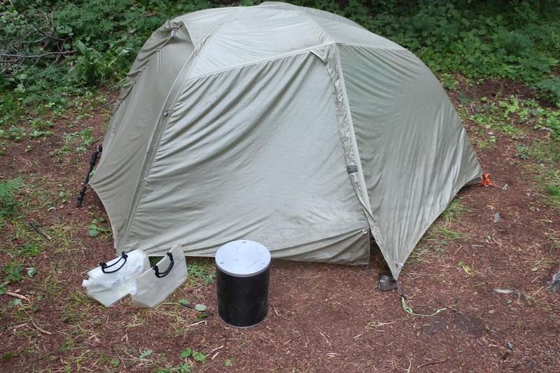
When we felt a few drops of rain, we decided to take down the laundry and the line. What wasn’t fully dry we hung inside the tent. Then we headed inside ourselves. We got dressed for the night and stuck our legs under the goose down quilt. Then we read our books as evening fell. We had no need to consult the map this time – we would be heading directly north to Canada tomorrow morning! Oh, yes.
For a topographic map of the hike see my CalTopo Page
For LOTS more photos of the trek see my Flickr Page
 << Back to Day 3 Onward to Day 5 >>

