This backpacking trip was planned in advance to be a tough one, a long one, to get our 2016 hiking season off to a solid start. And, if you want to collect some serious trail mileage, there’s no better place to do it than the PCT (Pacific Crest Trail). At 2600 miles long, it offers plenty of hiking excitement. We’d already done most of the sections down near San Diego (as well as assorted sections in northern California and Washington), and were now “shopping” the Los Angeles area for new PCT ideas. In fact, we had planned to do one section near San Gorgonio Mountain last year when the Lake Fire broke out and burned for weeks, causing a trail closure right where we wanted to hike! So this year, even though the burnt section was still closed, we set our sights a bit further north, to a section near Big Bear Lake.
A popular trail, the PCT has been thoroughly mapped out; it’s been broken down into named sections, complete with virtual mileage markers, GPS tracks, and downloadable topographic maps, all available online. For those who care about PCT nomenclature, the hike I chose was part of California Section C, namely: PCT miles 279 through 314. In other words, we’d be hiking 35 miles total, beginning at a dirt road just north of Big Bear Lake near the town of Fawnskin and heading roughly northwest, descending gradually toward the Mojave Desert, ending up in a dirt parking lot at the end of Highway 173 near the town of Hesperia. After considerable study, making use of various online water reports, I came up with a plan. I figured that this hike could be done by the two of us in about three days. Three LONG days, because we’re not exactly the fastest of hikers.
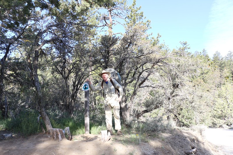
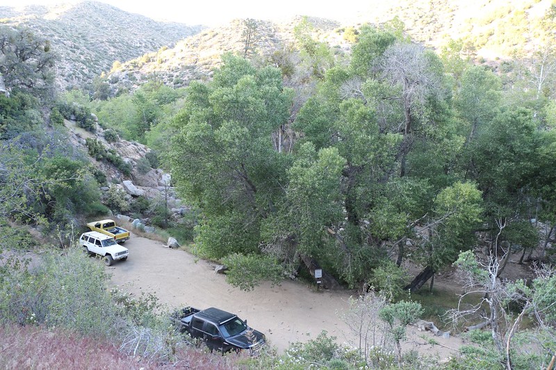
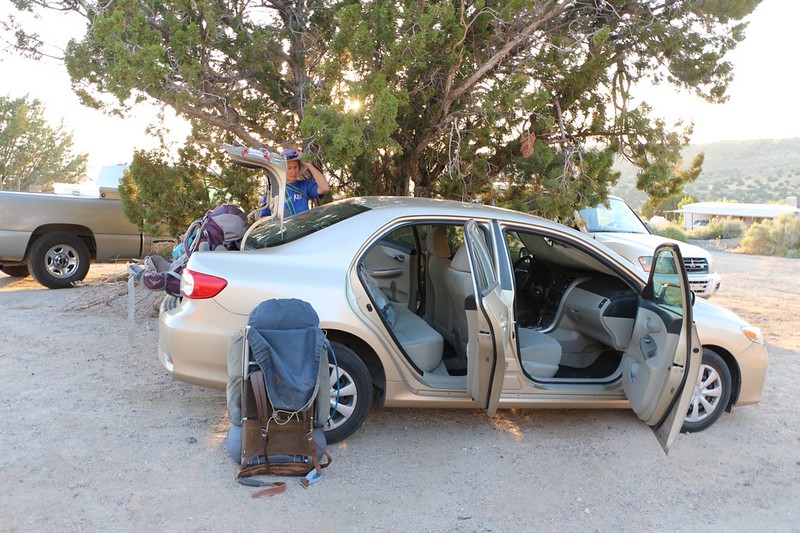
The trickiest part of the entire hike was finding a way to leave our car at the end of it. We decided to invite our son and his friend along, so that we could use two cars, and I was worried that they might back out at the last moment. As it turned out, they almost did, but not quite: They decided to spend the weekend backpacking in the Sierra Nevada. Dropping us off at the trailhead only made their long drive an hour or two longer, so it all worked out just fine.
We left San Diego shortly after 2 AM, stopped for breakfast in San Bernardino, then headed for the end of the trail. We dropped off our car, then crammed ourselves into our son’s truck for the hour-long drive to the beginning of the hike. We got our packs out of the truck, threw a ton of gas money at the two of them by way of thanks, and wished them a great weekend. All we had to do now was find a way back to our car, and that meant getting down to business with some serious hiking!
Our first day was planned to be about eleven miles, another eleven on day two, followed by thirteen on the final day. I figured we’d be tougher by then. But we could change it if we wanted. The first day I wanted to camp somewhere near mile 290. Unfortunately, there was water at miles 287 and 292, but none in between, as the trail climbed high away from the stream. But camping up high was also where the nice views are, and there are often mosquitoes near streams. So the plan was that we’d have to filter and carry an extra eight pounds (one gallon) of water for a few miles later that afternoon, but it would pay off if we found a nice spot with a view and a breeze. And that’s exactly what we did.
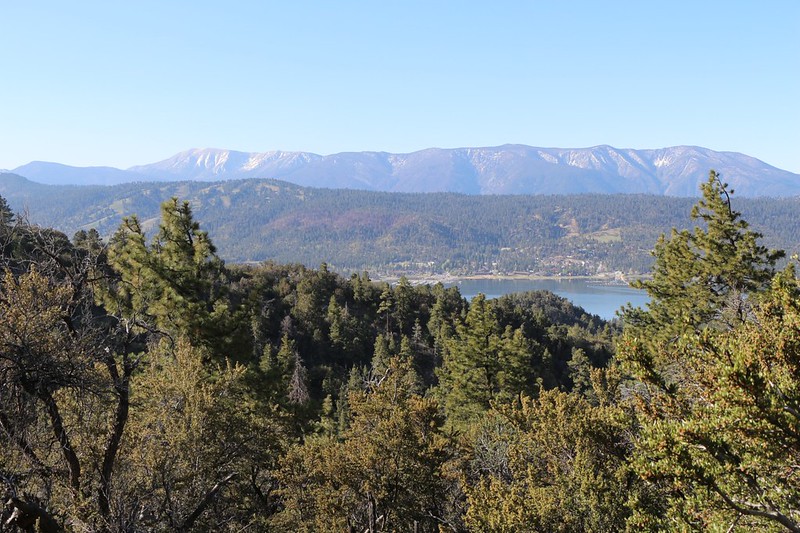
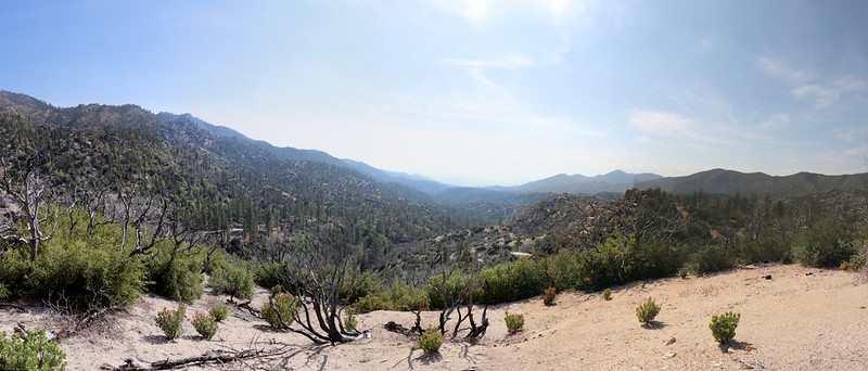
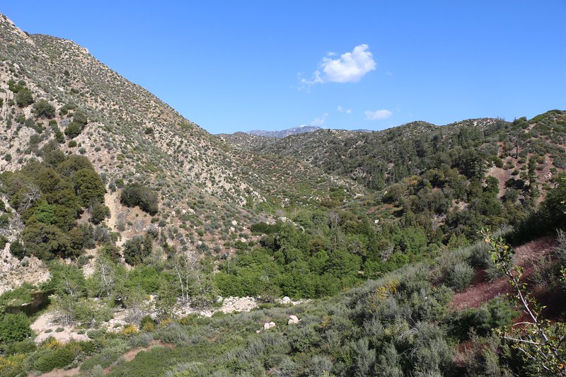
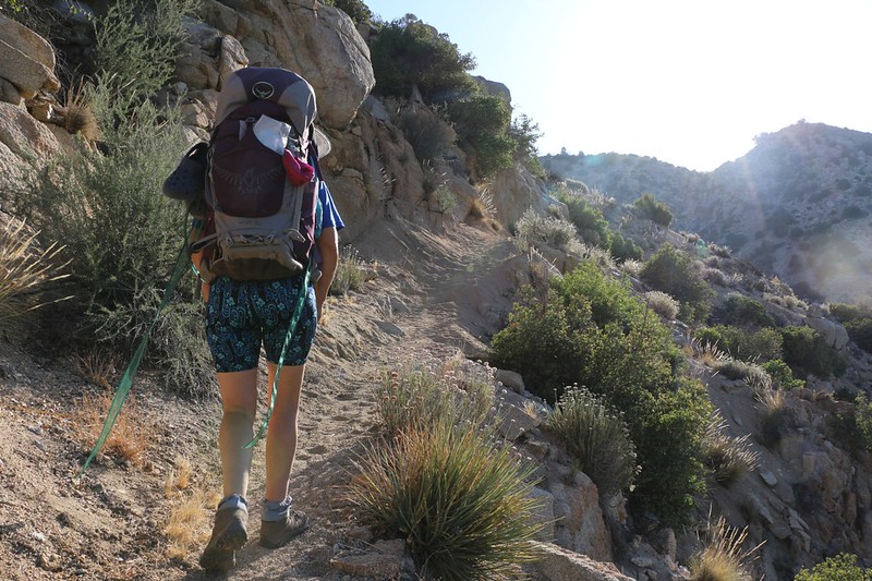
The hike started off in some pleasant forest, and the trail wound around trees and boulders, climbing gently at first. We got some great views along this high ridge, looking south toward Big Bear Lake. Beyond the lake and ski resorts was the San Gorgonio Wilderness, where we could see the nine 10,000-foot-plus peaks that we had climbed back in 2012 (on The San Gorgonio Nine Peaks Challenge), and the sight brought back some great memories.
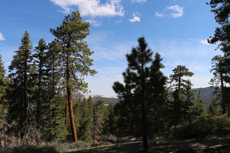
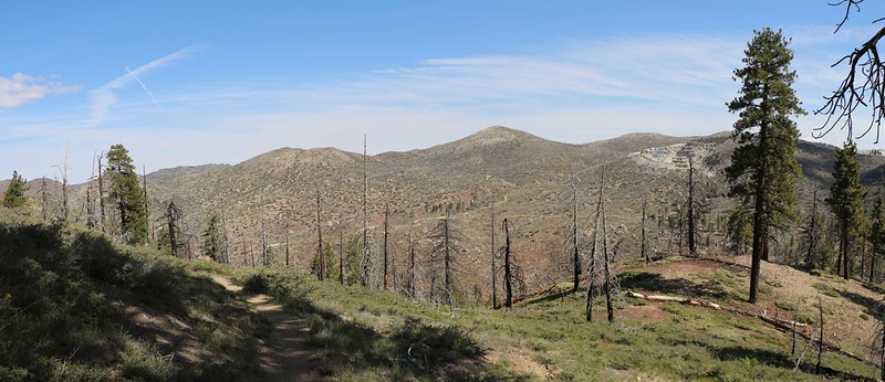
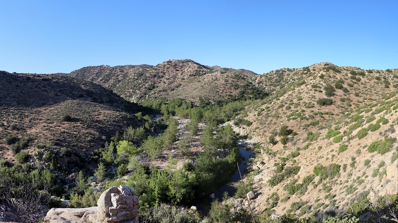
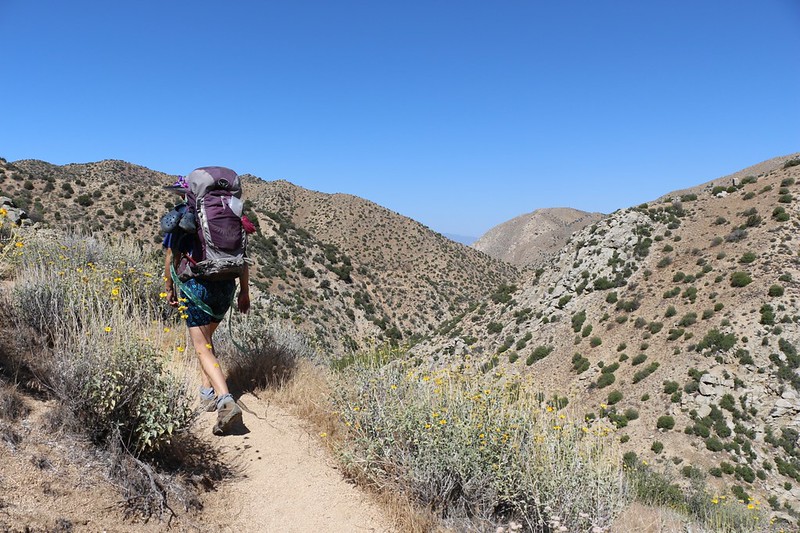
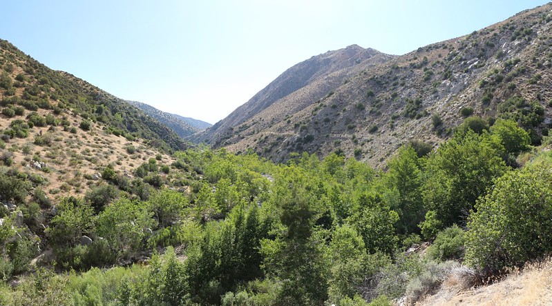
But all too soon the trail crested the ridge to the north and we found ourselves on the “dry” side of the Pacific Crest. All the rainfall on this side of the ridge drained into the basin of the Mojave Desert. Initially, it didn’t look very dry. There were still plenty of big pine trees, green grasses, and blooming wildflowers. But as the trail headed inexorably downhill into the Holcomb Creek drainage, the vegetation grew more sparse. Part of that may have been due to a wildfire in the relatively recent past (1999), so that there were plenty of dead tree trunks standing starkly all around, but it also seemed drier to us, far less lush than the sea-facing slopes.
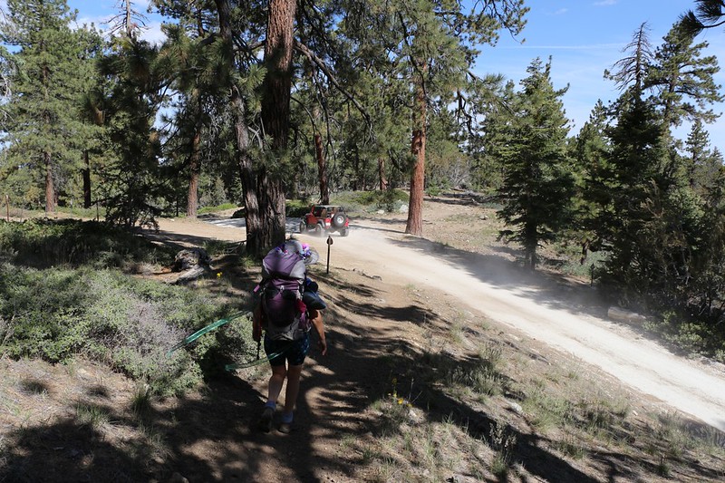
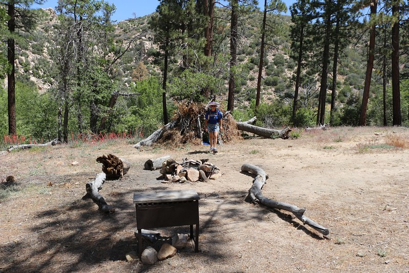
Another interesting thing about this area was that it was on National Forest Land, not Wilderness, so that there were a number of dirt roads crossing the land. We could hear (and see, and get choked on the dust of) entire convoys of jeeps and four-wheel-drive vehicles driving all over the place. Now don’t get me wrong: I love hiking, and I don’t like hearing truck and motorcycle engines when I’m out in the otherwise-peaceful woods, but some of those roads out there looked like they’d be a lot of fun to drive! And, as the temperature and the sun climbed higher, I began to get jealous of those happy people sitting in air-conditioned comfort! But we didn’t try hitching a ride. That would be downright embarrassing!


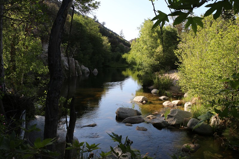
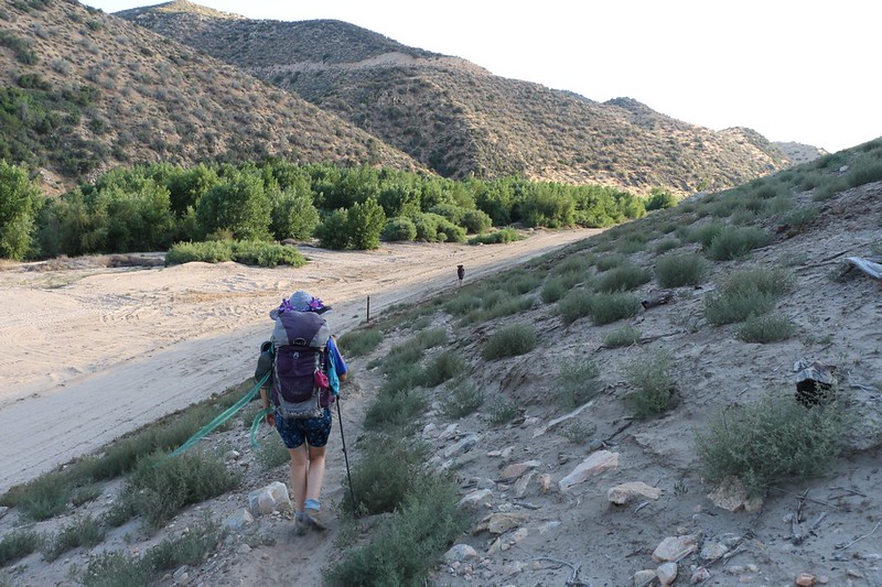
After a few miles, we began making our way downhill toward Holcomb Creek. We knew that there would be water down there somewhere. But not right away. We passed a more official looking campground with a roofless outhouse and a stockade for horses, but there was no water nearby. Eventually, the river bottom filled in with bright green willows and cottonwood trees, so we knew we were getting close. And then we saw some stagnant pools in a flat area, and finally, some flowing water. Right at mile 287.5 and exactly the way the PCT Water Report predicted it.

Video of Holcomb Creek flowing near WR0287.5
We filtered LOTS of water here. Two gallons total. We re-filled our now-empty water bladders with two liters each, and ended up with one full gallon in a large bladder. This was meant to be used for dinner and breakfast. After a nice mid-afternoon nap, Vicki awoke feeling refreshed and decided to carry the extra gallon herself. So we put our packs back on and continued hiking, the trail heading uphill and away from (but parallel to) the main creekbed.
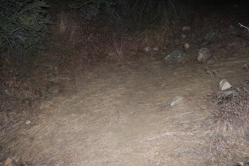
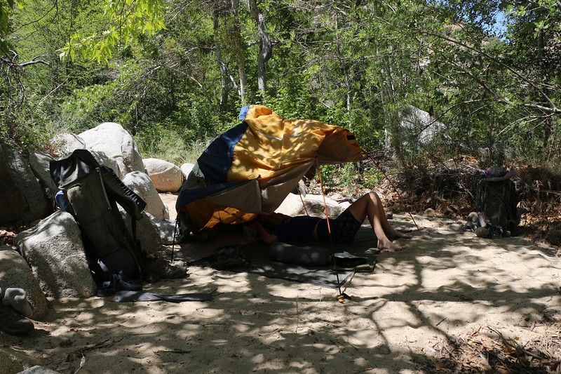
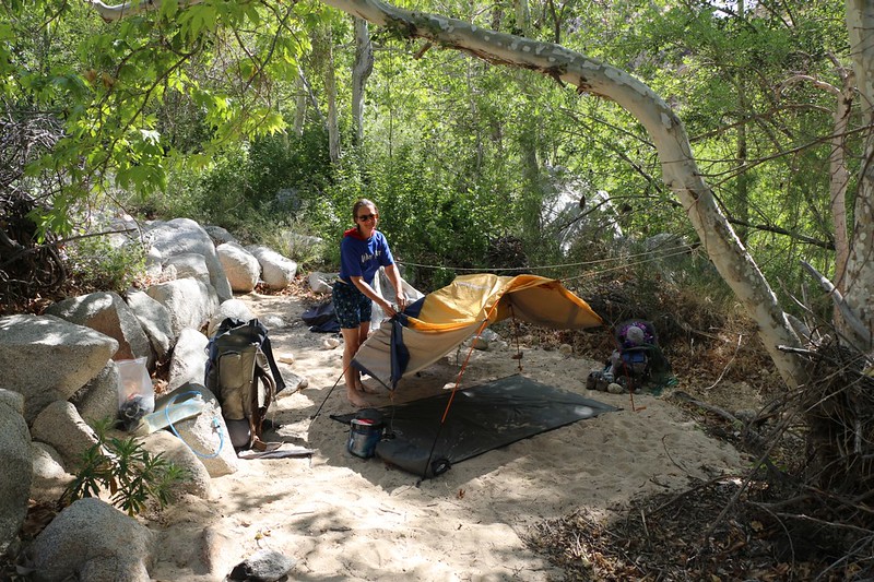
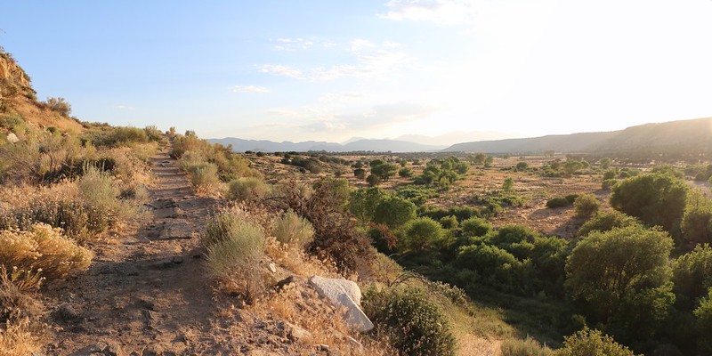
The views got better as we climbed out of the valley. We walked along and I consulted my GPS as we neared mile 290 and our planned camp. But we never made it. About a half mile before the “official” campsite, Vicki suddenly headed off-trail. So I followed her, grumbling vaguely about detours and proper campsites and what was she thinking anyway, until we reached a spot with smooth sand for our tent and a really great view! Hooray! I’m not sure how she does it, but when she wanders off-trail she almost always finds something worth the excursion. In this spot we would never be noticed by anyone. It was all ours. So we put down our packs and set up the tent. I got the air mattresses blown up and the tent ready for the night while Vicki cooked up some food.

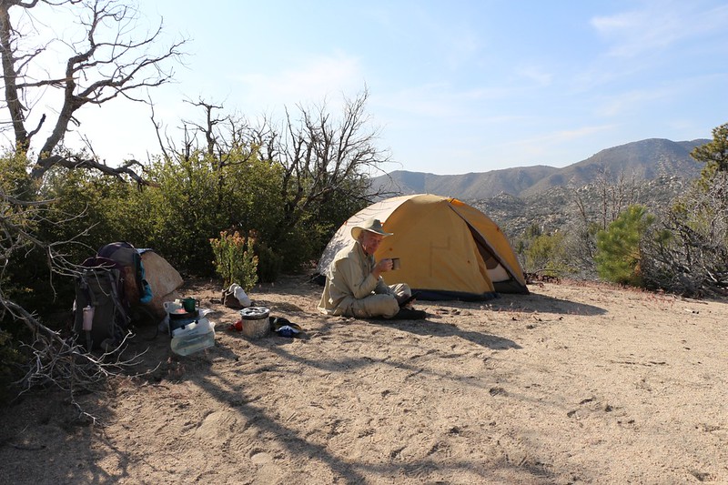

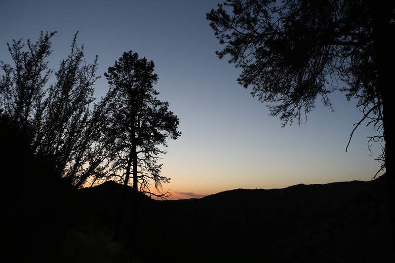
We ate dinner, read our books, and watched the sunset. It was truly beautiful. And, since we’d been up since one in the morning, followed by hiking all day, the two of us fell asleep long before it was totally dark. We also knew that tomorrow was supposed to be even hotter, and the next day hotter still. Meanwhile, we were losing elevation with nearly every mile we hiked, which only made the temperature increase. We decided to set an alarm and wake up in the dark, at 4 AM, so that we could get hiking as soon as possible.
Day 2
And that’s how we ended up cooking breakfast by headlamp Sunday morning.
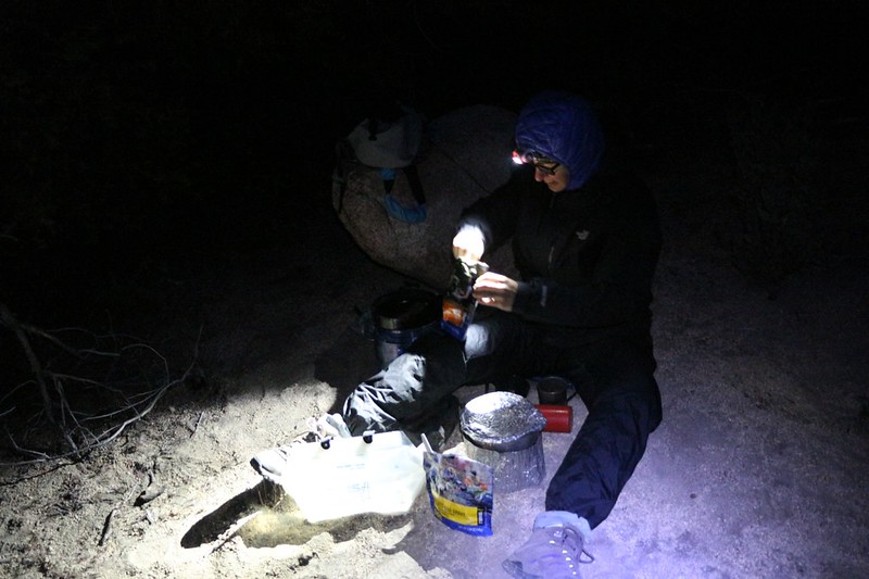
We ate and packed as the skies grew lighter, and finally began hiking at six AM, just after sunrise. We had to cover about eleven more miles today, heading for the Devil’s Hole at mile 301, and our strategy for dealing with the high temperature was to take a long siesta in the shade during the hottest part of the day. Vicki’s internal thermostat doesn’t work quite right; she doesn’t begin sweating when she ought to, and so she gets overheated easily, and that can be dangerous. Let’s face it: You don’t want to get heat stroke at any time. Especially not when you’re out in the middle of nowhere.
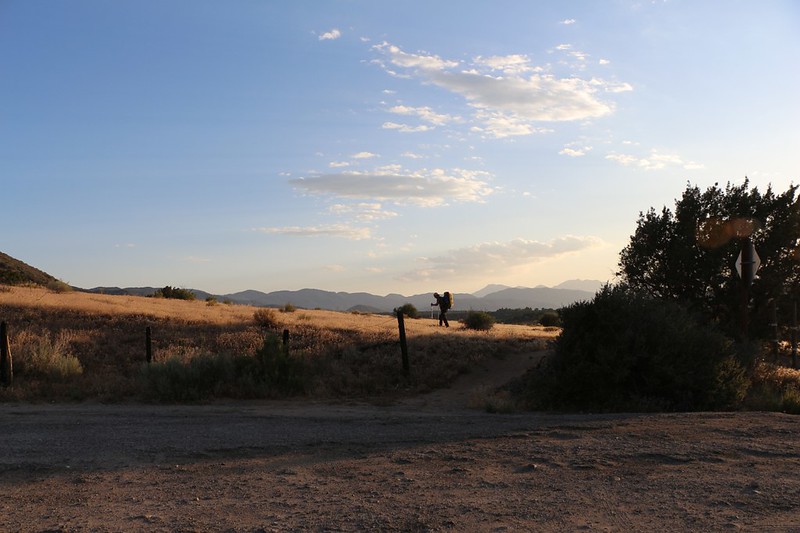
So we began hiking on yet another beautiful day, with the morning sun lighting the trees while casting long shadows to the west over the valley in front of us, causing the nearby mountains to put their glowing contours on display.
The first thing we did was check out the campsite I had intended to camp in, at mile 290. And it turned out to be quite pleasant, in fact, with good views and a nice shady spot under an oak tree to pitch a tent. We would have been happy there, but I still liked our own private spot better. This one was directly on the trail, and other hikers might show up at any time, day or night. Some PCT through-hikers are serious hiking machines, and refuse to stop until late in the evening. Night owls and morning people shouldn’t share the same campsite; it leads to loss of sleep and general crankiness for all concerned.

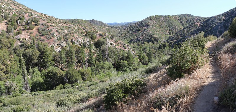
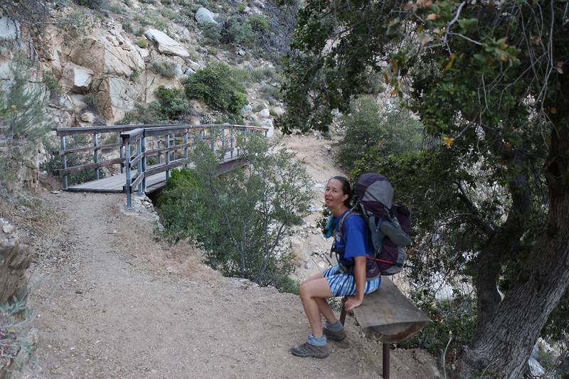
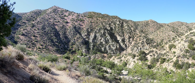
The trail gently wandered downhill past trees and wildflowers until it arrived back at Holcomb Creek. We had to cross it a few times that day, but the crossings were easy and the water level fairly low. We crossed a road, and found a crazy road (County Road 3N93) that was for serious four wheel drive vehicles only. And that road was why we heard so many off-roaders driving by the day before. It must have been a lot of fun to drive, and the word of it has obviously spread. Most of the vehicles are fairly quiet, but there are always a few inconsiderate clowns that think that mufflers are unnecessary. You could hear those idiots for miles out there in the oh-so-peaceful backcountry. Those folks should stay in the city where there are lots more people to impress with their manly awesomeness.


GoPro video of me crossing Holcomb Creek at PCT mile 294
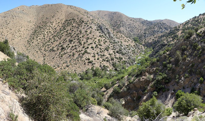
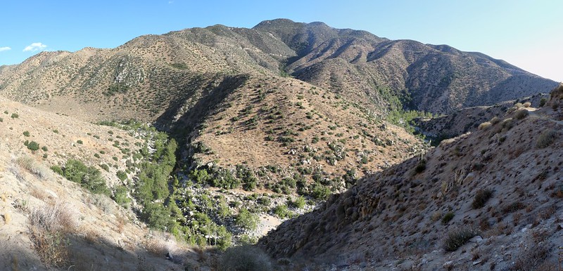
After four miles of hiking, we arrived at the Bench Group Camp and decided to take a break and eat some trail snack. We’d been hiking since dawn, and this was the perfect spot for it. Vicki took a nice long nap in the shade, and I went down to the stream and filtered a gallon of water to get us through the next dry section. The map made it quite obvious that we would be leaving the Holcomb Creek valley and heading directly across some high rolling country toward Deep Creek (which Holcomb Creek later joined, further downstream), and there would surely be some hot hiking on that stretch.

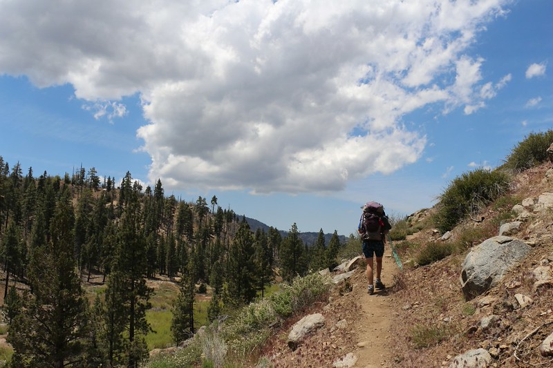
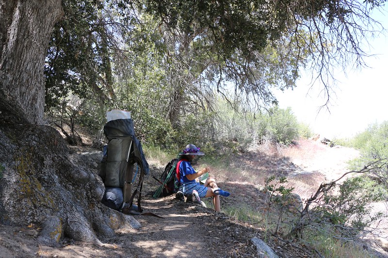
And it truly was hot! Vicki was already suffering after the first long, gradual ascent. “I thought you told me the trail was downhill the entire way!” she berated me, as we both sat down in the shade of an old oak tree. “Well, it’s mostly downhill” I said, even though we’d been climbing continuously for a half mile under the roasting noontime sun. It was mostly downhill if you looked at the Big Picture, I tried to explain, but she wasn’t having any of it. So I wisely shut up, and then the two of us took off our shoes and wiggled our hot feet in the breeze. I got out our books and we did some reading for awhile. We cooled off. But there were too many small flies and gnats enjoying the same bit of shade, and they took the joy out of it. So we hiked onward. And there was more uphill, although it was mostly just the usual PCT up and down as we wandered along this high plateau area. Finally, Vicki couldn’t take it any more. I could tell just by looking at her. She needed a real rest, and maybe a full siesta, and an opportunity to wait for the afternoon heat to subside. Soon enough, we came upon a few tall pines, which promised plentiful shade (without gnats!) and we headed off-trail a bit. Vicki spread out her tarp, we ate our lunch, and then both of us took a nap. It was great. We heard a few people hike by on the trail but they couldn’t see us and we ignored them. We spent a couple of hours there. It was a glorious, well-deserved rest.

After Vicki woke up I mentioned that we still had five miles left to hike that day and that we really couldn’t lay around here forever, she gave me a dirty look. She was not amused. “Is it downhill?” she asked, squinting at me suspiciously. But I wasn’t worried, as I had done my homework this time. “Well, it starts off downhill, then there’s a flat section which probably means more up and down stuff, but nothing major, followed by a long gradual slope downward to the campsite after we reach Deep Creek.” And then I handed her the GPS so that she could see for herself, since she still had a bit of a squint in her eye. The GPS doesn’t lie.
And that was enough to get her to hike onward. It wasn’t much cooler out there, but at least it was easier hiking.
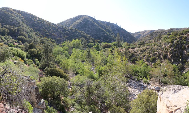
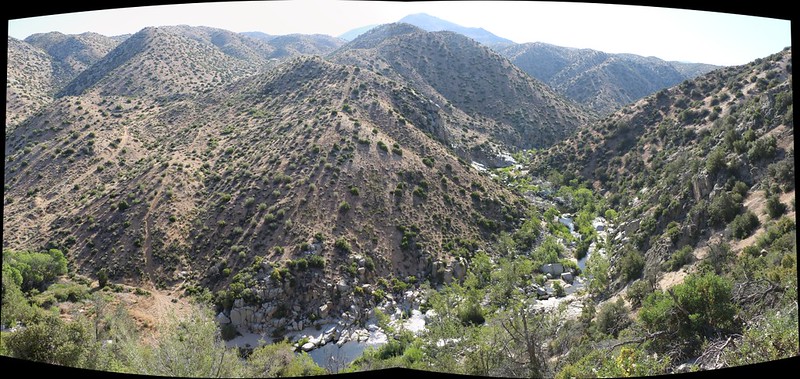
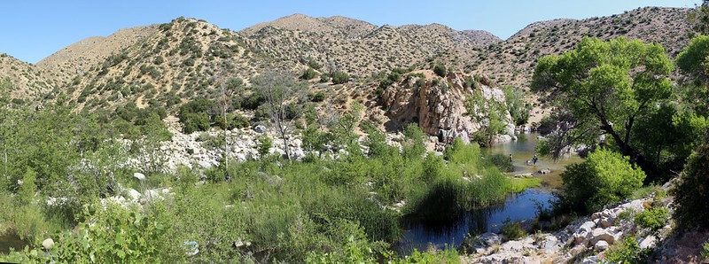
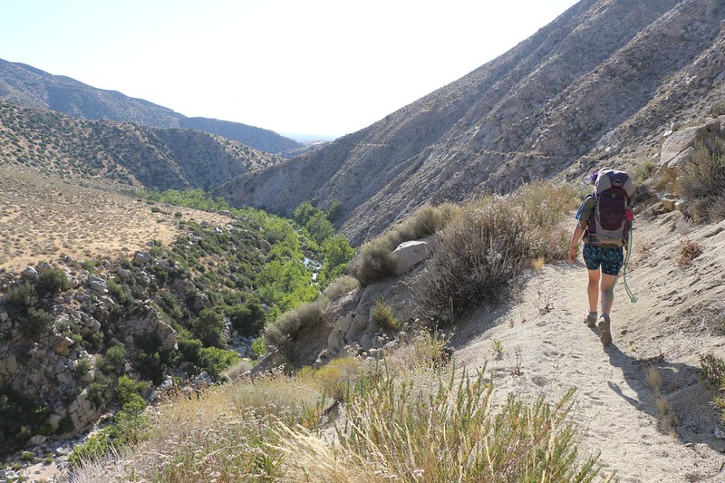
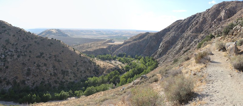
After an hour or so, the trail began heading downward in earnest. We were dropping into the Deep Creek drainage. And now we know why they call it Deep Creek. It wasn’t only because of its tremendously deep, clear pools of water, it was also because the creek itself had cut a deep valley through the mountains over the millennia, carving its way into the granite heart of the hills. And we’d be learning all about it, because we’d be hiking alongside this creek not only the rest of today, but all day tomorrow, as well.
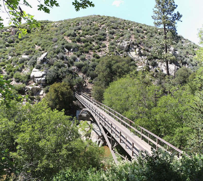
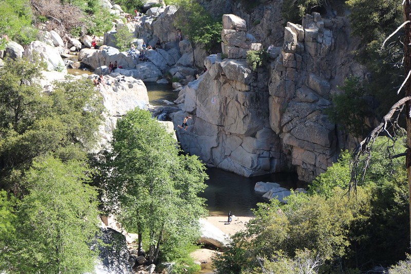
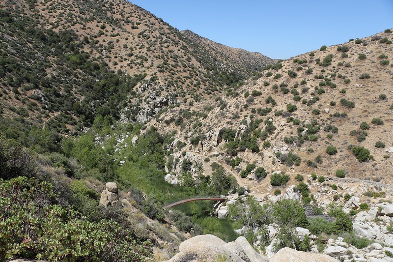
We were introduced to the creek by an excellent arched bridge, and by the sounds of people having fun in the water. There was a dirt road nearby, and there were lots of cars parked there. We visited the remains of Splinter’s Cabin (but never found out who Splinter was), and then decided not to stop there as it was too crowded with people for our taste. We hiked onward, the trail staying high above the creek the entire way. It was an impressive trail, in fact, and was quite a feat of trail building. Plus, there were views down into the creek the entire way. We even got to see a crazy person jumping off a cliff into the water. And the icing on the cake? The trail turned north, and we were hiking in the afternoon shade! And it was also downhill! Vicki was ecstatic. We made excellent time.
GoPro video while crossing the bridge, looking down at swimmers playing in Deep Creek
A few enjoyable miles later, we began our descent to the creek itself. This spot was called the “Devil’s Hole” on the map, and it was at mile 301, eleven miles from where we started. I had read that it was technically a Day Use Area and that camping was not permitted, but I figured that we could simply hike a bit upstream or downstream, or wait until dark, and then set up our tent. We’d be leaving in the early dawn anyway, so no one would mind. Vicki, however, takes silly rules like these very seriously. The thought of “stealth camping” gets her so stressed that she probably wouldn’t be able to fall asleep anyway.
So, even though it was late afternoon, I got out the map and started looking to see if there wasn’t another place to camp just up the trail. And there wasn’t. The trail obviously continued along the left side of the canyon, about midway up the side, for the next seven miles! And we both knew that camping on a 45 degree slope will challenge even the hardiest of backpackers. Still, looking at the topographic map more closely, I figured that we could almost certainly find a spot up above the trail at mile 304, if nothing suitable showed itself before then. And there was a decent chance we’d get lucky, as PCT hikers have created and used many small spots along the trail. But there were certainly no “named” spots nearby. I warned that hiking three more miles might well mean we’d be hiking after dark. But Vicki didn’t care. She liked it now that it was cooler.
So we decided to eat dinner right here, right now. We needed energy if we were going to hike another three miles. Plus we’d be able to fill up only our hiking water bladders (plus carry an extra liter for breakfast), and not carry an entire gallon like the night before, which would save weight. And that’s what we did. But we needed to get a move on. Vicki cooked dinner while I filtered water, then we shoveled down the food and re-packed our packs. It was time to get moving again!
All too soon, we were hiking high above Deep Creek again. With the sun at such a low angle, the trail was mostly shaded, but occasionally we hiked directly into the setting sun. The temperature, however, was cooler and it was quite pleasant. If only we weren’t so desperate to find a camping spot! We hiked along, our heads scanning off to each side, both above and below the trail, looking for a bit of flat ground. And there wasn’t any, none at all, just like I predicted. Well, we found one spot, but another hiker was already camped there. So we kept going. The only other option was to return to the Devil’s Hole, and that really wasn’t an option.

We kept on hiking, even after we knew that the sun had set. There was still a bit of light in the sky, so we hiked in the twilight. It was actually quite pretty, but beauty is hard to notice when you’re bone tired, mildly dehydrated, and have roasting hot feet. Eventually we neared mile 304, where I had imagined that I might find a spot. It wasn’t looking very promising, and who wants to go wandering off in the dark with no real destination at hand? But something had to be done, and soon.
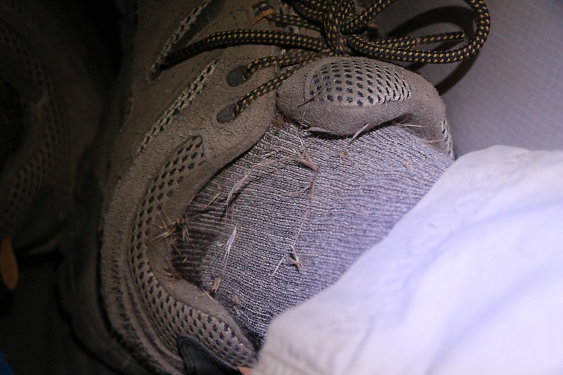
In the last light of day I noticed that the valley had gotten wider, and that there were two long ridges heading toward the trail, either one of which might have a flattish section on top suitable for a tent. Nearing the first ridge, I put down my pack, got out my headlamp, and climbed up into the grass and brush above the trail. And, indeed, the top was semi-flat. I stomped around looking to see if there were any boulder-free areas, because digging up a big boulder wasn’t going to work for us. Nor was uprooting any medium sized bushes. And that’s pretty much what I found up there. I decided that I would only camp there if there was nothing else within the next mile. This opinion was formed not only by the boulders and bushes, but also by the foxtail grasses that I had walked through. As my legs swept past, the ripe grass seeds had lodged themselves in my wool socks, and, since they are very pointy and have one-way barbs on them, the poking seeds were working themselves inward and creating significant pain in my ankles. It was like I was wearing barbed-wire socks! It hurt. And I wasn’t happy. But I was even less happy about the thought of camping in the middle of a thousand more grass seeds. They were everywhere up there on that ridge!
So I climbed back down to the trail and put on my pack once more. I looked at the next ridge and realized that it would probably be similarly bad. But I had to try. I hobbled along, trying not to bend my ankles at all, to stop the pain from getting worse. It seemed like something new poked me with every step. The trail angled into a small side-valley between the two ridges, and right at the low spot, at what would be a watercourse during a rainstorm, I noticed a faint path leading up into the little valley. “A path!” I shouted to Vicki. “A path!” she replied, elated. We knew what that meant. Surely there would be a camping spot within the dry watercourse. Why else would there be a path?
And there it was! It was small, it was bowl-shaped and not flat, with a definite but not unacceptable slope, and it would just barely fit our tent if we didn’t extend the side vestibules. In other words, it was perfect!
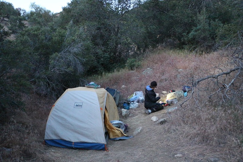
So we put down our packs and started setting up camp. We both put up the tent, then I inflated the air mattresses while Vicki got the stove ready for breakfast in the dark the next morning. We decided that it didn’t matter if this spot had no view because it was dark anyway, and we’d probably be leaving it in the dark. We laughed about it, but it wasn’t the best of laughs; still, it was better than grumbling.
Then we got inside the tent and got ready for bed. Even though I was exhausted, it took me almost a half hour to pick out all the horribly evil grass seeds that were lodged in my socks and shoes. No, I couldn’t leave them there.
Once that was done, the two of us fell into a deep, restful sleep, happy that we’d hiked almost fifteen miles that day, truly an amazing accomplishment for us, and that we only had ten more to go tomorrow, when it was supposed to be even hotter. We also had the famous Deep Creek Hot Springs to look forward to, and now they were only four miles away. We’d be there in the morning.
Day 3
Once again, we woke up in the dark and started getting ready. Today was supposed to be downright HOT, and here we were, heading downhill into the Mojave Desert! We were probably nuts, but it didn’t really matter. We had to get back to the car, and there was no other way to get there but to hike. We ate breakfast in the early dawn light, then packed everything up and were hiking by six. The air was cool as we got started, and the trail was still tending predominantly downhill, which made Vicki happy. Naturally, it waited for the sun to start blasting before tending upward again, and we immediately got overheated. Vicki doused her hair with water to cool off, and we hurried forward, trying unsuccessfully to get into the shadow of the hills as the trail oscillated, following the winding canyon, tending generally toward the northwest; the sun rose in the northeast and therefore was shining down on us almost the entire time.


It wasn’t until we turned the corner to the west that we found some relief, and that was also when the trail began descending toward one of the highlights of our hike: Deep Creek Hot Springs.
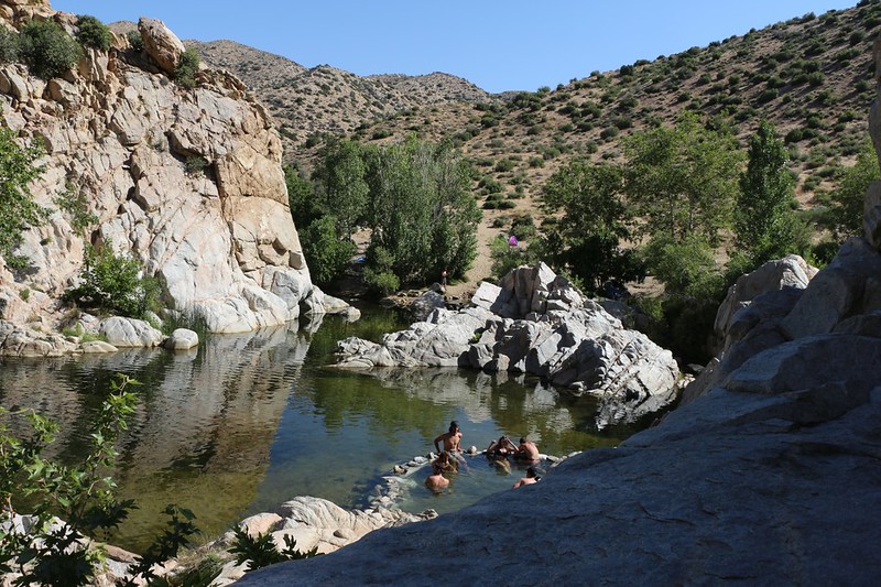
We’d heard rumors about this place. That it was full of Hippies. Nudists. Drugs and Sex. And maybe those rumors are true. But they weren’t the day we showed up. Well, except for the Hippies and the Nudists. They were there, all right. But not really all that many. Mostly there were a bunch of people just hanging out, almost all of them relatively non-naked, enjoying the hot springs. It was a very mellow scene.
We arrived just before nine AM, so maybe it got rowdy later, but I’m doubting it. People were just waking up, doing the usual morning thing. It was already getting hot, so everyone was wearing shorts and bathing suits (except for a few inveterate nudists).
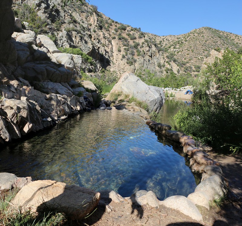
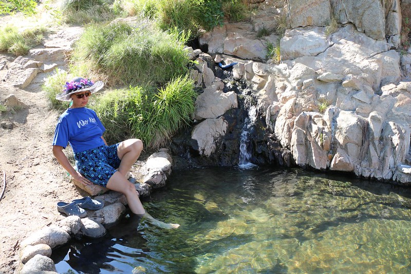
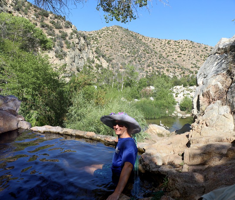
We put our packs down near the trail and put on our water shoes. It was time to check things out. One of the hot springs started right next to the trail, and the water was very hot. And it didn’t stink like sulfur, thank goodness! It was simply hot water. It flowed downward toward the main creek, and along the way previous hot spring lovers had cemented small granite boulders into low, semicircular stone walls, forming convenient pools, just the right size and depth for bathing. Since people were still waking up, we had a couple of hot pools to ourselves, and they proved to be a bit too hot for a warm day like this.
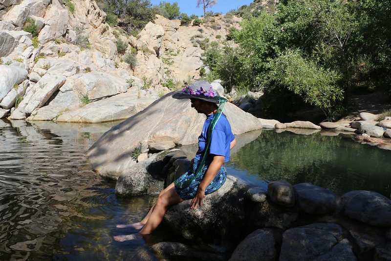
So we put our feet in the nice cool creek, instead. We watched some young dudes jumping off a tall boulder into one of the deeper sections of the creek. We also wandered upstream a bit, looking for a granite chute to slide down, but had no luck as the granite around there was a bit too rough in texture; you would have been a partial nudist soon enough if you tried sliding in your bathing suit!
We went back to the pools and spoke with some locals, who told us that each pool had its own unique temperature, and showed us to a warm pool. It was far more comfortable. There were a few semi-nude hippies in that pool singing buddhist songs, but Vicki didn’t notice the nudity as they were under water. She climbed in and sang along, mostly humming because she didn’t know any of the words. But she had fun. I laughed afterward, because she told me that she suddenly realized that they were naked, and that’s when she got a bit embarrassed and left the pool. Meanwhile, I had been walking around taking more pictures of both the area and of non-naked people. The naked ones were safe from my lens.
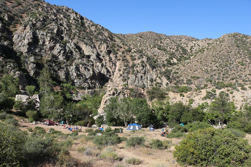
And there were plenty of people. There were tents all over the place, including right next to the sign saying “Day Use Area. No Camping.” It looks like the official rules were only loosely enforced, if at all, and I didn’t really care. They were people having fun, and nobody was hurting anyone. It was truly out in the middle of nowhere, so who cared? It was a perfect spot to relax on a long Memorial Day Weekend.
Video of a hot pool at Deep Creek Hot Springs
GoPro video above and below the surface of Deep Creek at Deep Creek Hot Springs
Video of a man jumping into Deep Creek from a large boulder
Panorama video at Deep Creek Hot Springs
After a while, we noticed that there was more activity. Some people were already packing up and heading out, while others had just arrived for the day. The ones camped on the PCT side of the creek had to wade across, waist deep, carrying everything up high out of the water in order to get to the shorter trail back to their cars, which was a steep uphill hike in the sun, and it was getting hotter.
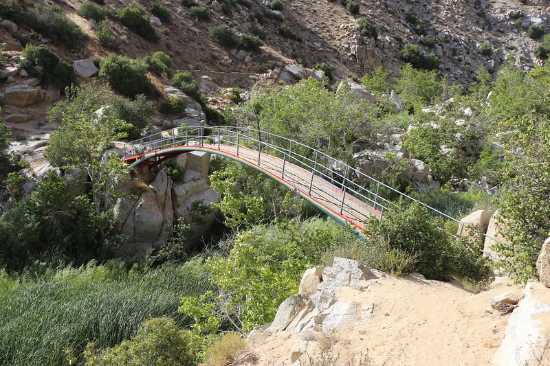
We decided that the scene here, while fun, wasn’t exactly our style, as we prefer to enjoy the peace of the wilderness whenever possible. We decided to hike a couple miles further before it got even hotter. The trail was supposed to cross the creek on a footbridge at mile 310, and we figured that there would be a nice spot with shade down near the water where we could take an extended siesta. So we put our hiking boots back on and shouldered our backpacks. And then we had to climb back uphill for a while, because the trail builders really liked the idea of keeping the trail halfway up the side of the canyon. I have no idea why. The views were nice, but you were too far away from the water. Oh well. There’s no changing it now.
So up we trudged, sweating and overheating. At least there was bit of a breeze, but it was sure hot. Then the trail went back to its usual story: A long gradual downhill slope as it followed the creek. Eventually, about eleven AM, we arrived at the footbridge, and it was beautiful. It was arched high over the stream, and had been painted with rainbow stripes on one side.
Panorama video near PCT mile 310 looking across Deep Creek

On the way down we met a man on a bicycle (we’d seen him earlier carrying his bike across the creek at the hot springs). Technically, bikes are not allowed on the PCT, but he’d been hurt in an accident, and hiking was painful, so bike riding was all he could do these days. He told us about the next section of trail after the bridge, about how it followed the path of an old water flume that had been constructed in the 1940’s, which brought water from the creek and delivered it miles away out in the Mojave Desert. Wildfires had destroyed it eventually, and now it had been plowed under and mostly covered over with dirt, forming the trail itself. And we could see that it was amazingly flat, winding along the side of the canyon, extending itself far into the west. This was another case of “technically, it’s downhill” because water only flows downhill, but let’s be real: It was flat.
Anyway, we thanked him for the history lesson and headed down to the streambed to find a shady spot. We saw one down below the trail and scrambled down a steep use trail. There was some excellently soft sand under a leafy sycamore tree. It was only partial shade, and we knew the sun would keep changing the shadows, so we set up the poles of the tent and spread the tarp over the top, creating a small patch of full shade. Then we got out our books, positioned our water and food within easy reach, and balled up our extra clothes for pillows. We crawled into our shady zone and stayed there for hours, napping and reading and lounging around.
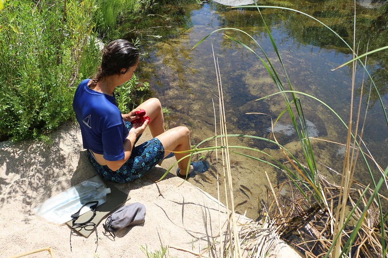
Fishy Fun Video – GoPro underwater shot of small Bluegill fish that were pecking at Vicki’s feet. And the camera!
After laying around for way too long, we started to move around a bit. It was still too hot, but at least the temperature was beginning to drop noticeably. Vicki got up to pump some more water to get us through the next four miles. She had fun with the bluegill fish in the stream that were nibbling at her feet. They thought that she was the most interesting thing they’d seen in a long time. There were also some giant tadpoles that must be the precursors for some of the deepest-voiced bullfrogs I’ve ever heard. They were great. I can’t imagine how loud it must be along that stream at night.
Then we folded up the tent and packed everything back into our packs. We climbed up the steep path to the PCT itself, and crossed over the stream on the rainbow bridge. The big frogs said goodbye from the reeds down below, and I tried to answer them. It isn’t easy sounding like a frog that big.
After that we hiked along the flume-way, making good time, and taking short cool-down breaks when the canyon turned southward, providing short stretches of blessed shade. Just the same, it was easy hiking, and Vicki kept cool by soaking her hair and bandanna with water. OK, she wasn’t cool; she was merely slightly less hot. But we had to keep hiking if we wanted to get to the car at a decent hour, so we did.
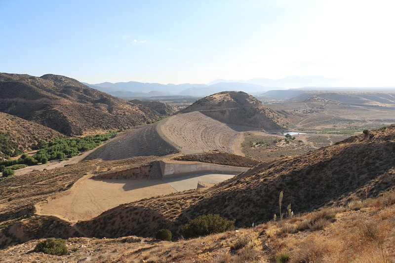
Eventually we came within sight of the Mojave Dam. It was gigantic; it was ridiculous; it was insane. There was no water on either side of it! What was it doing there, and why did they build a dam in middle of the desert to hold non-existent water? Well, there really IS an answer, and I found it on wikipedia; it mainly has to do with flash flooding events, and protecting the towns downstream of the dam. So now it makes sense. But it still seems insanely large to me.
When the trail reached the dam, it switchbacked downhill and eventually reunited with Deep Creek. We walked across the high spillway, and tried to imagine the water level ever reaching such heights. And we hoped we weren’t there when it happened. We followed along the side of the dam and saw the enormous “pipe” where all the water from Deep Creek and the Mojave River pass through unimpeded to the downstream side. There are no gates to block the flow, so the pipe’s diameter and the water level behind the dam are the only constraints to the flow. We could see light through the pipe to the other side, and only thought about hiking through it for a moment or two. We wanted to get to the car!

The rest of the hike passed by quickly. The only sad part was that the last stretch went uphill. In the sun! Vicki was not amused. She was grumpy and wouldn’t talk to me, because I was far too cheery. The more I tried to cheer her up the sulkier she got. But eventually we made it to the car, of course. And it was parked in the shade, just the way we planned it. I jumped inside and turned on the engine, opened the windows and put the air conditioner on full blast.
We sat down near the cool blowing vents and changed out of our hot shoes and socks. Our feet truly deserved this. They’d just hiked over thirty five miles in three days. They were heroes! We drank water and ate some salty chips, trying to rehydrate and get our electrolytes back into balance. We changed into some cleaner clothes that we’d left in the trunk for this occasion and felt better right away. Vicki even smiled a bit.
I thought about the trip as we drove away, heading for San Bernardino and some dinner along the way, thinking about what went right and what went wrong, and how the trail itself ended up being far different than I had anticipated. It was probably the temperature that was the most “wrong” but we did what we had to do in order to mitigate it as much as possible, by taking long siestas in the shade. We also did exceptionally well on our long distance hiking, with a fifteen mile day (and only one small blister, thanks to taping my feet beforehand). Finding the campsite in the dark was definitely my “darkest hour” but we found one in the end; I only wish I had put my gaiters on before heading off-trail, which would have stopped the bad grass seeds from poking me. Live and learn, and don’t let time pressures stop you from making the best decisions. Finally, we did really well on the third day, with plenty of fun at the hot springs and an extra-long siesta when it got too hot. That really saved the day for us.
And when I mentioned to Vicki that we would be doing another section, the one just south of this one at Big Bear Lake, she groaned and told me to be quiet. Would I ever stop planning more hikes? I laughed out loud. Not likely. But I wisely kept my thoughts to myself this time.
For more photos and videos please check out my Flickr Page
For an interactive Topographic Map of our hike and GPS track see my CalTopo Page
