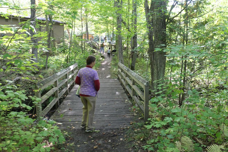
On my final day of hiking on the North Country Trail within Pictured Rocks National Lakeshore, I went from the Mosquito Falls trailhead to the western end of the park at Munising Falls, passing Mosquito Falls, Mosquito Beach, Bridalveil Fall, Miners Beach, Miners Castle, the Cliffs section, and Sand Point. All told, I hiked a total of fifteen miles, and I did it solo this time. It was a long day but a satisfying one. This marked the completion of a 42 mile section of a major national trail within a national park.
Vicki’s foot was still quite sore, so she begged off on accompanying me this time. This wasn’t exactly optimal, as the two of us love to share our observations as we hike, but it would certainly be faster. I tend to cruise right along, especially when the trail is relatively flat. This section promised to go up and down the sandstone cliffs a few times, but it was only a 200 foot climb, so I wasn’t worried. In fact, I was excited. This park was really beautiful!
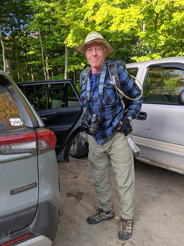

Vicki dropped me off at the trailhead, then went off to have some fun on her own with our friend who lived nearby. She would be picking me up later on in Munising. Unless I wimped out and bailed at Miners Castle, which seemed doubtful.
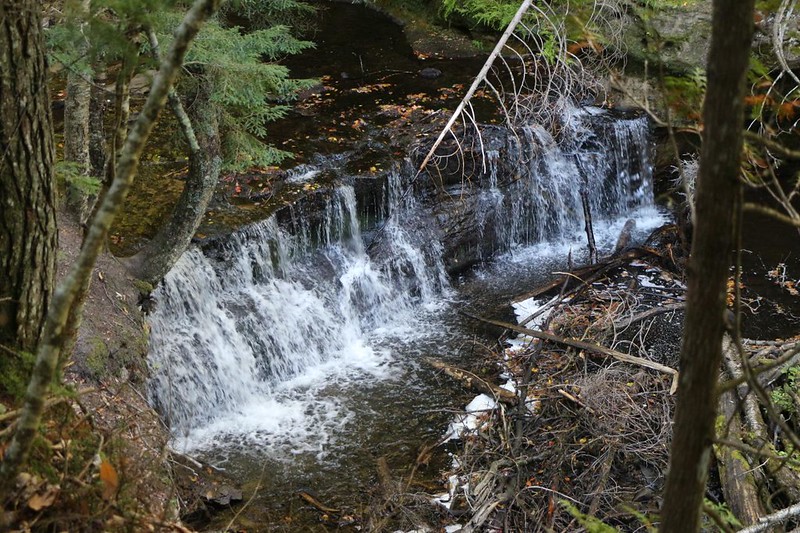
I decided to take the slightly longer Mosquito Falls Trail so that I could check out the waterfall on my way to the Lake Superior shoreline. The falls turned out to be more of a wide waterfall than a tall one, and more like a series of cascades. There wasn’t a lot of water flow, this late in the dry year of 2021, but that didn’t matter. Any waterfall is better than no waterfall. I took some photos and videos and hiked on.
The trail paralleled the Mosquito River for the most part, and soon enough I arrived at Mosquito Beach. I walked east on the trail until I reached the bridge over the river where Vicki and I had been before (to properly complete this NCT section). I briefly checked out Mosquito Beach and then headed west. I was back on the trail!


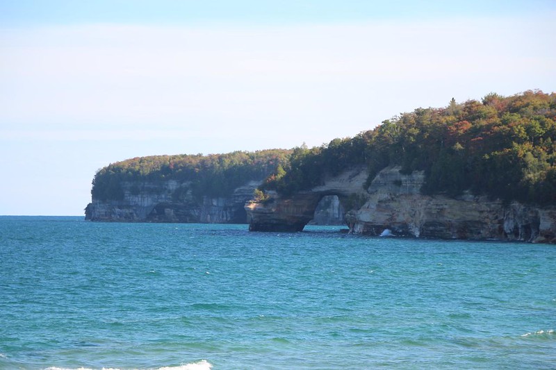
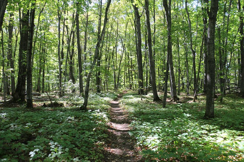
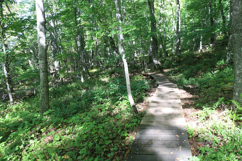
At first the trail stayed inland, within the forest, which was composed largely of small spruce trees in that section. In other spots it would be primarily a Maple-Beech forest. But the path didn’t stay inland all the time. There were numerous side-trails which led to excellent viewpoints. I took photos at all of them. At first I was able to zoom in on Lover’s Leap, the huge natural bridge (or arch) and other times I only got a view of the lovely sandstone cliffs that gave Pictured Rocks its name.

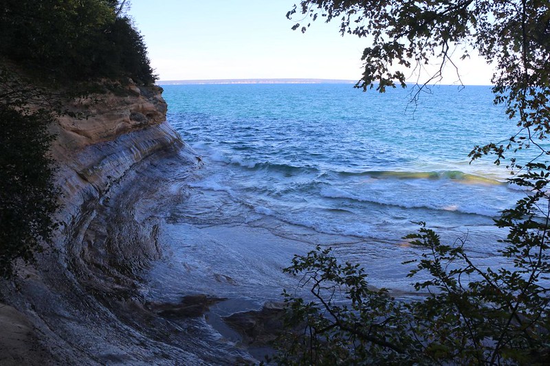
The trail was well-built, and even had convenient wooden stairs. Both up and down. These undoubtedly helped to control erosion, as most of the land along the lake was composed of either sand or sandstone. In general, I was always happy to climb higher, because the views almost always got better.


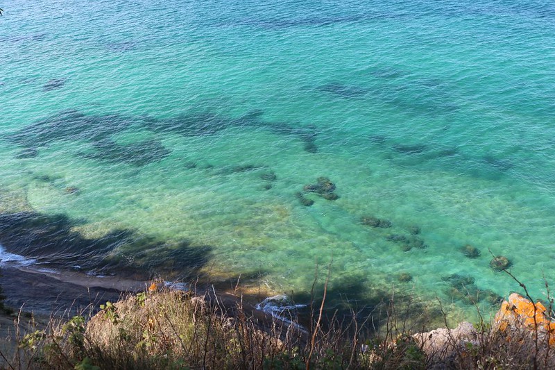
Soon enough, I was hiking up above some of the most colorful cliffs I’d seen. Gorgeous! The color was supposedly due to exotic minerals and metal oxides leaching out from within the sandstone, as groundwater seeped toward the lake. See the Park’s website for more information on the pretty coloration.


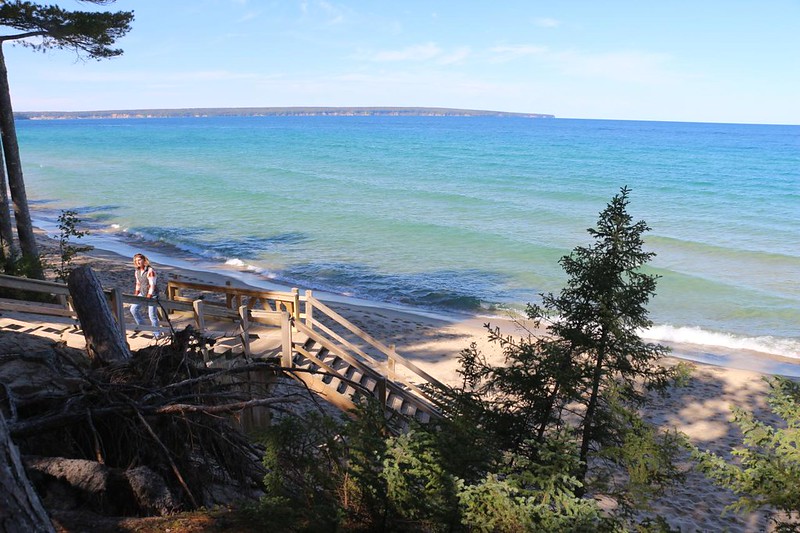
Eventually, the trail headed downhill steeply, and suddenly I was back on Miners Beach, where I’d viewed the sunset (by car) a week earlier. I decided that this was a good spot to stop and eat some lunch. I took off my boots, and read a book in the shade for a short while. Very relaxing. I’d already hiked about six miles and I figured that I’d be up to the halfway point by the time I reached Miners Castle in another mile or so. That was my final bail-out point, when I would decide whether to continue on for another 7 miles, or come back to finish it up tomorrow.


After slogging along through the deep sand on the beach trail, I turned inland. The trail crossed Miners Creek, then climbed steeply up to the Miners Castle area. There were zillions of tourists up there. Well, compared with the number of people I’d met on the trail, at any rate. I took another obligatory photo of the castle, then paused to evaluate my condition. Could I make another seven-plus miles? Yes, I said to myself. I wasn’t feeling any strain at all. I knew that this would change later on, but I still thought that I’d be OK. Let’s be honest: I really wanted to get this hike over with, and I was worried that we were overtaxing our welcome at our friend’s house. Fish and guests stink after three days, and it had been well over a week! It was time to move on, sadly enough. And the only way to do it was to keep on hiking! I liked the sound of that.


After that, I left all the tourists behind, and started hiking on a very lonely section of trail. It still stayed up high on top of the cliffs, just like it had been, but for some reason I met far fewer hikers along the way. And that was OK with me. I was having a great time!
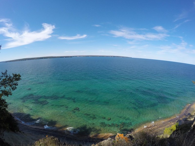
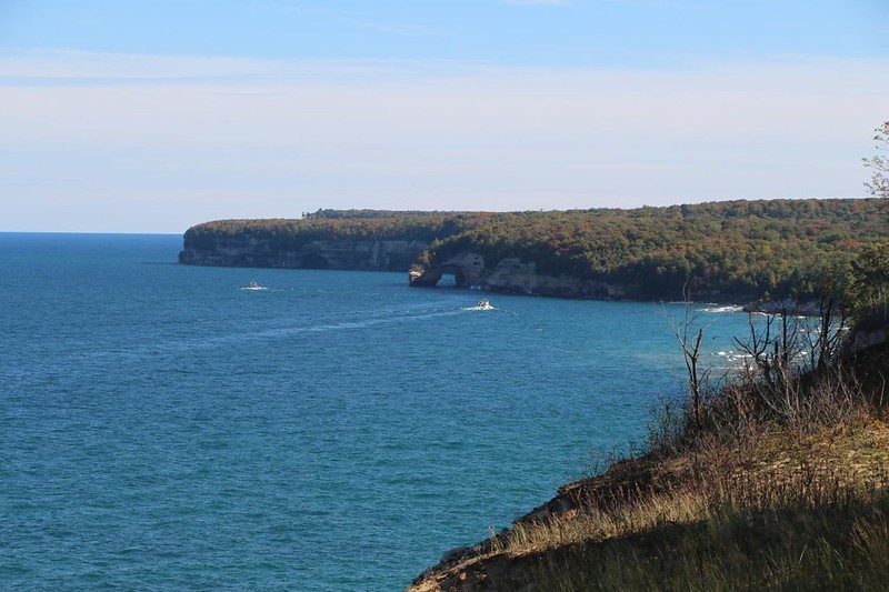
I took another boot-off break near the Cliffs Campground. That’s what this section of the park was called, I guess. And the trail certainly followed along on the top of the cliffs. It was quite a bit of fun, and there were plenty of views to be had. The biggest difference along this section was that Grand Island was directly across the way, rather than the nearly-unlimited vastness of Lake Superior.

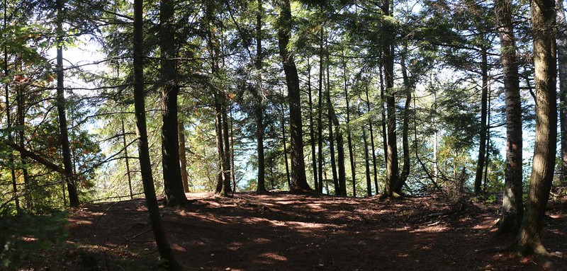
After that, the cliffs didn’t seem so steep, and there were more trees on the steep slopes that led down to the lake. The result of this was that there were fewer excellent viewing spots along the trail. Previously, there had been a side trail every quarter to half mile or so, but now there were hardly any. I met some backpackers who were just starting out (heading east) and they asked me point-blank whether there were any views to be had, as they were not amused. I was shocked. All I’d seen were great views the entire time! But it didn’t take long before I understood how they felt. There really weren’t all that many spots along this final stretch of trail. Oh well. I was still enjoying the forest, so it was all good for me.


After I passed the major side-trail that led down to Sand Point, the NCT essentially merged itself into a maze of cross-country ski trails that Winter tourists enjoyed. This park wasn’t only a Summertime paradise; it was a Winter Wonderland as well, with skiing, snowmobiling, and even ice climbing on frozen waterfalls. Quite the park, really.
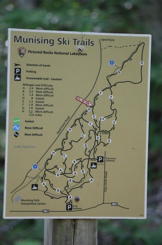
It may have been a maze of trails, but they were all well-marked, and I had no trouble staying on the North Country Trail. I hiked along, my legs starting to show some signs of fatigue, but all in all I was feeling pretty good. It was nice to know that I could still crank out a fifteen mile day.

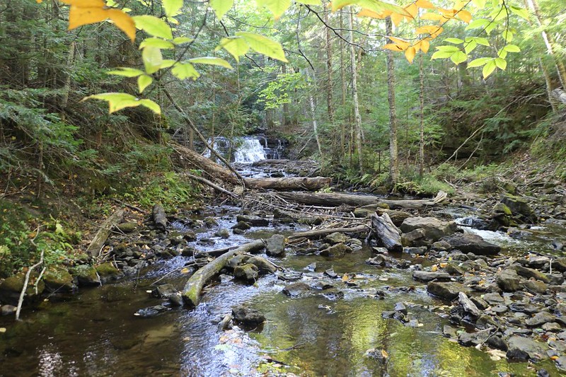
As I neared Munising Falls, the trail crossed over one last creek (complete with a small waterfall) and began to descend. I looked ahead of me, and there was Vicki! She had arrived to pick me up, and headed up the trail to meet me. We held hands and walked the final steps to the car in the trailhead parking lot. It was time to head back to our friend’s house. I needed a shower, for one thing. And a tasty meal would go a long way.
All told, I had hiked 42 miles on the North Country Trail through the park. Counting side-trails, we had hiked over 63 miles over the week. We were both glad that we had arrived in early Autumn, when the trees were turning color and the bugs were a thing of the past. It was the perfect time to visit. We had seen a large part of this beautiful park, and yet, I knew that there was still plenty more left to explore.
We promised our friend that we would be back again one day. We really wanted to do some kayaking, but we had to admit that we were hesitant about the cross-country skiing and ice climbing. Somehow, spending the Winter in San Diego sounded much more appealing to us. Instead, we invited our friend to come and visit us during the cold months. Now that was a plan!
For a topographic map of the hike see my CalTopo Page
For LOTS more photos of the trek see my Flickr Page
 << Back to Day 6

