On our first day’s visit to Pictured Rocks National Lakeshore, we opted to behave like typical tourists, visiting the most accessible attractions like Miners Castle and Munising Falls, plus, we also took the Pictured Rocks Cruises tour boat to view the shoreline with it’s colorful sandstone cliffs.
After a four-day, 2300-mile road trip from San Diego to Michigan’s Upper Peninsula, we were more than ready to check out some sights. Luckily for us, we knew someone who lived near the park, so we had inside information on what to see first. It’s always good to have a Local Guide.
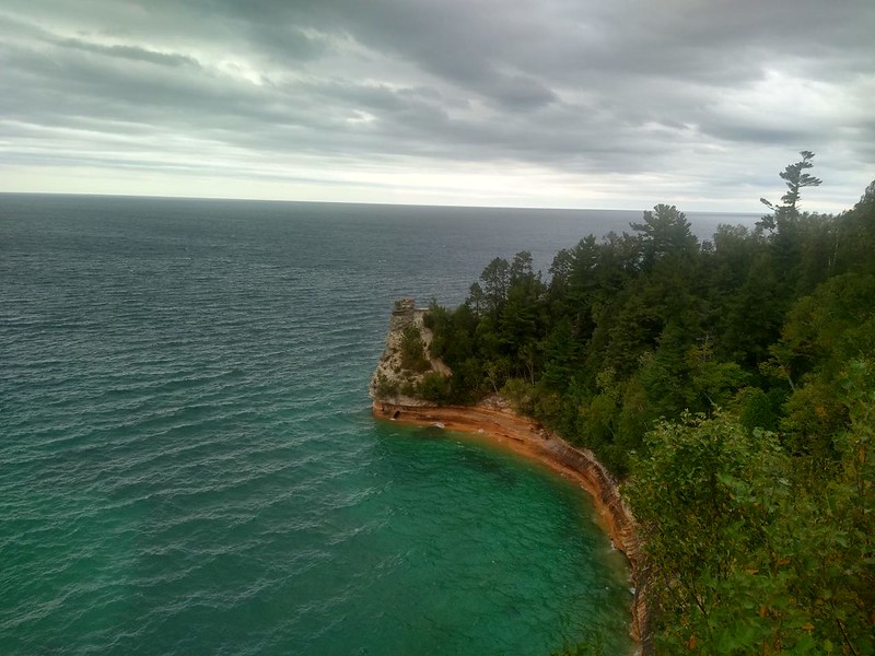
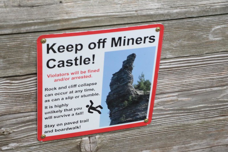
Technically, the first part of this “Day 1” page actually takes place on Day Zero Eve, after we arrived in town and went out to dinner with our friend. Munising seemed like a very tourist-friendly town, and everyone we met was helpful and pleasant. After a good meal, we took a drive east of town to visit the Miners Castle area. There was a large lookout platform up on the cliffs, and it provided a great view of the vastness of Lake Superior. Supposedly, Canada was out there somewhere, invisible beyond the curvature of the earth. The lake was huge. It was more like an inland ocean than a lake! Very impressive. Superior, indeed. Closer at hand, however, was Miners Castle, a sandstone formation on a point of land that jutted out into the lake. And, yes, it looked a bit like a castle. Then we took a short walk on a trail to a smaller viewing platform out on the point, to get a closer look.

After that, we drove down a graded gravel road to the trailhead for Miners Falls. We took a short hike to check it out. The Miners River poured impressively over sandstone cliffs. Vicki and I love waterfalls, so this was pretty cool. Our friend said that this had been a dry year, and the flow was very low, but we weren’t complaining. Not at all. Nice!

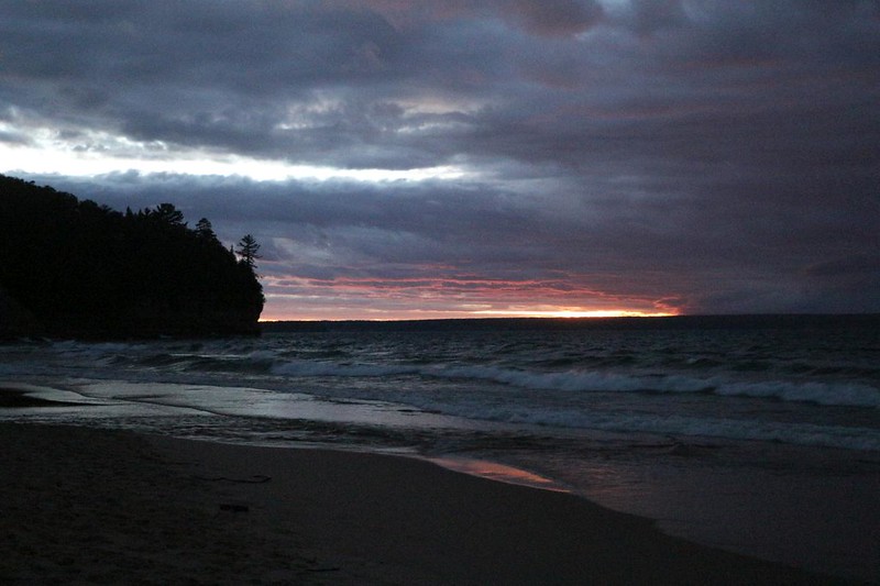
As long as we were there, we learned that we really needed to check out Miners Beach, to get Up Close and Personal with Lake Superior itself. There were only modest-sized waves rolling in, but I knew that during storms the waves on Lake Superior can get truly enormous. With 150 miles of fetch and a strong gale, massive seas can develop. In fact, the largest wave ever recorded on the lake was 29 feet tall, and it happened not far from here. Impressive, and scary. But this evening the lake was in a mellow mood, and we had a fine time checking out the sunset along the beach.
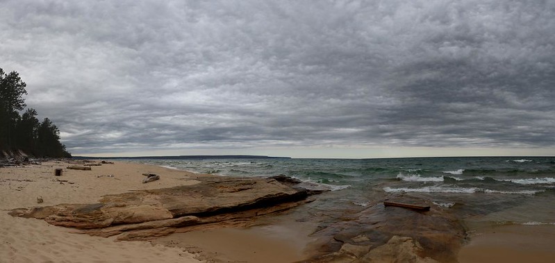

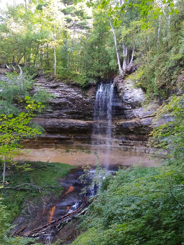
The next morning (the real “Day 1”) we decided to check out the town of Munising, in so far as Pictured Rocks National Lakeshore was concerned. First stop: Munising Falls. This spot was very close to downtown, and it was an easy hike along an asphalt trail. Once again, we were told that the water was barely flowing, but we liked it just fine. There were two main viewing spots, and some well-built stairs to reach them. There were lots of other tourists here, even this late in the Summer season.

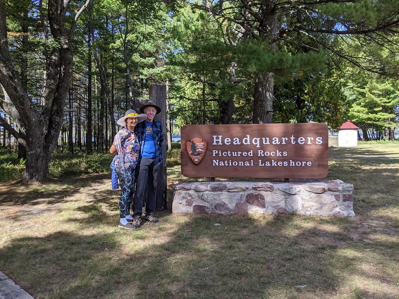
We drove a short distance to Sand Point, where the Park Headquarters was located. It wasn’t a Visitor Center; it was more of an administrative building. It used to belong to the Coast Guard. This lake was so big that they had the Coast Guard here? I was a bit shocked, as we were a thousand miles inland from the ocean. But, technically, it was along the U.S. border, so it made sense. We explored the sand beach, and saw Grand Island across the way. That island is what protected Munising Harbor from the worst of the stormy seas in Winter.

Afterward, we headed off into town to get a “Pastie” for lunch. Pasties are considered to be proper Upper Peninsula food, and we had never had one. What are they? Kind of like a meat and vegetable filled pot pie, but surrounded by baked dough, and without the pot. They probably originated as a way to turn leftovers into tomorrow’s lunch, but that didn’t matter. They were good! We were glad we had them.
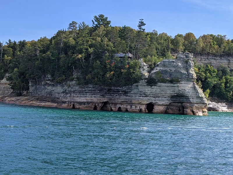
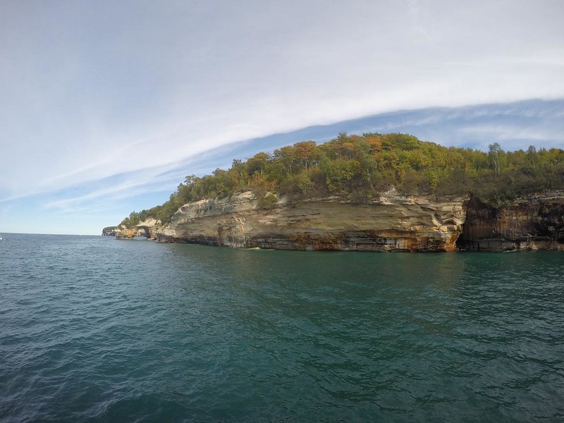
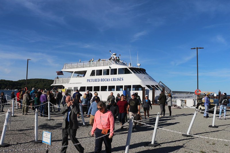
Our friend had made reservations for us on a local tour boat, Pictured Rocks Cruises. We were informed that the best boat was the big catamaran, as there was less spray and more stability. And we also arrived at the dock quite early, to get in line for the best seats, which were on the starboard side. This was the side facing the shore on the way out, and the shore is where the action is. For, after all, this was Pictured Rocks National Lakeshore, and the rocks along the shore were, arguably, the main attraction of the park. There were also plenty of lakes and trees and creeks and waterfalls, but the rocks were what it was all about in the end, as they were truly unique.

We eventually boarded and got the good seats on the second level. Most folks like the upper deck, but we didn’t want to be in the cold breeze. The Boat pulled away from the dock and made its way out of the inner harbor. It was a fast boat, and the captain gunned it along in between attractions, while slowing back down for the good stuff. Soon enough. we were idling along next to Miners Castle, and the captain told us that, back in 2006, there was a second “tower” on the castle, which broke off and plunged into the depths of the lake. Nowadays, it still looks like a castle, but not as much as it did before.

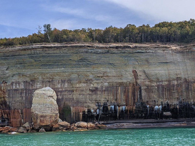
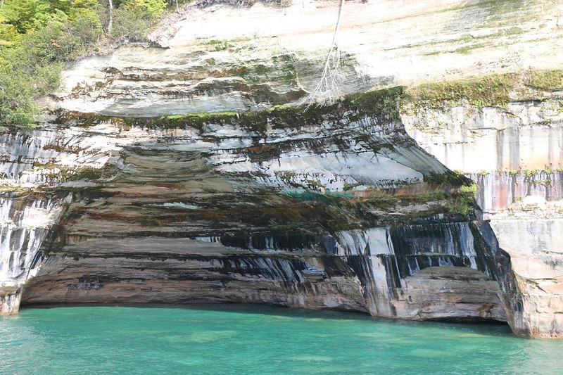
We continued along the shore, and learned that the sandstone cliffs were given their distinctive colors by various minerals. We also saw where Bridalveil Falls would be, if only there was enough water. All along the shore, we saw where the lake’s wave action had undermined the cliffs. We also saw quite a few people hiking along the top. We waved to them and they waved back. I’m pretty sure we ended up in each other’s pictures.


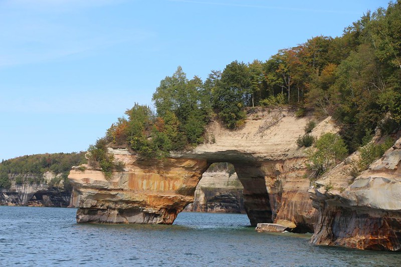
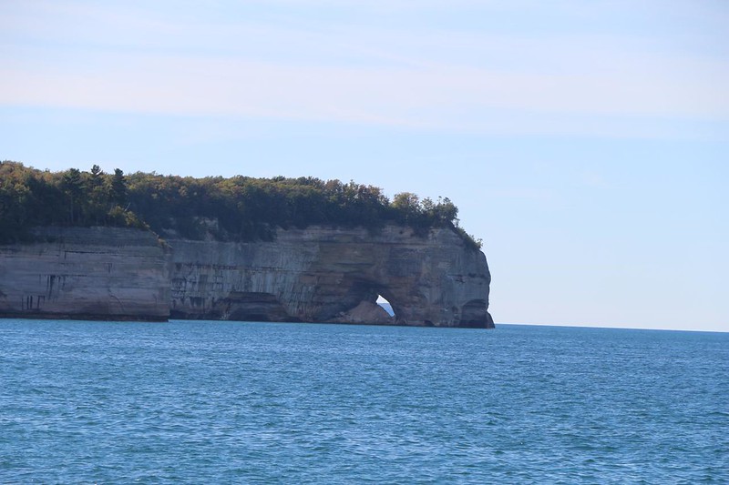
Next stop: Lover’s Leap, which is also known as “Petit Portal.” The leap was a stunning natural bridge that arched over the waters of the lake. It would have been cool if the tour boat could have gone underneath, but it was probably too shallow. Or the park didn’t like the idea. I don’t know. But it looked like a fun spot to take a kayak! We saw several groups of kayakers paddling along the shore, tended by a big guide boat. That looked like a lot of fun, provided the weather was warm. And calm. Because you really don’t want to fall in the frigid waters of Lake Superior. Hypothermia can be deadly, and this lake has claimed the lives of many people.

The boat tooled along, and the captain told us about various interesting features along the way. And I took way too many photos and videos, as usual. I had to work hard to select only a few of them to show here on this page.

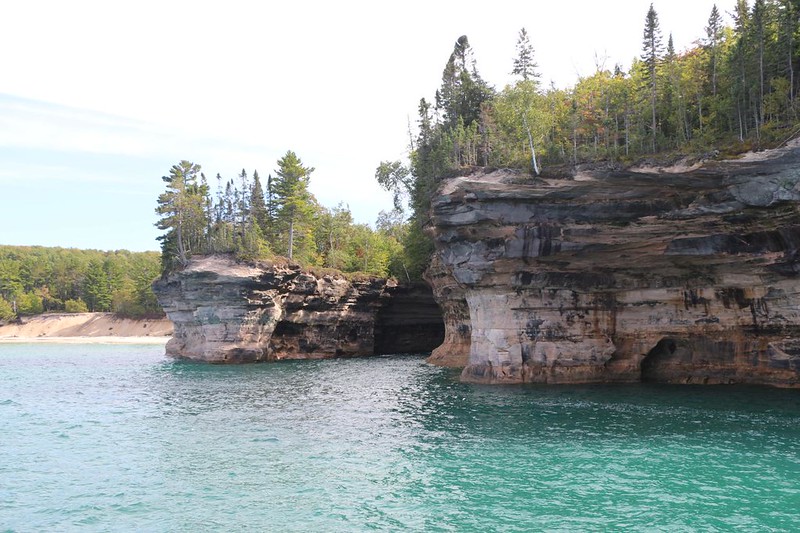
There was yet another natural bridge in the park. It was called the Grand Portal. Several years ago, a roof collapse had occurred, and now the area underneath showed a large pile of debris. Seeing this made me happy that we hadn’t taken the boat under the first arch! This was also a popular spot for hikers, as we saw quite a few of them relaxing in the sun up on the top of the cliffs. I don’t think that they realized just how far their perches were overhanging the waters of the lake. It looked like it might collapse underneath them at any moment! The reality was quite a bit less scary, of course. The chances were probably closer to those of winning the lottery, but, just the same, it was a bit worrisome. The bigger danger was for people taking selfies for social media (slipping and falling off the cliffs), not the cliff’s stability.


The biggest excitement of the journey was when the captain took that big old catamaran right inside one the the small indents in the shoreline. The boat barely fit inside, with maybe five feet to spare on either side! Luckily for us the lake was relatively calm that day, or he wouldn’t have tried it. In fact, on many days the waves are too big to leave the harbor at all. Unless you like the sight of seasick passengers and the smells thereof. No thanks! But on this day we were in luck, and we took a quiet break inside what Vicki and I decided to call “Hidden Cove.”


Next stop: Chapel Rock. This outcropping was truly amazing. There was a large tree growing on top of it, and over the years, the intervening sandstone gradually eroded away, leaving the tree perched atop a tall sandstone pillar. It also left two large roots behind. These roots swung across empty space to the mainland, where there was enough water to sustain such a large tree. The stone beneath the boll of the tree had also been partially eroded, leaving a hollow zone underneath. It was pretty darned impressive. We learned that Chapel Rock and its amazing tree was chosen for a commemorative US Quarter. Our friend said that we might hike down to check it out ourselves, and this got us thinking.


The captain gunned the boat a bit further east, to the final highlight of the tour: Spray Falls. This waterfall was a true curtain of water flying directly off the top of the cliff. The water level was low, of course, but we were still impressed. There were hikers up above, but I already knew that we had the best view. Waterfalls simply aren’t very exciting from the top. Bottom and side views are always the way to go.


On the way back, we were on the wrong side of the boat, facing out into the vastness of Lake Superior. The captain did his best to give all of the portside passengers a chance at getting photos of the highlights along the way, but, let’s face it, the initial visit was the best and longest-lasting.

GoPro video of the twin 1500 horsepower engines on the catamaran

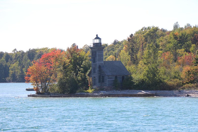
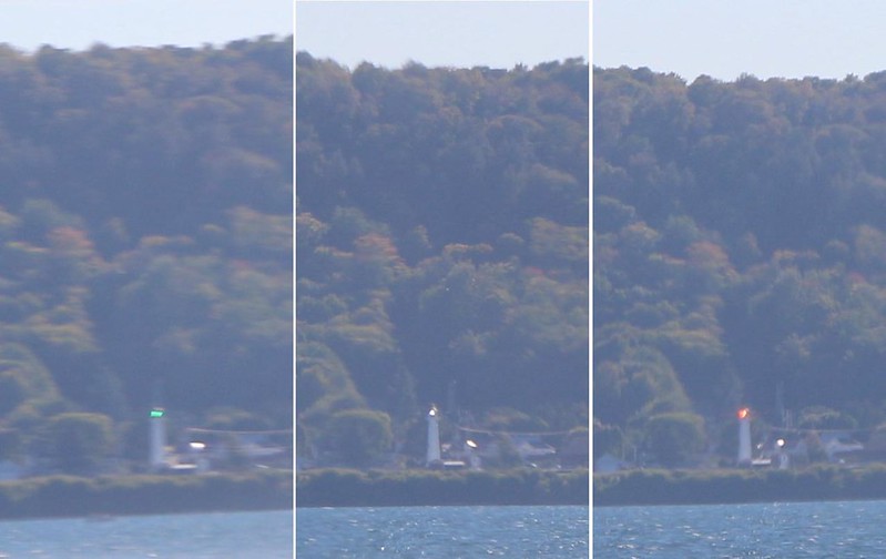
The return trip was also when we got to see Grand Island. There was an old lighthouse there, to mark the entrance to the harbor. But it had been decommissioned years ago. The new light was a fancy lens affair, that guided the really big coal-carrying ships into the harbor. There was a factory in town that burned coal to make power for the mill. Yes, there are big freighters plying the waters of Lake Superior.
All told, the boat tour lasted about two hours, It was definitely worth taking, and really showed off the beauty of the park. It also gave us good ideas for places to hike later on that week. After the tour, the most important thing (for me) was to check out the Gift Shop. Yes, I got myself a Pictured Rocks T-Shirt. And a fridge magnet! I even found a few gifts for the folks back home. Thus far, the only thing they’d received were texted photos of a beautiful place that they weren’t able to visit, so they surely needed a consolation prize!
We went back to our friend’s house for dinner that night. And that was when we discovered that a national trail, the North Country National Scenic Trail (4500 miles long!) passed directly through the park! It was about 42 miles from the east end to the west, and it travelled directly along the coast most of the time. Vicki and I surely had to backpack through this park! So, we started doing our research online, and making our campsite reservations. And that trek is what the rest of this trip report is all about. Hiking and backpacking, as usual! We were super excited, and had a fun evening making plans.
For a topographic map of the hike see my CalTopo Page
For LOTS more photos of the trek see my Flickr Page
Onward to Day 2 >> 

