Paul and I got ready to begin our hike at the crack of dawn. We knew that it was going to be a very, very long day. Our plan: Bag at least three of the trailless “bushwhack” peaks in the southern Catskill Mountains. We’d do a fourth peak if we had both the energy and the time. True, the days are long at the end of May, but we knew we needed to start early or we’d be hiking back in the dark.

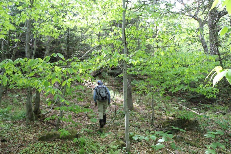
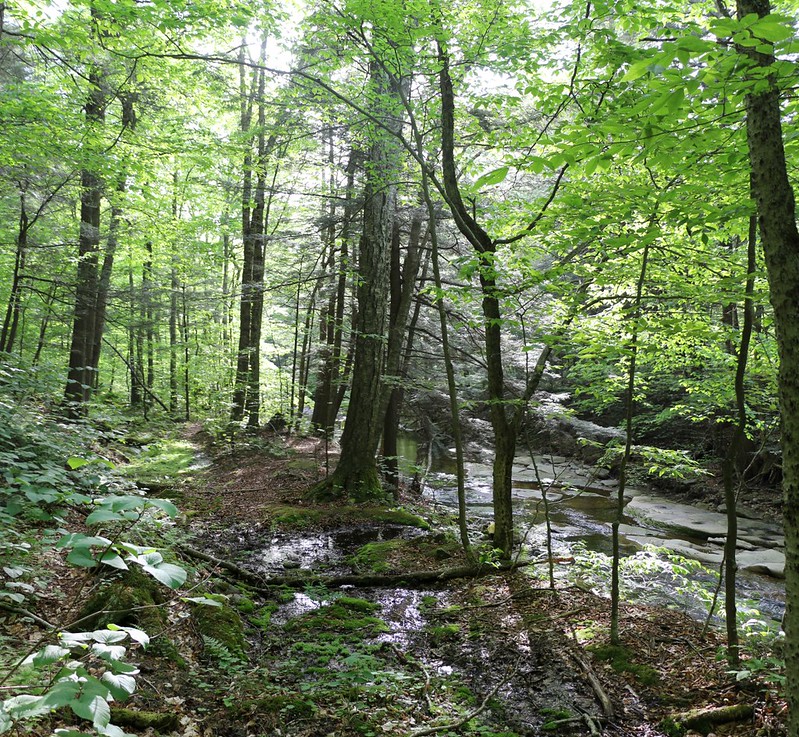
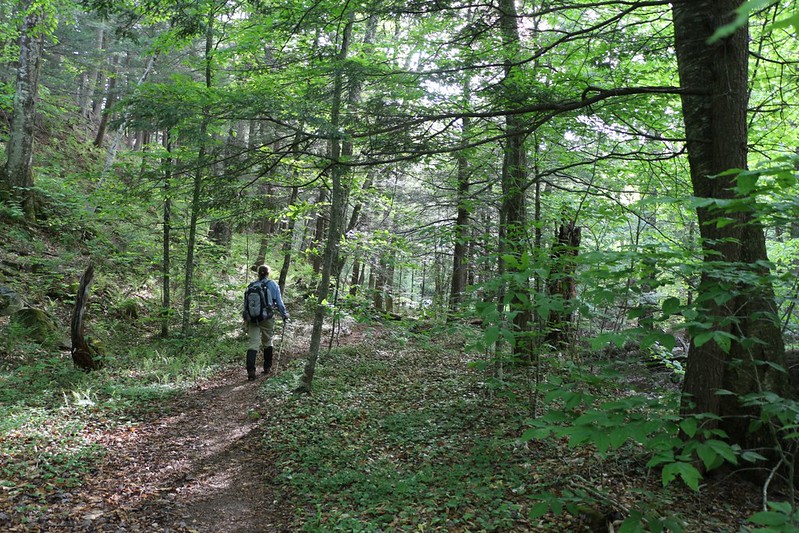
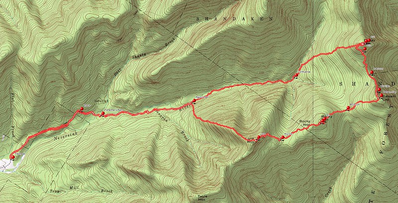
We began at the Denning Road trailhead parking area, hiking on a well-maintained trail toward Table Mountain. Once the trail crossed the East Branch of the Neversink River, we turned left (leaving the trail) and followed a fairly well-defined fisherman’s path upstream along the south side of the riverbed. Mellow hiking, not steep at all, and it lasted for four and a half miles.


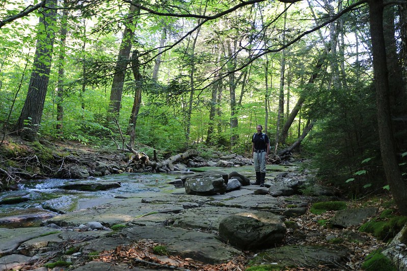
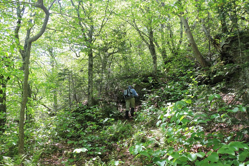
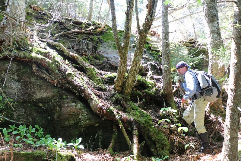
Still, this “preliminary” part of the hike took us three hours. And we’d only gotten to the point where we were ready to begin assaulting an actual peak! But once the bushwhacking began, the going got steep, the brush got thick, and the rocks got mossy. We had about a thousand feet to climb in order to reach the summit of our first peak of the day, Friday Mountain (elevation 3694 feet). There were no trails leading to this peak.
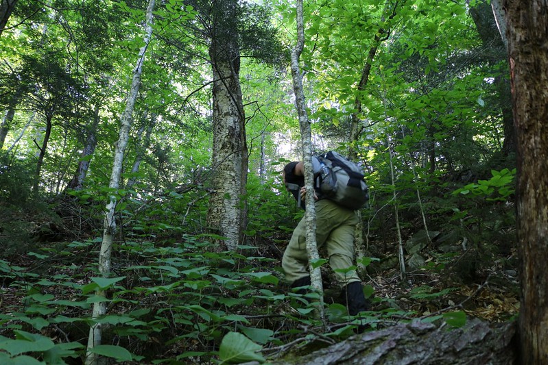

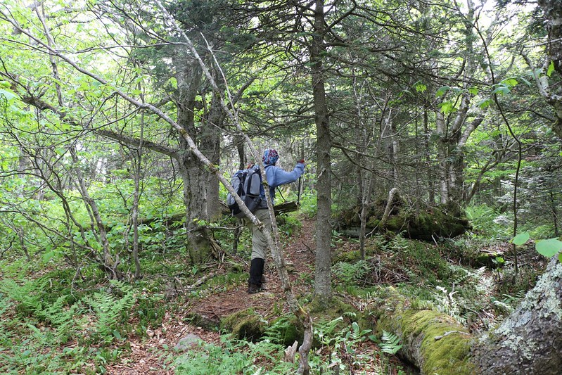
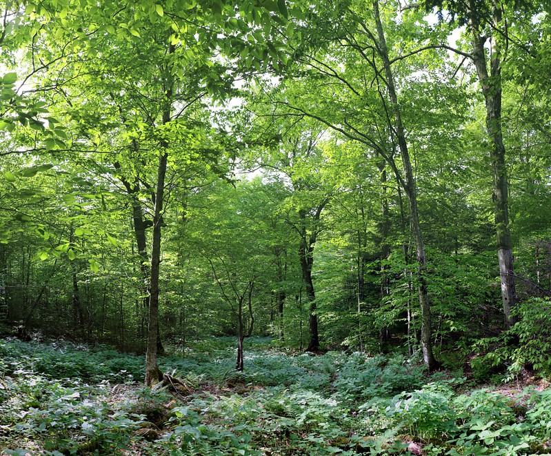
At the lower elevations the forest was bright and green and open, mostly maples and beech, but as we got higher the flora shifted to smaller balsam pines, much closer together, with lots of little dead branches conveniently located at face level. Our choice of paths ranged from bad to worse: Pushing between smaller trees with hundreds of tiny branches that break easily but always seem to aim for your eyes, or pushing between larger ones with bigger branches that crack explosively, thus providing sharp points that leave you bleeding and bruised. What a joy!
But it really wasn’t quite as horrible as all that, because these brutal sections lasted only so long, after which, typically, there was a respite where you could see a bit further through the underbrush, thus allowing you to clamber over crotch-high fallen logs or climb up steep, towering ledges, complete with slippery, mossy rocks. What a pleasure!

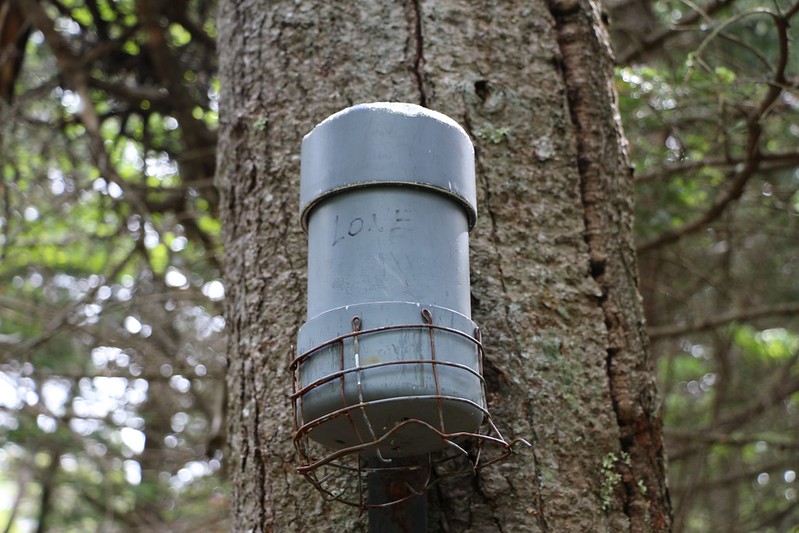
After what seemed like ages, we reached the gently-sloping area near the summit of Friday Mountain. There were a number of “herd paths” up there, created by other hikers seeking the canister containing the peak register. We followed the paths around, looking for the canister, which was typically mounted to a tree just above head level (up high so that people could still find it when it snowed in the winter). But it wasn’t there. Someone must have moved it! So we wandered around even more, and trampled through still more brush looking for it. We went everywhere. Except where the canister was hidden. After twenty minutes of this we gave up. We’d summitted the peak, and that was the most important thing. Right? Wrong! We wanted to sign the register! But we had to give it up as a lost cause, as we had other peaks to bag that day. What a disappointment!

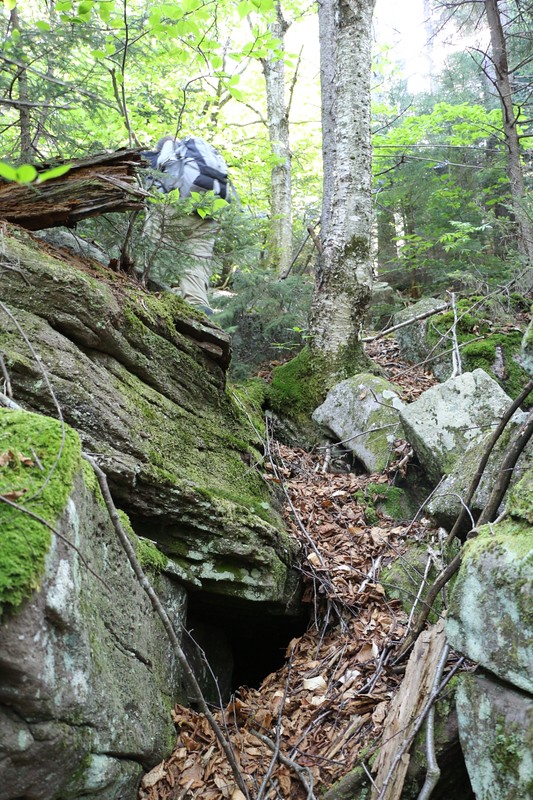
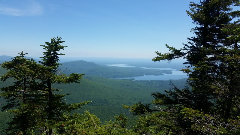
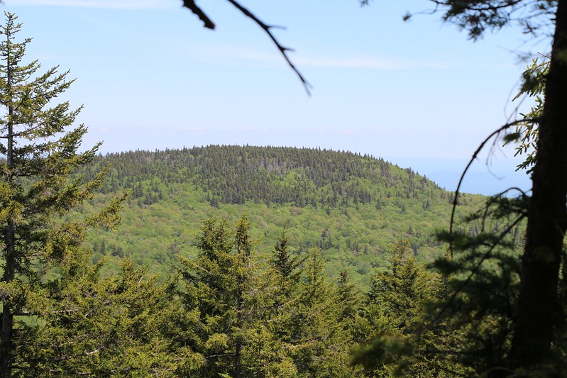
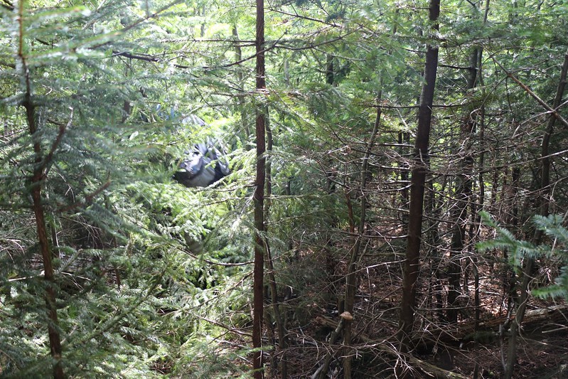
So we headed off to bag Balsam Cap (elevation 3623 feet). On the way, we got off-track almost immediately, as the herd path we were taking slowly veered west. It was taking us back the way we’d come! So we headed directly into the bushes, bearing south toward the Friday-Balsam Cap Col. On the way down we found ourselves on top of a high ledge, and we actually got a view out to the south and east. Yes! We could see Balsam Cap, Ashokan High Point, and the Ashokan Reservoir. We had heard that there were NO views to be had on Friday Mountain, but obviously this wasn’t true. All you had to do was get slightly lost first, and then you’d be sure to find it! In fact, this view almost made up for the missing canister at the summit. Almost. It wasn’t easy finding a way to descend this ledge, but eventually we discovered a steep path along a wide crack and were able to scramble down it safely.

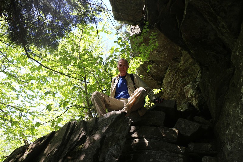
Once at the Col, we came across a herd path, one headed directly toward the summit. We looked at each other in amazement: “A path? Here? Wouldn’t that almost be cheating? This was supposed to be a bushwhack!” But there was really no question about what we were going to do. We joyously began climbing on this wonderful trail; it was as if we’d received an answer to our prayers. It seemed that in no time at all we were nearing the summit. And then we came upon an even better view than the last one! We could see both north and east from here, and were busy identifying all the peaks we could see in the distance. Along the horizon were the peaks of the Devil’s Path, where we’d both started hiking in the Catskills such a long, long time ago. Thirty years for Paul, and forty years for me. Wow.

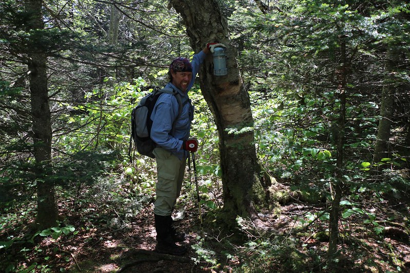
But enough reminiscing: It was time to bag another peak! We followed the herd path and found the canister, right where it was supposed to be. Hooray! We took the requisite photos and signed the register. And, since it was about 12:30pm (we’d been hiking for seven hours with only the shortest of rests), we decided to sit down and have some lunch.

And that’s when we really began to notice the flies. They had been present earlier, but now that the temperature had warmed up, they became a major issue. There were large flies, medium flies, small flies, and tiny gnat-sized flies. They flew behind us when we were hiking, just hanging back, gliding along easily in our slipstream, but once we stopped, wham! They were totally in our faces. And on our clothes, and packs, and food, and skin, and shoes. They were everywhere. I applied a second round of DEET to my exposed skin, and that pretty much stopped them from actually landing there, but they never stopped flying nearby. It was hard not to accidentally breathe one in. They were the main reason we took a short break for lunch. Only movement could keep them at bay. So we moved.

And this is when we walked directly into a wall of Balsam Pine. It was the thickest bushwhacking yet. We checked our direction using the GPS, which said that it was less than a mile as the crow flies to the summit of Rocky Mountain (elevation 3508 feet, the lowest of the 35 Catskill 3500 foot peaks), but, oh, what a mile it was turning out to be! The brush slowed us down so much that even the flies were able to beat us!

Video of tough Bushwhacking west from Balsam Cap to Rocky Mountain
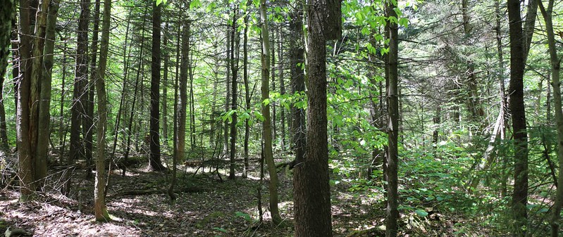
As we got lower, near the col, the balsams disappeared and we were in more open forest. It was actually quite nice. Except for the flies, of course. So we continued onward to the summit of Rocky. And, yes, there was more bushwhacking, but mostly it was steep climbing this time.
Mellow bushwhacking at the Col
Steep climbing up to Rocky
We also got to another viewpoint, looking north, and were able to see Slide Mountain (the highest peak in the Catskills), and several others. Ah, yes, this was why people climb mountains: To get great views, not to suffer! Not long after that we discovered a herd path and were soon on the summit. It had taken us two hours to hike less than a mile! “Brutal” is a word that describes it well.
We signed the summit register and put it back in the canister. Then we had to make the big decision of the day: Do we bail down the hill to the river and go home, or do we bushwhack another “easy” mile over to Lone Mountain (elevation 3721 feet) and bag our fourth peak of the day? It was 2:30pm. Based on past performance, we wouldn’t get there until 4:30pm. But the sun didn’t set until 8:30 at this time of year, so we definitely wouldn’t be hiking in the dark. It really was a no-brainer: We decided to go for it!
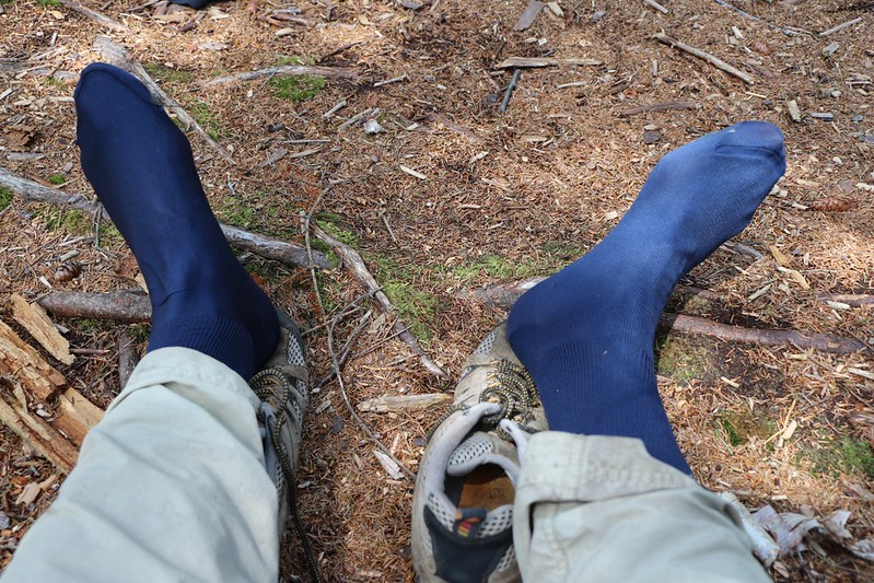
But not until after we took a good long break and let our hot, sweaty feet dry out a bit. They were seriously sore. Paul thought he might have a blister, so he applied some duct tape to his foot. I still felt OK, but my feet were sure happy about being dry and cool, even if it wouldn’t last very long. We drank some more water and ate some of our snacks, to be sure we had enough energy to get to Lone. We’re both pretty sure that we didn’t accidentally eat any flies.
I’m certain that the next bit of bushwhacking was the heaviest we’d seen all day, at least up near Rocky’s summit. The balsams were very thick. But after that it got easier. Or maybe we were simply getting used to plowing directly through the forest without regard to life and safety. We’d learned by this time to duck our heads downward to protect our eyes, to keep our forearms up to protect our faces, and to never, ever stop unless we were about to go over a cliff. This strategy works well in many aspects of day to day life.
Video of Heavy Bushwhacking west from Rocky Mountain to Lone Mountain
We reached the col and headed around to the northeast of Lone as there were insurmountable cliffs in front of us. The gps tracks that I’d found on the internet all showed people hiking up or down these cliffs from that direction, so there must have been a good reason. And there was: We found a great herd path that led us right up the cliffs to the top!
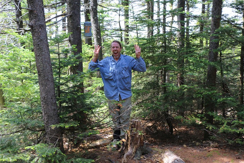
We signed the register and celebrated a bit. This was Paul’s 35th peak of the Catskill 3500, and it was truly worthy of celebration. He could now join the Catskill 3500 Club as a fully qualified member. He’d started climbing these mountains back in 1985. And it wasn’t until ten years ago that he realized just how many he’d climbed over the intervening twenty years, and so he began to get the peak-bagging bug. After that, it was simply a matter of going to a new peak every time he could (which is never often enough). The trailless “bushwhacking” peaks he mainly did with me, as it’s less safe to be off-trail solo; the buddy system is a very good thing under these conditions. And that’s how I got lucky enough to bag quite a few of these crazy fun peaks myself! I doubt that I’ll ever bag all 35 like Paul did, but I sure had fun watching him succeed. Congratulations, Paul! And, I must say, he sure had a satisfied look on his face.
At that point, all that was left was to get back to the van alive.
We headed off on a herd path that lead toward the northwest ridge of Lone. We didn’t expect the path to last very long, but this one was quite nice. There were very few balsam pines, so the woods was airy and green, and there was a slight breeze up there on the ridge. It was almost as if the Catskills were rewarding us with easy hiking now that we had a proper thirty-five-hundred-er leading the way. And I sure wasn’t going to complain.
Just the same, we had almost 1600 feet total to descend, and it wasn’t going to be easy on our feet. Part way down Paul stopped and applied duct tape to his other foot, and on we hiked. The trusty herd path faded out but the bushwhacking remained easy. The afternoon was getting late and the light began to slant in sideways though the trees. Very pretty. Eventually we reached a point where we could hear the river down below us, and we knew that we were near the end of the bushwhacking part of the hike.
We arrived on the fisherman’s path, and only had three more miles to go. Easy hiking, and we’d been there that morning. By this point in the hike we weren’t talking a whole lot. We were mostly concerned with stepping carefully on our sore feet, and making it back to the van. We stopped for a rest near one of the big bridges on the main trail, and enjoyed it more than we should have. We needed to get going, or we’d never want to get up! So up we got, and on we hiked. Only one more mile to go.
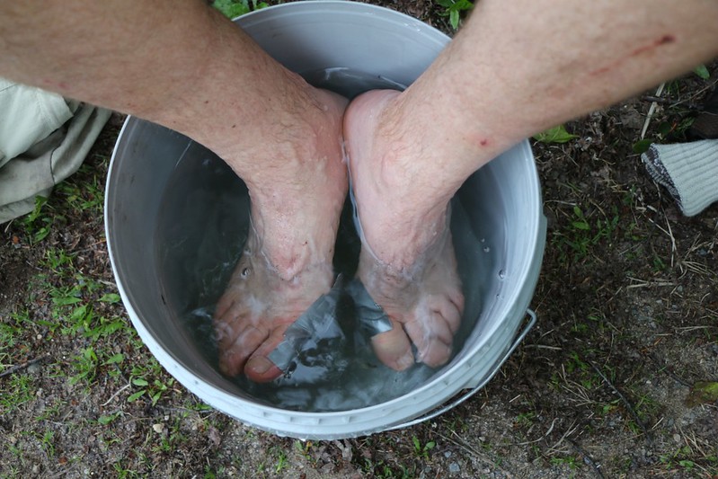
We got back to the van and changed out of our sweaty, stinky clothes. Paul went off to the nearby stream and brought back a half-bucket of water. He sat down on a folding chair and plunged his feet into the icy water. Woooo! It was cold! But it also felt so good. He stayed sitting like that for at least ten minutes. We also did some stretches and got ready to drive home.
I finalized our track on my GPS and read out the days stats:
Miles hiked: 14.48 miles
Hours total: 13 hours and 54 minutes
Average Speed: 1.0 miles per hour
Total elevation gain: 3200 feet
As we drove home we did a review of the hike: What went wrong and what went right? The biggest thing that went wrong was that we never found that annoying canister on Friday Mountain. We’re still kinda ticked off about that. But that’s life. The flies had been incredibly annoying but they’d only bitten us a few times. That was about it. As for what went right, well, pretty much everything. We’d finished off most of our food and most of our water, so we hadn’t carried too much gear with us. We’d made good time, considering what we’d hiked through. Plus, we hadn’t gotten injured beyond a few (OK, a lot) of scratches; there was minimal blood on our clothes. We’d gotten some truly excellent and unexpected views along the way. And we’d had a great time hiking together. You can’t ask for more than that, in the end.
Interactive Topo Map of our hike on my Caltopo Page
Even more photos from the trip on my Flickr Page
