My brother Paul and I decided that we were going to spend a day hiking in the Catskills during my yearly visit to New York. But not merely hiking on a conventional trail – our plan was to summit two (or even three!) of the notorious trail-less “Bushwhack” peaks of the Catskills. I had my outdoor skills, as well as a map and compass, so I wasn’t too worried about getting lost. Of course, I also had a topo- and waypoint-loaded GPS, but let’s not dwell on that…
We drove up on a Thursday night, and parked the van at the Mink Hollow trailhead at the west end of the Devil’s Path on Spruceton Road in West Kill. We slept about six hours and woke up just before dawn; it was going to be a long day, so we needed to hustle. We had some oatmeal for breakfast, got our gear and clothing together, and still didn’t get started until well after 8 AM! But that didn’t bother us, as we were strong hikers; this bushwhacking thing was sure to be a “Walk In The Park!” In fact, when we were finished bagging North Dome and Sherrill we were figuring to still have plenty of time to run up Halcott or Rusk, thereby checking off a third “bushwhack” peak on our scorecard for the day. Like I said, a Walk In The Park.

The weather report said that there would be a twenty percent chance of rain until 2 PM, which wasn’t great, but we decided to hike anyway, as my vacation schedule wouldn’t permit waiting another day. When we got out of the van it was drizzling, but surely we wouldn’t notice that under the trees. And the trees dripped when the breeze blew, but it didn’t really blow all that strong. And our view of the top of Rusk Mountain across the valley was completely obscured by a low ceiling of clouds, but we were confident that those clouds would rise by the time we reached a viewpoint at the 3500 foot level. And, finally, even though it was unseasonably cold this morning, at least we wouldn’t have to worry about overheating. Yes, with a bit of optimism, this would be a glorious day for hiking!
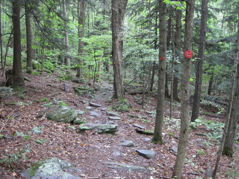

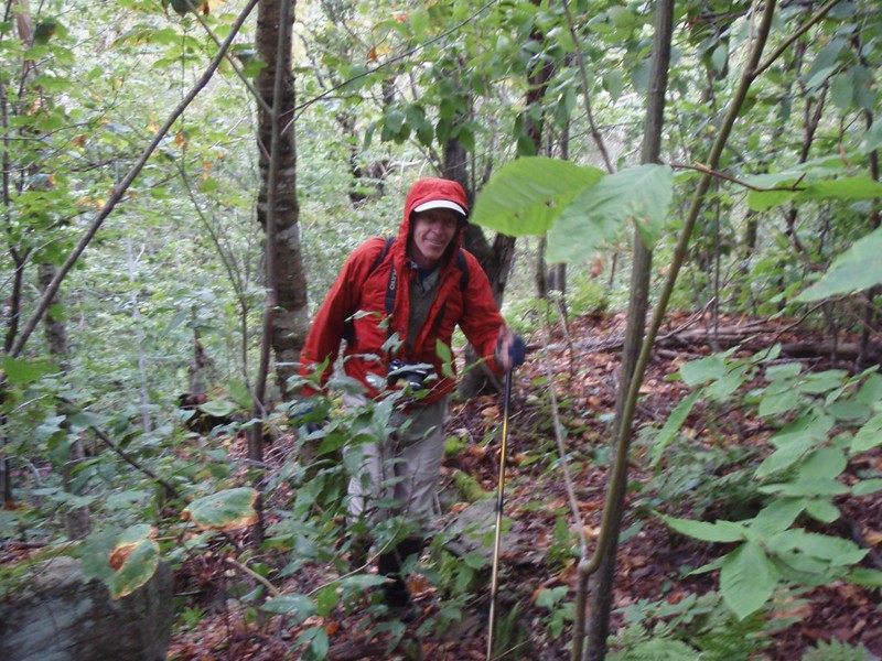
About a half mile up the trail, Paul realized that he had forgotten his hiking poles, so he dropped his pack and went back to the van. Oh well, there goes another half hour. I enjoyed the silence and the occasional drips of the rain while waiting. I wasn’t even getting wet. This really WAS a Walk In The Park! It was nice hiking on the well-worn trail. When Paul returned we continued uphill for another mile, then consulted the GPS to see if it was time to turn. Our plan was to turn off early, heading to the summit of North Dome at an angle that looked to be less steep on the topo map than the other published routes, which basically took the trail south to the notch, then turned due west and powered directly uphill. Now it’s a known fact that the true, old-time bushwhackers didn’t need to use a new-fangled GPS, but then again they often got lost (and then pretended that they knew where they were all along). So we decided on a compromise: We took a bearing for the peak using the GPS, then translated it into a bearing that we could use with our trusty compass (which never needs batteries). We headed off at 250 degrees magnetic, and continued up the slope. Afterwards, checking our GPS track on the computer, we found that following a compass course can be quite good! We went in a straight line nearly all the way to the peak. Oh, and by the way, it turned out to be a wise decision to go back for those hiking poles – we used them often (one pole for each of us) on the way up, and especially on the way down; they really saved us from some falls and bruises. Highly recommended for bushwhacking!
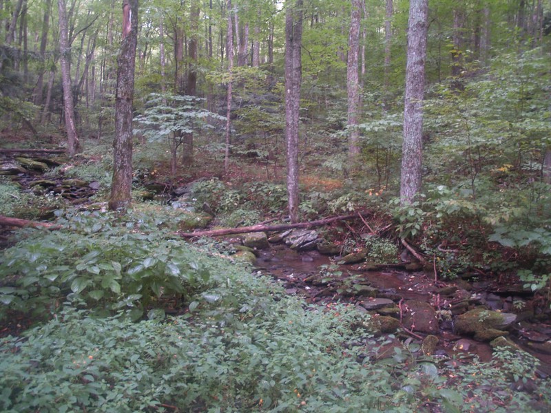
Video of Dripping Rocks
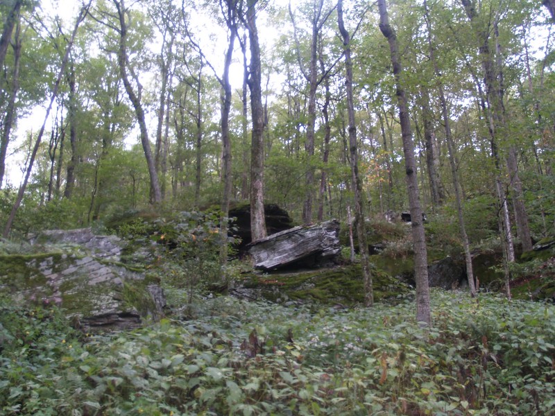
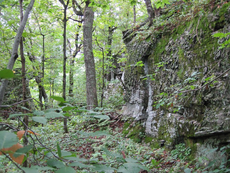
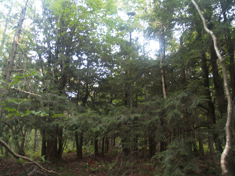
There were a number of ledges on this side of North Dome, but none of them were overly difficult to find a path through. Nonetheless, it was a relentless uphill slog. And the undergrowth was soaking wet from the night’s drizzle. Not only that, but the undergrowth seemed to be composed primarily of thorny raspberry vines and stinging nettle plants! Paul was ready for this, as he had massive waterproof boots on, and knee-high nylon gaiters. I, on the other hand, am a California hiker these days, so my “boots” were actually more like sneakers, complete with plenty of ventilation, and no waterproofing whatsoever. Waterproof your boots? Why bother? It almost never rains in the summer in California! And if it does, everything will be dry five minutes later anyway. Luckily for me, Paul loaned me a pair of gaiters, so my lower legs didn’t get soaked so badly. But my thighs would get an occasional slap with a wet bunch of leaves, and every so often a thorn would penetrate my thin hiking pants. Luckily for me, the heat my legs were generating from the climb was nicely counterbalanced by the frigid sogginess of my shoes and pants. I just had to keep climbing uphill to maintain a comfy equilibrium, and the mountain provided plenty of uphill.

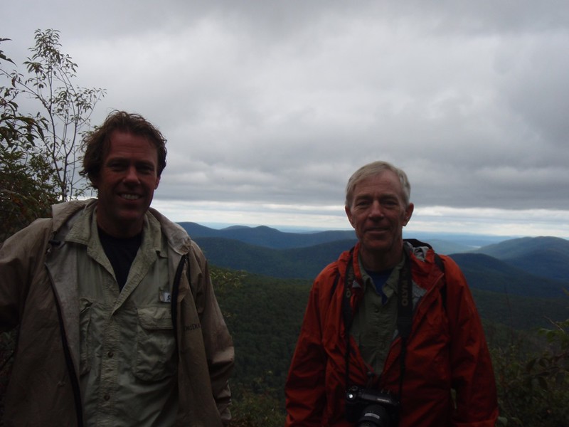
Once we reached the summit plateau we headed southwest looking for a viewpoint that we never found. The GPS coordinates I’d found online didn’t help us at all. Maybe the woods grew up above the ledge and blocked the view, or else it was only a good view in the winter when the trees had no leaves. We gave up, turned around, and headed for the peak. Bushwhacking through the stunted balsam forest wasn’t exactly fun, but we were prepared for it from our reading about other ascents, and we never got stuck in any really thick patches. We found the canister with very little trouble; it was on a well-travelled path. We took a break, downed some carbs, signed the register, and congratulated ourselves on a job well done. Our first bushwhack! And it was Paul’s 16th peak of the Catskill 3500’s. But enough of that; it was time to get going. It was past noon, and we had a lot of bushwhacking left to do! Three miles in four and a half hours – is that an acceptable time for a bushwhack-climb of 1800 feet? Maybe yes and maybe no. If this was a Walk In The Park, it was a very, very slow one.
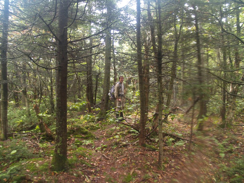

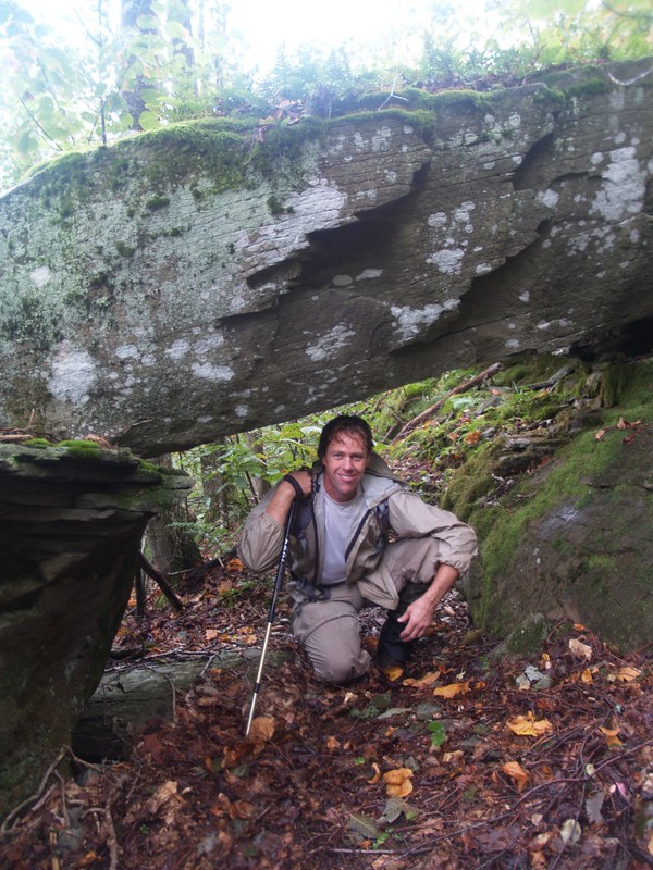
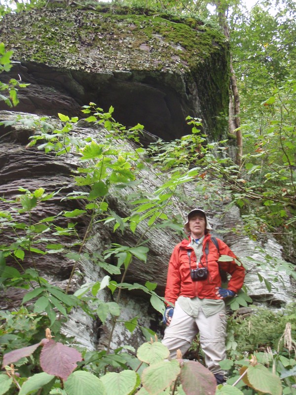
On the summit of North Dome

Onward to Sherrill! At first, we were able to follow a faint path left by other hikers on the way west across the summit plateau of North Dome, but by the time we began descending to the saddle the path had faded out and we were in full bushwhacking mode once more. Part way down we found the spring I’d read about, but we didn’t need any water. It was a mile from the peak of North Dome to the saddle, and a descent of about 600 feet. We decided that the saddle would be a nice place to camp, but unfortunately it’s just above the 3000 foot line, so no go. But we weren’t staying overnight so it didn’t matter. It was time to climb once more, another three quarters of a mile and 500 or so feet.

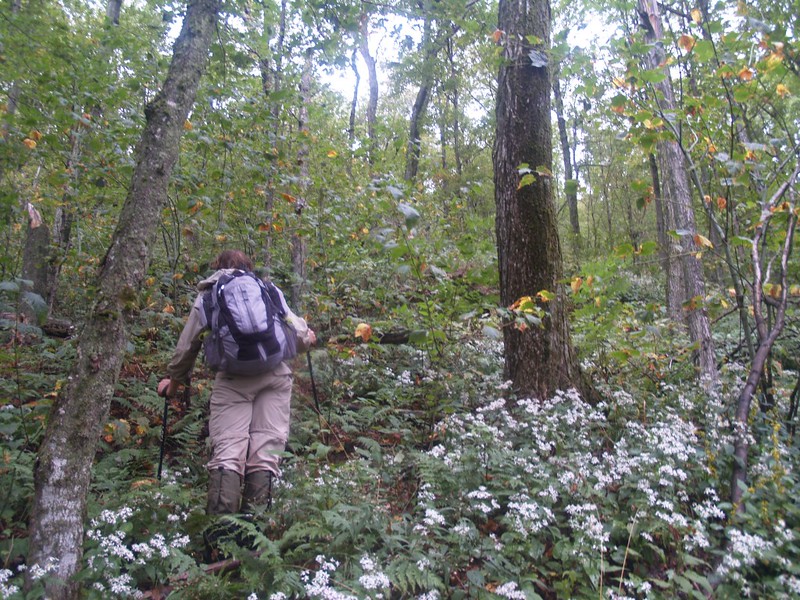
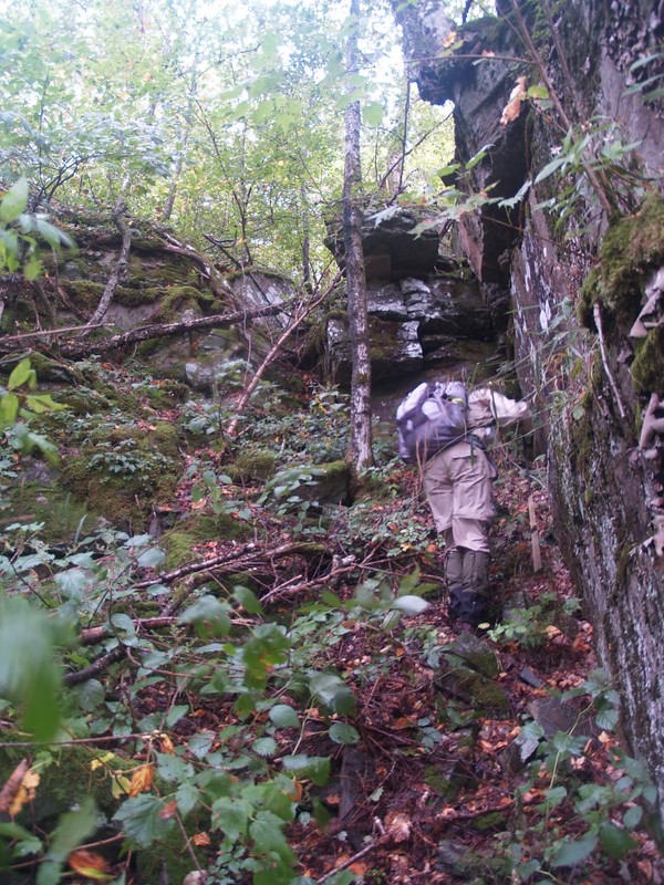
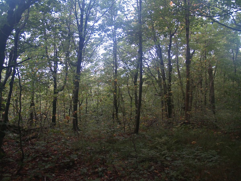
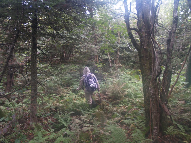
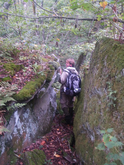
Bushwhacking in all it’s glory
Bushwhacking. Why would anyone want to do this?
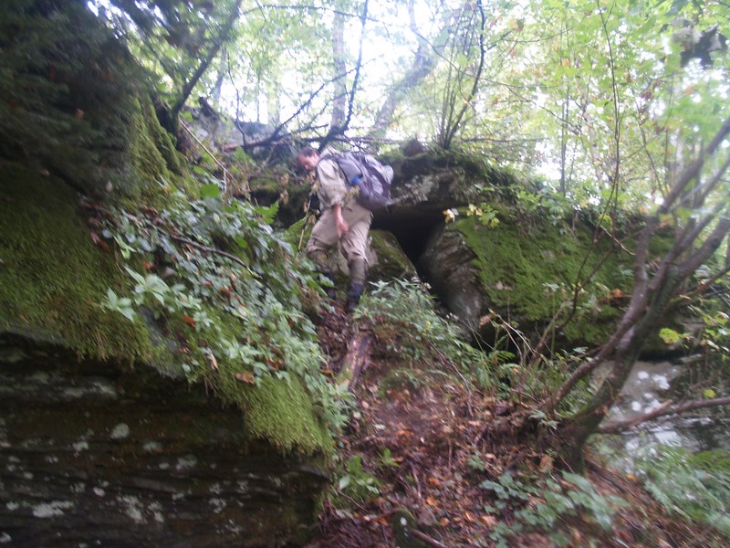
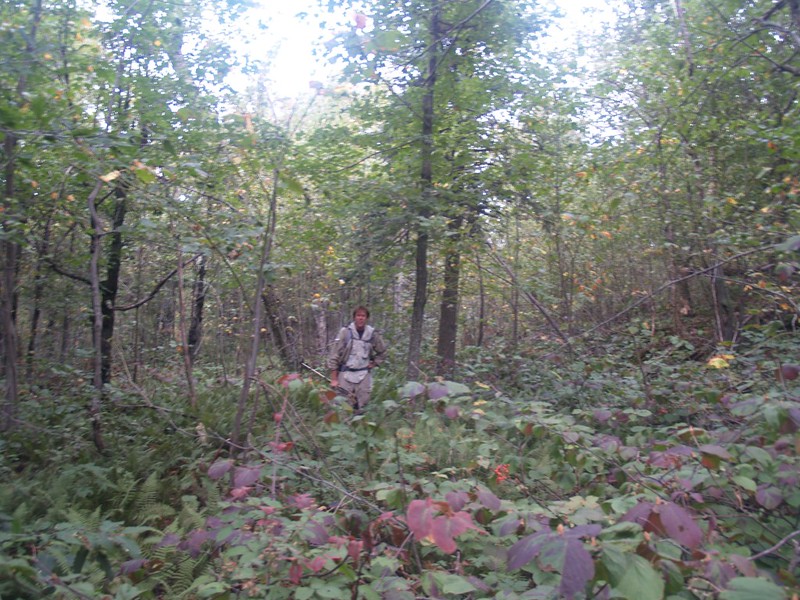
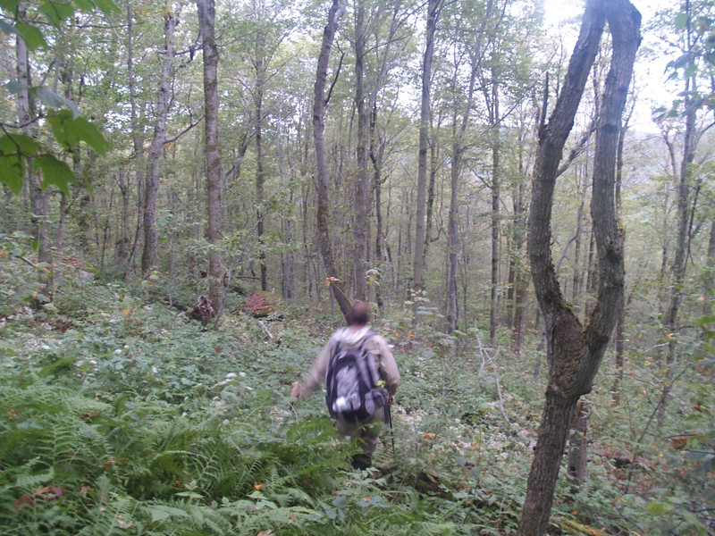
Descending to the saddle
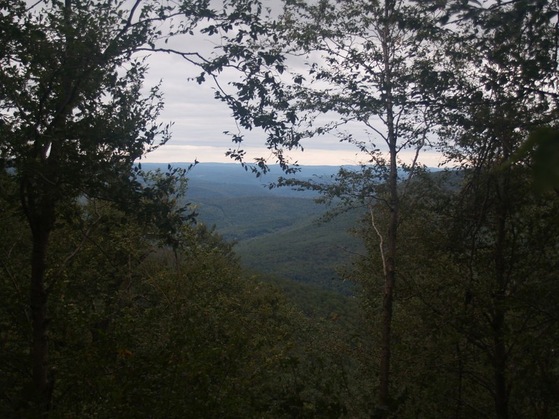
We began ascending more ledges and realized that this was going to be a very long three quarters of a mile! On the way up we found the last of the season’s raspberries, and ate them happily. We eventually reached the summit plateau and began heading southwest along the top edge of a cliff, looking for yet another supposed view spot. We really wanted to find at least ONE decent viewpoint after spending an entire day climbing! And, lo and behold, we found it. It really made up for all the thorns and nettles and slaps of wet leaves that we’d endured for the past seven hours. Yes, that’s right: It took us over three hours to travel less than two miles between North Dome and Sherrill. We were beginning to feel like a couple of out-of-shape wimps. Still, WE were the ones on the top of a trailless Catskill peak, and where were the rest of the truly macho hikers? Hah! They were hiding at home from a few low clouds and bit of drizzle. Forget them! On to the peak! We charged along through the balsam and found the canister with no trouble whatsoever. We signed in and had some well-deserved lunch. We were also rewarded with about thirty seconds of actual sunshine there on the peak. Or at least it was sunny enough to cast a shadow. Ah, life was good again! The air was warmer and the breeze had begun drying out the undergrowth. My pants were no longer wet, although my soggy shoes still had a long way to go. Just the same, my feet were warm in my merino wool socks, and I was happy. We were truly on a Walk In The Park.
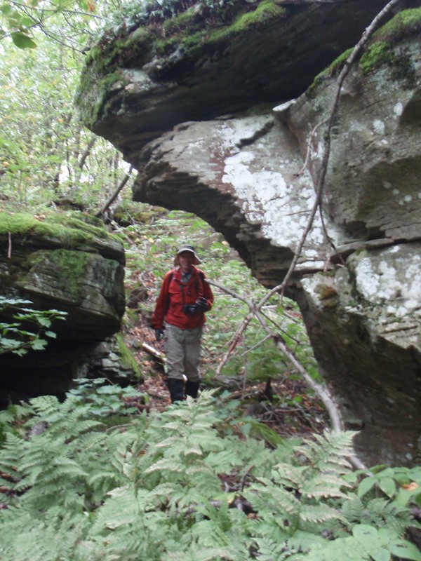
“Just a Walk in the Park, John, just a Walk in the Park”

Bushwhacking video on the summit of Sherrill


At this point, it was time to decide on our route for the descent back to civilization. We had two choices: One was to follow the footsteps of others and take the north ridge of Sherrill down to the road. This is the well-described “standard route” and the bushwhacking section along the ridge was known to have many ledges on the way down, followed by a stream crossing and a two mile hike back to the trailhead on Spruceton Road. Our other option was to try a completely unheard of route down the westerly north ridge of North Dome. Note that North Dome has two ridges extending to the north, an easterly one near the Devil’s Path where we started and a westerly ridge heading north toward some private property. Between the two ridges is a valley where Hagadone Brook flows. This valley is NOT private property; there is an extension of the park through this valley from the peak all the way to the road. There were no official trails here, and I had read nothing about this area. Virgin territory for a bushwhacking expedition! And it had the added benefit of cutting the boring hike along the road in half! All we had to do was descend back to the North Dome / Sherrill saddle, then traverse across to the ridge, maintaining elevation for a half mile. After that, we’d walk north on the ridge, then cut downhill to the northeast (avoiding the private property) into the Hagadone Brook Valley. At that point it would surely be a Walk In The Park until we reached Spruceton Road. And, as you can guess from all this route-talk, we chose the path to adventure and glory.
We descended the ledges down to the saddle/col between the peaks, and checked the map and GPS yet another time, to make sure of our plan. And that was when we noticed that it was 4:45pm. The sun set at seven! We had two hours to bushwhack several miles on an unknown route. This didn’t look good at all. Sure, we had our headlamps with us, but did we want to be descending ledges and climbing over boulders and downed trees in the dark? To say that this added a sense of urgency to our bushwhacking pace is an understatement. It was time to haul some serious a$$! No more of this “Walk in the Park” nonsense!
This “mere” half-mile traverse to the ridge, however, took us nearly an hour! Oh yes, we tried our best to hike fast, but the mountain wouldn’t allow it. I had been figuring that this traverse would be easy, as we didn’t need to change elevation at all, and I knew that the typical terrain in the Catskills is to have many cliffs and ledges separated by relatively flat terraces. I figured that we could easily travel along the side of the mountain on one of these terraces until we reached the ridge. But no. There were no major ledges. There were also no terraces. Instead the ground sloped off to the north, and it was populated by many mini-ledges, boulders, and small ravines, each of which only served to slow us down and impede our progress to the east. None of the hiking was particularly difficult, but the combination of thick undergrowth and mini-ledges drove us nuts. We made too many quick-checks of the GPS, and every time it told us the same sad story: The ridge was still far, far away and we needed to hike faster. Meanwhile, it seemed that hiking directly sideways on the mountain was impossible. We had to either hike uphill to a nicer-looking area, or hike back downhill to a nicer-looking area. The area we were currently in was always lousy. We zig-zagged along the mountainside like drunken fools, trying desperately to gain easting while maintaining the roughly 3100 foot elevation we needed to reach the ridge top in the correct spot. Reviewing our GPS track afterwards, I was not surprised to discover that this was the slowest we’d hiked all day. It was also the stretch of “trail” with the fewest pictures taken. In other words, we put everything we had into getting to that ridge. Of course, the lack of photos may also have been due to the fact that it was beginning to get too dark to take decent pictures. My digital SLR wanted to take one quarter or even one half second exposures. Not the type of photo that works well when hand held. My Canon D10 took some videos, however. But not many. What we really needed to do was to finish this horrid traverse and get down off that mountain!
And, like all bad things, the traverse came to an end. The slope began flattening out and we swung along the side of the ridge, gradually heading north, until we popped up over the top. The land on the crest of the ridge was nearly flat, and we felt like we had made a major accomplishment. But there was no time to be spent on congratulations. We blasted north along the ridge-top, and covered the next half mile in fifteen minutes! Now THIS was a Walk In The Park! Major progress, in the right direction, headed directly for the road!
And then we reached the next decision point: When do we head down off the ridge and into the Hagadone Creek Valley? We looked at the map and our position on the GPS. Earlier, when planning the route, we had decided to head downhill to the right when we reached 2900 feet elevation, so that we’d be sure to miss the private property line where it intersected the ridge. And that’s exactly what we did, and it worked perfectly. However, at this point it was 6pm, it was getting noticeably darker, and we were still quite far from the road. But we felt better nonetheless, as we knew that we could always follow the “Rule of Down” even in the dark without a GPS, and that the valley would eventually lead us directly to the road. Still, we weren’t sure what to expect in this valley. It might be as horribly slow as the traverse. In which case the next mile and half would take three hours! Oh boy. Good thing I had extra batteries for my headlamp. So much for a Walk In The Park; this was going to be a Walk In The Dark!
We headed downhill as fast as we could. Luckily for us, there were no cliffs or ledges to speak of, just a continuous downhill slope. We used the branches of trees and bushes to keep us from losing our footing, and we still slipped once or twice. Unlike our earlier bushwhacking where we avoided damaging the plants and made sure to place our feet carefully, we were hardened bushwhackers now: The plants had better get out of our way, because we were coming through! Couldn’t they tell that the sun was going down? Their current suffering was nothing in comparison to the wholesale plant destruction that we would wreak once it got dark. What did those insolent plants think this was, a Walk In The Park?

Just the same, it seemed that our luck had finally begun to turn. We had truly enjoyed the glorious ridge-top, followed by the easy downhill into the valley. And as for the valley itself? It was fantastic! There was a wide, flat area where the creek began, somewhat marshy and full of the usual nettles and thorns, but those no longer bothered us. If anything, we liked them, as they were easy to blast through, offering little resistance to our powerful, gaiter-clad legs. Pain was only an illusion, after all. We followed the valley floor at a brisk pace, heading directly for the road, when suddenly there appeared before us an orange-painted blaze on a tree! And several more in a line not far away! Not only that, but there was a trail right next to them! A trail! Hallelujah! We were truly in luck, and the bushwhacking was over! It had become a Walk In The Park once more!
Down in the Hagadone Brook valley, the hiking is excellent and we made great time.

And the rest of the hike was a tale of happiness and redemption. As this trail looked to be traveled mostly by horses, we figured that it was the western boundary of the strip of park-land that headed for the road, and that the property owner made the orange-painted blazes. But there were no “Private Property” signs posted. Still, we intended to respect the property’s owner, so we followed along the nice trail, hiking at a brisk pace. Lovely woods in that valley, by the way, with some interesting spruce patches amid the usual beeches and maples. Later on, looking at my geolocated pictures and our GPS track on Google Earth, I discovered that the orange blazes were NOT marking the property line – they were well within the park’s property. Nonetheless, we eventually ended up discovering an old stone wall, an ancient property marker right where it crossed the creek, and at that point we stayed off to the east. Or so we thought. There were some old logging roads in the woods, and we must have become confused. Somehow we made a left when we should have gone straight or to the right, and we ended up arriving at the West Kill river right near someone’s house. We tried our best to stay hidden in the woods, but I admit that we spoiled what would have been a perfect plan, to take a new route down off the mountain while remaining exclusively on Park Property. Still, no harm was done, no one saw us that I’m aware of, and we never crossed any signs or fences that warned us of being on Private Property. If there ever is a next time for this bushwhack, we won’t make this mistake again, however.

Old stone wall property line in the Hagadone Brook Valley.
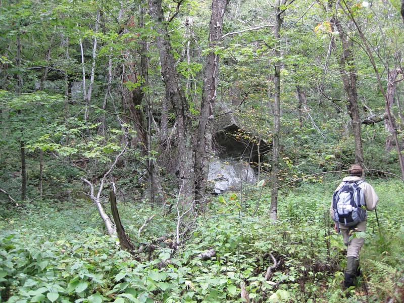
Hiking on what I thought was an old logging road.
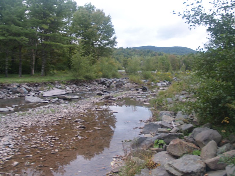
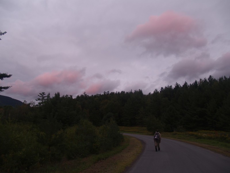
We rock-hopped across the West Kill river and arrived on Spruceton Road at 6:57pm. And there was still a bit of light in the sky! In fact, it was much brighter out on the road than under the trees in the valley. It took us another twenty minutes to hike the final mile along the lonely country road; only one or two cars went by in that time, and this was a Friday night. The low clouds began to break up into puffy cumulus above us, and the setting sun turned them pink as we hiked the final stretch.
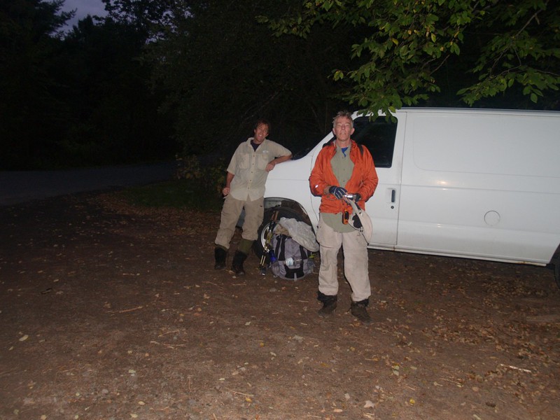
We made it back to the van by 7:30 PM. We’d hiked a little over nine miles in eleven hours. We laughed at our arrogance, for thinking that we would be able to climb a THIRD trail-less peak that same day. Sorry Halcott and Rusk – you’ll get yours another time! We changed into some dry clothes and footwear, and had a well-earned meatball sandwich from the cooler for dinner. We were tired but not completely whipped, and from that fact it can be concluded that WE did the whacking on the bushes, not vice-versa. Oh yes. It really HAD been a Walk In The Park!
The rest of this trip’s photos and videos can be found on my Flickr Page.
And an interactive topographic map of our GPS tracks can be seen on my CalTopo Page.

Very enjoyable read. A friend and I just did a similar version of this hike, and we too experienced the painful slanted traverse across the shoulder of North Dome and then the descent into Hagadone Brook, albeit during the winter instead of early fall.
LikeLiked by 1 person
Nice write up on the hagadone. I was going to use that valley as a descent for a loop of North Dome. Any idea how far up the valley the orange trail goes ?
LikeLike
If you look at my Caltopo Map page, the orange blazes began just after we crossed the creek, on the east side, just above the 2000 foot topo line. I put an orange marker on the page for you. I know that’s where we first saw them because I geolocate all my photos. Of course, the blazes may have continued up the creek further on that same side – we certainly didn’t have the time or energy to head back uphill! Anyway, you can use the “Export” function on the caltopo page to get a gpx file for loading into your own GPS if you want. Have a great hike, and I hope you avoid the private property!
LikeLike