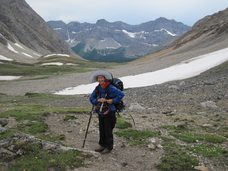
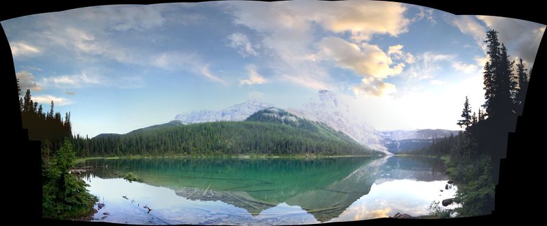
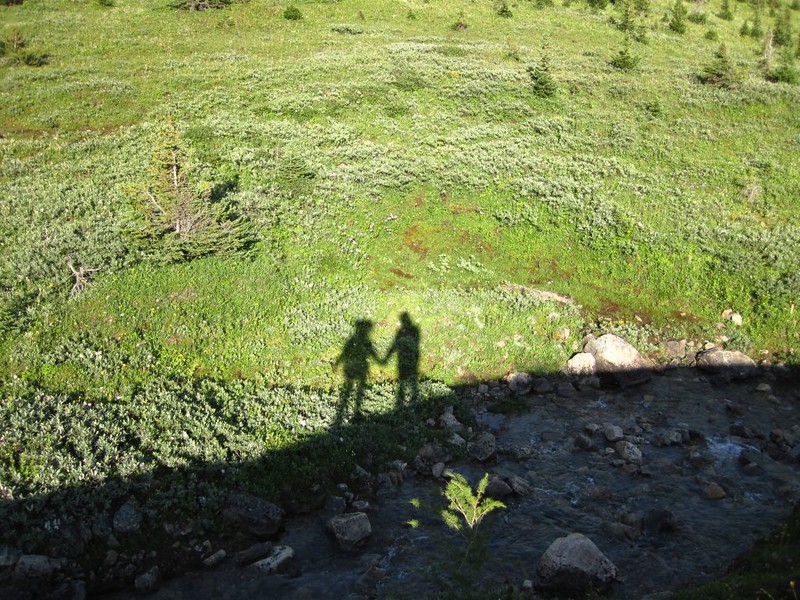
This trip to Banff National Park was entirely Vicki’s idea. She wanted to visit what is arguably the most beautiful place in Canada, and that was fine by me. The main drawback was that it was 2000 miles away, not to mention being in another country. So she started her research a full six months before the hike. And she found out plenty: The park didn’t make backpacking easy, as they insisted that you stay only in certain campsites, and each night’s spot had to be reserved beforehand. Meanwhile, I had to upgrade my mapping software to the latest version to view and download the Canadian topo maps, and also had to upgrade the firmware on my GPS to use the new software. We created a map online and had it printed on waterproof paper. Vicki called the ranger station in Banff, received some great advice, and made reservations for ten days of hiking.
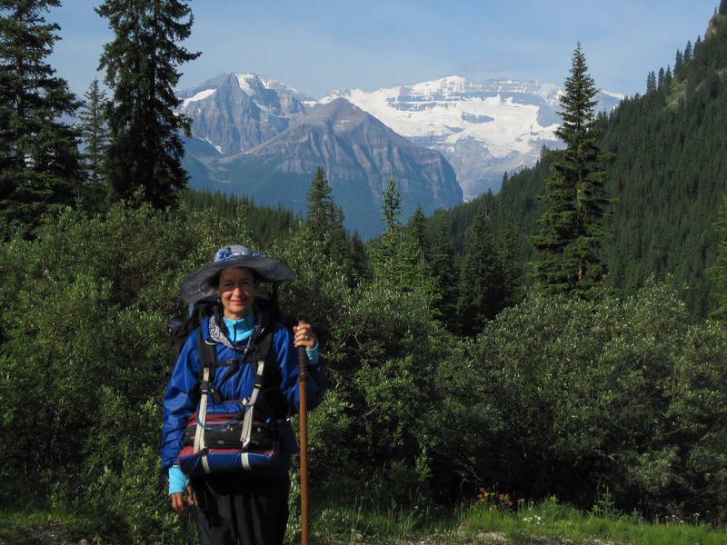
And her plan was ambitious. Due to the spacing between allowed campsites (typically ten kilometers, or six miles), there were many days when she intended to hike twelve miles! This was WAY beyond her normal amount. I was impressed. I didn’t say what I thought, however. I knew that if it had been MY plan (to hike this many miles per day, day after day), she would have shot it down in a heartbeat. Instead, I simply smiled. More hiking! Sounds great! I just hoped that I wouldn’t be carrying both her and her pack by the end of each day.
Day -1
We left San Diego at Midnight, in the car we’d rented the day before. Putting four or five thousand extra miles on our old car didn’t seem wise, somehow. And it sure was great to drive a brand new car, but soon after leaving we discovered that we’d made a big mistake, as this particular car was so cheap that it didn’t even have cruise control. That’s tough on a long drive, but we didn’t have much choice at midnight with our camping reservations set in stone. So we made the best of it. Although I-15 was the more direct route to the park, we decided to make a big loop of our trip, by first driving north on I-5, then east to the park. We’d come back the fast way. So we drove up I-5 to Canada, then hung a right on the Trans-Canada Highway. It was a long and beautiful drive. We stopped only for gas, food, and the Canadian Customs agent. We were driving machines, taking turns and napping as we went. But, eventually, we had had enough. So we slept in the car on a lonely turnout around midnight just as we entered the big mountains.
Day 0
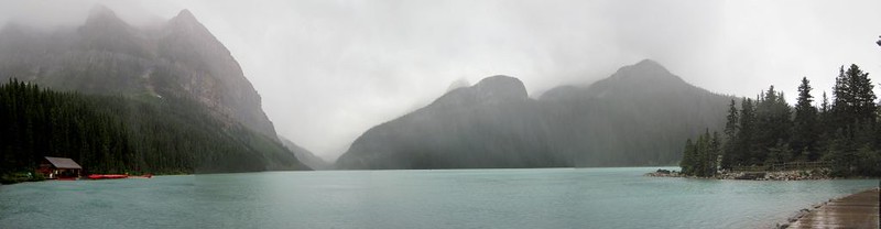
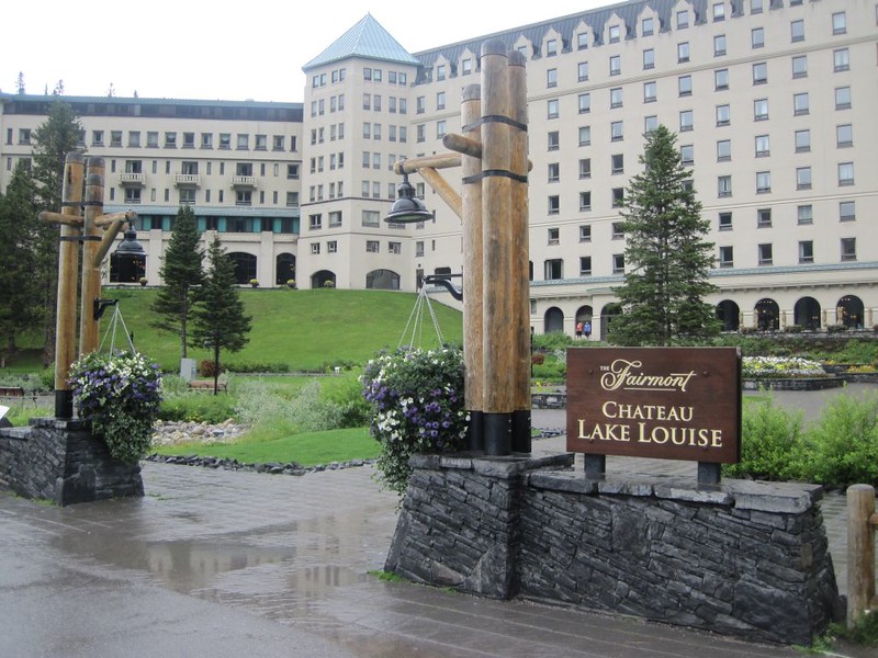
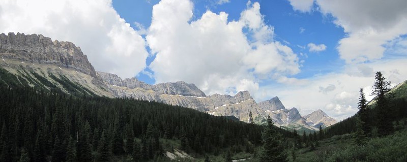
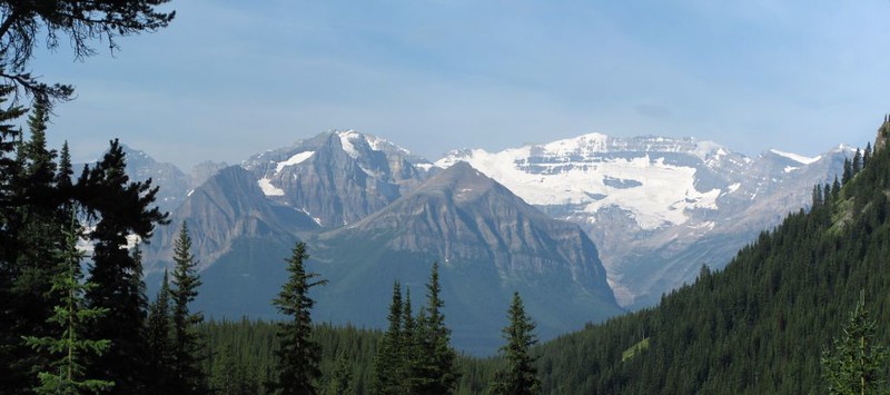
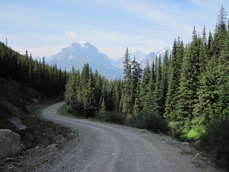
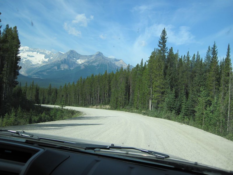
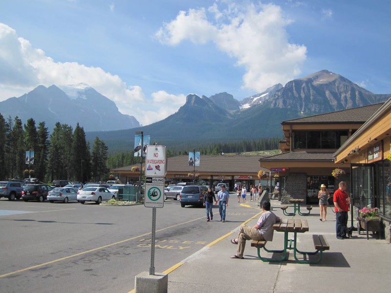
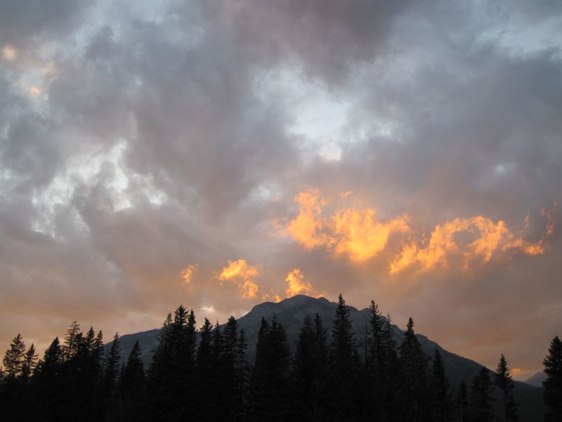
We woke at dawn and continued through the Canadian Rockies on the Trans-Canada Highway. This was a road that was truly worth seeing. Beautiful mountain vistas, roaring rivers, and lumber-laden freight trains were all part of the experience. Eventually we made it to Lake Louise, where we did the tourist thing, walking the concrete pathways, taking photos of the lake and lodge, and buying t-shirts at the gift shops. But we weren’t stopping in the park for long, not this time. We kept on driving all the way to Calgary, arriving after dark at a distant relative’s house. We would park our car there for the next ten days as we’d found out earlier that they won’t let you park in Banff unless you have a motel room. Banff likes rich tourists much more than it likes cheap hikers who show up with their own food and stoves and tents. Sad but true. Happily, in Calgary our gracious hosts provided a delicious salmon feast (grilled on the barbeque) and we thoroughly enjoyed their company. We were wishing that we could visit with them longer, but the mountains were calling. Then we crashed in an actual bed. Nice!
Video of driving through a Snow Tunnel on the Trans-Canada Highway
Video of a Canadian Pacific Freight Train from the Trans-Canada Highway

Day 1
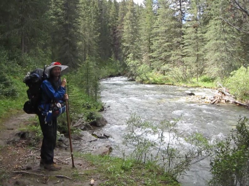
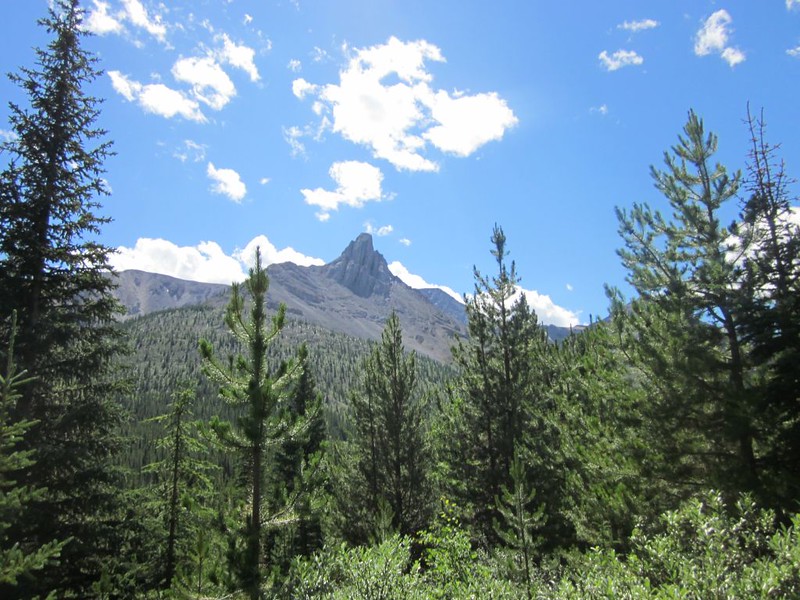
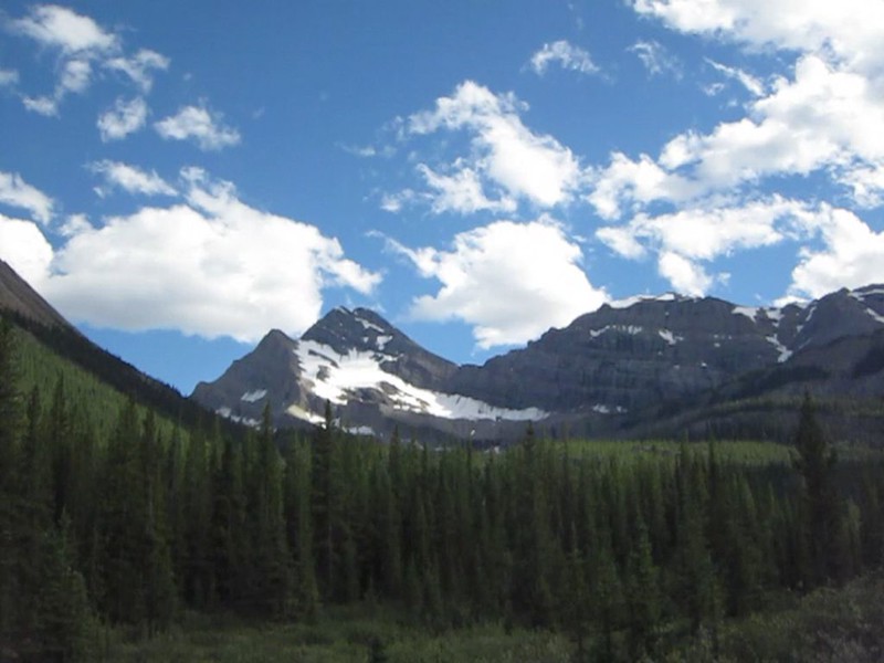
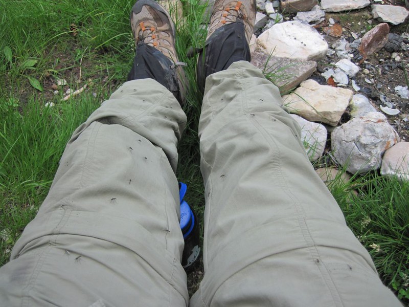
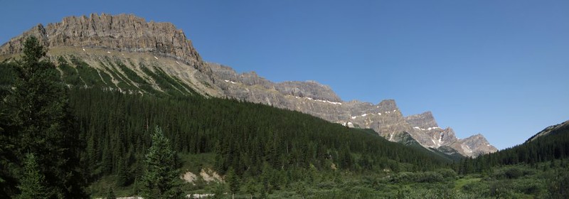
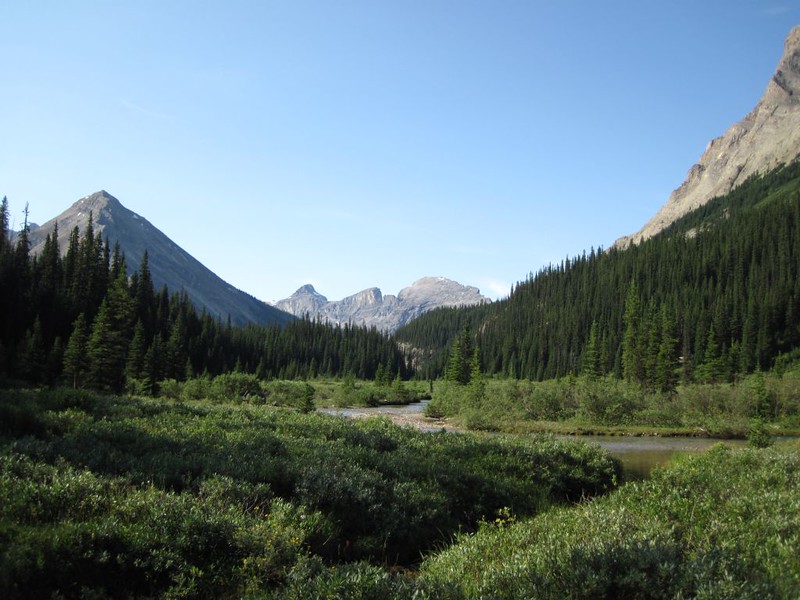
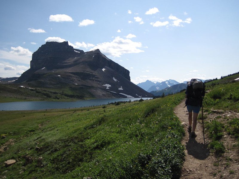
We got a pre-dawn ride to the bus station and took the earliest Greyhound Bus back to the town of Banff from Calgary. It was over an hour’s bus ride. We called a local cab who took us far up Mount Norquay Ski Area to the trailhead. At that point we kissed civilization good-bye and hiked onward into the gigantic cloud of mosquitos that was Banff National Park in the soggy summer of 2012. The smell of DEET insect repellent never left us for the rest of the hike. It was either that or emerge, pale and bloodless, 75 miles and nine days later, in Lake Louise.
Taking the bus to Banff from Calgary
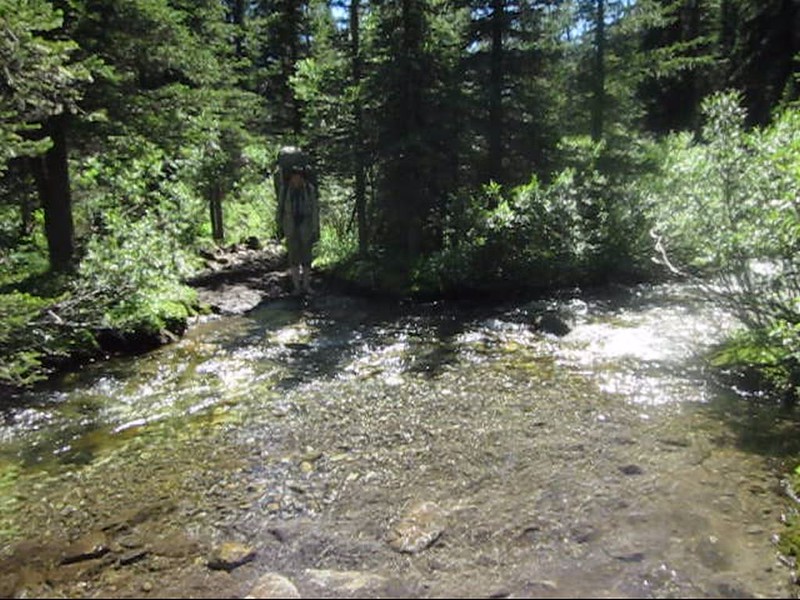
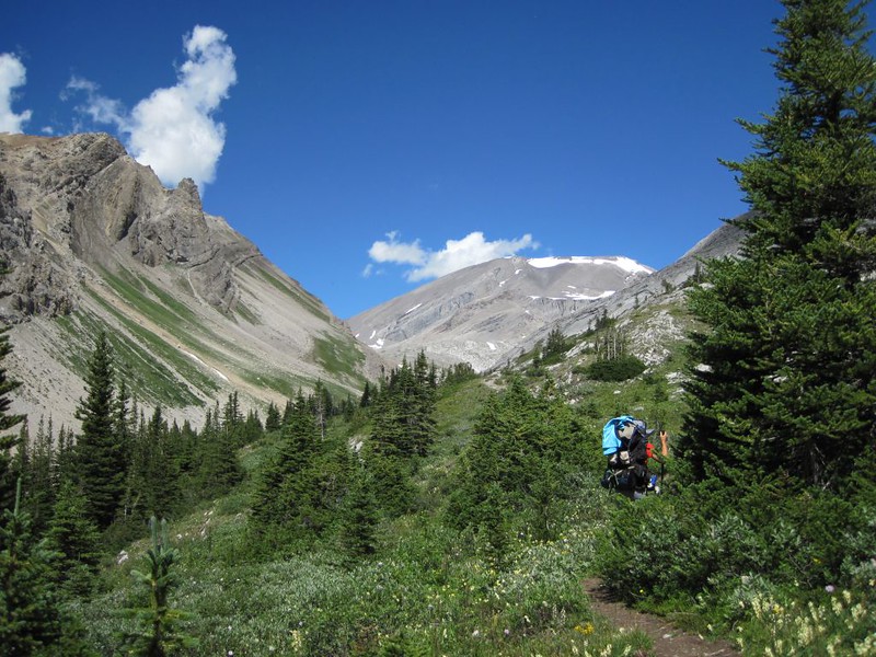
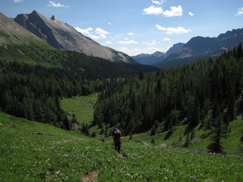
Bugs or no bugs, we had a long hike that day, and a late start. The weather was humid and warm, so we were sweating profusely, but the bugs were quite bad, so Vicki couldn’t wear shorts to cool off. She tried putting on her hand-made arm and leg bug netting suit over the shorts but the mesh kept snagging on bushes. It was a narrow trail to Forty Mile Creek. She had to put her rain pants on to stop the bugs, but then she overheated. Not good.
Video of Forty Mile Creek just north of Mount Norquay
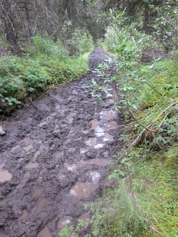
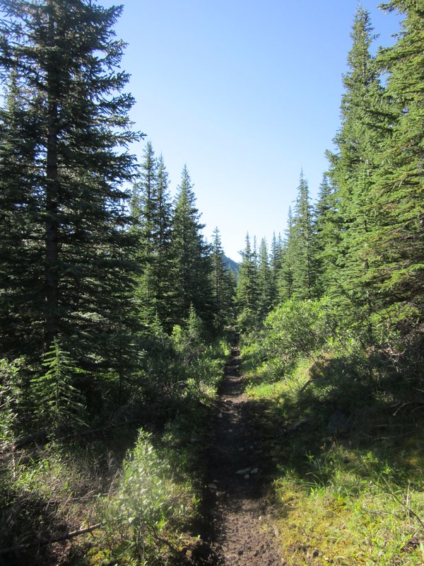
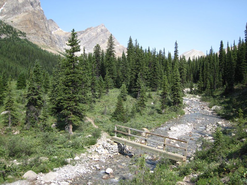
We hiked on, up the Forty Mile Trail, until the wider trail joined it. This is the trail the horses use, and it was a muddy mess. Horses damage trails, and it wasn’t fun to be constantly having to avoid mud puddles, but we had no choice. We had to hike along the edges of the trail, which, naturally, was where the snagging branches were, so she still couldn’t wear the cool bug-net leggings. It was hot work.
Video of muddy footprints of humans and horses on the Forty Mile Creek Trail
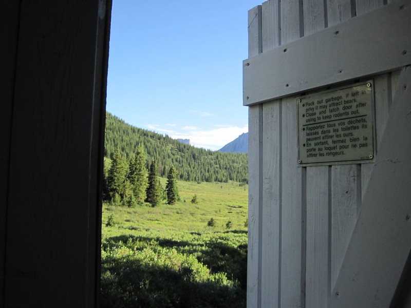
Video of the Bear-Proof Cable System for Hanging Food in the FM10 Campsite on Forty Mile Creek

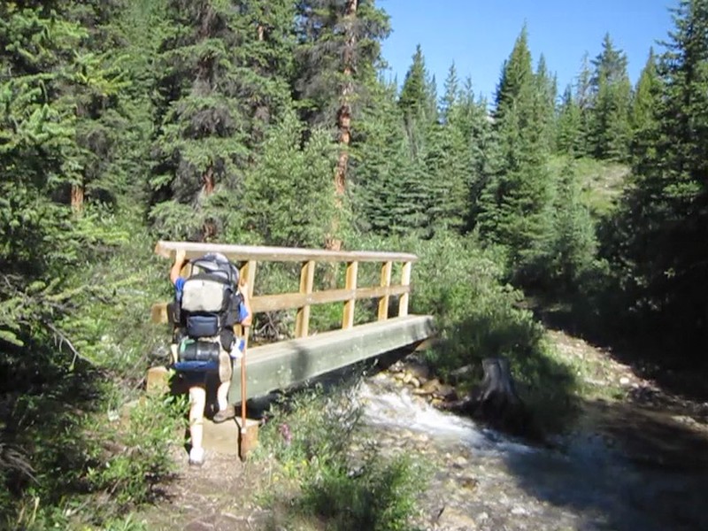
Video of crossing a wooden bridge over Forty Mile Creek
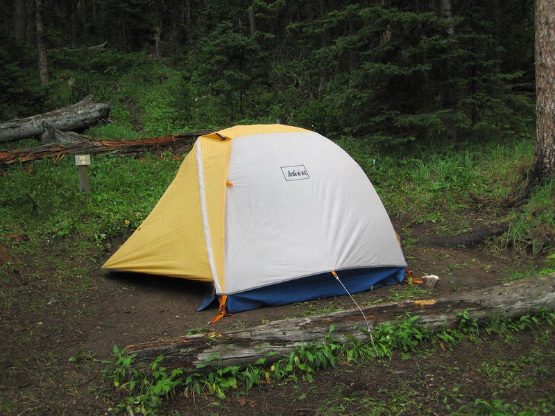
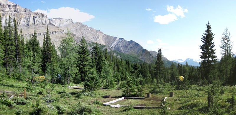
It wasn’t until late afternoon that we reached the Mystic Lakes Trail junction. Then we had to climb uphill to the ML22 campsite. More overheating and bugs. We got there at sunset, and ended up eating in the dark. We probably ate a few bugs without knowing it, but that’s OK because they deserved it. Nonetheless, we sure slept well inside our bug-free tent. We were exhausted!

Day 2
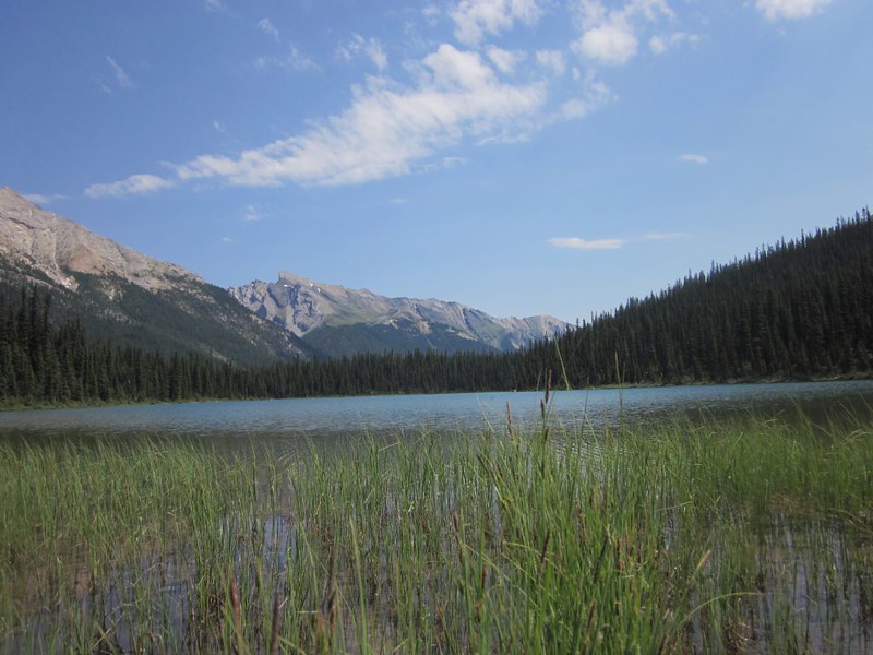
We woke up at dawn and ate some breakfast. Summer nights in the Great North are all too short. We packed up our gear, left it in camp, and day-hiked up the trail to Mystic Lake just to check it out. It was a pretty lake. Too bad the ML22 Campground is a mile away from it. It would have been nice to camp on a lake.

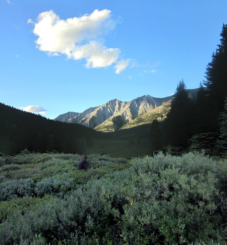
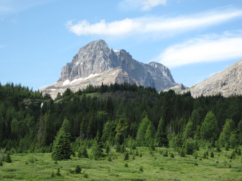
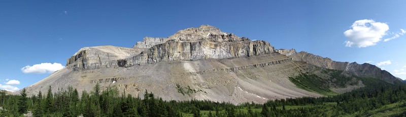
We grabbed our gear and headed north, back once again on the Forty Mile Creek Trail. Uphill all the way to Forty Mile Summit, then down the other side. The summit (actually more of a pass) was pretty, like a broad grassy slope, but it had little or no flowing water. There were far less mosquitos up there, but, perversely enough, that was the cue for the huge biting horseflies to appear! Arghhh! They are big and fast and never give up. You can’t possibly out-hike them, so you collect more and more flies as you hike along. We began to get better at hitting them with our palms. You had to carefully line up your shot, then whack down fast and hard or they’d escape. Of course, we were also smacking ourselves at the same time, but it was still satisfying to stun them senseless and then stomp their obnoxious selves into the mud. We also realized that the horses didn’t only destroy the trail by making it a muddy morass, but they also helped to breed the horrible horseflies! Still, the horses probably enjoyed them even less than we did.
Video of cold wet feet crossing a small side creek on the Forty Mile Creek Trail
Video of a high meadow and pine trees on the Forty Mile Creek Trail

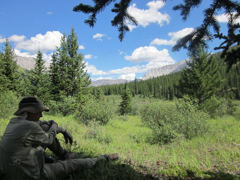
After the summit, we descended to Sawback Creek, then hiked upstream to the FM29 campsite. This time we arrived before dark and enjoyed meeting some other hikers in camp, including two gentlemen that were traveling the trails via horseback. They had a third horse which carried their gear – they even had a cooler with beer and fresh meat for grilling! What a lifestyle. I admit that I was a bit jealous of them, though I haven’t changed my mind about the damage the horses do to the trail.

Day 3
We decided that hiking up to Sawback Lake was too much trouble, as we had plenty of miles to go before the next campsite. So we packed up and began hiking down Sawback Creek toward the Cascade River Trail. We met other groups of equestrians on the trail heading uphill, back toward Banff. At least twenty horses with people and gear. I smiled and waved at the folks riding by but all I could think of was the newly churned mud, steaming horse manure (complete with flies!), and stinky horse urine that we were about to be hiking through. But it didn’t turn out so bad, as the soil on this stretch of trail drained well so mud wasn’t an issue. We stepped carefully and avoided the landmines, and as for the bugs, well, the bugs never let up, but that was true everywhere.
Video of Sawback Creek

Video of a Guided backcountry tour on horseback on the Forty Mile Creek Trail
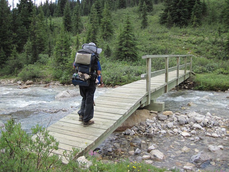
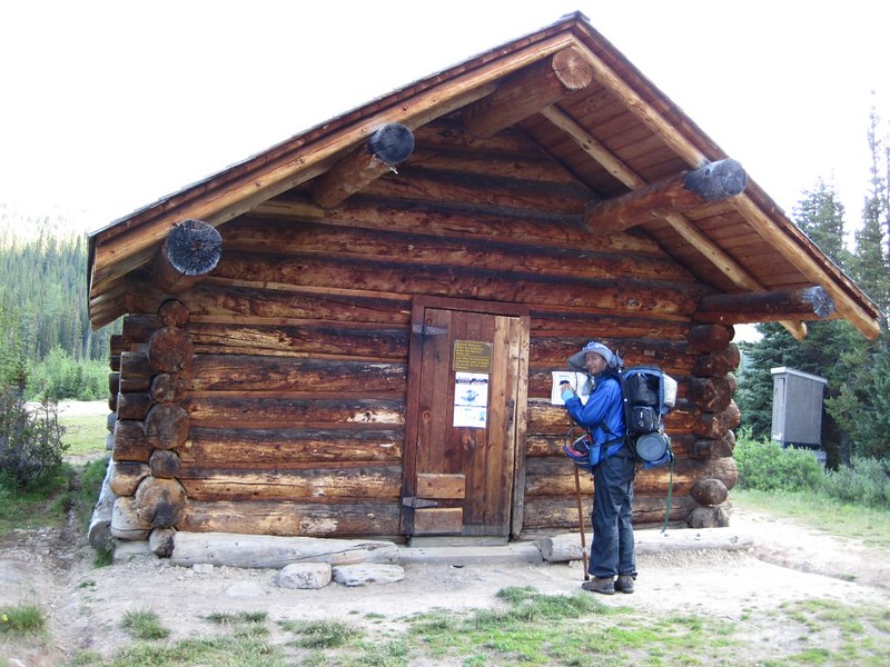
We eventually arrived at the end of the Forty Mile Creek Trail where it met with the Cascade River Trail. There was a footbridge over the River, and nearby was a Ranger Cabin with a great view. What a nice place to live! We checked it out, but no Rangers were in residence.
Video of the Cascade River near the Ranger Station at the end of the Forty Mile Creek Trail
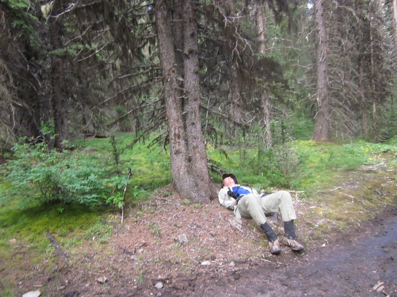
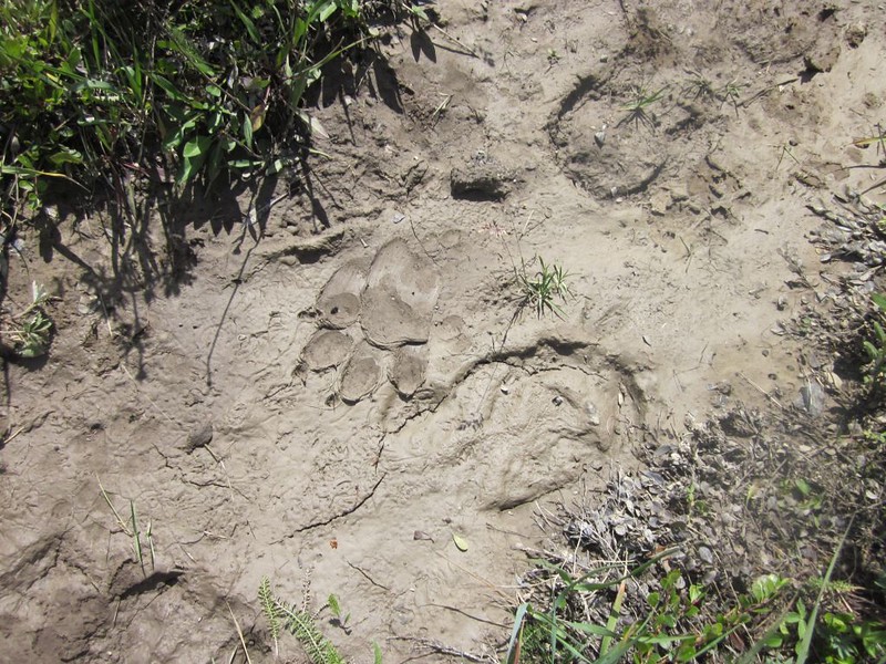
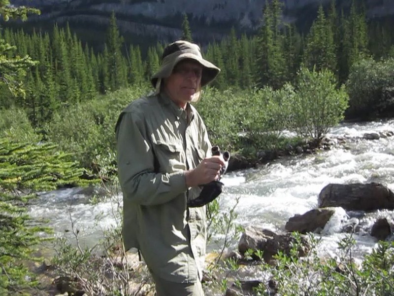
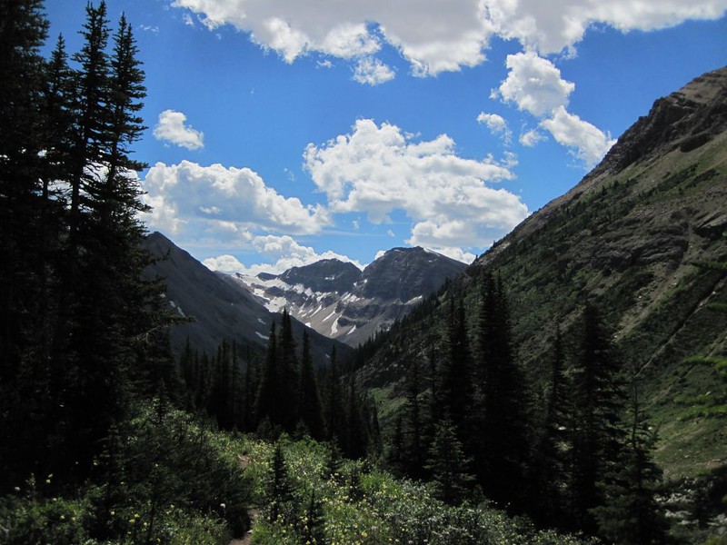
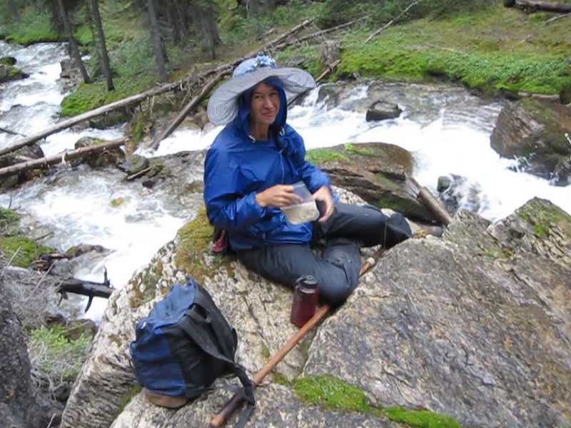
So we hiked on up the Cascade River. We saw some bear tracks on the trail, but luckily the bear was heading the other way. We realized that the trail was drifting far up the side of the canyon from the river, and we began running low on water. We should have filled up back at the footbridge. So I hiked part way back alone, cut through the woods to the river, and filtered some water while Vicki took a nap. Then we ate lunch and hiked onward.
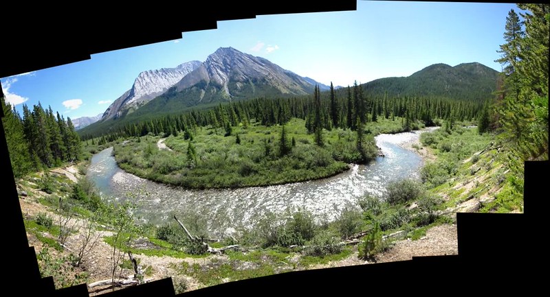

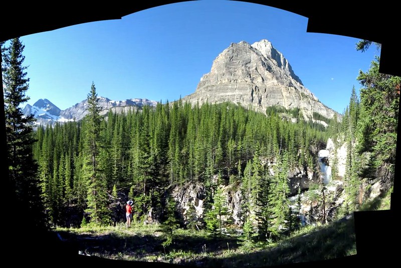
Video panorama of the Cascade River Valley looking east through south through west
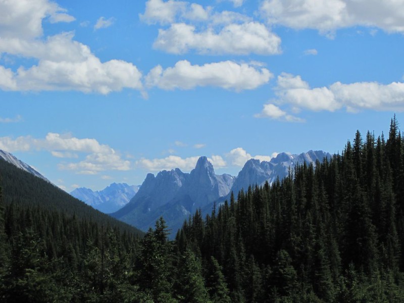
Video panorama of Block Mountain, Noetic W3 and Noetic Peak from the Cascade River Trail
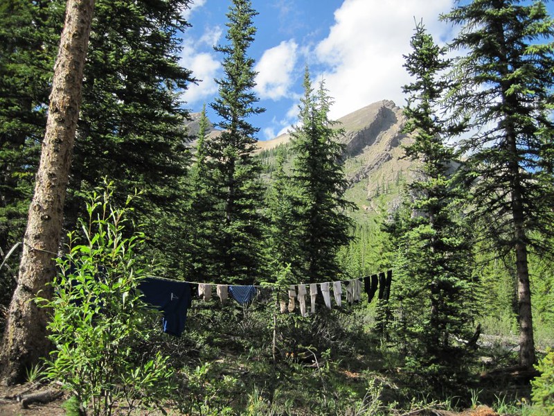
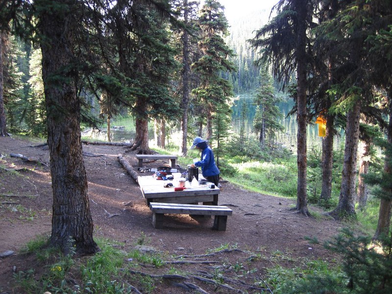
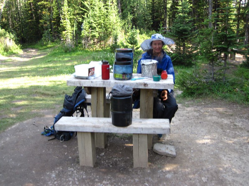
We weren’t really sure of the precise location of the CR37 camp, so we kept a good lookout. In fact, I walked right past the small sign but Vicki spotted it, and this made us quite happy, as there was plenty of daylight left. We found a campsite, set up the tent, and headed to the cooking area. We decided that this was a great time to set up a clothesline and do some laundry. Those shirts and socks were getting a bit stinky, and there are only so many pairs you can carry in a backpack. We also gave ourselves sponge baths using the ice cold water from the river. Brrr!
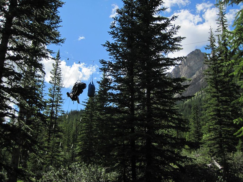

Later on, more hikers showed up and we had a nice social time around the dinner table. We were really liking the way these campsites were set up in the park, as they kept the food (and bears) away from the tents and also “forced” everyone to eat in the same place and get to know one another. We went to bed early that night because tomorrow was set to be the hardest and longest day’s hike of the entire trip.
Day 4
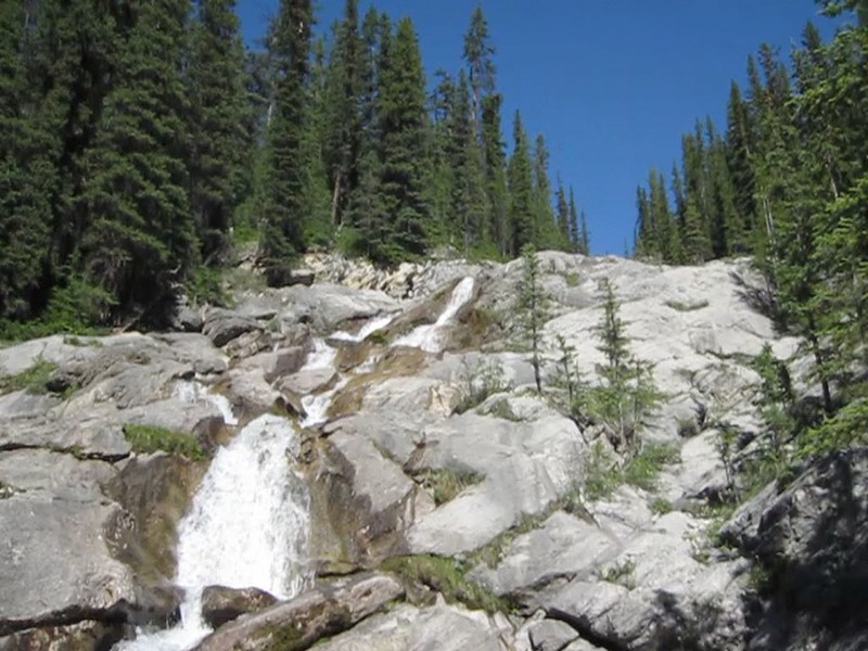
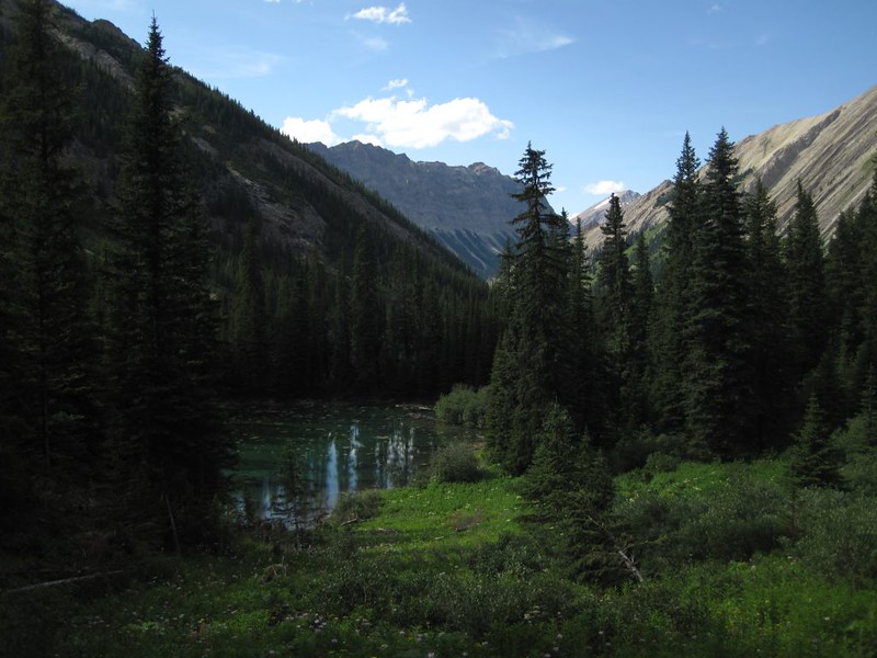
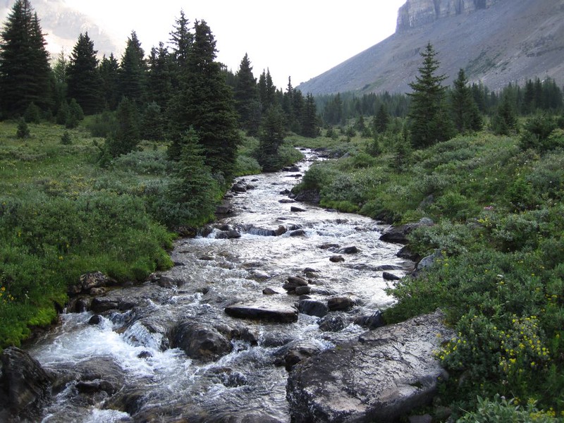
We got packed up and ate breakfast as early as possible. Then we hiked upriver through forested and swampy areas. There weren’t many views under the trees but we were able to hear (and see) the river down below. Along the way we collected a small retinue of mosquitoes which followed us like tiny clouds. We could lose them by running fast, but then new ones would join as others fell behind, so we gave up on it entirely. Bugs were a way of life in Banff that summer. There was lots of water flowing in this area, and several beautiful waterfalls. We realized why they called it the Cascade River.
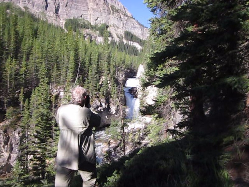
Video of a Waterfall on the Cascade River
Video of the Cascade River, from just northwest of Block Mountain
Once we turned north the cascades were even better, with the river flowing madly down long, steep, and narrow granite sluices. We rinsed our hot heads under the blasting water to cool off as we hiked up the steep trail. We also soaked our shirts in the icy water and put them on immediately. Whoa! That was quite a shock! But at least it helped cool us off during the hot climb.
Video of the Cascade River cascading down smooth granite
Video of Vicki soaking her head in the river
More video of the river cascading down a long smooth granite chute


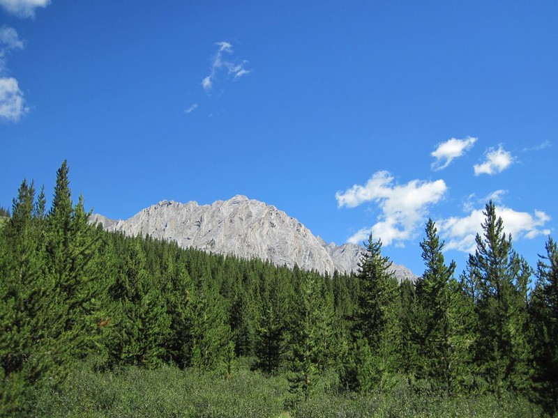
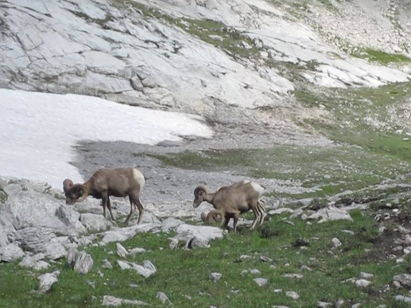
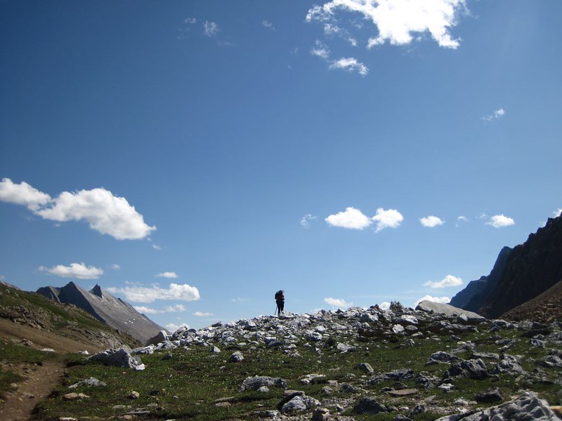
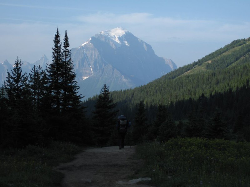
Eventually the trees thinned out as our elevation increased beyond 7000 feet. Luckily the mosquitos also grew less, but sadly the horseflies increased. At 7K, the only thing that outnumbered the bugs were flowers. The bug misery index remained high at all times. But the views also improved. We could see mountains in the distance, and eventually, as we approached Badger Pass, we came upon a herd of Bighorn Sheep! This was truly awesome. We even saw some of the younger males bashing heads! Way cool. We had a feeling that the horseflies up here weren’t from horses (there were no horse tracks), but were instead (essentially) Sheep Flies. They bit just as hard, and were just as difficult to swat. We hated them, whatever they were called.
Video panorama as we hike north
Video of Bighorn Sheep not far from Badger Pass

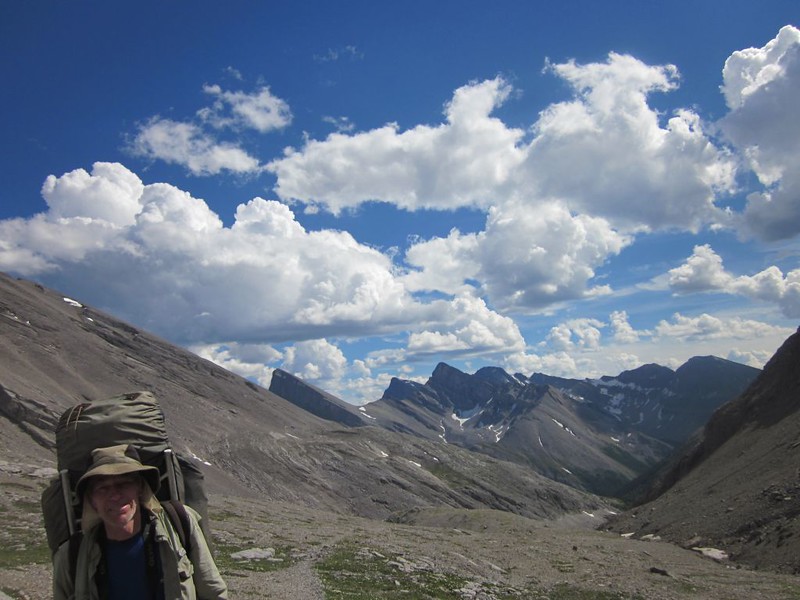
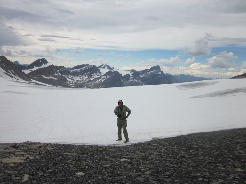
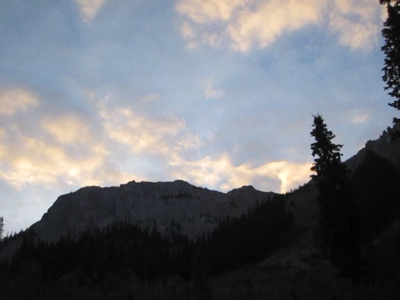
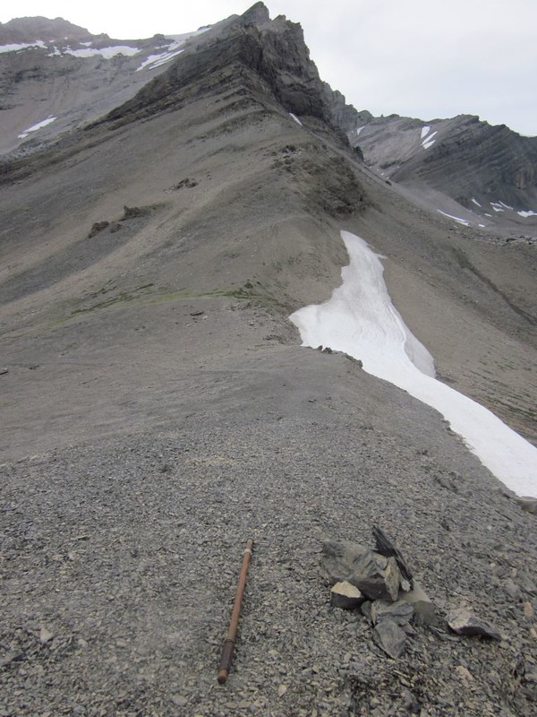
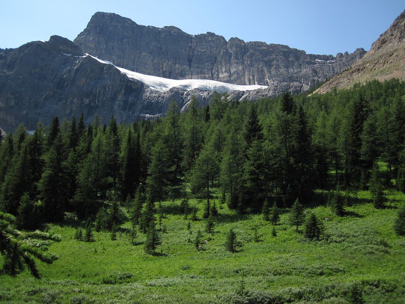
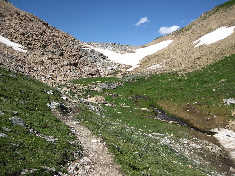
As we climbed near Badger Pass, high above the tree line, old snowdrifts were present all around us. The snowbanks were melting in the warm air, and what used to be the large Cascade River was now a small silt-filled creek. When we reached the pass, we set down our packs and got out our daypacks, as we intended to continue climbing up this canyon to the top in order to visit the Bonnet Glacier. Even though it was getting late in the afternoon, we really wanted to see this glacier. And it didn’t look that far. But looks are often deceiving.
Video of the melting cornice on Badger Pass, and what’s left of the Cascade River is down below

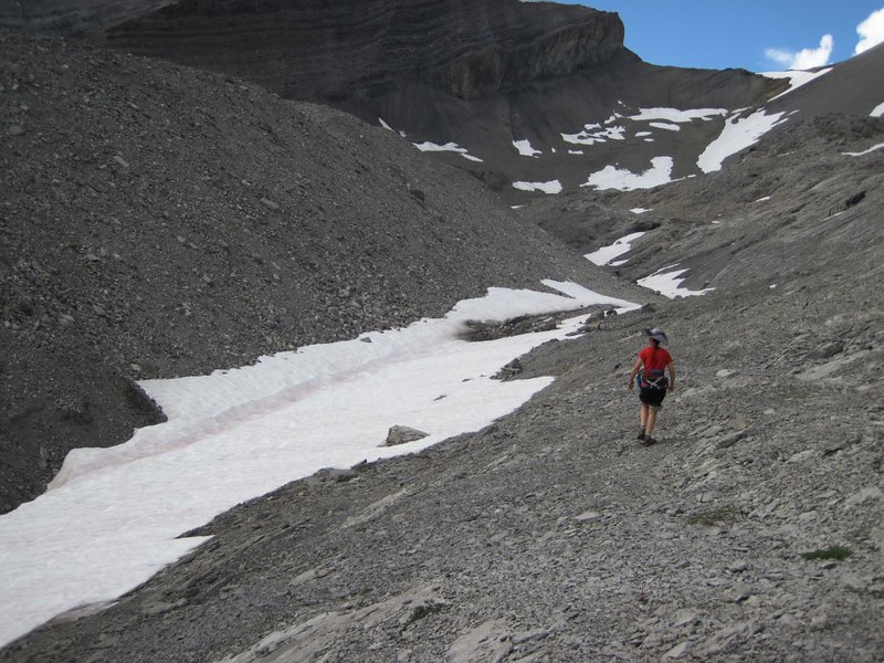
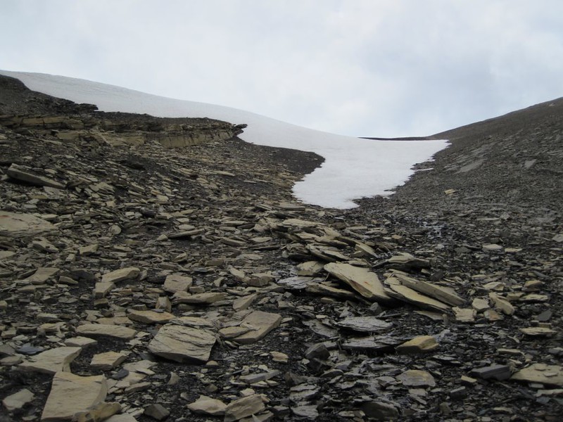
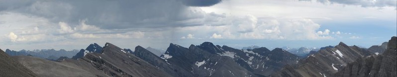
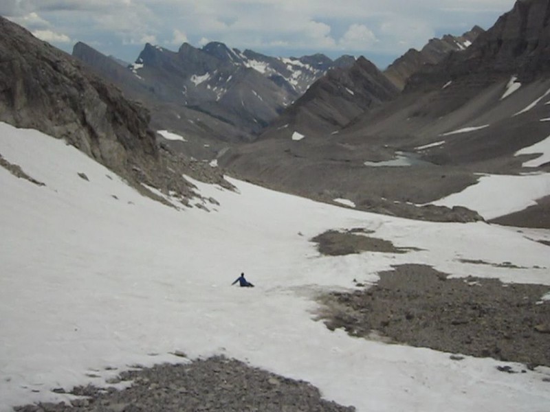
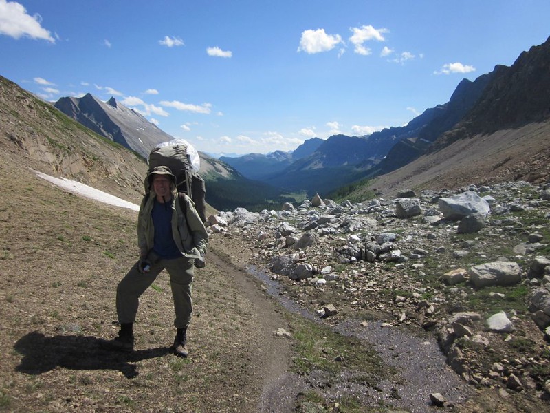
We hiked up through the loose flaky scree, avoiding patches of snow, and it kept getting steeper as we headed to the top, until it was difficult to walk without causing minor slides around our feet. It was tough, even a bit scary, but we finally made it to the top and there it was: The Bonnet Glacier, a huge sheet of snow that stretched out nearly endlessly in front of us. It was awesomely huge. Also, we were up so high that we had views of distant mountains all around us, complete with towering cumulus clouds. Some had virga (rain) trails coming out below them. We saw lightning and heard thunder in the distance, and tried to determine whether the storm was heading our way. It wasn’t, but it didn’t really matter as it was getting late, and we were going to be hiking in the dark later on if we didn’t get moving. So we got moving, but not fast enough: The loose scree kept our speed down. Eventually Vicki was able to glissade down some snow on her butt, which sped things up significantly. I mostly just shoe-skied, but it was still fun.
Video panorama of Bonnet Peak and the Bonnet Glacier

Video as we hike down the loose scree on the faint use trail from Bonnet Glacier back toward Badger Pass

Video of Vicki glissading down a snow patch

We got back to our packs, filtered some water from some fresh snowmelt, and climbed up and over Badger Pass. After that it was all downhill to the JO29 campsite. At first, above treeline, we got whistled at by numerous Badgers (at Badger Pass!) who were warning their buddies about us. Then we entered the upper trees (mostly Larches, unique deciduous conifers that don’t grow back home in California) and began the accretion of our own personal mosquito entourages. They were voracious! We tried to hike faster but it didn’t help, and finally we just sprayed DEET on exposed skin and tried to ignore them. But we couldn’t stop hiking or we’d be breathing them. They were worse than we’d ever seen! Also, it began getting dark, and we were nowhere near our camp. We had to ford a swiftly running stream and could barely see where the trail was on the other side. We eventually found the trail, but we were so exhausted, hungry, dehydrated, and bug-ridden that we were getting grumpy and extremely unhappy. Full dark at that latitude was about ten PM.

Video panorama from Badger Pass with a final zoom-in of me down below after filtering water

Video of a very unhappy Vicki covered in mosquitoes on the Badger Pass Trail

Video of waterfalls on the creek from Badger Pass heading toward Johnston Canyon
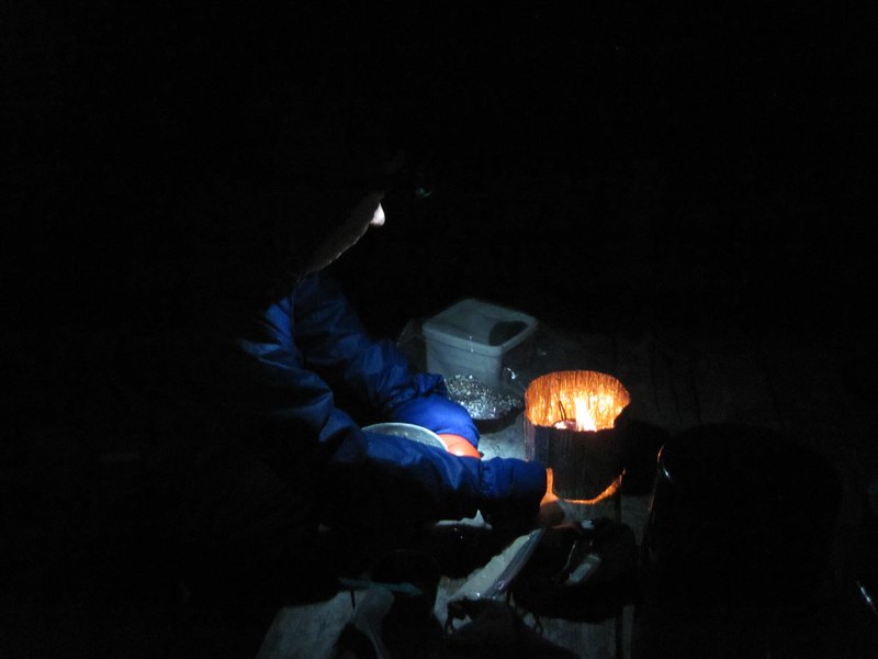
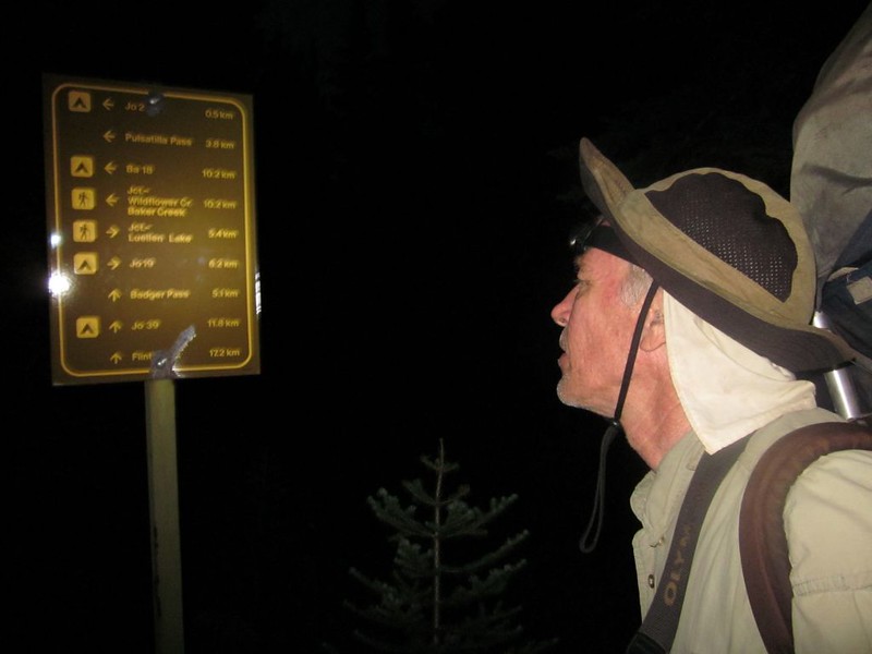
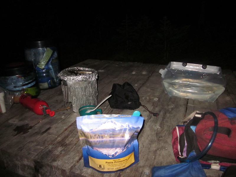
Finally, we reached the trail intersection sign at the Johnston Creek Trail. It said that our camp was 0.5 km away. So on we trudged, headlamps on in the pitch dark night, looking for the campground. Vicki noticed something shining across a meadow, but was so tired that she simply waited while I checked it out. It was the campground! Yes! We walked into the silent campground, and saw tents here and there. Everyone was sleeping, so we walked along, whispering to each other. Where was an empty spot? We couldn’t see very far with our headlamps, so we weren’t sure what to do. We finally found a site marker and a bare flat spot, so we decided that this was far enough. It was after eleven PM! We got out the tent and set it up, then we headed off into the dark to find the stream, where we pumped water. But we still couldn’t go to sleep, as we hadn’t had any food. So we wandered in the dark until we found the cooking area. We cooked and ate dinner with our insect companions, and noticed how the mosquitos loved the CO2 exhaust from the stove. They flew all around us in the light from our headlamps.
We cleaned up dinner and hung the food from the cables, then headed for the tent. We got inside and hunted down the dozen or so mosquitos that snuck in with us, smashing them on the walls of the tent. Finally, a bug-free zone had been created, and we were able to sleep in peace! What a relief! It had been an incredibly long, tiring, yet excellent day in the mountains.
Day 5
We woke up to discover that we had set up our tent in someone else’s campsite! It would have been embarrassing if they had gotten up early, but they didn’t, so we quietly crept off to the cooking area for breakfast, leaving the tent sitting there as evidence. We’d worry about that later. Food first. Sadly, that’s also what the mosquitos said. They descended on us like locusts. But they didn’t like the DEET bug repellent we’d already sprayed ourselves with. They buzzed around us in clouds but wouldn’t land on our bare skin. They still drove Vicki nuts, but I had already reached the point where I no longer cared much anymore.
While we were eating another man showed up, and it turned out we’d met him at our first night’s camp; he’d taken a different trail to get here. It also turned out that he was the person whose campsite we’d crashed in the dark! He’d woken up and wondered what was going on. But he wasn’t upset, especially now that he knew it was us. He also told us that the “word on the trail” was that this (JO29) was known for being the worst spot for mosquitos in Banff National Park that year, and that this year was the worst year for bugs in the last twenty years. Supposedly, small animals all over Banff were dying from blood loss! We believed it. Without DEET, impervious clothing, and a bug-proof tent we would have been extremely unhappy.
He told us to take life easy, that we were hiking too hard, and that Luellen Lake was a great campsite. After that, we went back to the tent and stared at the map and our itinerary. Vicki’s hiking plan had been extremely ambitious. Maybe it was time to take a breather, but then we’d miss seeing lower Johnston Canyon! Plus, we had made reservations for that distant campsite and weren’t due to stay at Luellen Lake until the next night after a long dayhike even further south today. In other words, if we cut it short today we’d be staying at Luellen Lake for two nights, and the campsite might be full the first night. If that happened, where would we camp? Well, we decided that we’d chance it, as we really needed a layover day.
Video of breakfast with the mosquitoes at the JO29 campsite cooking area
Video of mosquitoes trying to get through the screen of our tent. They were waiting for us to come outside.
Video panorama from the Johnston Creek Trail near our campsite at JO29
Video of the creek flowing down from Badger Pass as it goes under the skinny footbridge in Johnston Canyon
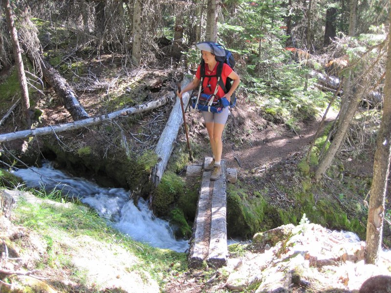
So we packed up and began hiking down-canyon on the Johnston Creek Trail. Very nice. Or at least it was for the first two miles, and then disaster struck: As I was crossing a very small stream, trying to walk on dry rocks to avoid getting my shoes wet, the rocks beneath my feet suddenly shot out like huge ball bearings and I fell, face-first, into the stream. My 65 pound pack was on top of me and my face was underwater. Vicki was horror-stricken: She couldn’t have lifted the pack, let alone me! But it wasn’t that deep, and my hands had automatically shot out to protect myself, so I basically had to do a mighty push-up and get up on my knees to breath. Then I struggled to my feet. I was soaking wet, but unharmed. Vicki was relieved. But then I looked down at myself and saw the true damage: My Camera had been underneath me, completely submerged. I looked at it and the red “disk access” light was on. No! I opened the battery compartment and dropped out the battery. Then I took out the compact flash card with all of the trip’s pictures (hopefully) still stored on it. I handed it to Vicki and took off my pack, and got out some bags to put the camera in. I had no idea if the camera was ruined or not, but I suspected that it was. As an amateur photographer, this was truly a disaster. I felt miserable. It seemed that the entire trip was ruined for me at this point. But there were a couple rays of light. Vicki had taken a few pictures along the way, and I had taken a few with my Canon D10, along with many videos (I had two cameras as my DSLR didn’t take videos), so all wasn’t lost. And maybe the card still had pictures on it. I would have to use the point-and-shoot for the rest of the trip. Also, the D10 was waterproof! It, too, had gone underwater, but it was fine. As was my waterproof GPS, which had been in my other hand. I tried to make myself happy with these and other thoughts, but I wasn’t overly successful. Still, there was nothing that I could do now, so I tried to put it behind me, and lug the dead weight of the heavy DSLR around with me the rest of the way. Needless to say, I was a grumpy hiker after that, and had little patience with Vicki. Life sucked. And so did Banff, and all of its mosquitos. If I had been near the car or a road I would have left for home. But we were truly in the middle of nowhere, at the midpoint of our long trek. I’d have to make the best of it. And I did, of course, but not until later on.Even though my clothes were soaked, it was warm that day, so I just kept hiking onward, my feet squishing in my boots. Being soggy reminded me of how miserable I was without my camera, which was perfect for a grumpy person like me. We hiked on.

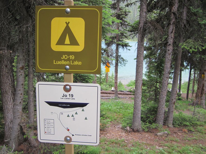
Eventually we reached the side trail to Luellen Lake. The JO18 campsite was here, not far from Johnston Creek. We explored the camp, but it was down in the trees and had few views. There was no one there, so we decided that we’d use it if the JO19 camp at Luellen Lake was full.
Video of Johnston Creek where the Luellen Lake Trail crosses the wooden footbridge
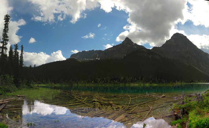
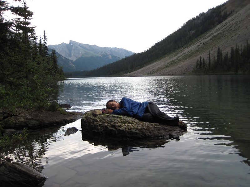
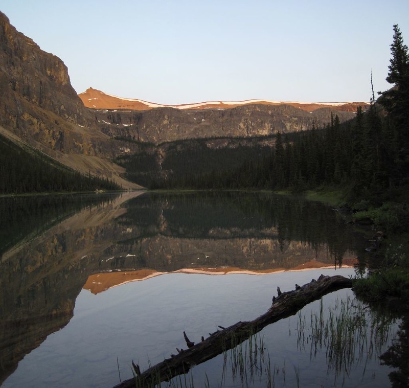
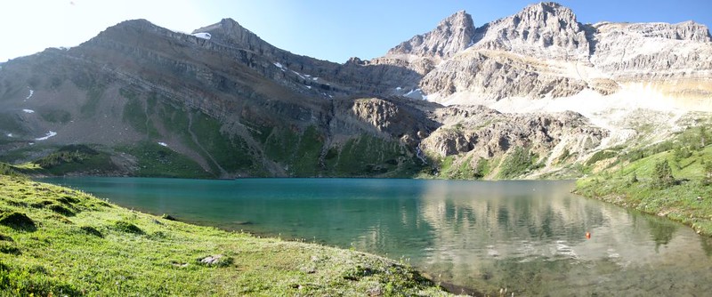
Then it was uphill for another kilometer to the lake. Vicki didn’t like it, but she never likes going uphill. Little did we know it, but the entire tone of our trip was about to change. We crested the hill and descended the final slope to Luellen Lake and the JO19 campground. What a great campground! It was right near the lake, and the lake was beautiful. As we arrived, a summer squall arrived and it began to rain. We put on our raingear and headed for the shore. Huge raindrops were falling everywhere, with sheets of rain blurring visibility of the far shore. It was fun, and didn’t last very long. Then we went and explored the camp. We were the only ones there! Yes! Of course, it was still early, so others might show up. Just in case, we picked the furthest campsite and set up our tent.
Video of a summer rainstorm at Luellen Lake
Video of Fish Jumping in Luellen Lake from the JO19 Campsite
Video panorama of Luellen Lake from the JO19 Campsite
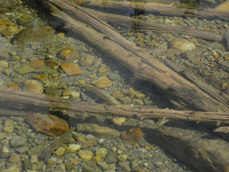
Video of trout swimming near the outlet of Luellen Lake from the JO19 Campsite
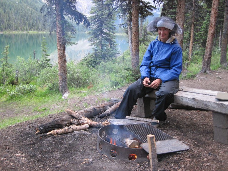
Then we worked on collecting some wood for a fire. Maybe the smoke would drive off the bugs, we thought. The afternoon was spent wandering around camp and relaxing in the tent reading. Very nice. Just what the doctor ordered. We ate dinner and lit a fire before it got dark. The smoke did nothing to stop the bugs, but the bugs also weren’t quite so bad here as they were at the JO29 camp. Still, it was a lake (plenty of water for breeding), and they were everywhere. We went to bed early. Amazingly, no other campers showed up that night, so our fears of being ousted without a reservation were groundless.
Day 6
We truly enjoyed our rest day at Luellen Lake. That pretty much sums up Day 6. But we didn’t simply hang around camp doing nothing. We decided to do a day-hike along the lakeshore, as we could see a stream (and waterfalls) pouring off a high plateau up above the far western end of the lake. After sleeping in and relaxing with a mellow breakfast, we packed our daypacks and headed off along the northern shore of Luellen Lake. We weren’t sure what to expect, but it turns out that others have had this same idea, and there was a faint but followable use trail (or fisherman’s path) along shore. It was a nice hike, and it sprinkled a few times as occasional cumulus clouds drifted by, and then the sun would pop out again. We saw many large trout swimming along shore, and wished that we had some fishing gear.


Video of a brief summer rainfall on Luellen Lake

The headwaters of the lake had the large waterfalls, which were lots of fun to see and hear. We ate lunch by the lower falls, and thought about climbing higher, but decided not to. This was supposed to be an easy day. So we hiked back to camp.

Video of the waterfall of the stream feeding into Luellen Lake

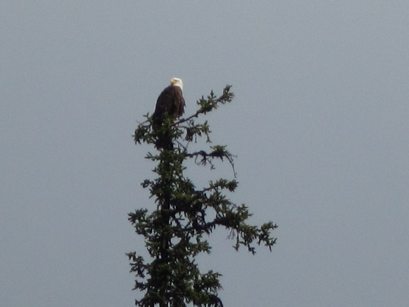
We met up with a woman and her son back at camp, and hung out with them around the dinner table and campfire that evening. While we were eating dinner, a bald eagle perched on the top of a nearby pine. We were hoping to see him catch a trout in the lake, but no such luck. We also saw what looked to be a loon, swimming and diving for fish. The son was fishing, but he didn’t catch anything. He also stripped down to his shorts and waded out into the lake, then dunked himself completely in the icy water. Brrr! I’m sure that the bugs enjoyed this treat, even though he ran for the smoky fire to dry off as quickly as possible. The fire was nice, but we didn’t stay up late, as we had a long day of hiking ahead of us. All in all, it had been a great layover day at Luellen Lake, and our happiness level was at an all-time high.
Day 7
We woke up fairly early and got back to the routine: Vicki headed off to cook breakfast while I packed up everything inside the tent. We ate breakfast looking out at the lake, then headed back to camp to roll up the tent and pack the backpacks. Then it was hiking time! We said goodbye to our neighbors and headed out, back to the Johnston Creek Trail. We were headed back north toward the mosquito-ridden JO29 campground, but we weren’t stopping this time. Not that we wanted to.
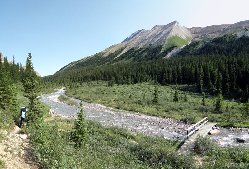
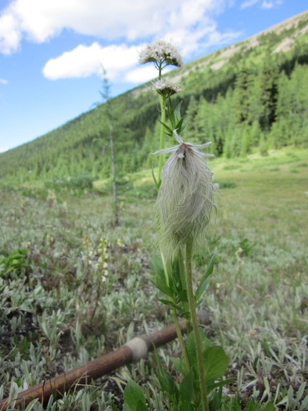
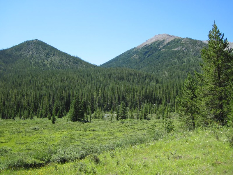
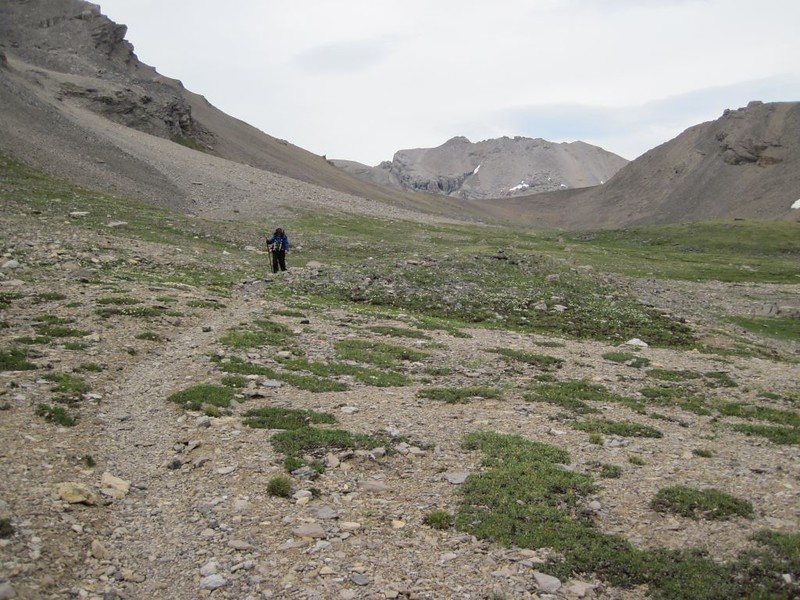
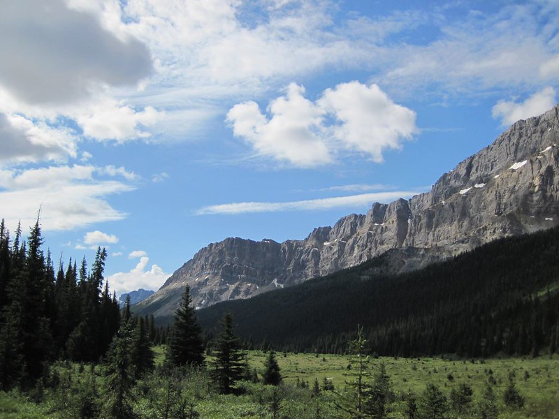
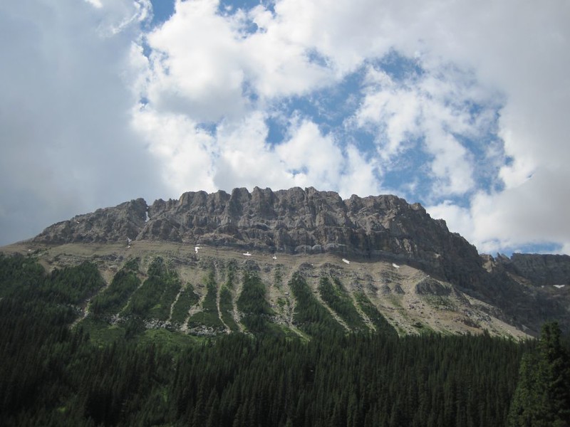
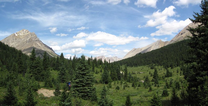
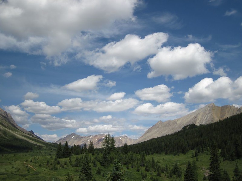
We continued onward, up the trail to Pulsatilla Pass. It was very pretty in this section, with lots of water flowing and plenty of wildflowers. There was even a big chunk of blue glacial ice on the northeast slope of Pulsatilla Mountain. As we climbed, the pine forest gradually shifted to Larches, and finally to low scrub and tundra as we climbed above the tree line. There was still water flowing up near the pass, unlike Forty Mile Summit which had been very dry. Once again, the horseflies came out as we climbed higher, and Vicki was suffering from excess heat due to the climbing combined with the need to cover all bare skin from the biting flies.

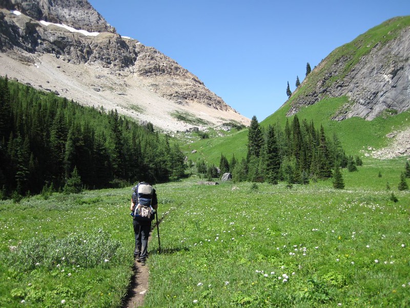
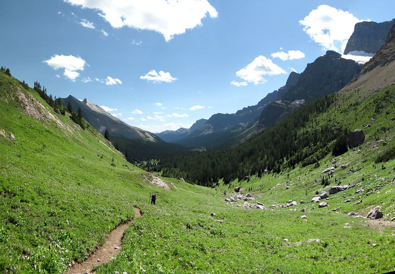

The view from the pass was worth all the climbing, however. We could look south at the Johnston Creek Valley, with many mountains far off in the distance. And we could now see what lay to the north: More distant peaks, as well as a beautiful high mountain lake ahead of us. We descended toward the lake, and Vicki decided that she wanted to take a bath. So we dropped our packs, grabbed a towel (in reality a small facecloth) and headed down to the shore. I was hoping to see her skinnydipping, but it didn’t happen. Still she DID get in the water, but it was too cold to go in much more than thigh deep. She splashed some water over herself quite bravely, considering the temperature, and got out before the bugs could find her bare skin. My job was to shoo them away. She felt better after that, and we continued down the valley toward Baker Creek. There were streams to cross and piney woods, and it was a nice easy hike.

Video panorama from Pulsatilla Pass


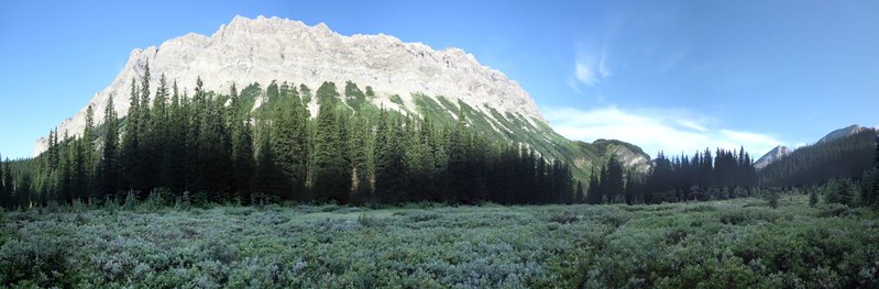
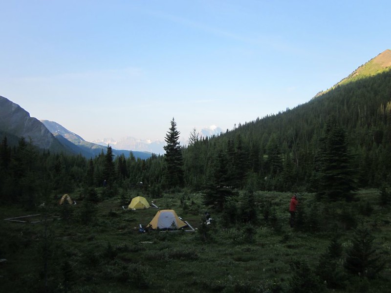
We got to the BA15 Campground before dark, and found that the camp was packed. We got the last open tent site, cooked some dinner, and met all the neighbors around the fire. We were amazed at the lack of mosquitos in this valley; it was the first time the entire trip that we ate a meal (almost) without bugs. Everyone was in fine spirits, and life was good.

Day 8
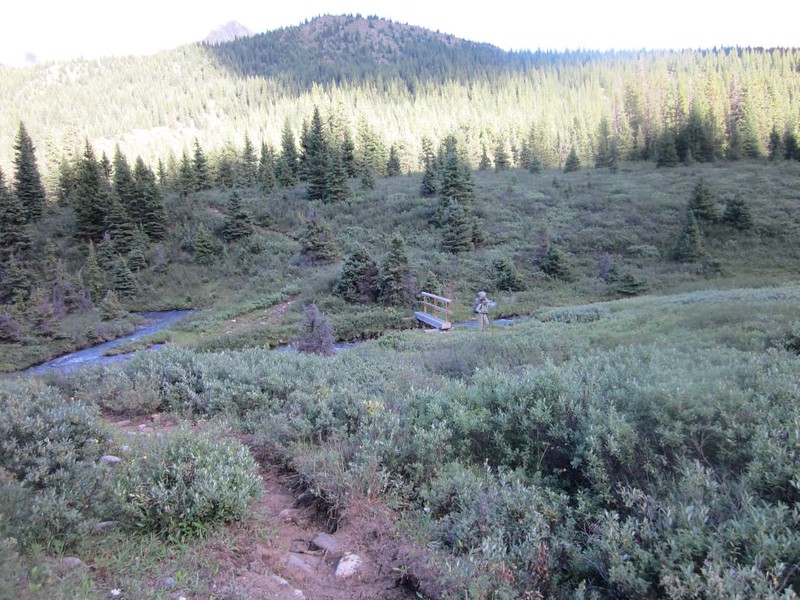
Once again, we woke up early and packed it all up. Only two days left of hiking, and we now felt that bittersweet feeling of being happy that the trip was over while simultaneously wishing that it would never end. Hiking up the Baker Creek Trail, we waded through wet grasses in soggy morning-dew meadows. The trail would spread out into faint paths then come together again at the ends of the meadows. It was hard to follow, and you had to be on the lookout for boggy pools of muddy water.

Video of me crossing Baker Creek wearing my water shoes as there was no dry path
Regardless of our wet feet, the trail climbed steadily, and we eventually arrived at a series of high, dry, grassy meadows with fine views of the surrounding peaks, forests, and even some distant waterfalls. Very nice. As for the bugs, well, maybe we were getting used to them by now, but I really think that there were fewer.
We got to the intersection with the Skoki Lakes Trail and hung a left. Baker Lake was there, complete with a very nice campground (SK11). There were lots of sites, so we figured that there must be good fishing in the lake. But we hiked on. The bugs returned to their usual annoying level at this point, thanks to the nearby lake, but they were nowhere near as bad as they were at Johnston Creek.

Video panorama of Baker Lake
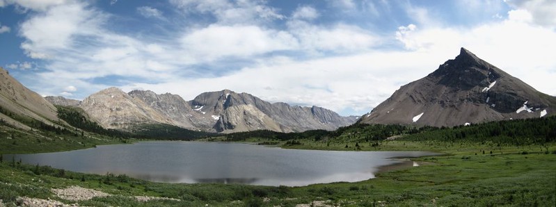
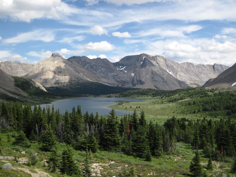
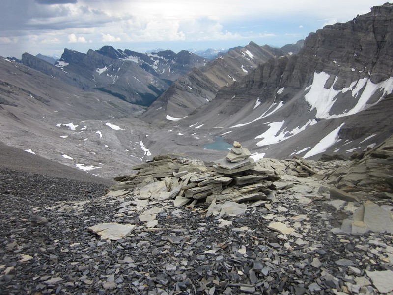
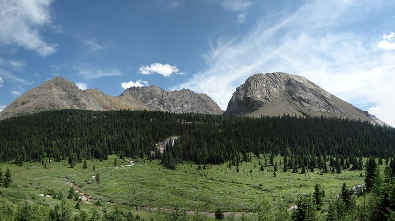
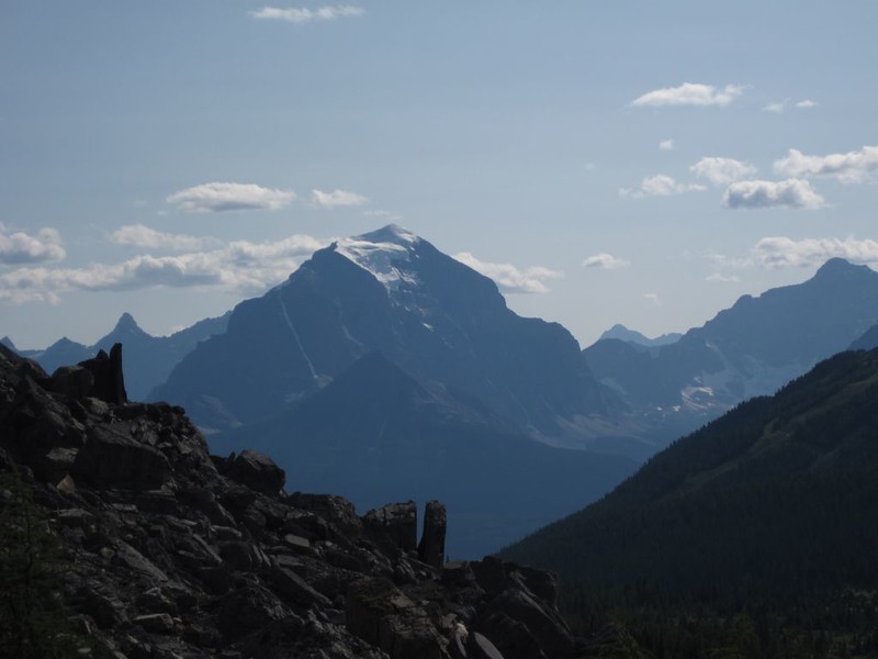
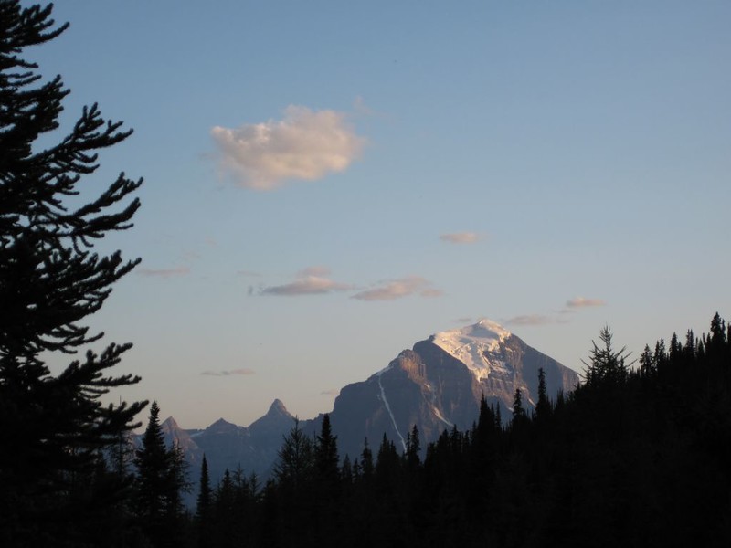
We hiked along and came to Ptarmigan Lake, situated between Ptarmigan Peak and Redoubt Mountain. Just beyond it was our final high point, Boulder Pass. Oddly, there were lots of loose boulders there. We also got great views of the icy glaciers on Temple Mountain and Mount Victoria. Now THOSE were some truly awesome mountains! Even in August they looked amazingly massive and majestic.
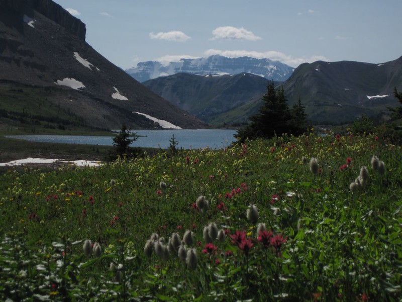
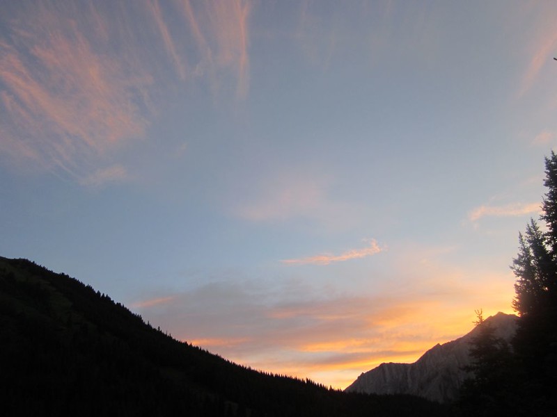
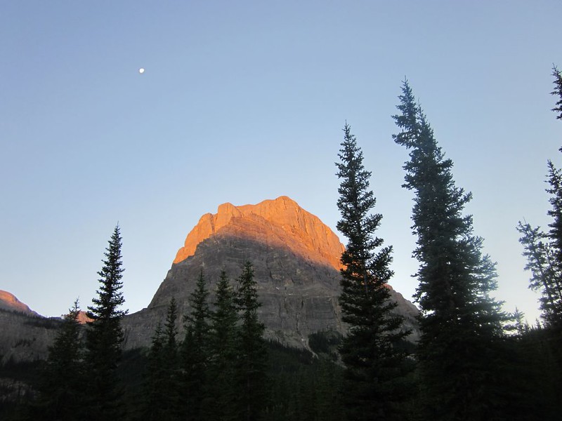
After the pass it was all downhill (or mostly downhill) to our final night’s camp at the SK5 campground. We got there with plenty of time to spare. We set up our tent and had some dinner, then took a nice hike up the valley to Hidden Lake. The lake was nestled between three peaks, and was very scenic and romantic. There were fields of wildflowers blooming everywhere, and there couldn’t have been a better time of year to visit that spot. We enjoyed sitting by the grassy shore in the sun, then headed down to the cooking area. We ate the cheesecake dessert we’d made earlier, and it was excellent. We took far too many pictures of mighty Mount Temple in the distance, glowing in the setting sun. Then it was off to sleep.
Video panorama of Hidden Lake with Mount Richardson, Pika Peak, and Ptarmigan Peak
Day 9
Our last day in Banff actually started out extremely early in the morning, through no desire of our own. In fact, it began about two AM.
I was awakened by an elbow in my ribs, and the sound of Vicki whispering urgently. “John! There’s something in the tent! John! Wake up! There’s something here!” Well, that certainly got my attention. I opened my eyes but it was pitch dark. “It’s right next to me!” she insisted as she crowded close. “Don’t you hear it?”
Indeed, it seemed that I heard a faint noise. I reached for my headlamp in the tent pocket next to me and fumbled to turn it on. Click! Bright white light blazed out. I directed the beam toward Vicki’s side of the tent, and there it was: A large spine-covered porcupine! It was just outside of the tent’s mosquito netting but was inside the overhanging nylon vestibule of the tent. Indeed, it had originally been about three inches from Vicki’s face!
“Porcupine!” I growled at it, but it didn’t move. I told Vicki to open the tent door and shoo it out. Suddenly, I discovered that it was only a foot away from MY face: Vicki had jumped sideways (inside the sleeping bag!) right over me! I was obviously the one that had to deal with this problem! And now my own advice seemed a bit reckless. Stick my arm out there, into the zone of pointy quills? Let’s not be too hasty! I came up with an alternate plan. I began doing what they tell people to do with bears: Make noise and flash lights in an attempt to be fearsome. So I growled and flashed the light, but nothing happened. The porcupine wasn’t moving!
I immediately discerned what the problem was. The poor thing was in a limbo, of sorts: It couldn’t get to us due to the netting (not that it wanted to – we were WAY too scary), but it couldn’t escape out of the vestibule either. It needed to lift a nylon flap to escape under the edge of the tarp, but it was standing on the flap, and had no idea what to do. I realized that we were safe from porcupine bites (and quills) unless it chewed a hole in the netting (not very likely), and yet I also had to get it out of there RIGHT NOW. So I really had no choice but to revert to Plan A: I scooted toward the front of the tent and unzipped the netting (hoping that it wouldn’t suddenly go insane and jump into the inside of the tent with us) then reached out into “his” area in the vestibule and unzipped the main door of the tent. I flung the door wide open and zipped the netting shut as fast as I could. We were safe once more, and a path to freedom for the critter had been opened.
I then returned to the old caveman standby: Making noise and flashing lights. I did this from the back of the tent, striving to drive him toward the door. “Porcupine!” I growled. “Rrraawwrrr!” I threatened, waving the bright light back and forth like mad. I meant business. I was truly in his face this time. And he finally got the idea. He started forward and smelled the fresh night air of freedom. He ran out as fast as he could waddle, and then Vicki and I both breathed a sigh of relief.
“He’s gone.” I said, quietly. All was quiet outside, as well. Hadn’t anyone else in the campground heard the commotion? There was another tent not far from us. Apparently not. I hadn’t had to shout, after all; it had only been a porcupine a foot away from me. And if they’d woken, well, they weren’t screaming out loud about it; perhaps they were catatonic with fear, cowering in their tents with their sleeping bags pulled up over their heads. We’ll never know.
After a minute or so, I unzipped the screen and stuck my head out of the door. I shined my light all around, but discovered nothing. Our unwanted roommate was gone for good. It was then that Vicki realized what she had done, how she had thrown me to the lions, so to speak. We looked at each other and started laughing.
We were wide awake at this point, so we got dressed and went outside, looking around the camp and viewing the stars. We had heard about these raiding porcupines back at the Baker Creek camp. Supposedly they weren’t out looking for food, but for salt. They would literally eat the leather on people’s shoes to get at the dried salt from their sweaty feet. That’s when we decided to go back and see if our shoes were OK. We thought that putting our shoes in the vestibule area of the tent would be good enough, but these porcupines were apparently quite bold. We looked, and the back of Vicki’s boot had been gnawed on. This gnawing must have been what had woken her up. We looked in the vestibule area and found many quills on the ground, and a couple were lodged in the netting. But they would have to wait until morning. What a night! We got back into bed and eventually slept for an hour or two.
Then we got up and began our typical morning routine. We ate breakfast and packed up camp, meanwhile taking even more pictures of Mount Temple in the rising sun. The glacier on top seemed to be making its own weather, as a small ever-renewing cloud drifted downwind from the summit. We said goodbye to our neighbors (the porcupine story had been a big hit at breakfast) and began our final day’s hike, a long downhill trail to Lake Louise.

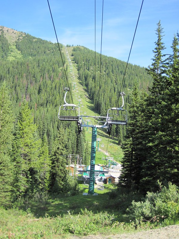
The bugs were back in force that morning, we noticed. It seemed they wanted us to be sure to remember them fondly as we hiked away. No worries there! The Skoki Lakes Trail followed Corral Creek on its way toward the Lake Louise Ski Resort. The trail continued to get wider, and then signs appeared, warning us of snowmobiles. Not much use in August. Soon we were amongst the grassy ski slopes and ski lift machinery, and the trail had become a well-graded gravel road. We could see the lift cables as they ascended Whitehorn Mountain to our north.

We had several miles still to hike in order to reach our bus at Lake Louise when one of our fellow campers (illegally) drove his truck up the road to pick us up! They had hiked much faster than us. He gave us a ride all the way to the bus stop. Our long hike was over in a flash. We ate some ice cream at the store, then hung around the area for several hours waiting for the bus to arrive. We almost wished he hadn’t picked us up. Meanwhile, we ate our last dehydrated meal and also got some Banff T-shirts and other souvenirs.
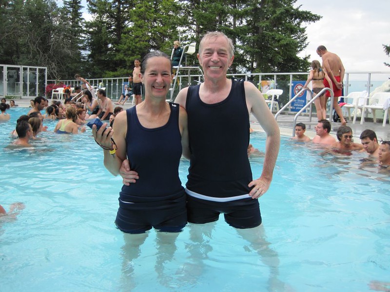
We boarded the bus and took it only one stop, and got off back in the town of Banff. Basically, we drove in an hour what had taken us nine days to hike! We took a taxi ride to the Upper Hot Springs, where we rented a towel and some amusing antique bathing suits. There we had an enjoyable bath in the warm waters. It felt good to become a clean, civilized human being again. We didn’t have much in the way of clean clothes, so we wore our new Banff T-shirts and our clean(er) spare hiking pants.
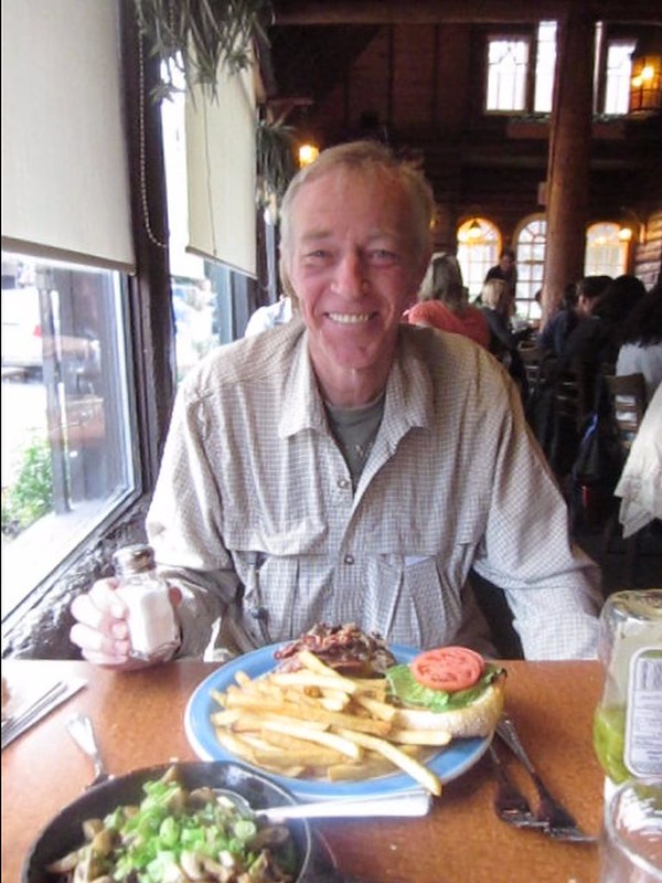
We took another cab back to town and ate dinner in a nice restaurant, then hiked on down to the bus station, and waited for the last bus to Calgary. It was running late, and was already full of people, but another ten were here in Banff with tickets to board. They had oversold it! The driver tried to say no, but as a group we wouldn’t have it. We convinced him to let us all board, even though many were sitting on the floor the entire two hour drive back to the city. When we arrived it was late, but Vicki’s relatives were still nice enough to come get us. They offered to let us stay the night, but we really had to get going, as I only had so many days of vacation, and we had a very long drive ahead of us. We said thanks and goodbye and got back in the car for the long haul south. We were still driving in Canada at midnight.
Day 10
We crossed the U.S. border and continued south on I-15 for 2000 miles. This highway would take us within 5 miles of our home in San Diego. But first we had to get there. We repeatedly traded places, one driving and the other sleeping, all through the night and on into the day. We stopped for food every so often, but mostly we just drove and drove. The day passed, the sun set, and on we drove. We finally arrived not long after midnight. We carried our packs inside, took a shower, and slept the good sleep in our own wonderful bed. And there were no more bugs to bother us!
Epilogue:
After getting back home, I discovered that there were absolutely no photos on the flooded DSLR camera’s memory card. I tried all kinds of data tricks and computer programs to read the card, but none worked. Still, I wouldn’t give up. I sent the memory card off to an expensive data recovery specialist, and they put my job off for months, but I was patient, and finally I received a package in the mail: The remains of my memory card (they had physically removed the chips to try to read them) as well as the sad, sad truth: My pictures were gone forever. And that’s why the first five days of this trip have very few photos and many more videos than usual. The only pictures left are the ones in my head, and they are difficult/impossible to set down on paper. And even now as I write this, a year and a half later, I still think about my destroyed camera first when I think of Banff. The memory of the insanely horrible mosquitos are a long distant second place. But the beauty of Banff, thankfully, comes in a close third. On a better bug-year, with no accidental camera damage, I think that Banff’s intrinsic natural beauty would shine out, and be a hike that any backpacker would love to remember.
The rest of this trip’s photos and videos can be seen on my Flickr Page.
Interactive topo map and GPS tracks can be seen on my Caltopo Page.
