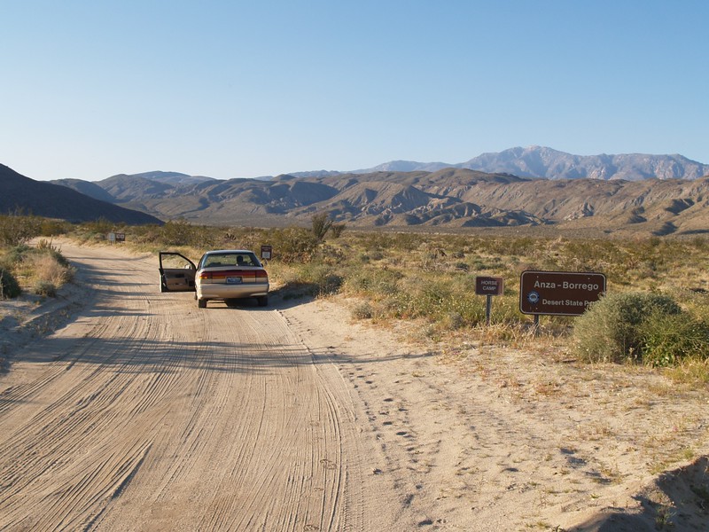
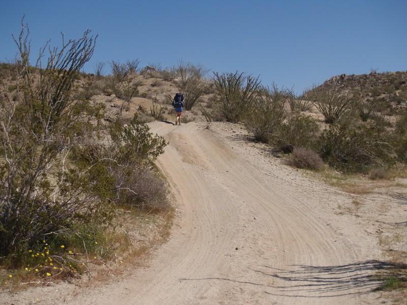
We left for the desert late Friday afternoon, heading for Coyote Canyon, just northwest of Borrego Springs, in Anza-Borrego Desert State Park. It was mid-March, and prime season for the annual desert flower bloom. Our plan was to drive as far up Coyote Canyon Road as our old Saturn would go, at which point we’d camp for the night. In the morning we’d don our backpacks and head upstream to the Middle Willows area, where we’d stay until Sunday.
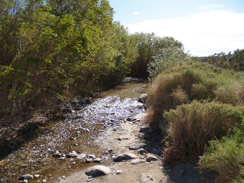
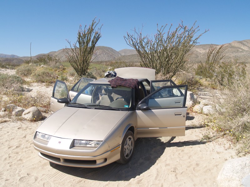
The road makes three “crossings” of Coyote Creek (there are official park signs for each of them), and the Saturn made it across the first, but not quite all the way to the second. This was significantly better than we’d expected, and would make tomorrow’s hike that much easier. Twenty five years before, I had driven this way in my old VW, an excellent desert car, and I didn’t get much further. All it takes to end the journey is one bad spot with some exceptionally high and unmoveable rocks, rocks that a high-clearance vehicle like a jeep would drive over without a care. The “crux” of this road happened just after a likely-looking turn-out, so we backed up, parked the car, and set up our tent. There were lots of people camping along the road that night, but most of them had stopped before the first crossing. We had our own little piece of desert. We ate dinner, watched the sunset, and went to bed.

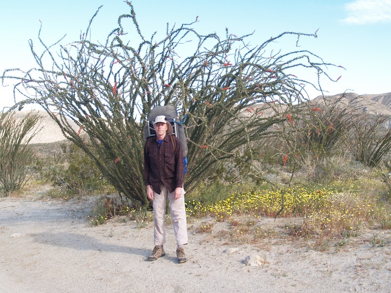
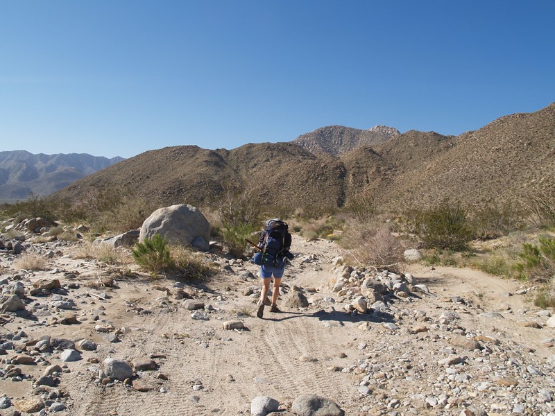
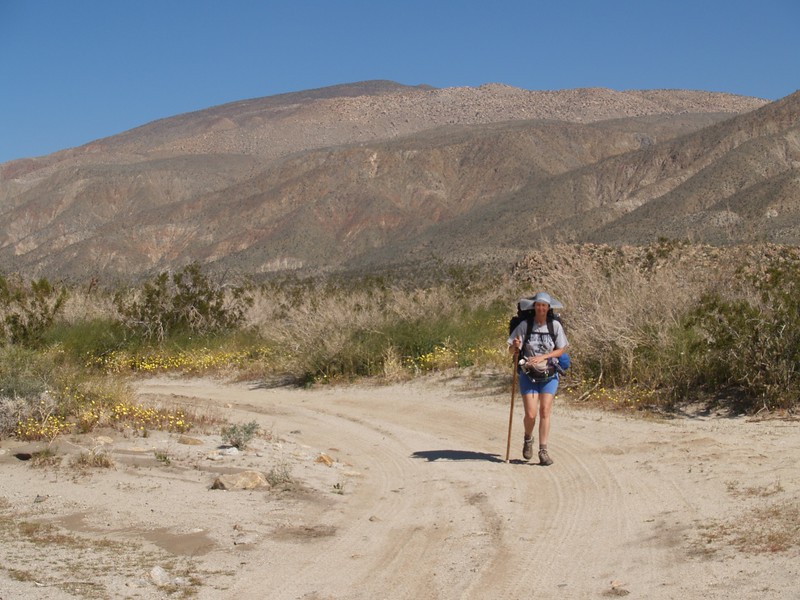
I woke up just as it was getting light, and spent the dawn taking pictures and lazily exploring around. Vicki stayed cozy in the tent until the sunlight finally blasted her out. We ate breakfast, broke down camp, and packed our gear. I carried a very heavy pack, with an extra gallon of water, as we weren’t entirely sure of the creek’s condition at the far end of our hike. If the Middle Willows area was dry, we’d have just barely enough to hike right back out that night. But I didn’t expect to, as it had been a good winter for rain, and the desert was in bloom, flush with moisture.

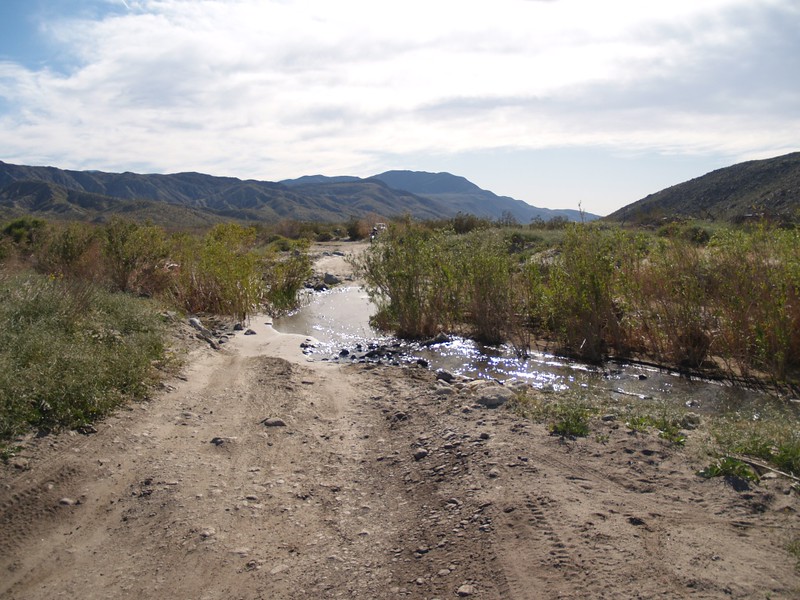
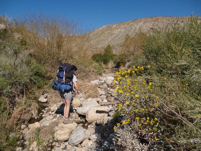
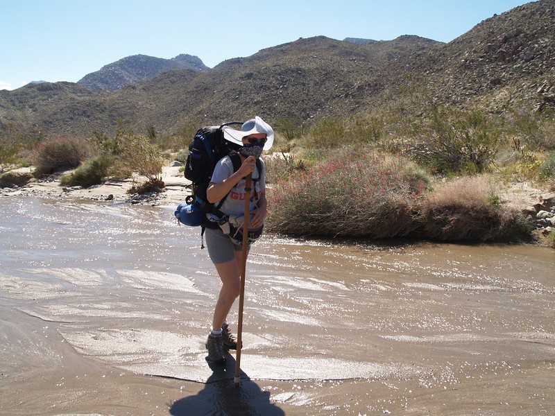
We hiked along the road, up-canyon. Some jeeps and trucks passed us, and we met a nice couple with a couple of nice dogs; the dogs liked to run in the water. We found a way to get across the stream without getting our feet wet. We made it to the third crossing, where we discovered that the “road” had become the stream, and it went through a brush tunnel for over one hundred feet; the water looked to be about a foot deep, but you wouldn’t know until you tried it. Pretty fun driving. Folks were taking videos as they powered down the watery tunnel. It made me envious and desirous of owning a 4WD vehicle. But we were 2FD (two foot drive) vehicles today, so we took the bypass trail. At this point the main “road” headed off, up and over a side canyon, as the Lower Willows area was closed to cars. But not to hikers!
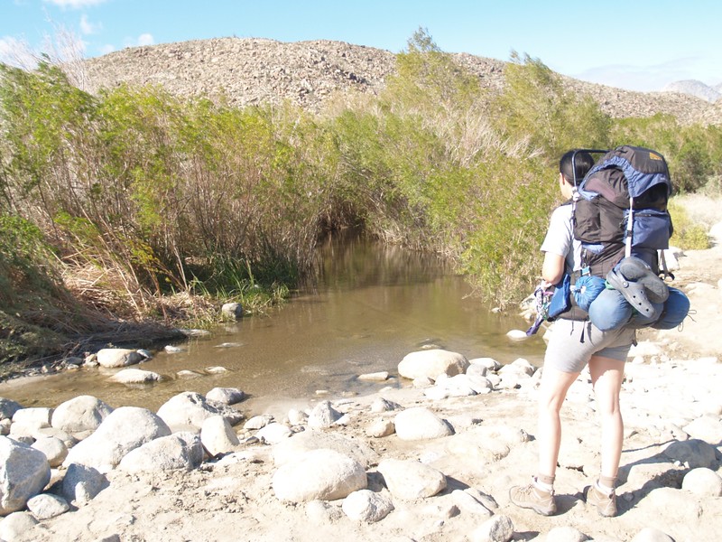
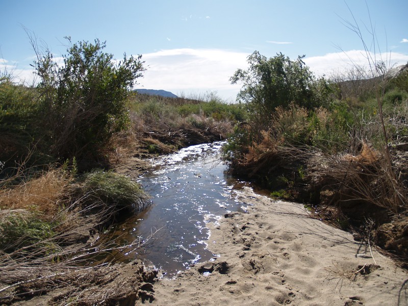
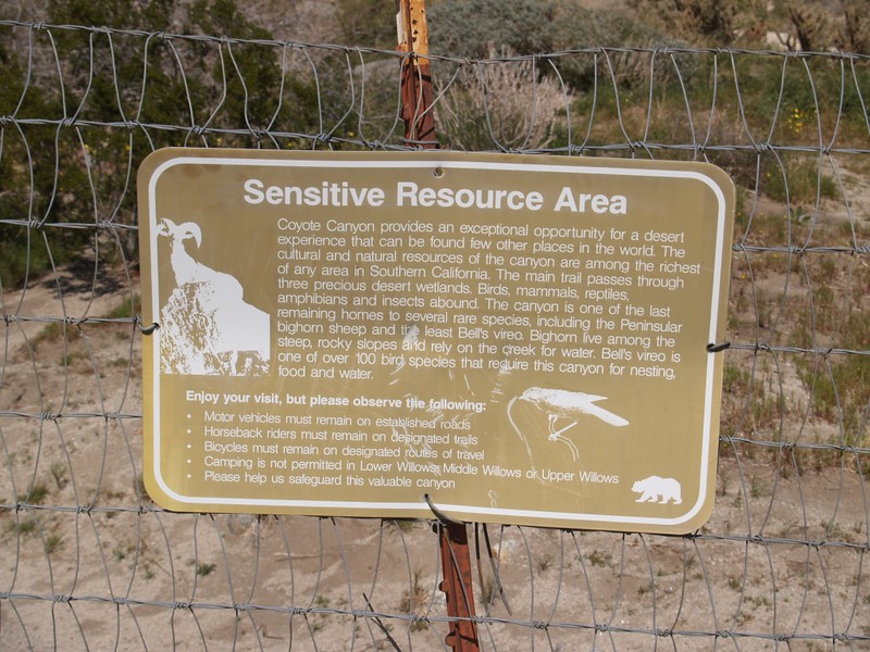
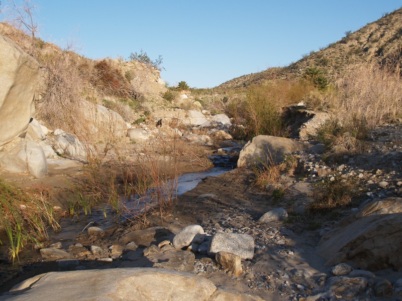
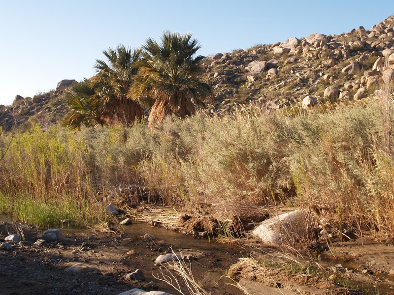
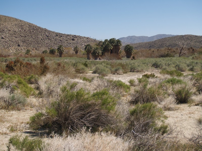
The Lower Willows is an area at the lower end of the Collins Valley, where the normally-subterranean waters of Coyote Creek finally reach the surface as a flowing stream. As you might well imagine, the plants are lush and nearly impenetrable in this area. This is where the Bighorn Sheep come to drink in the hot dry summer, as the water never completely dries up; this is also why it’s closed to humans during the summer, as the Bighorn are very shy. The trail through the willows follows the streambed for the most part, and it isn’t particularly well-marked or well-maintained. In fact, it seemed to take forever to hike through it with our large packs. Also, Vicki lost her footing crossing the stream at one point and soaked both her boots. She wore her camp shoes, a pair of crocs, while the boots were tied on the back of her pack to dry, and crocs are NOT what anyone would call great hiking shoes. So it was slow going. Eventually, the water level sank back into the ground and a normal trail was revealed. As we hiked along, the vegetation became thinner, and finally we were out of the Lower Willows entirely.
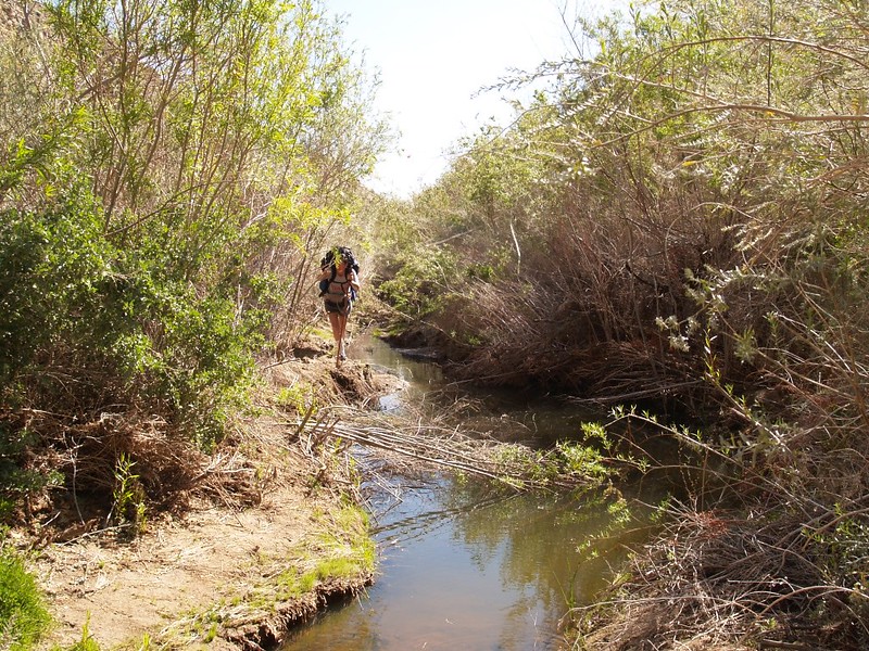
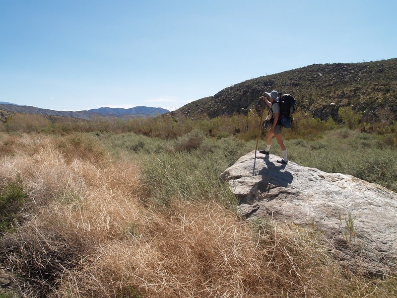
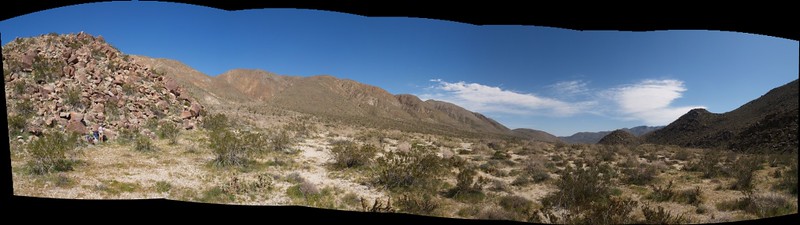
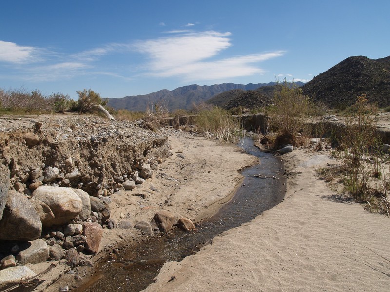
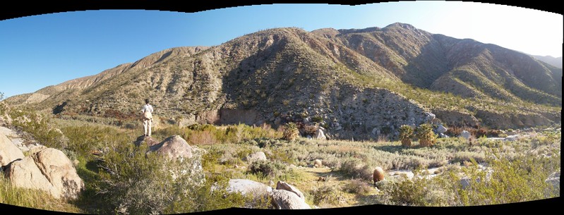
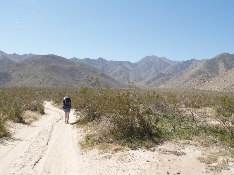
We were in the main dry wash of Coyote Creek, which crosses the Collins Valley along its eastern side. There was no trail at this point, as the “official” Lower Willows Trail headed back around to meet the main road to the west. We hiked along on a gradual, uphill slope toward the head of the valley. And the wash wasn’t simply one wash. It was many branching possibilities of washes, any and all of which may have formed by being torn out by some earlier flash-flood from above. Sometimes we were down on the sandy wash and couldn’t see over the steep banks, and other times the wash petered out and we headed over the top. Very broken country, in other words.
And then the wind began.
It started easy, with an occasional gust, and it wasn’t too bad. In the beginning. But as we hiked (directly into the wind, of course!) it got stonger and stronger. I pulled down the never-before-used tie strap of my hat and tucked it under my chin to keep from losing it. I kept my face aimed down so that the hat’s brim would protect my eyes from the stinging sand that whipped along the wash. Vicki eventually had to get out a bandanna to breathe through; she tied it around her mouth and nose like a western bandito of old. Her hat was like a mesh, and she let the brim get blown down over her eyes and sunglasses, so she could still see where she was walking. I was dreading setting up the tent in this weather, but I didn’t say anything to her about it yet. Hiking directly into it was bad enough.
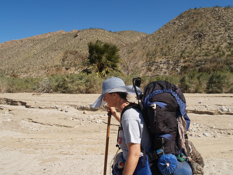


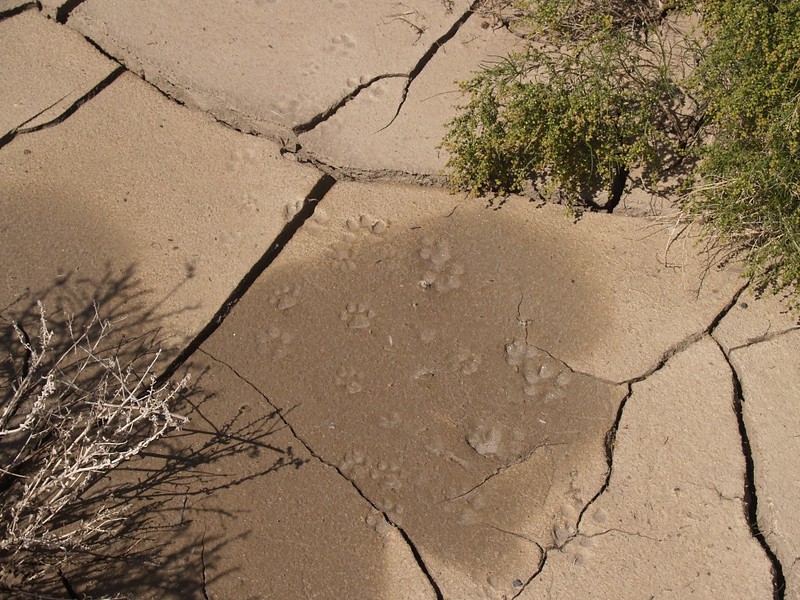
We had lunch near Monkey Hill. How it got that name I have no idea. It looked nothing like a monkey. It wasn’t all that big, but it just sat out there in the middle of the valley. Not far from our lunch spot, Vicki found some dried mud with both cougar and Bighorn tracks. Nice! Soon afterward, a thin band of wet sand/mud could be seen running down the length of the wash. Signs of water! Life was looking better all the time. As we hiked onward, the wet mud became an actual running trickle, and soon grew to be a wide, thin sheet of water flowing on the surface. Then the sheet drew together into an actual stream, and we knew that we’d be fine, that we’d have plenty of water for dinner, breakfast, and tomorrow’s hike back.
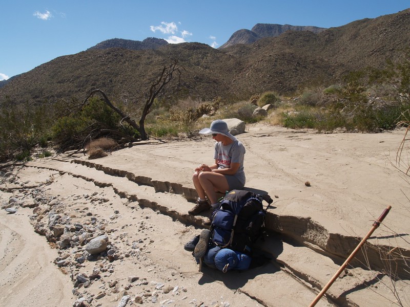
As we neared the head of the valley, one of two belt straps on my pack broke! Basically, the entire weight of my pack was now on one (old and weak) strap, and all on one hip. I was not amused. This was my old, trusty pack from my teenage years, and it had never failed me. But I wasn’t overly worried, as I always followed the scout motto: “Be Prepared!” I had some nylon zip-ties as well as some light rope in one of my pack’s pockets, so field-repairs could be made. Vicki took a look at it, and told me that she would be able to sew it once we got home, so all it needed at the moment was some temporary first-aid. And, as we were nearly where we intended to camp, I simply took more of the weight onto my shoulder straps (ouch!), and pushed on. I’d end up getting a backrub out of Vicki later on that evening.
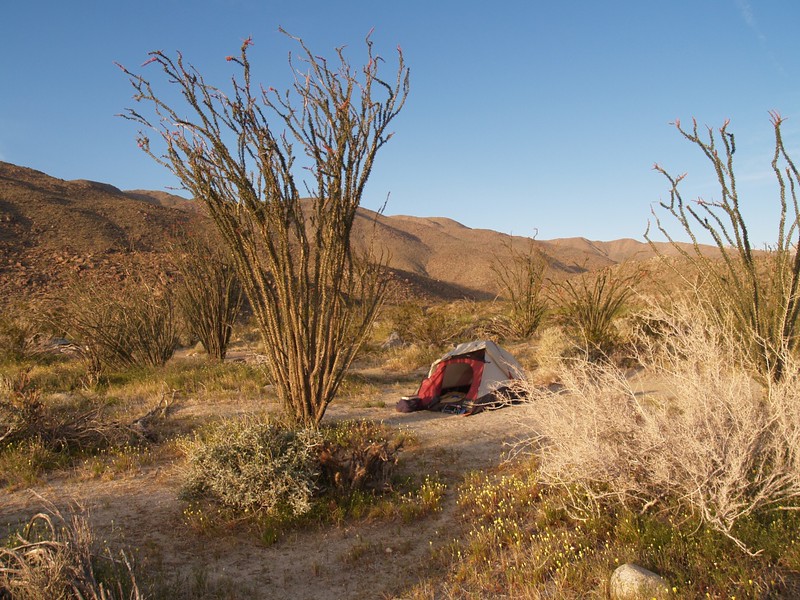
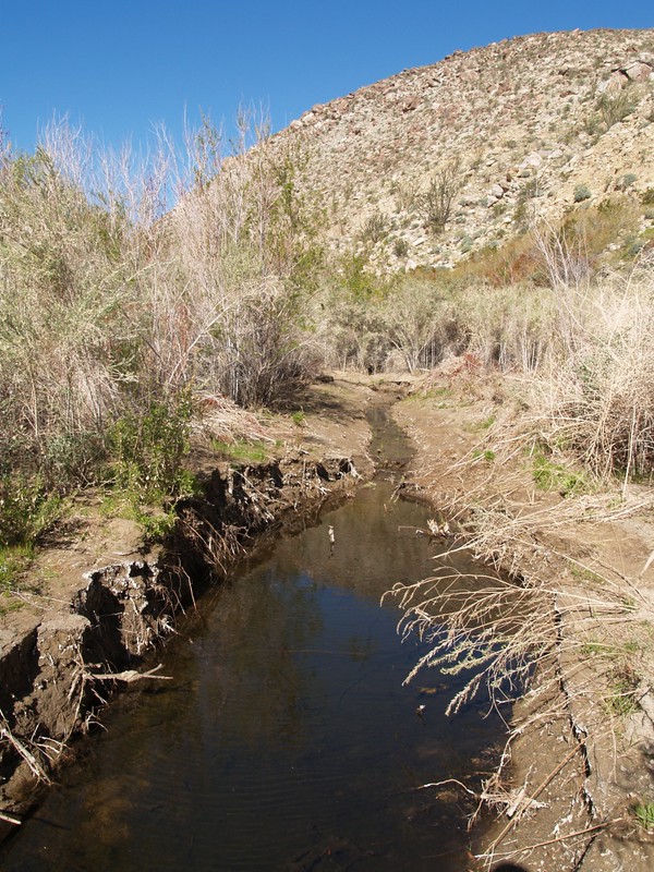
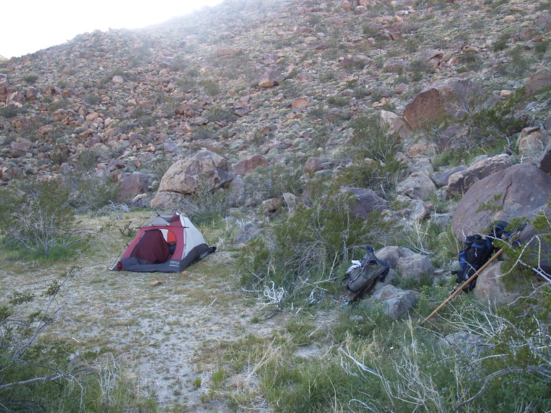
The creek headed directly into the brushy moist area of Middle Willows, but the wind was REALLY howling through the gap, so we sought shelter in the lee of the ridge just to the west. The wind here was gusty, so we dropped our packs and walked along the flat area next to the ridge, standing here and there, saying “I think it’s less windy here” and then a moment later “Well, maybe not” as a gust tore through, sending sand flying. We eventually found a spot that wasn’t absolutely horrible, and set up the tent. We staked it down and piled gear inside to hold it there. We were home for the night!
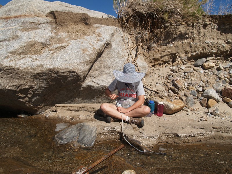
Vicki went off to find an extra-sheltered spot for the stove while I blew up the thermarests and got the sleeping bags ready. She likes to cook, and I’ve got more lung-power; it’s a perfect division of labor. Then we headed off to the creek and pumped/filtered over a gallon of excellent-tasting water.
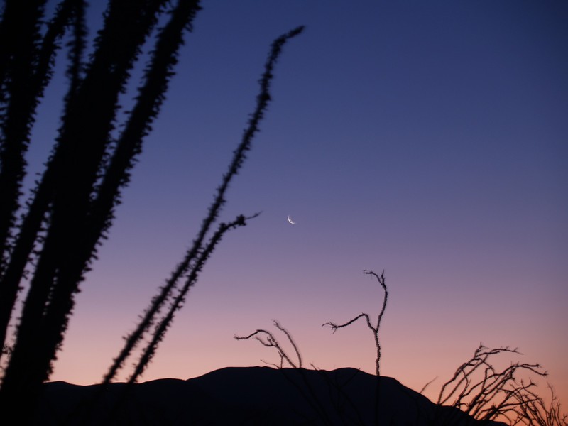
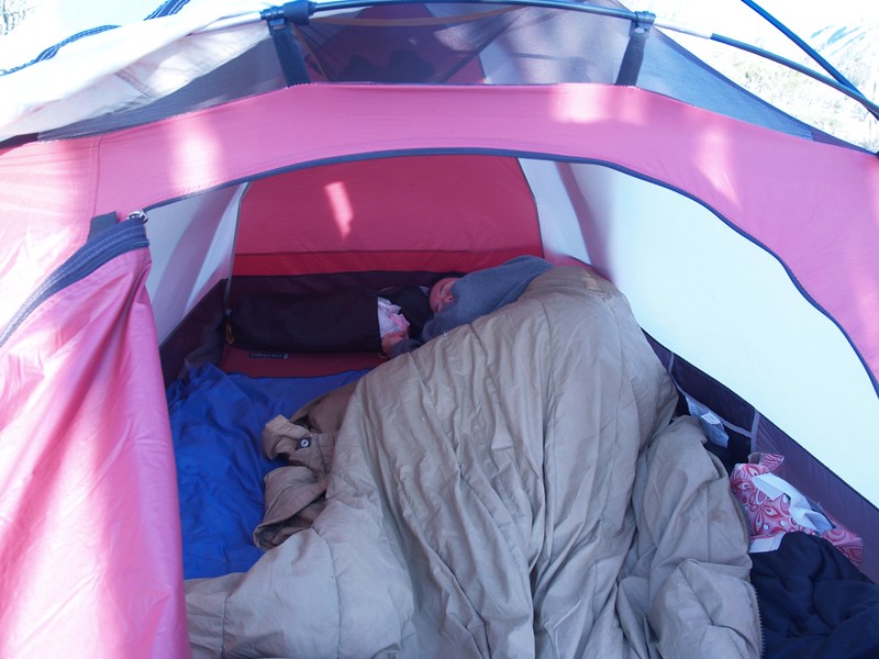
It was still windy, and we were tired, so we cooked dinner, ate, and crawled into our snug little tent well before the sun went down. The tent shook noisily from the occasional gusts of wind, but it was warm and cozy inside. We read our books until it was dark enough to see some stars, and then we went out for one last look, hugging each other in the windy dark desert night.
Day 2:
By morning the wind had died down. We got up, ate breakfast, and took a short day-hike up the creek into Middle Willows. We didn’t go too far, as the trail followed the creek, and the brush was very thick; getting our shoes wet didn’t sound like fun. We climbed up on the sides of the canyon and found some morteros and what was obviously a choice spot for a campsite. Surely this had been a temporary place for a nomadic tribe to stay. And it probably was also used by some early settlers/miners/Spanish Conquistadors back in the good old days. If it hadn’t been for last night’s wind and all those pesky “No Camping” signs by the mouth of the willows area, I would have been happy to stay there myself.

We packed up camp and got ready to hike back out. Weekends are too short, even three-day ones. I fixed my pack’s belt with a zip-tie, and it felt normal, with the weight solidly on my hips; my shoulders would still be alive when I reached the car. We still had enough water left over from yesterday’s pumping, so we were good to go. I bade goodbye to Middle Willows and the protective ridge we’d camped next to, and we hiked out.
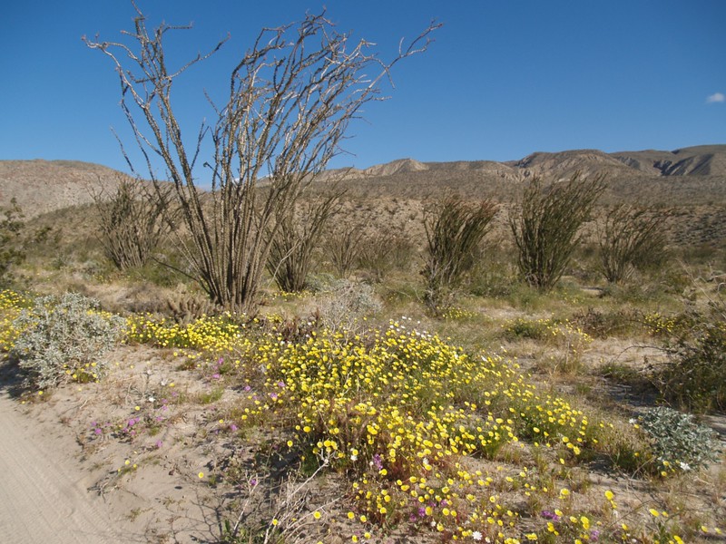
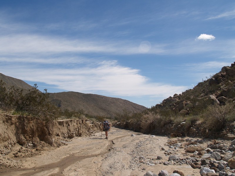
On the way back, we decided to be different and hike out via Coyote Creek Road. This would make it a loop hike, of sorts, and we also wouldn’t have to struggle through the Lower Willows again. But the road wasn’t really all that exciting to hike on. In many places the sand was too soft and deep, which is tiring, and every so often a caravan of jeeps would drive past, leaving us in clouds of dust. We began wishing for some wind, both to blow the dust away and to cool us down as the sun rose higher. On a hot summer day this dry valley would be murderous. But it was still springtime, and the wildflowers made the hike much more colorful. We saw a couple of desert hares, with their long, long ears. They were probably eating some of those lovely flowers.
We were tempted to bushwhack directly toward the Lower Willows, as the road headed west toward Salvador Canyon before turning south. At this point we turned around and were able to see a snow-capped mountain not very far away. The map indicated that it was Toro Peak, and we decided to do some research on that mountain, for another hike, in the summer when there wouldn’t be any snow.


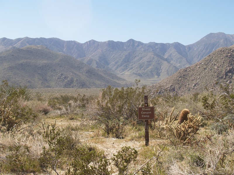
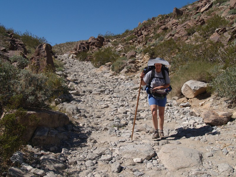
We hiked onward, and passed the turnoff to Sheep Canyon, where it seemed that most of the hikers and 4-wheelers go. From what I heard, they closed the road through Lower Willows several years ago, then built a new one which bypasses the sensitive wetlands by going up and over a pass to the west. We hiked back via this route, and I was impressed by the difficulty of the new road. On the west side, it was quite steep with large bumps and was all dirt. But the east side was amazing, as it was a road paved with stones, but not smoothly paved. Oh, no. Not at all. In fact, it was treacherous in spots, and this was truly a road where four wheel drive, high clearance, and a gutsy driver were all required. In fact, we didn’t hike much slower than some of the jeeps and trucks! Yes, I tried to feel like a smugly superior backpacker, travelling “green” and being “one with the planet” (et cetera), but I couldn’t fake it for long; the truth of the matter is that I was absolutely jealous and wanted to drive one of those big trucks on a challenging road like this one, instead of being the owner of a wimpy car that couldn’t clear a few tiny rocks like the ones that stopped us a couple of miles away. Sad but true.

We hiked the last stretch of road and got back to the car. It was sunny and hot, so we opened all the doors and let it cool off. We drove away, looking at the wildflowers for one last time this season. Traffic on the dirt road increased as we neared town. People were parked on the side of the road everywhere. There were people posing for pictures with wildflowers, getting close-ups of wildflowers, and mounting cameras on tripods to take artistic photos of wildflowers. It was a full-blown desert wildflower weekend in Borrego Springs. When we reached the point where the dirt road turned back into a paved road, there was a major traffic jam of cars (low-clearance passenger cars), all filled with people checking out the flowers. Quite a difference from the lonely area where we began our hike that morning. Still, it was nice to see everyone enjoying the desert, even if our own goal at that moment was to get home, unpack, and look at all of our pictures.

All in all, it had been an excellent backpacking weekend.
For more photos and videos check my Flickr Page.
For a topographic map and GPS track of our hike see my CalTopo Page.
