We left San Diego for Anza-Borrego on Friday evening about 7:30pm, about two hours after I got home from work, which was the fastest I could go. Yes, we knew that it would be dark when we got there, but we didn’t care; we had a plan, and we were going to squeeze in two nights of camping no matter what.
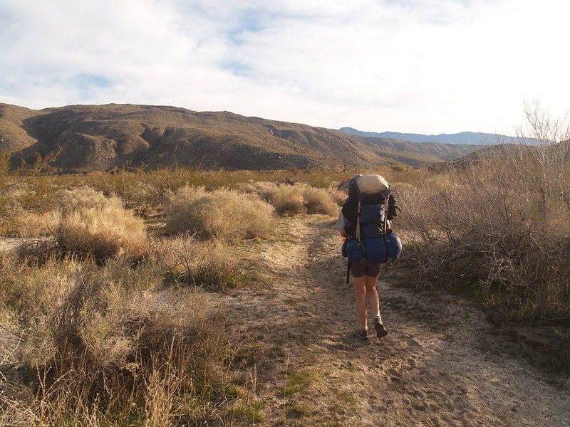
Our plan was to spend Saturday exploring Cougar Canyon, the mouth of which was about five miles from the nearest spot that we could drive our car. That pretty much made it mandatory that we backpack the entire five miles on Friday night, camp that night, explore the canyon all the next day, sleep in the same campsite again, then backpack out on Sunday morning. And that’s what we did.
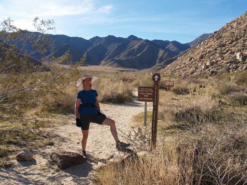
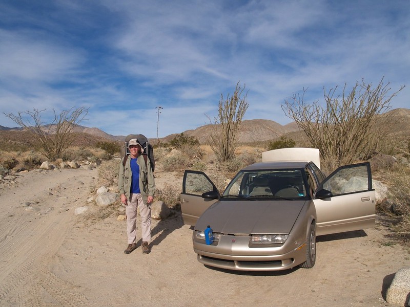
We parked in the same spot on Coyote Canyon Road which we used in March 2010, when we hiked to the Middle Willows. So we already knew the initial part of the trail, and hiking along the road/stream was not as confusing as it would have been for a first-timer.
Now, starting out on a five mile hike with a heavy backpack at 10pm in the dark may sound like pure misery, like needlessly suffering when one could otherwise be comfortably lying in bed, but in reality it wasn’t like that at all. On the contrary, it was beautiful.

The moon was gibbous and waxing, so we had lots of near-vertical light coming down. The white desert sand made visibility excellent, and we only needed our headlamps when we were crossing and re-crossing Coyote Creek, which was still swollen with December’s heavy rains. The sound of the frogs at the Third Crossing was nearly deafening! They were having a great time mating and fighting in the creekside reeds. Frogs and their moonlit antics: An old song and a good one.
Video of Frogs in Coyote Creek, singing under the gibbous moon.
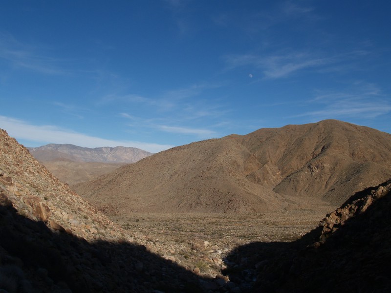
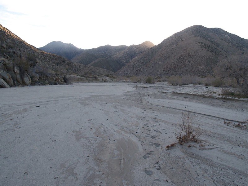
We followed the dirt road up and over the low pass due west of Third Crossing, and descended into Collins Valley. The air was cool that night, but not too cold, with a mild breeze blowing occasionally; it was just about the perfect temperature for hiking uphill with a heavy pack. If we had stopped for a rest I would have been chilled, but we didn’t stop for more than a minute at a time. We wanted to get as close to Cougar Canyon as possible before we began feeling sleepy. Eventually the road turned west, headed toward the canyon, via a sandy wash. The sand gradually got much deeper, softer, and more annoying to walk on; the slogging was tiring us out. I checked the GPS, which said that the Sheep Canyon campground was less than a mile away. The thought of hiking another mile in deep sand was not at all pleasant, and we immediately decided that “this is far enough!” So, we headed south, perpendicular to the road, hoping to find a secluded spot. It was just after midnight. We set up our tent on a sandy patch near the hillside, got our gear arranged for the night, and slept until dawn.
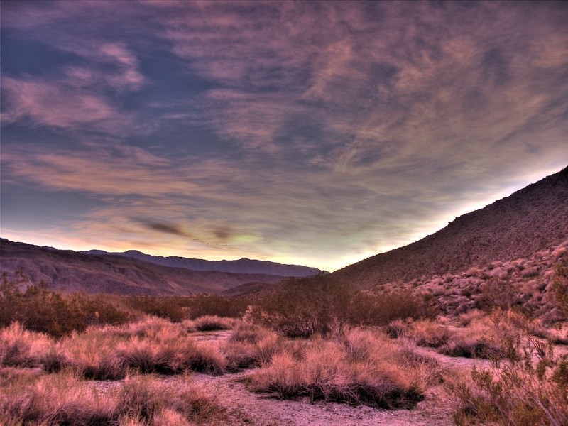
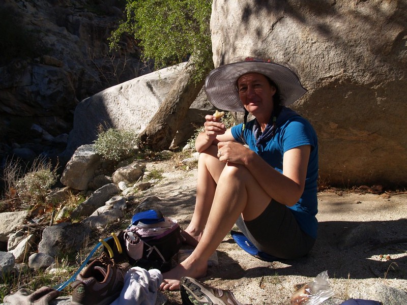
We woke at first light to a gorgeous sky, with pink and purple cirrus clouds extending from horizon to horizon. It was quite cool in the shade of the hill, so Vicki boiled up some ramen, and I ate a freeze-dried granola-blueberries-and-cream breakfast. It was the last of the extra breakfasts we bought for our Yosemite trip last summer, and it was still tasty.


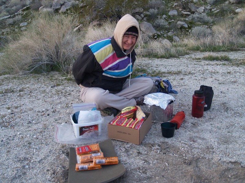
We got our day-packs together and discovered that we had forgotten our water filter! We decided that we’d fill up the empty gallon jug in the canyon if/when we found some water, and we’d boil it if we had to. We still had enough fresh water on hand to hike all day, so we wouldn’t have to boil anything until dinner.
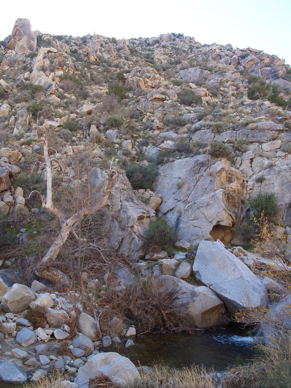
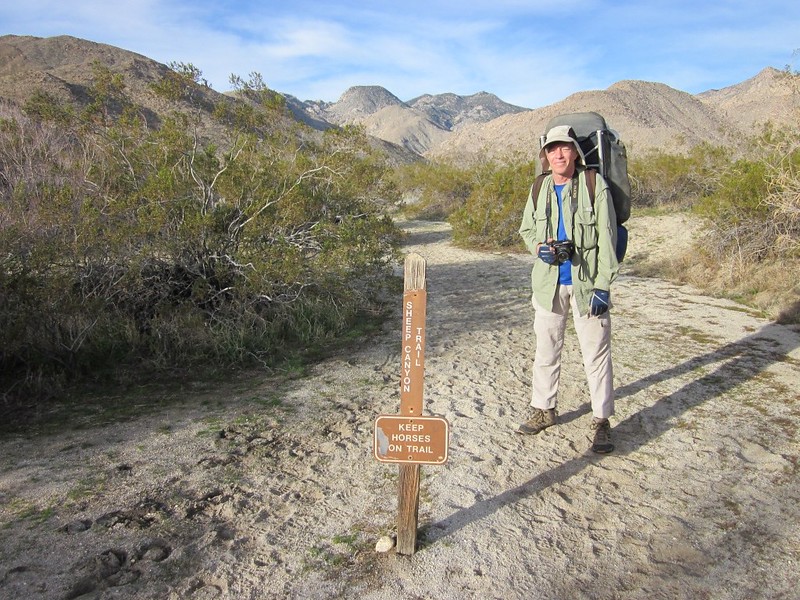
First we hiked to Sheep Canyon, and saw the stream flowing nicely not far from the official campsites. But we didn’t linger there; we were mainly just scoping the place out. Maybe we’d come back another day and explore this canyon.

Panorama video of Collins Valley, Sheep Canyon, Indian Canyon, and Cougar Canyon


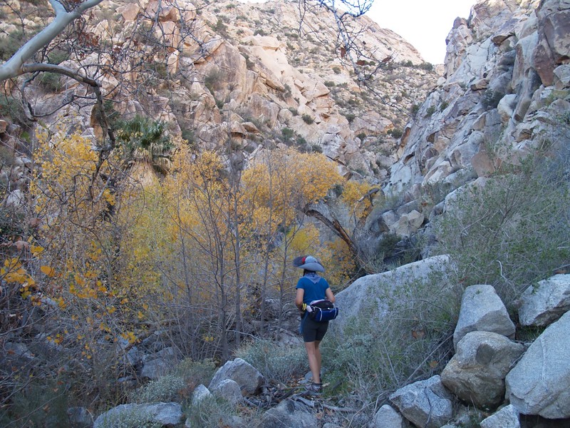
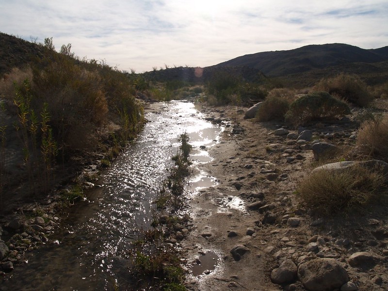
We followed the foot trail from the campsite toward Cougar Canyon. Soon, we came to a nicely-flowing stream, called Cougar Creek (obviously). There was plenty of water here, so we’d be fine for later. As we approached the mouth of Cougar Canyon, we came across three tents and several people sitting outside, getting ready for the day. It turned out that they, too, had hiked in the night before, and we’d probably been not that far behind them on the trail. Also, they had a water filter, and let us use it! Life was truly good again. We filled up all of the containers we had, and left them sitting in their camp for the day. We headed off to the canyon, letting our nice neighbors finish their breakfast.

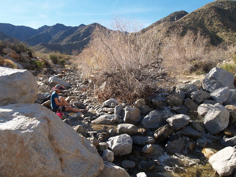
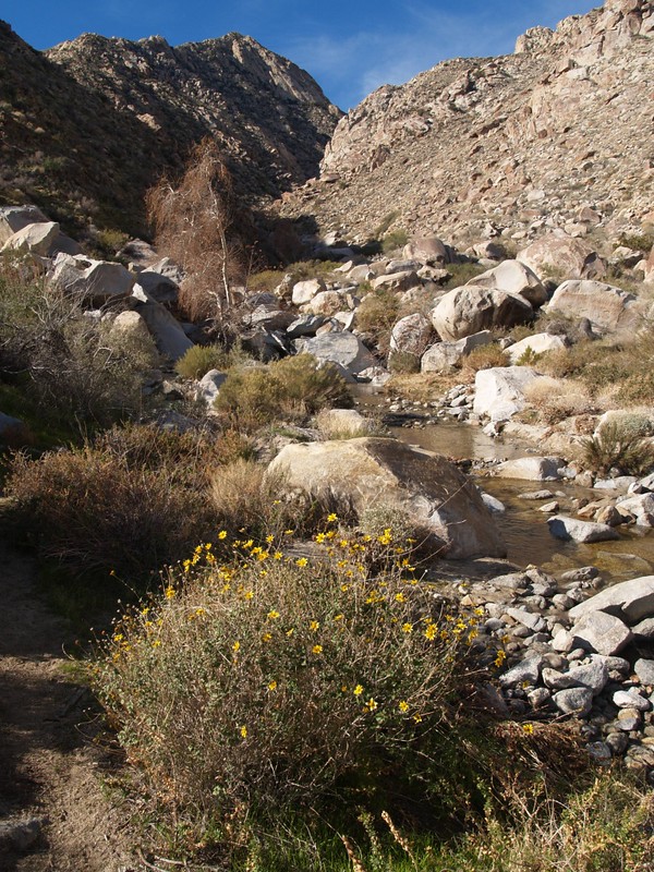
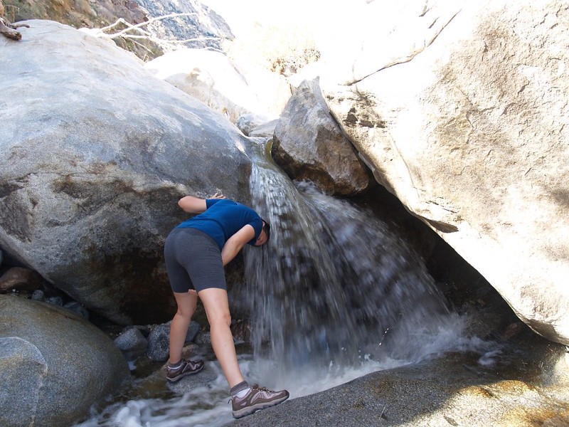
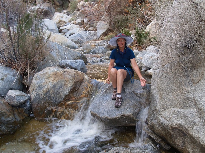
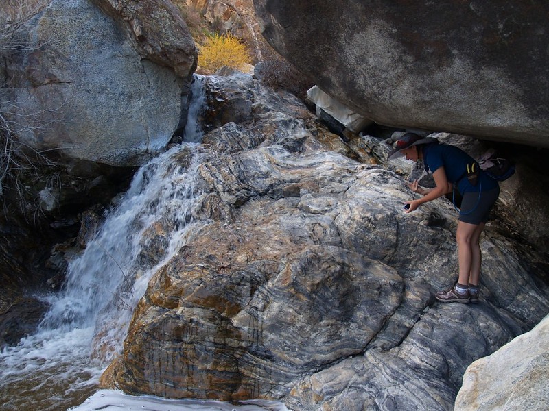
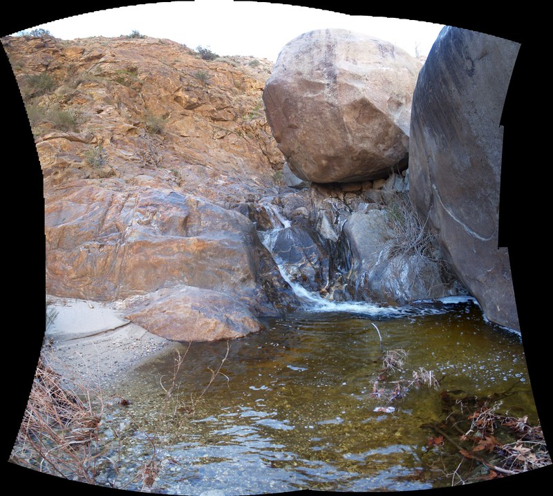
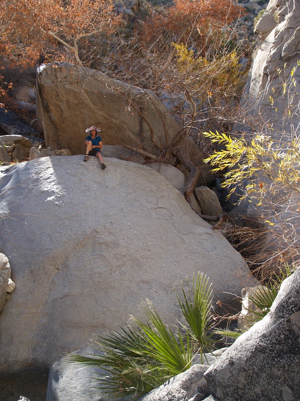
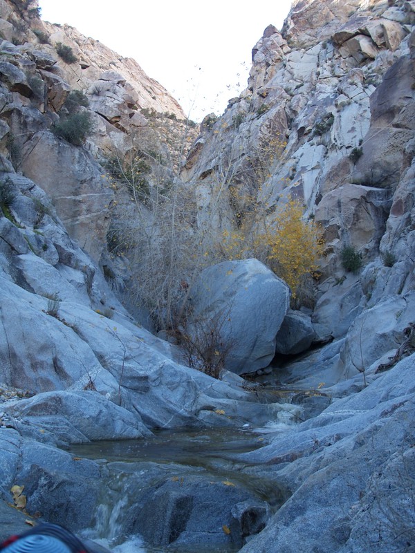
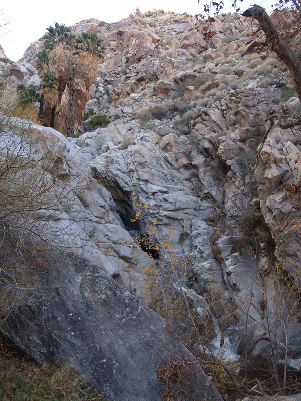
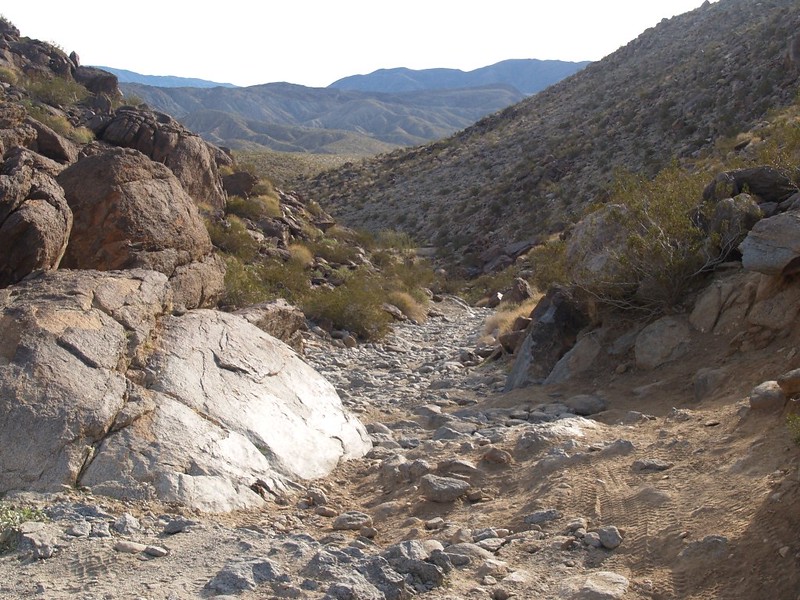
In the canyon, the sound of water was everywhere. The slope was relatively steep, with large boulders, so there were many pools and waterfalls. The rocks showed signs of wear, and the recently bent-over reeds and grasses indicated that much larger water flows had happened recently. The water had that slightly brownish color of dissolved tannins from the trees and plants upstream. (The satellite pictures showed quite a large area of trees in its watershed, which extended beyond 4000 feet elevation.) This stream rarely, if ever, runs dry. There were even deciduous sycamore trees, a rarity in the desert. It was fun to be a photographer here, what with all the waterfalls. And it was fun to scramble over (and under) the big boulders.
Video of Vicki cooling off in a waterfall

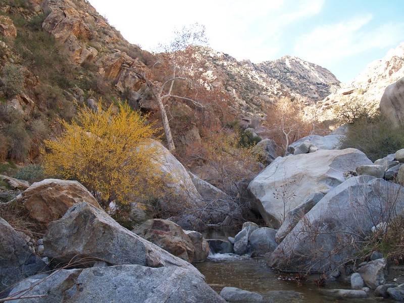
We saw some Kumeyaay Indian pictographs near what I’d read (on the internet) was a sweathouse (i.e. a dry sauna, but with burning sage smoke). There were also a few morteros in some of the likelier areas for habitation, particularly near the palm groves. This canyon, with its perennial water flow and abundant plant life, was a regular stop for the nomadic tribespeople.


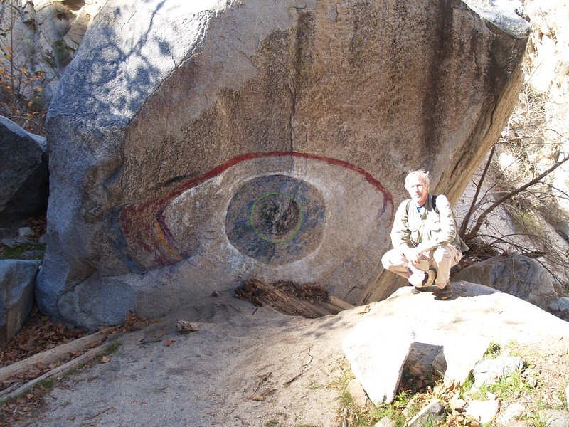
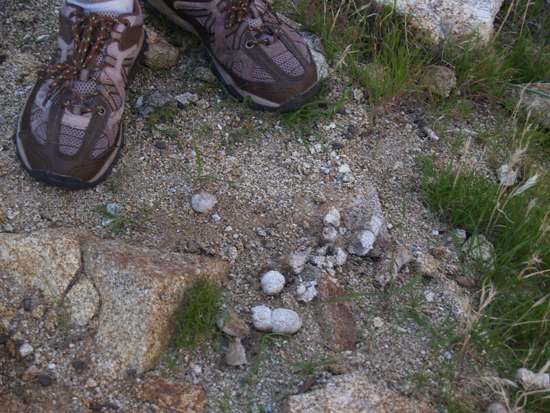
In general, the canyon was very steep. The large boulders required that we move slowly, or else climb high up on the steep canyonsides in order to get around some of the larger waterfalls/cliffs. It took a long time to gain any measureable distance on the map. But we didn’t care all that much, either; this canyon was beautiful! Still, the steepness caused my GPS to lose signal just after we stopped for lunch, and, since I didn’t bother to look at it for hours, some of my pictures are now geolocated more by eyeball than by precise location. But that’s life. If you want to know the exact coordinates of that giant psychedelic eyeball painted on that huge boulder by some drugged-out hippies in the 1970’s, well, just hike up Cougar Canyon, and I’m certain you’ll find it. It’s hard to miss!


https://www.flickr.com/photos/_jfr_/5382834839/in/album-72157625892814702/
Waterfall Video

Video of water racing down a narrow chute

Water flowing in Cougar Canyon
Water racing down the granite


Two o’clock was our predetermined turn-around time, and we managed to reach one last cliffside waterfall. We also met up with the folks who’d camped out down below. It turned out that they had forgotten to bring along their water filter, and were running low, so I gave them a liter of San Diego water! It was a good trade, and well-worth carrying it all that way for the use of their pump earlier that day. We turned around and headed back down-canyon, but they decided to climb up to the ridge high above us. When we reached their campsite (and our stashed water supply) we could hear them talking somewhere up there, but we never did see them again. I took a nice shot of their tents with the sun setting above the canyon; I did some HDR enhancement on it and it came out stunning (in an HDR sort of way).


Video of Cougar Creek as it exits Cougar Canyon


The shadow of the hills preceded us across Collins Valley as we returned to our campsite. We ate some freeze-dried beef stew and watched the sky turn pink, like a reverse-repeat of the morning. As usual in the desert, it began getting cool the moment the sun went down. Warm inside the tent, we read books into the evening for as long as we could, but it we couldn’t keep our eyes open long enough. These winter nights last way too long, and I ended up wide awake at two AM, with nothing to do but read. So I did, then fell asleep again. It wasn’t so bad, really. And I was thrilled to hear a pack of coyotes howling and yipping under the moon. What a great sound that is. It was a long night for them, too.


Sunset panorama video

We woke up as soon as we saw some light on the tent, ate breakfast, and packed up. Vicki had to be somewhere in the early afternoon, so we had to hustle. And we did. I even packed up the tent while it was still a bit wet from condensation (I had to set it up and dry it back home). We hiked fast and arrived at the car an hour ahead of schedule, and made it home with time to spare. And the biggest advantage of getting home early is that I got to check out all of our pictures and videos that afternoon. For me, checking out the pictures is like going on the trip all over again.


In conclusion, Cougar Canyon was excellent. Vicki and I are already making plans to go back there soon, with possibly a longer visit to Sheep Canyon. This is truly an excellent area of the park for backpackers.
The rest of the trip’s photos and videos can be found on my Flickr Page.
For an interactive topographic map of our hike please see my CalTopo Page.
