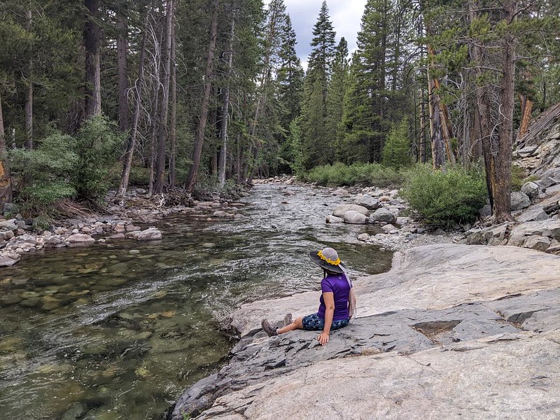
We backpacked south on the John Muir Trail from our camp at Senger Creek, downhill to the Piute Creek junction, where we spent some time fly fishing for trout in the South Fork San Joaquin River.

As per our plan, we woke up in the dark and got ready to hike. Vicki was worried about the exposed manzanita section on the hillside leading down into the South Fork, and wanted to get down there before the sun rose high enough to roast us. Why suffer? Plus, we generally followed Ben Franklin’s advice of “early to bed and early to rise,” so this was fine.
The sky was already getting light as we descended the many switchbacks, There were fine views across the way. Down below was Muir Trail Ranch (MTR) which was an often-used resupply spot for both JMT and PCT hikers. We could see a light shining through the trees down there.

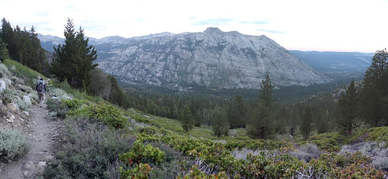
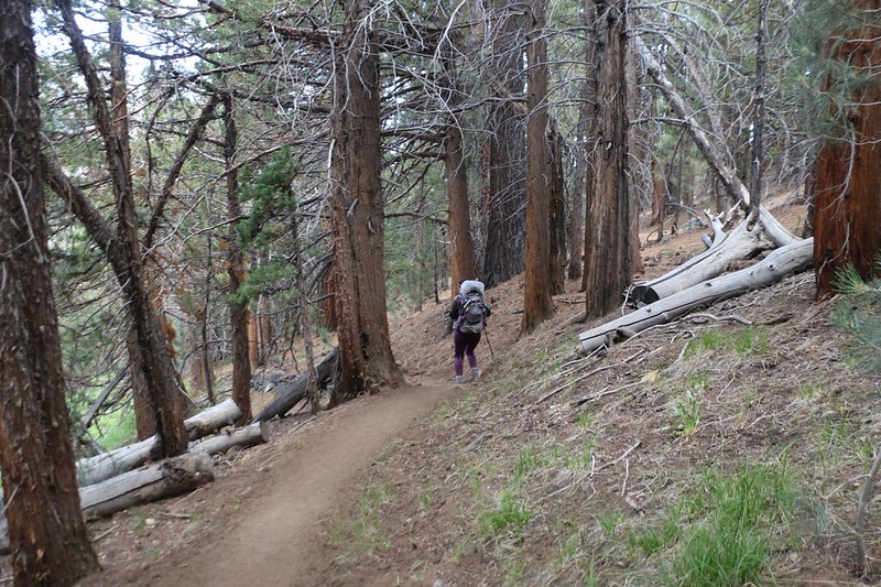
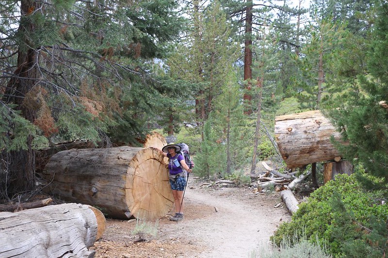
Not surprisingly, we cranked out the chaparral section in record time, and re-entered the forest as we neared the valley floor. For the most part, the woods were quite dry, as the slope faced southwest, but there were occasional soggy spots where flowers bloomed profusely.
This river valley was very deep, and very wide. By the time we descended 2000 feet to the canyon floor, we discovered that we were still exposed to the sky, due to sparse tree cover. Luckily for us, there were high clouds drifting by that day, and the sun rarely achieved its full strength. We were grateful, and hiked on happily. Down there at 8000 feet, the air was quite warm. I’d be happier tomorrow after we climbed back out of this valley.

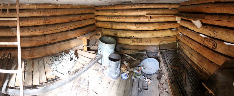
Along the way, we took a small side trip to examine the Muir Trail Cabin, which was shown on my USGS Topo Map. What was it? Well, it was basically an old log cabin that had been used as a snow survey shelter. Unlike the other shelters, this one was left unlocked. It had a plaque above the door saying that it had been dedicated to John Muir by the forest service. It was a bit of a disappointment, as the the insides were quite messy. It was nothing like the solid stone Muir Hut up on Muir Pass. Getting rid of the metal garbage cans would help, as they were an invitation to dump excess weight from too-heavy backpacks, and would attract bears. It’s probably for the best that almost every thru-hiker passes this by unseen, or it might be even more trashed, sad to say. Or maybe it would be in better shape? I like to believe that young hikers care more about Leave No Trace than you’d think.

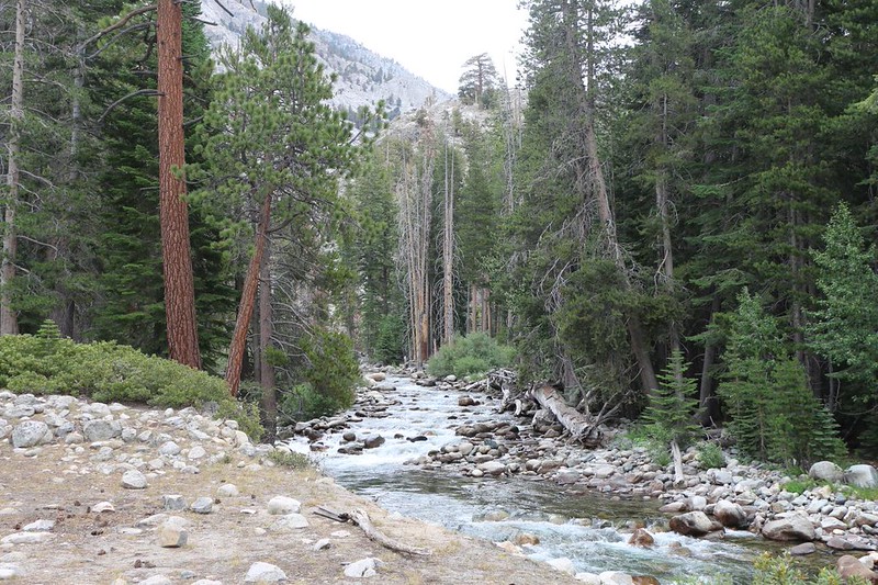
We continued on. As we neared Piute Creek, I kept checking my phone app for campsite locations. When I hiked there from the south, back in July 2021, I was less than impressed with the selection on the far side of the creek. Vicki and I checked out several small side trails, but none of them had a good spot. We resigned ourselves to the main camp in the end. At least we tried.
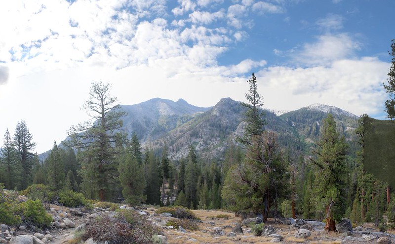
Soon enough, we arrived at Piute Creek, where there was a sturdy metal bridge. This was where the Piute Canyon Trail began, the trail we would be taking tomorrow, that led uphill to Piute Pass and, eventually, our car at North Lake. We posed for pictures on the northern side. This spot marked the end of the JMT-PCT part of our trek. It also marked the completion of my final section of the John Muir Trail, and the final section of the High Sierra portion of the Pacific Crest Trail! Hooray! This deserved a small celebration. Too bad we had no party supplies!

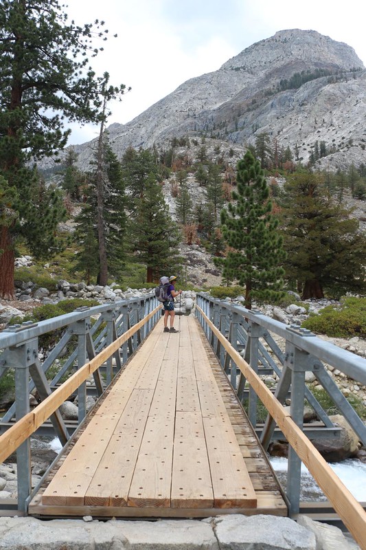


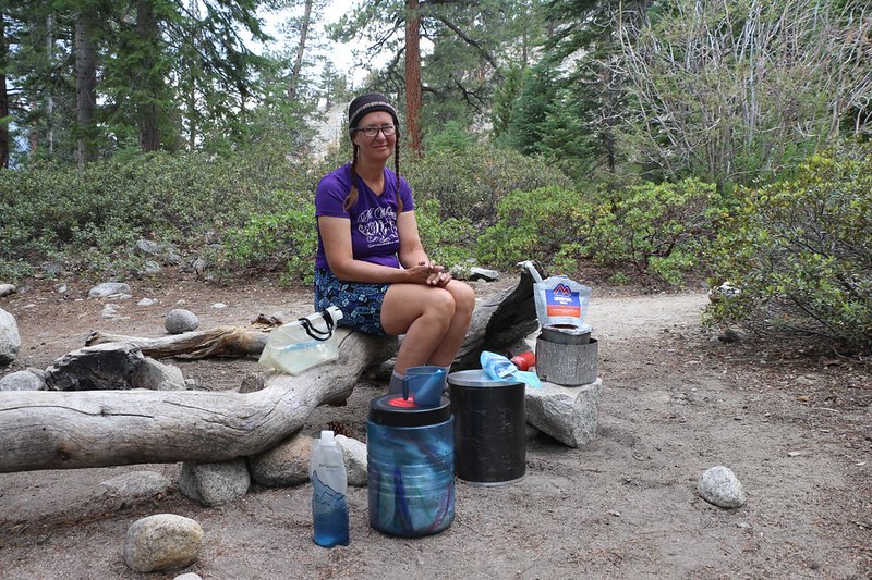
We crossed the bridge into Kings Canyon National Park, and began our search for a campsite., which wasn’t hard to find. We were ultra-early, and had our choice of spots. We found one in the shade of several tall pines, and set up our tent. We collected some water from the creek (upstream of the bridge) and ate lunch along the shore (below the bridge). Then Vicki took a short nap to recharge her internal battery.


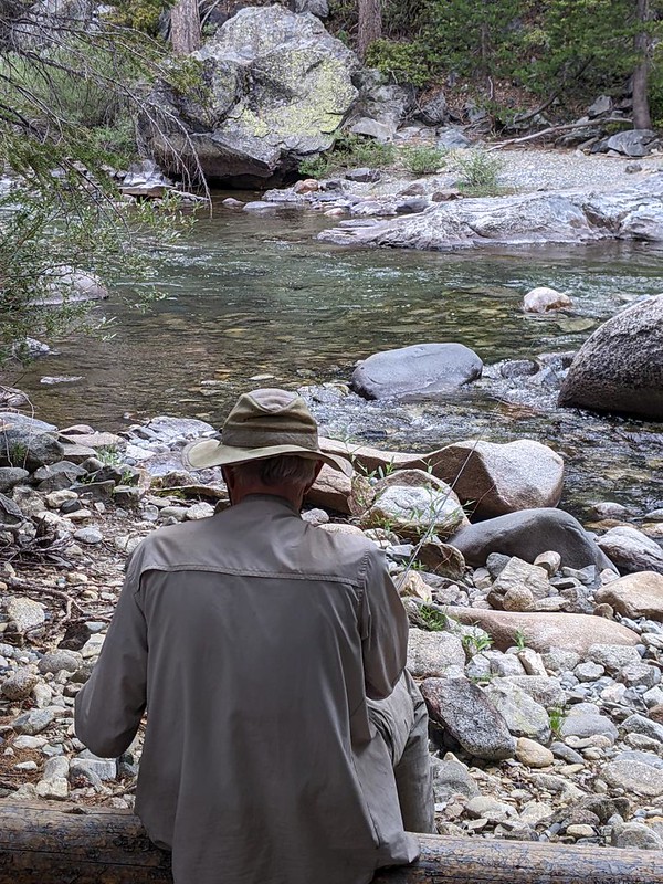
It was still early when we headed out fishing. We hiked up-canyon, cross-country, about a quarter mile to the South Fork San Joaquin River, which my fishing guide said contained Brown Trout. These are usually found at lower elevations, like this. I was hoping to complete the Sierra Grand Slam, an extremely unofficial award, which was defined as catching all four Sierra trout: Brook, Brown, Golden, and Rainbow. All I had left to catch was a Brown. We hiked upstream until I found a good pool, just below a rapids, and I began to cast my fly, again and again. And I caught one! Whoo hoo! I was excited. This was my very first year fly fishing, and I almost felt like a pro. Vicki said that she wasn’t in the mood for trout (after the three Goldens she ate yesterday), so I let this one go. I always use barbless hooks for this reason. It’s more of a challenge to land them, but it’s far less damaging to the fish.
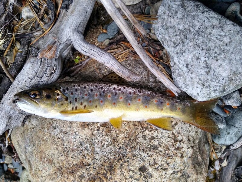
It wasn’t until I got home that I googled the Grand Slam and found out that it only counts if all of them are caught in a single day, not a single trip. Boo! Since it’s an unofficial award anyway, I decided to modify the rules a bit. Just this once. Ha ha!
We headed back to camp and ate dinner, then took a short hike afterward. More hikers had arrived and were setting up camp nearby. Everybody was very friendly, as usual.

Since tomorrow was going to be an uphill day, Vicki wanted to get to bed early and wake up extra-early, to attack the climb in the dark, while it was cool. That was OK with me, as I had already taken photos of the lower part of Piute Canyon. In fact, it was still daylight when we entered the tent. Outside, we heard hikers whooping in the distance as they jumped into the deep pool of icy water by the bridge. By the time the noise subsided and it began getting dark, another couple of hikers set up their tent just across the campsite from us. We said hello without seeing each other. The PCT and JMT are probably the only trails where folks will simply set up camp a few feet away from others. This is partly because there aren’t enough camping spots, but also because it’s a very social experience, where everyone shares the beauty of the wilderness. As expected, the newcomers were good neighbors and kept their voices down. And, soon enough, we were sound asleep.
For a topographic map of the hike see my CalTopo Page
For LOTS more photos of the trek see my Flickr Page
 << Back to Day 6 Onward to Day 8 >>