We backpacked south on the John Muir Trail from Bear Creek to Marie Lake, and camped high above the lake, just below Selden Pass. All told, we climbed about 1600 feet over seven miles, making it a mellow, enjoyable hike through some beautiful High Sierra scenery.
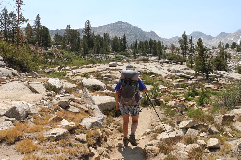
I didn’t bother setting an alarm that morning, as we knew the trail would climb steadily all day. There was no need to wake up and hike in the dark to overcome a huge climb, like yesterday. We’d simply be following along the valley floor next to Bear Creek. So we cooked a hearty meal like civilized campers, and enjoyed it thoroughly. Then we finished packing up our gear. After that, we continued hiking south, following the creek.

Following Bear Creek was a fun experience. The water wasn’t roaring like it would be during Spring snowmelt, but it was doing pretty well for a dry year in late July. The streambed was also composed of glaciated granite, making it smooth and polished. This entire valley had been under hundreds of feet of ice not that long ago, geologically-speaking. There were plenty of glacial erratics littering the ground all around us. Personally, I liked it better without the ice.


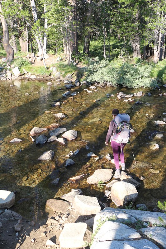
After three miles or so, the trail headed across the main creek. Luckily, it was much smaller by then, but there wasn’t a convenient bridge over it, either. Earlier in the season, during the Spring snowmelt, hikers either headed up or down the creek, looking for a big fallen log, or else they braved the icy water and waded across. Luckily for us, the water level was low enough that it was just about possible to rock-hop across the creek. One rock was a half-inch or so below the water’s surface, so foot positioning was crucial. I made it over with dry socks. There was also one boulder that wobbled disconcertingly. Fun!

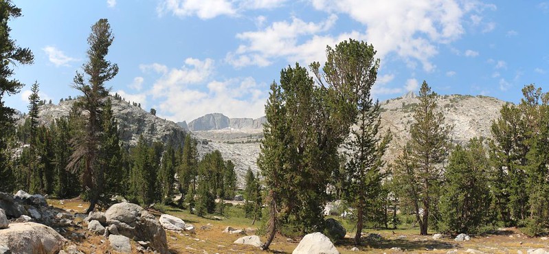
After the crossing, the trail continued upstream, then turned aside and followed the West Fork of Bear Creek. The slope remained gentle, and Vicki was hiking along just fine. We were really enjoying the wide open views within this canyon. Soon, we came alongside Seven Gables Peak, and met a young hiker getting ready to climb it. He was carrying an ice axe, but I didn’t think he’d need it. For him, travelling along the PCT was mainly a good excuse to bag plenty of extra peaks along the way. Sounded like fun to me! We passed the Sandpiper Lake Trail, and then the Rose Lake Trail, and the creek kept getting smaller with each crossing.


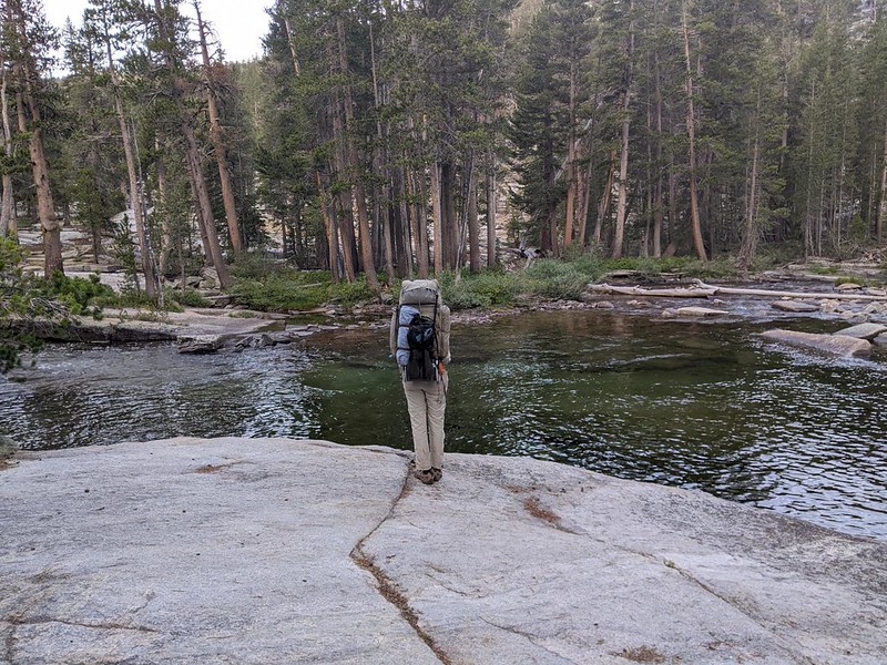
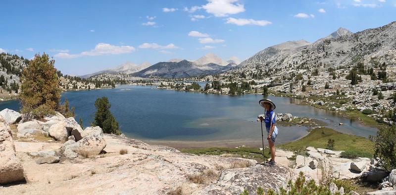
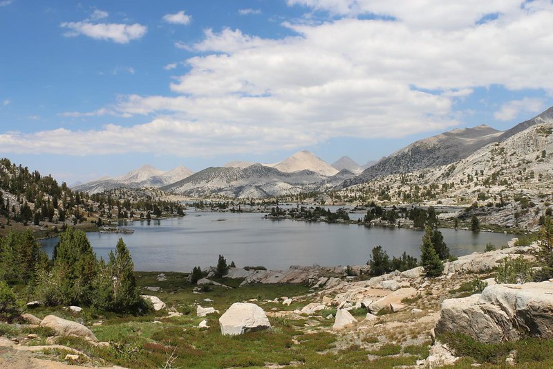
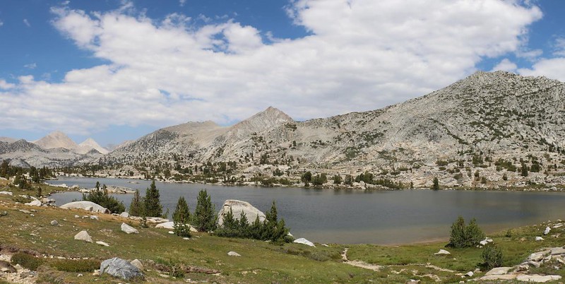
Eventually, the trail headed left, rising up from the valley floor. We were nearing Marie Lake. This last uphill had no shade, so it was a bit tough, but we made it just fine. We were up near 10,500 feet elevation, and the pine trees were not only sparse, but stunted, so no shadows to hide in. We crested the rise and there was the lake spread out before us. It was huge! It also looked quite shallow to my eye, but that was OK.

We put down our packs and walked out onto the isthmus, looking for a campsite. It was just past noon, and everything we found looked like it would be roasting in the sun all day long. We weren’t impressed. Surely there was a good spot here somewhere? But no. We went back to our packs and hiked a bit further.
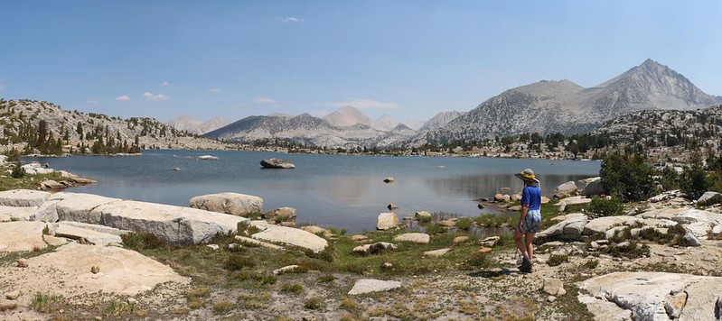


We had spoken with a northbound couple who described some nice spots up on a ridge at the southern end of the lake, closer to Selden Pass, but we didn’t want to hike all that way and then have to retrace our steps if they were wrong. So Vicki sat by the shore and soaked her feet in the water while I combed the flat area where most everyone camps. All the spots were shadeless and exposed. It wasn’t looking good.


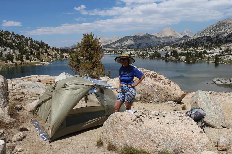
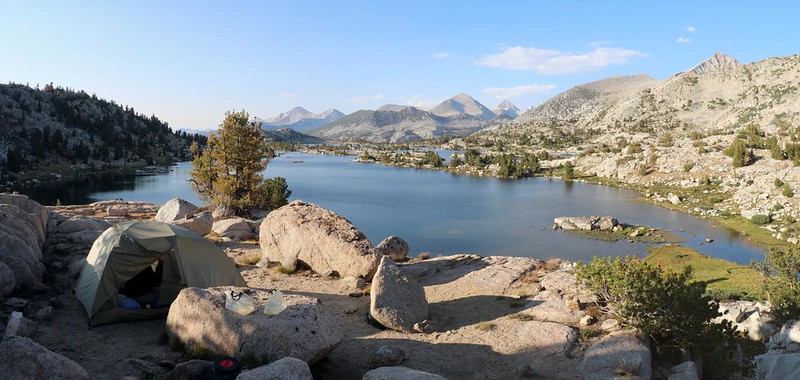
We could see Selden Pass in the distance, and Vicki was not happy about hiking any further, let alone climbing higher, but I convinced her to give it a try. So off we hiked. We ascended less than a hundred feet and discovered one spot not far from the trail. Everyone who hiked by would see us there. So, once again, we took off our packs and had a look. We ended up finding at least two other spots up there, hidden from the trail by some trees and boulders. One of them was still in the sun, but promised to get shady later on that afternoon. And it had an amazing view of the lake! We decided that we’d hiked far enough, and I went back for the packs. We set up the tent for shadiness, using a mylar space blanket under the top tarp to block the sun, and opened the doors for air. Vicki decided to take a well-deserved nap immediately.
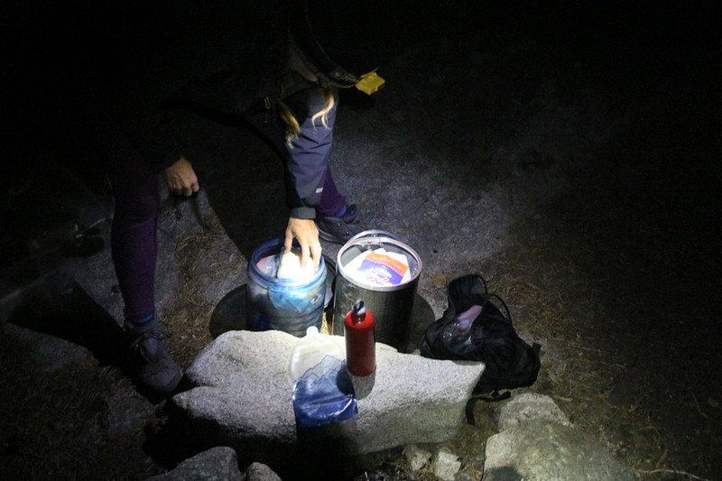
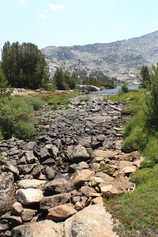
I admit that I took a nap, as well. It was a very mellow afternoon, and the air was a perfect temperature when lying in the shade. But eventually we got up. I went to get some drinking water from the inlet creek which flowed down from the pass. I liked this source of water much better than the lake itself.
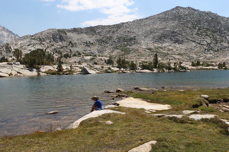
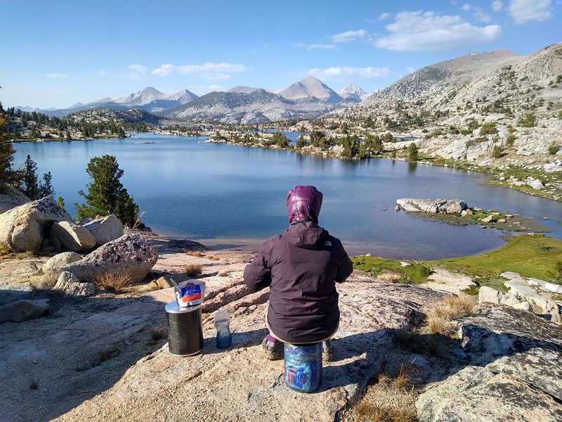
Then it was time to go fishing. It was quite breezy that day, and I knew it might be a waste of time, but I tried it anyway. They call it “Fishing” and not “Catching” for a reason. We hiked back down to the big boulder on the western shore and I tried my darnedest. I walked here and there along the shore, all to no avail. And I never saw a single fish the entire time. Usually the fish are very visible, and that helps to catch them. But not that day. All the reports said that there were Golden Trout in that lake, but I can’t corroborate them. Eventually, we gave up and headed back to camp. Oh well. It had been a good excuse to take a walk.


As the shadows grew longer the air got colder, and we put away the mylar sheet we’d used for shade. We closed the doors of the tent and sat inside, glad for the sun’s warmth as it heated up the interior. We used this final burst of solar power by getting dressed in our warmer night clothing. Then it was time to have dinner. Afterward, we decided that this was one of the prettiest dining rooms we’d ever eaten in.
We headed to bed after hanging out for a bit, as the air was getting even colder. I got out the map and showed Vicki what an easy day tomorrow would be. Do to water locations, we were only hiking about five miles, then seven the following day. Both of the days were mostly downhill, but I didn’t think that Vicki wanted to do all twelve miles in one shot. She agreed. Why have one miserable day when you could have two good ones? And this also meant that we could sleep late the next morning! Win win. That’s the way we like it.
For a topographic map of the hike see my CalTopo Page
For LOTS more photos of the trek see my Flickr Page
 << Back to Day 4 Onward to Day 6 >>

