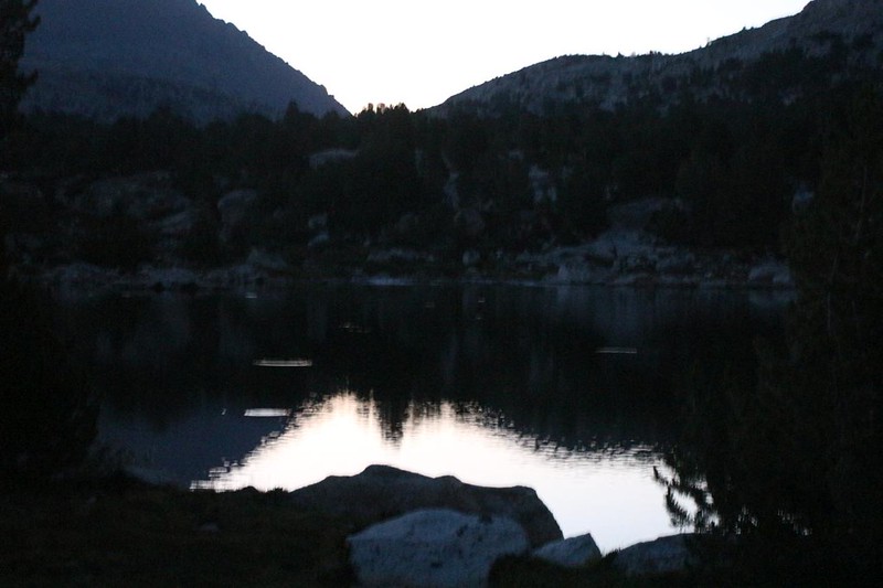
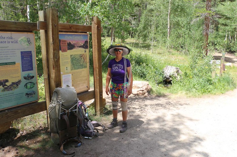
On the final day of our trek, we backpacked from Lower Golden Trout Lake, in Humphreys Basin, to our car at North Lake, crossing over the Sierra Crest at Piute Pass.
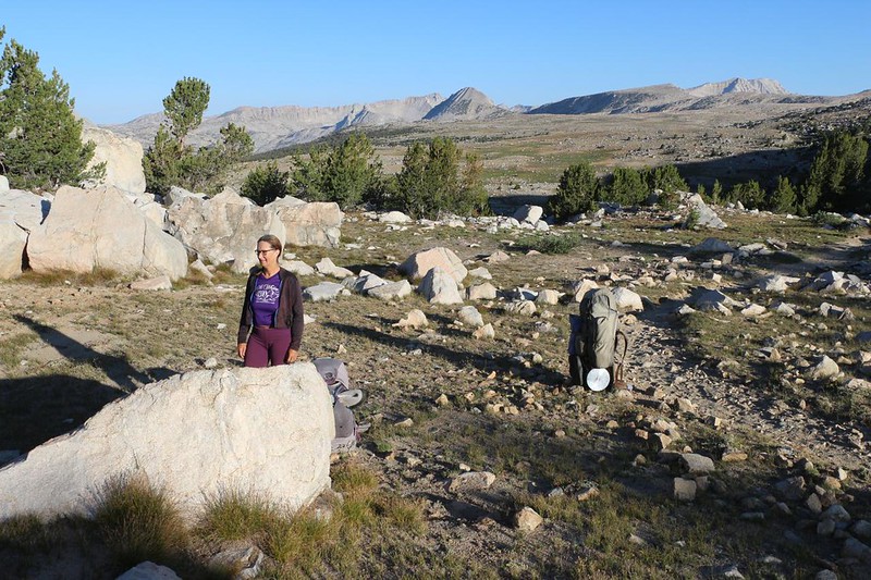
As planned, we woke up early and hiked out of camp at first light. While we walked along the shore of Lower Golden Trout Lake, I watched the trout rising on the still waters of the lake. It was good to know they were alive in there, but I was sad that I was unable to catch one yesterday afternoon. And now I had no time. Vicki wanted to get the three mile, 800 foot climb to Piute Pass over with while it was still shady and cool. Oh well. Maybe another time. The fish would still be there, and the hike over Piute Pass was a lovely one.

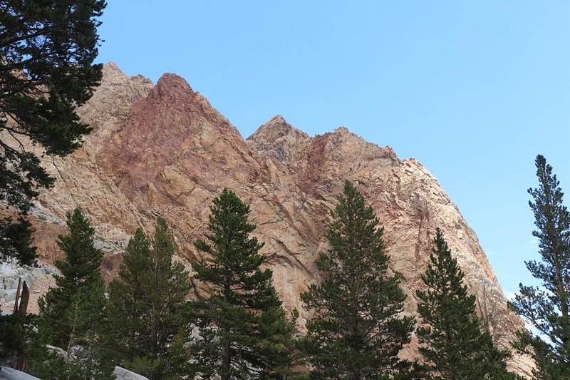
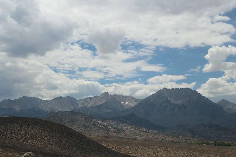
We viewed the alpenglow on the peaks of the Glacier Divide, and kept on hiking across the basin. Along the way, we discovered a lot of horse/mule footprints leading off on a side trail, one which didn’t match the trail on my map. We consulted together, and realized that the “main” Golden Trout Lake Trail was quite a bit longer than this alternate one. The stock were obviously taking a shortcut up to the Piute Canyon Trail. We decided that the horse packers probably knew the area best, and followed the tracks. And we were glad we did. It was easy hiking, and we remained in the shade for a very long time.

We continued on the trail in the morning sun and enjoyed the many views down toward Summit Lake. We recalled the other Summit Lake that was next to Mono Pass, which we passed nine days ago. You had to wonder about the way some lakes were named up here in the mountains.


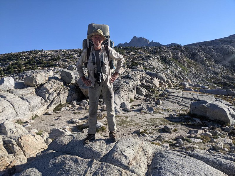
It was 8am when we arrived at the top of Piute Pass. After two and a half hours of hiking, we deserved a break. We took off our packs and ate some snack, looking west over Humphreys Basin, and east into the North Fork Bishop Creek valley. There were lakes visible in both directions. Truly a stellar view.

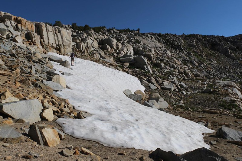
It was nice to have the pass to ourselves, but we didn’t stay long. We noticed a large snowbank on the east side of the pass, left over from last Winter’s snows. I went over to get some snow for Vicki to put in her hat. She likes to do that when the sun gets hot during the day, and this was probably the only snow we’d get close to. She liked it, and used it, but also decided that this was a perfect opportunity to engage in a butt-sliding glissade! I took a video, of course. It wasn’t too steep, and she had no problems avoiding excess speed. Quite the opposite, in fact.

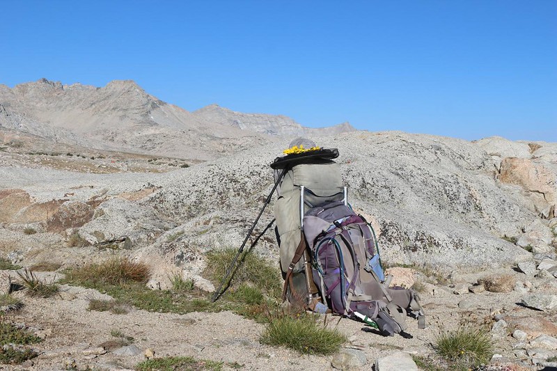
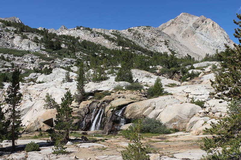
After that, it was time to begin our five mile, 2200 foot descent! I hoisted my big backpack, which was much lighter now, without ten days of food, and headed for our next stop: Piute Lake, situated at 10,958 feet elevation. There were a number of small ponds along the way, including swampy areas still wet from melting snow. It was a very pretty valley. Far below us was Loch Leven, perched on the edge of an apparent drop-off into a wide valley.


After the lake, we continued down the trail, passing by several small waterfalls and other unnamed lakes. The trail was well built, and had a number of granite steps, thankfully of a small size that didn’t destroy the knees. Just the same, Vicki had her elastic knee braces on, and both of us had our hiking sticks out, to help with the occasional larger step. This valley was made of granite, and the trail was, too.


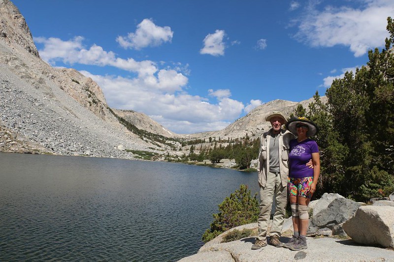
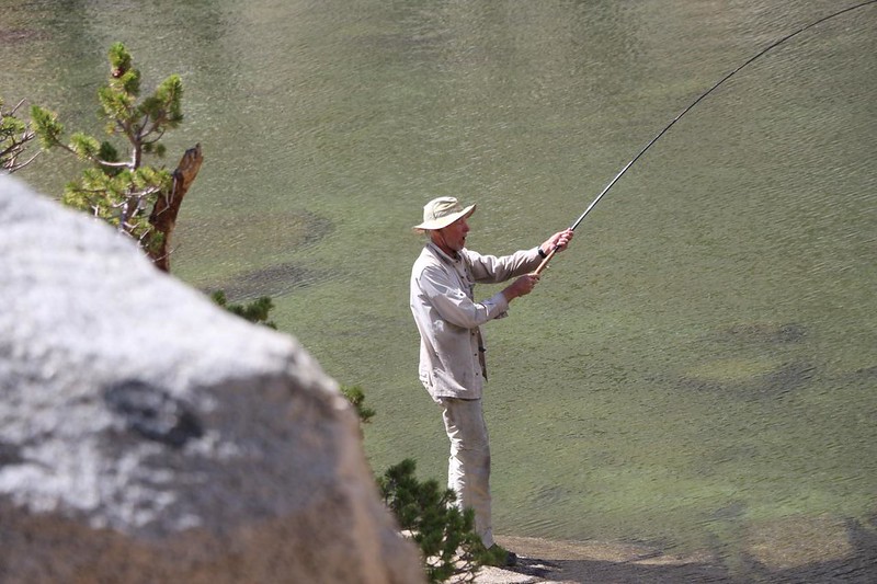
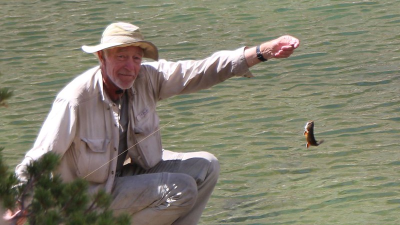
We arrived at Loch Leven, and got our photo taken. We don’t get anywhere near enough of these, as it takes a lot of effort to set up a posed timer shot. As we hiked along the shore, I saw plenty of trout swimming along in the clear water. I asked Vicki if she minded taking yet another break, so that I could take a shot at these fish. She agreed, but only if I released them afterwards. She didn’t want to go through the trouble of cleaning them. That was fine by me, and within ten minutes I had already caught three Brookies! These fish were hungry, and it was obvious that they didn’t get fished very often, unlike North Lake down below us, which was fished so much that the trout were wise to the tricks of fishermen like me.
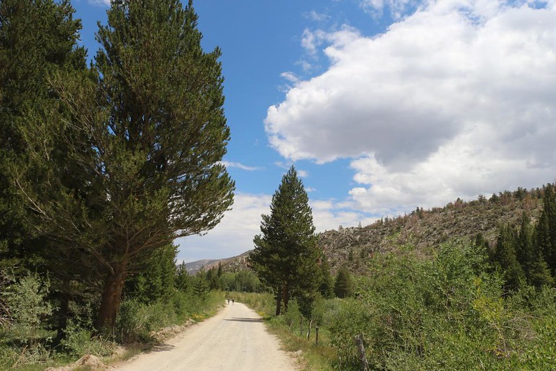
Vicki was feeling good, and had every intention of making it down to the car. We had been tempted to stay another night, here in the high valley near a lake, but we were hiking fast and it was still early morning. We both decided that eating some lunch in town was a very good idea. We’d already hiked five miles and only had three to go, although this last section of trail was going to be the steepest. Vicki was ready. We would finally begin harvesting some of that energy we invested over the last two days! And then we began the long series of switchbacks, down and down into the valley, alongside the tumbling creek.


After the exposed section through the loose talus, it was a relief to enter the aspen forest. The character of the trail changed, with more dirt and less rocks. The slope was easier, too. Soon we crossed and re-crossed the creek on log bridges, and arrived at the North Lake Campground. We walked through the camp and arrived at the official trailhead sign. We made it! Vicki’s feet were hot and tired. Luckily, there was a small flowing stream right next to the sign. She decided to stop and soak her feet in the cool water.

Unfortunately, our car was still about a mile away. The backpacker parking lot was quite far from the trailhead, I hate to say. But I knew this, because I had been here before. We decided that Vicki would remain here, soaking her feet and guarding our big backpacks, while I hiked down the road to bring back the car. It felt great to hike without all that weight! I was almost skipping down the road. When I got to the car I opened it up to air it out, and turned on the air conditioning. It was quite a dusty sight. But that was OK. I also remembered to get our car food out of the bear locker. I pulled out a cold soda and cracked it open. I sucked it down right away. Aaaahhh! That really hit the spot. Then I drove back to the trailhead and picked up Vicki. We loaded the big packs into the car after removing a few essentials for the long ride home.


We headed down the road to Highway 168, then cruised down the hill to the town of Bishop, where I bought some fast food. It felt great to eat that greasy, salty stuff! Hiker Hunger is real. After that, we headed down Highway 395, through the Owens Valley, on the east side of the Sierra Nevada. We watched as thunderheads built up on the crest, and we were glad not to be up there. We knew that hikers were getting drenched, and pounded with hail, and having the time of their lives. But our time was up, and we were heading home.

In the car, we talked about the trek, about what was good and what was bad. As for the bad, well, none of our gear had outright failed, except the zippers on the tent were having troubles. We needed to fix that asap. The primary bad thing was the bugs, both the mosquitos and the flies. True, they were almost unavoidable in the month of July, but it didn’t mean we liked them. They were miserable, even in the dry year of 2022. Also, Vicki’s lungs didn’t like the high elevation, but we figured out a way to get her acclimated with minimal suffering. That was also one of the Good Things. Other good things were the awesome views we got from the high passes, and the beautiful sky blue lakes. Lakes full of tasty trout! I was also stoked to have finished my final section of the John Muir Trail, and the High Sierra portion of the Pacific Crest Trail. These were milestones that I had been working on for years. All in all, a good trip!
After that, we realized that we only had two weeks to get ready for our yearly Monster Road Trip! I would write more about it here, but, in truth, it was a topic best left for later.
For a topographic map of the hike see my CalTopo Page
For LOTS more photos of the trek see my Flickr Page
 << Back to Day 9

