Vicki and I spent several days acclimating to elevation, by camping and hiking in the beautiful Little Lakes Valley, in the High Sierra south of Mammoth Lakes. We did a bit of fly fishing, too, and caught several tasty trout.
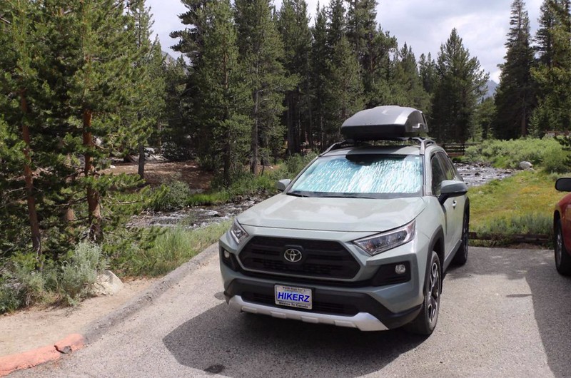
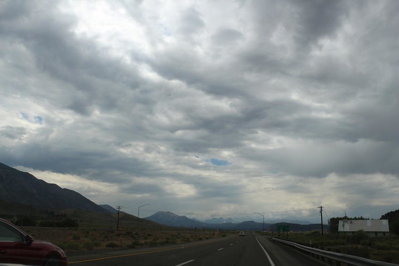
Our trip began in San Diego, in the pre-dawn darkness, when we headed north for the east side of the Sierra Nevada. This allowed us to avoid LA traffic, and also gave us some extra time to visit Whitney Portal, where we took a long break, eating tasty Portal Burgers. Thus fortified, we drove back down into the roasting heat of Owens Valley. We continued north along Highway 395 through Bishop, and up the long grade to Tom’s Place. We had never been in this area, so we drove slowly along Rock Creek Road, looking around in wonder. It was beautiful, and there were plenty of Inyo National Forest campgrounds dotted along our path. But that didn’t matter now, as our goal was the end of the road: Mosquito Flat. This was the trailhead for the Little Lakes Valley Trail.
It was also situated at 10,300 feet elevation! Vicki didn’t notice it initially, but as soon as she got out of the car and began walking around, her lungs let her know in no uncertain terms that there simply wasn’t enough air to go around. It was late afternoon when we arrived, so we took a test hike to the first lake, just because. This time, Vicki brought along her tiny finger oximeter, and after that tiny hike, she was already reading far below 0.90, which isn’t good. She was also getting a headache from altitude sickness, so we headed back to the car to a nearby campground. She really needed to acclimate!
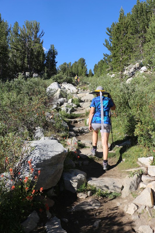
Luckily, the Little Lakes Valley Trail is well known to be perfect for noobs and dayhikers who want to experience the beauty of the High Sierra without all of that pesky climbing. In fact, the trail only ascends a few hundred feet over the first five miles, an almost nonexistent amount when compared to other trails on the east side. And that was partly why we were here. In a couple more days, we had a ten day backpacking trip planned, starting from this very spot, except that we would be climbing up and over the Sierra Crest at Mono Pass. Our goal was to get Vicki’s blood oxygen to an acceptable level, and only time spent up high would do the job. Don’t get me wrong: I had a headache too, that first night, but I was also gifted with strong lungs. We’ve learned that I usually take one day to acclimate, but Vicki takes several. So be it. We plan our trips to take this into consideration, because our goal is to enjoy them, not have a sufferfest.
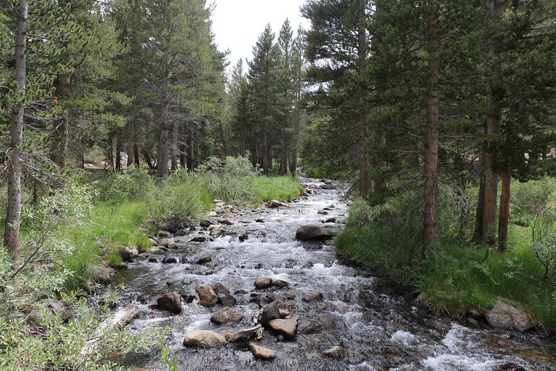
The next morning, I packed everything we needed into the big daypack, including my Tenkara fly fishing gear, and we headed up the trail. The grade started out quite mellow as the trail followed along next to Rock Creek. It was flowing quite well, considering that 2022 had been a very dry year, snow-pack-wise. And by late July, most of the snow had already melted.

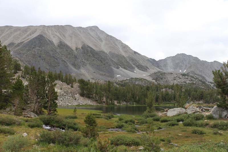
First stop: Mack lake. The trail initially climbed a short way up onto a granite bump, which put us high above the lake itself. This was fine, as we got some nice views, both of the lake and the mountains up the valley to the south. We took a few pictures and continued on. Vicki wasn’t happy that the trail lost elevation again, returning to lake level, but that’s the breaks sometimes. Good thing that I was carrying the backpack!

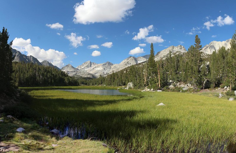
The next lake in the chain of “Little Lakes” was Marsh Lake. It was swampy and entirely lined with reeds. As I had very little desire to lose my fancy fly hooks, I decided not to bother trying to catch any trout. There were several other lakes up ahead. We decided to hike first and fish later. We could eat lunch at the furthest lake and go fishing afterward. Besides, I was quite happy taking photos of all this gorgeous scenery, and was particularly pleased to see the puffy clouds forming in the deep blue sky that you only find above 10,000 feet. “10k Blue” we call it.

The third lake in the chain was Heart Lake, which really did look like a heart on the map. We met an entire family fishing along shore. They all had spinning reels with lures (unlike me with a fly rod) and were casting into the relatively shallow water. I didn’t see anyone catch anything, however. We decided to hike on.


Next up was Box Lake. I have no idea how it got its name. Like Mack Lake, the trail climbed up and over a granite ridge on the western shore, which led to nice views. There were some people fishing at the southern end of the lake. That’s where they found a few spots along shore without reeds. We decided to try fishing here on the way back.

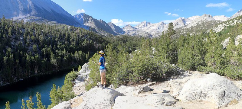
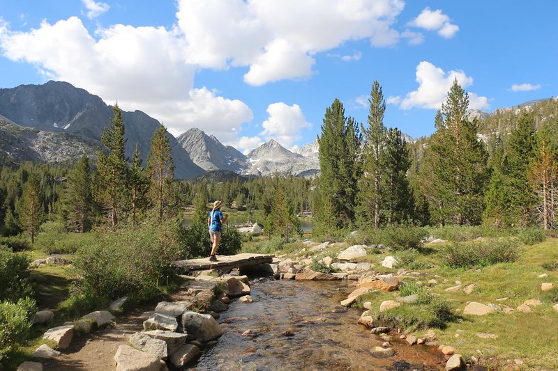
The fifth and final lake on our day’s hike (yes, there were lots of lakes in Little Lakes Valley) was Long Lake. The trail crossed Rock Creek before we got there, so we were on the eastern shore, which was largely without reeds of any kind. Perfect for fishing, in other words. And when we arrived, we were the only ones around. Nice! Sometimes it’s worth it to hike a bit further than the average fisherman. Meanwhile, I was pleased to see the picturesque cumulus clouds puffing up wonderfully behind Bear Creek Spire down at the end of the valley, and I took way too many photos. As usual.


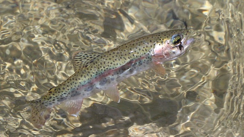
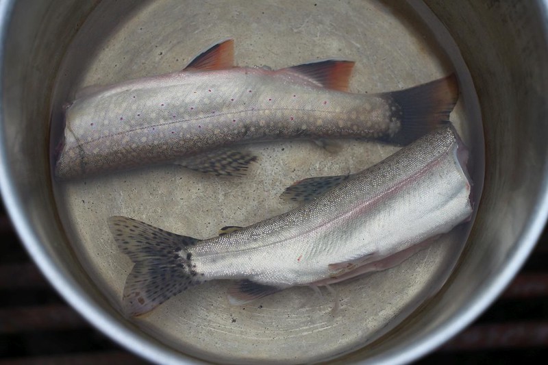
There was a perfect grassy area near the southern end of the lake. We ate some lunch and I got out my Tenkara fishing rod, which has no reel, just a line and fly. Tenkara doesn’t cast very far, obviously, but I didn’t need to: I could see the trout in the crystal clear water, swimming along just offshore. At first I had no luck, so I shifted my spot further north. Boom! I caught a small Rainbow Trout, and soon after, a Brook Trout. We put them on a stringer line, as Vicki was already salivating in her desire to cook and eat them. I even had the stove and fry pan with me in the daypack.

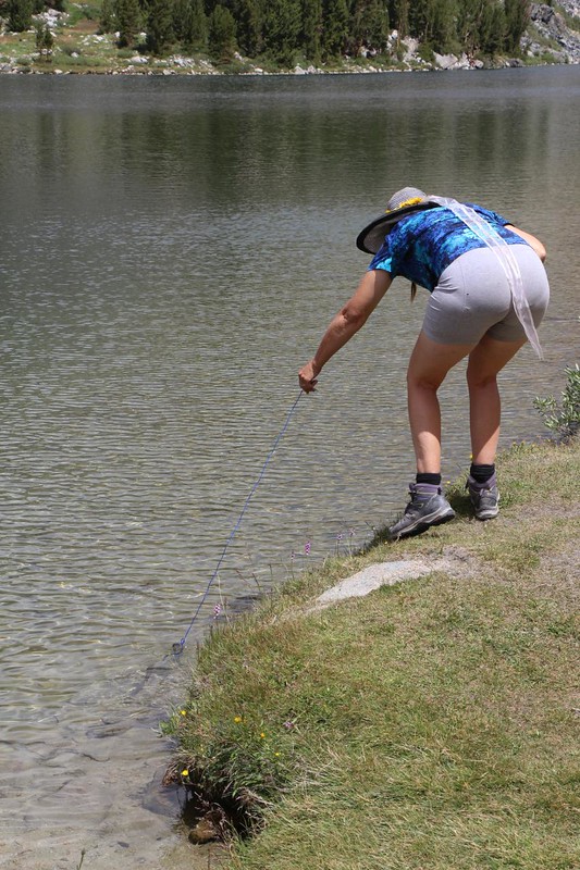
Unfortunately, by that time the cumulus clouds had grown significantly, and were looking quite threatening. Not surprisingly, the darkest ones were heading directly toward us! We realized that we were four miles from the car, and we had a bad feeling that we were about to get rained on. We packed up our gear and started back, with me still fishing along the way. Vicki declared that two fish were plenty, so we put them in the pack in a ziplock baggie, put away the rod, and began hiking in earnest. It sprinkled a bit as we hiked past Box Lake, but it stopped again, and we were grateful. We were keeping our fingers crossed that we’d get back to the car before the downpour. To no avail. We were doomed and we knew it.


Sadly, our hopes were utterly dashed when we arrived at Marsh Lake. The rain was still light, but it was getting our clothing wet, and we began to get cold. And that was when I realized that I only had one set of raingear in the daypack! This was a major No-No, ten-essentials-wise, but it was too late now. I gave the raingear to Vicki since she was only wearing shorts and a T-shirt. I was wearing two shirts and long pants, so maybe I’d be OK. As long as I kept hiking fast to generate heat, that is. I put my big camera in a baggie inside the pack, and hurried on.
The wind began gusting and the air grew colder. We heard some booms of thunder in the distance, and a few minutes later it began to hail! The air got positively icy. I tried hunkering down under a pine tree when it really started raining hard, hoping to wait out the main blast, but standing still while I was already soaking wet didn’t help my core temperature very much. My hands were hurting with the cold when I gave up and let the rain win. By that time, Vicki was far ahead of me. I half-ran, trying to catch up to her. This was becoming quite the sufferfest, after all!


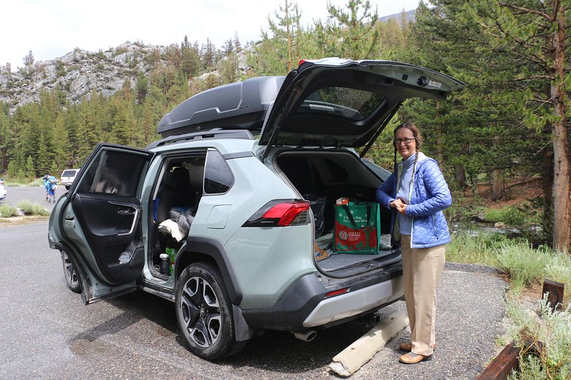
I caught up just in time. We arrived at the car and opened the back hatch, then stood under it to get out of the rain. Our teeth were chattering. We figured out a way to keep the inside of the car mostly dry while we stripped off our clothing and put on dry gear. I also started the engine and turned the heater up high. This helped a lot. Once we had dry clothing on, our attitudes began to improve. We had survived the storm, and still had the trout! And then the sun came back out, right on schedule. Life was good again.
By then it was late afternoon, and the forest was soaking wet. We knew that our clothes would take forever to get dry if we hung them on a line, so we decided to get in the car and head to Mammoth Lakes, where we found a coin laundry. As long as we were there, we also bought some dinner and ate it while we waited for the clothes to finish drying.
The trout were more like dessert for Vicki: They didn’t really count as dinner. We drove back to our camp in Rock Creek and she cooked the fish the easy way, by boiling them. She decided that frying them used up too much fuel, and all she really wanted was the meat, not any extra oil or spices. She took her time teasing the rib bones out of the cooked fish, and totally enjoyed it. There’s nothing quite like fresh trout.

And that was it for our exciting dayhike in the Little Lakes Valley. What a beautiful spot! We still had another day of elevation acclimation yet to do, and made plans that night for where we would hike tomorrow. There were so many choices on the east side of the Sierra! And all of them were wonderful, rain or no rain.
More photos and videos can be found on my Flickr Page
A topographic map with GPS tracks can be seen on my CalTopo Page
