My son and his buddy joined me on a three day backpacking trip into the Golden Trout Wilderness on Labor Day Weekend 2019. On the first day, we hiked out of Horseshoe Meadows over Trail Pass, and camped in Tunnel Meadow. The next day we traveled up Golden Trout Creek to Rocky Lakes Basin. And on the third day we were intending to camp at Chicken Spring Lake near Cottonwood Pass, but on the way there a nearly endless thunderstorm caught us, and we decided to bail out completely. We originally wanted to camp in the Cottonwood Lakes area for a while, but we gave up on that plan as a lot more rain was forecast for the next few days. Being cold and wet for one day can be a fun challenge, but staying wet for days on end really takes the joy out of a vacation. So we headed home early.
Day 1:
We woke before dawn in San Diego and drove five hours to the Ranger Station in Lone Pine. We got there just in time for the lottery, but the lottery had been abolished and there was now a long line. First come first served, and we were last. Crap! We had originally hoped to hike to Mount Whitney, but all the trail quotas had been filled the day before. This was because it was Labor Day Weekend, of course. I was a fool for thinking otherwise, but I figured we’d get something. And we did. But not Whitney. We got a permit for the quota-less trailhead to Trail Pass and the Golden Trout Wilderness. Unfortunately for us, the permit specifically mentioned not heading north on the PCT or entering Sequoia National Park, which made it impossible to aim for Whitney. We read it and re-read it, and there was only a tiny bit of wiggle-room in the rules. It looked like we could make a big loop through Golden Trout and then head to the Cottonwood Lakes, provided that we stayed out of the national park and didn’t head north on the PCT. So, we figured to spend two nights in the Golden Trout area (which sounded dull), and a couple more up by the Cottonwood Lakes (which we knew were beautiful and exciting). So that was our plan. Trail Pass, here we come!

We bought a map of the Golden Trout Wilderness at the Ranger Station and stared at it for a while. We decided to camp in Tunnel Meadow the first night. It was a ten mile hike, so we wanted to start out as soon as we could from Horseshoe Meadows. However, “as soon as we could” wasn’t all that fast. It was 11am by the time we finished getting the permit, buying breakfast in town, driving up to Horseshoe Meadows, and finalizing the contents of our backpacks. But we weren’t worried. We only had a vague destination in mind, so if we stopped early somewhere else it wouldn’t be all that big a deal.
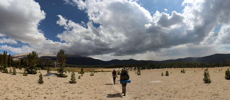
We asked another hiker to take a posed photo of us at the trailhead, and on we hiked. It was a beautiful day. It was roasting in the high 90’s down below in Lone Pine, but up here it was perfect, in the low 70’s, and the hiking was fine. We blasted across Horseshoe Meadows and continued up through the lightly-wooded forest to Trail Pass. It was only a 600 foot ascent. Easy.


The pass itself was very broad and covered in trees, so there was no view. We continued onward, over the Sierra Crest, and down into the wide valley known as Mulkey Meadows. There had been a smell of smoke in the air ever since we started hiking, and it wasn’t until we arrived in the meadow that the source of it was revealed. There was a large plume of smoke heading eastward from a point further south and west of our location. We checked the map, and it looked like it wouldn’t have any impact on our hike unless the wind shifted dramatically. That wasn’t likely, so we weren’t too worried. I discovered later that it had been named the Cow Fire, which I laughed about, because we ended up seeing some actual cows later on, and plenty of cow manure down in the meadow.
Mulkey Meadows turned out to be two miles long, and most of it was spent slogging in the hot sun in deep sand. It became the hike that would never end. We soon grew to hate this place, and we renamed it Manky Meadows, due to the sand and cow patties, not to mention the lack of green grass. At least “Manky Creek” still had water in it, but we figured the cows had probably fouled it anyway. Manky. Definitely manky.


The trail continued into the trees and over a low saddle. We headed downhill in the forest along a small creek and eventually entered the “South Fork Kern Wild and Scenic River” area of the wilderness. The south fork was quite small up this high in the mountains, but it sure was pretty. We took a good long break by the water and cooled our feet. Then we continued onward, and met up with some fisherman who were angling in the river with fly rods, hoping to catch (and release) some small Golden Trout, which are only native to this small area of the Sierra Nevada.


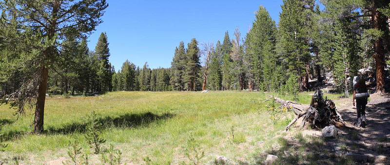
The trail followed the river and eventually reached Tunnel Meadow, which was our planned destination. It was 5pm by then, and our only goal after such a long day was to set up camp and eat dinner. We were glad that Tunnel Meadow was a lot greener than the manky one, but the trail was on the north side, and the river was on the south. We’d be needing to get water from somewhere. So we continued hiking down the long and narrow meadow, looking for a good spot.
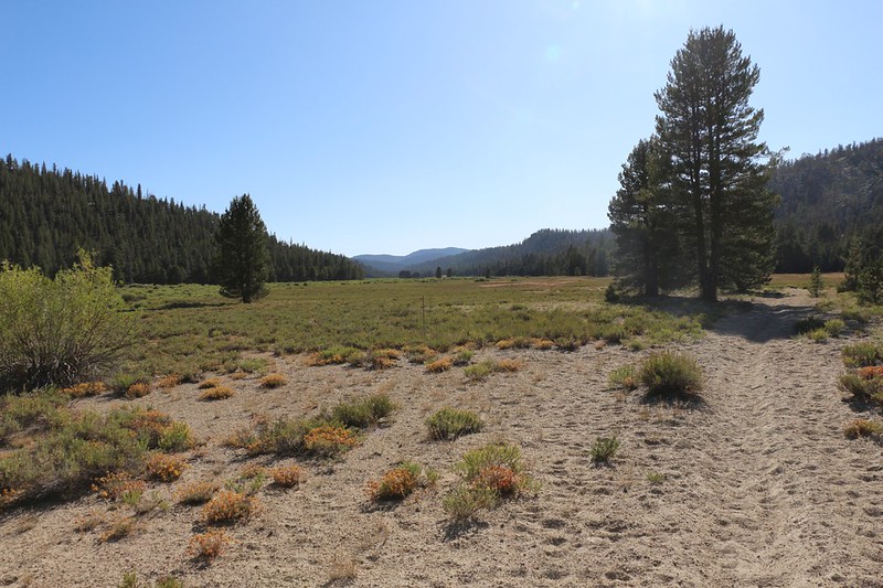
Eventually, we came upon a mighty outcropping of stone that stood directly in the center of the meadow. Keven ran out there and climbed it right away. That’s what he does. Climbs things. We asked him about campsites. Did he see any? We didn’t want to damage the sensitive plants in a meadow, but if there were no plants, then we could put our tents there. And he said it was good, not too far from the river. So off we hiked to the other side of the monolith. We set up camp and had an amusing time trying to get water out of the river, which was flowing slowly and had lots of reeds and mud and a steep shore. Keven waded out into it. He had muck between his toes while he scooped up water, then handed the container to Evan, who brought it over to me for filtering. Three gallons, two liters at a time. It took a while. After that, it was time to start cooking and eating. We’re good at that.


The sun went down behind the hillside to the west, and the air began getting cooler right away. We got into our warm clothing and watched the crescent moon in the cloudless sky as the sun went down. We didn’t bother with a campfire, and went to bed instead. It had been a very long day.

Day 2:
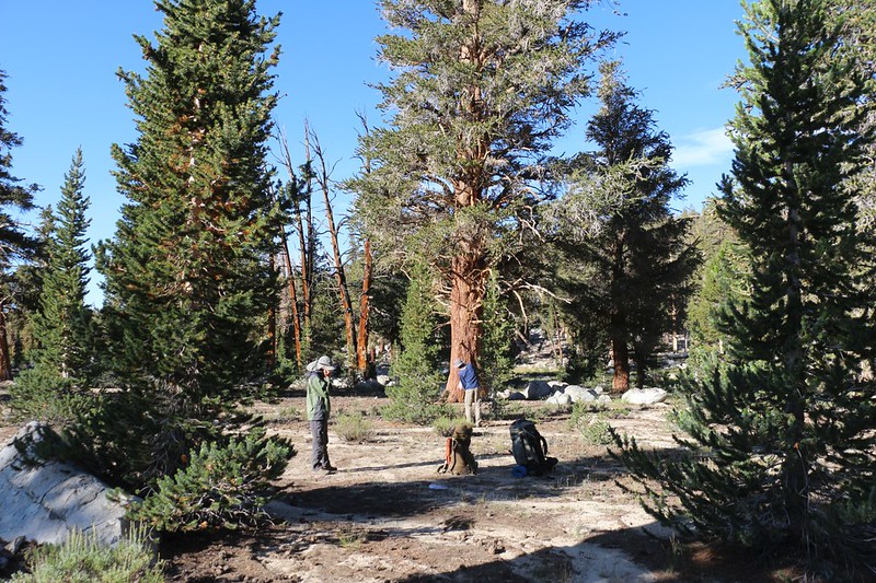
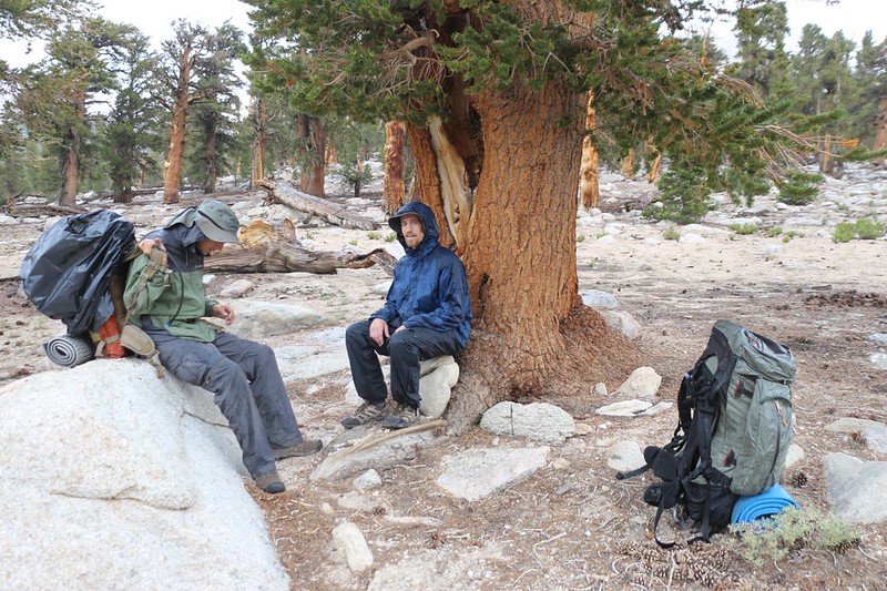
The morning dawned crisp and clear and frosty. It was cold out there! I should have thought about the way that meadows collect the coldest air, but I hadn’t, and there we were, camping in the lowest, coldest part of it. I got dressed in extra layers and ducked back into my sleeping bag to warm them up. Then I headed outside the tent. I knew those guys, and they weren’t known for waking up early. So I grabbed the stove and started boiling water for coffee. That ought to do the trick, I thought. And it did. I had to hand a cup into their tent to get a response, but after that they came to life. Then I boiled some more water for breakfast. They joined me soon after, and we hung out, shivering, with our hands in our pockets. We watched the sunlight slowly creep across the meadow toward us as the sun rose higher. As expected, it didn’t reach us until we’d already packed up all our gear and were ready to leave.

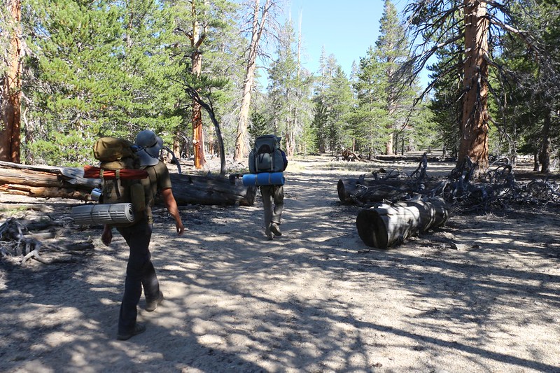
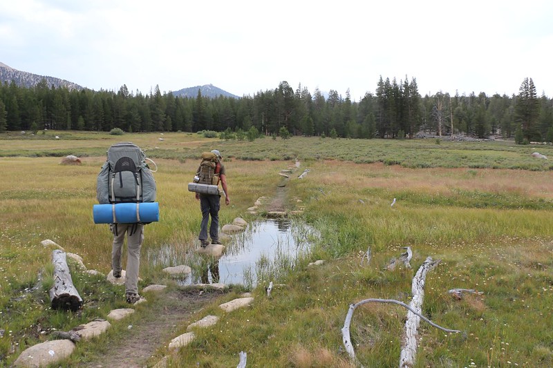
We had a long day of hiking ahead of us, nearly ten miles, and most of it was uphill. It wasn’t going to happen by itself. So we headed a bit further down Tunnel Meadow, then turned right on the trail toward Big Whitney Meadow, which followed Golden Trout Creek. I was excited, as this was surely the heart of the Golden Trout Wilderness. And it was very pretty. The creek was flowing strong, and we saw some Golden Trout in the water. When we stopped for a long lunch break, I purposely filtered a liter container of the rare water from this creek. It tasted excellent. And I didn’t share it. Sorry, lads. Then we doused our heads and hats in the creek to cool us off, and we continued upstream.

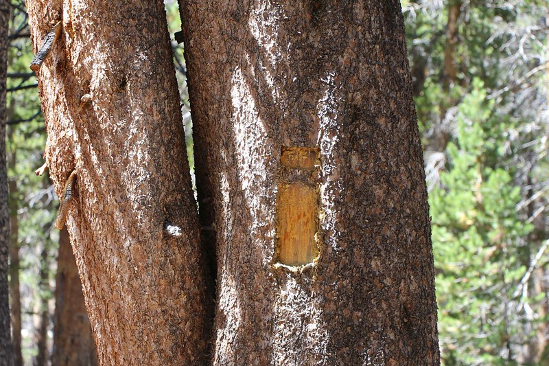
After five miles of hiking, we turned left at the Rocky Basin Lakes Trail junction. At first, after checking my GPS, I thought we’d missed the trail entirely. The map we bought showed the trail in the same exact location as the one on my phone’s GPS (which used the official USGS Map). But what the big map lacked was the “Location Approximate” wording! Minor details. But we found it, thanks to the official trail sign bolted to a tree. That made us feel better. But we could tell right away that no one ever uses this trail! The only thing left from its original construction was the faintest suggestion of a trail. Since the GPS was useless, I told the guys to use their woodcraft skills, to look for signs of the trail’s true location. And we found them! Things like sawn logs, stone ducks (cairns), water drainage diversions, and ax-hewn blazes cut into the bark of trees. Generally, the trail followed a watercourse called “Barigan Stringer” for about two miles. It was a gentle uphill climb, with ponds and meadows, and the trail-finding added to the fun. We had a good time. And that’s when Keven and Evan learned what “Blazing a Trail” really means.


We made it to the junction with the Big Whitney Meadow Trail without losing our way. After that, the Rocky Basin Lakes Trail was well-traveled and presented no difficulties, other than the fact that it kept on going uphill! All in all, we climbed almost 2000 feet that day, and our legs were feeling it. The trail continued along Barigan Stringer, which was the outlet stream for the Rocky Basin Lakes. This late in the season, it was mostly dry, with only a few stagnant pools of water in evidence. And a few hungry mosquitoes as well. The last part of the trail climbed up across a talus field, and the trail’s location was mostly guesswork. But it didn’t matter at all.

We arrived at the lowest lake and it looked like it was drying up. It’s water level was too low to overflow into the stringer. But we didn’t care. We were tired, and decided to camp on some nice soft sand not far away. We set up camp and the guys wanted dinner right away. Sadly, the only water we had left was my hoarded liter of Golden Trout Creek water! I sighed a big sigh, took a last sip for myself, and handed it over. They boiled it up and added it to the freeze-dried dinner, and all of its trouty goodness was smothered in food. Oh well. It’s always good to eat, so that’s that.


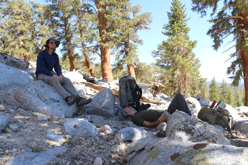
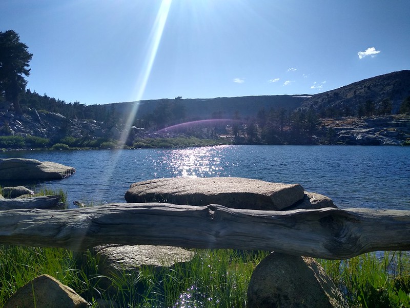
Our next order of business was getting more drinking water. We headed over to our little pond and discovered that it was full of thousands of strange aquatic insects that looked like small beetles. There were way too many of them for our taste, so we continued upstream to the biggest of the Rocky Basin Lakes. And it was a truly beautiful sight with its deep blue water. We stopped along shore and filled up all of our containers, plus a bit more for breakfast and some more dinner. The water tasted great, too, so I wasn’t annoyed about the trout water any more. We hung out up there by the lake and enjoyed the view. We wished that we’d come up here to camp instead, but there weren’t any obvious spots. Oh well. Live and learn. And when you’re asleep it doesn’t really matter where you are.
We went back down to camp and ate some more dinner. Life was good. We were at about 10,700 feet elevation, so we weren’t allowed to have a campfire, but we didn’t really care. We were pretty much exhausted from the long hike, so we headed off to bed before sundown.
Day 3:
We woke up that morning to no frost whatsoever, even though we were 2000 feet higher in elevation. It was probably the meadow that caused it before, or maybe the weather pattern was changing. Supposedly, today was going to be sunny and clear, and for the next few days after that there was a 20% chance of rain and thunderstorms. Normal Sierra Summer weather. But that morning I was not thrilled to notice that there was quite a bit of cloudiness already. When this same thing happened last year on Mount Whitney I got walloped by a hailstorm. So I was a bit nervous. But worrying solves nothing, so we did what we had to do, namely: Wake up, pack up, and get hiking.

My two partners were hungry men, however, and they insisted on having two breakfasts. I’m not big on eating breakfast, so I had all my gear packed long before they did. Then I sat around and read my book in a sunny spot with a view of the lake. So it was all good. Besides, we were strong hikers and a delay wasn’t the end of the world. We’d just hike faster. And that’s what we did.

In no time at all we arrived at the Big Whitney Meadow Trail. We hung a left and aimed for Cottonwood Pass. The trail ascended a few hundred feet over a broad forested ridge, then continued steadily downward along a dry watercourse for a mile and a half. The soil was very sandy, and there was little or no undergrowth. Meanwhile, the puffy white cumulus clouds continued to form overhead, so that we were in the bright sunshine as often as in their drifting shadows.


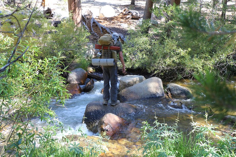
Big Whitney Meadow was, well, big. It was a mile and a half wide, with a wooded “island” in the middle section. This meadow provided much of the water in Golden Trout Creek. It looked dry and sandy, but we knew that down below the surface there was plenty of water. And it was still green down in the lower section, where we found a spot to jump across with dry shoes.


After hiking the wooded section, the eastern fork of the creek proved to be a bit more challenging to cross. The main trail crossing was very wide, and we didn’t want to take off our boots, so we walked upstream a bit and found a better spot. Naturally, after that was another crossing, and then a whole bunch of soggy ground. We did what we could, but our shoes got a bit wet anyway. My toes felt some water seep into my socks. Oh well. They’d dry out in the sun eventually. If the sun would only shine again, that is.

After the meadow, the trail headed up into some trees, and we saw a cabin off to the left. I knew right away that it was a Snow Survey Cabin, that the survey team skied to in Winter and sheltered inside. There was a shovel in a tree about twenty feet above the ground, which was used to shovel down to the cabin in heavy snow years. That’s when they used the small upper door to enter the cabin, not the main door. There were several old pieces of auto licence plates nailed to the trees way up high, to help them find the location of the buried cabin. That sounded like a really cool job to us, getting paid to ski into the wilderness and camp in a cabin in the middle of nowhere.


When we went back to our packs, we stopped and ate some lunch. It was noon, and already the clouds above us had blocked out the sun. Off to the west there was still plenty of blue sky, but not here, so close to the Sierra Crest. We heard a couple of tiny drops of rain hit our gear while we sat there on a log. And that’s when we realized that the 20% chance of rain for tomorrow might be early, and that it would probably be a 20% chance of rain today. So we covered our backpacks and made sure our raingear was ready. It certainly wasn’t raining enough to put it on yet.
We continued hiking, and crossed another small meadow. Once again, we had to jump across a creek, called Stokes Stringer, and our shoes remained dry. The rain drizzled occasionally, but it wasn’t a big deal. And then the trail began climbing upward in earnest. There were plenty of switchbacks along the way, and we kept on trudging along.


It was 1:30pm when the drizzle became heavy enough to call it rain. We stopped under some leaning pine trees and looked at each other. Should we wait it out a few minutes? We decided to try. But it became obvious that it wasn’t going to stop anytime soon, so we put on our rain gear. Then we put our packs back on and continued up the trail. We kept looking back to the clear skies in the west, hoping the clouds above us would blow on by to the east, but it never seemed to happen. Oh, they were moving to the east just fine, but new ones kept forming where the old ones used to be. And the gentle rain kept coming down. We stopped for short breaks under some pines to get out of the rain, but our altitude kept increasing and eventually there were fewer and fewer big trees along the trail. And all the bushes along the edge of the trail were now covered in droplets, which landed on our shoes and pants as we brushed past them. We laughed at all the trouble we’d taken to keep our shoes dry earlier. Our feet were drenched! But still we kept on hiking upward. We had fifteen hundred feet to climb to reach the pass, and it wouldn’t happen if we stood around under a tree.


Cottonwood Pass finally came into view about an hour later, at 2:30pm. And that was when the steady drizzle really became a continuous rain. There was a big pine tree there, and we headed for it. We needed a break in the worst way. We’d already hiked over eight miles, and we were feeling whupped. It also turned out that Evan didn’t have any proper rain pants, so he was getting cold, even hiking uphill. We put down our packs, and Keven got out the stove. He boiled up some water and prepared a hot meal right there on the side of the trail. Evan was shivering by then, and the hot water helped. But we really needed to get moving if we wanted to stay warm.

Video in the rain from the trail below Cottonwood Pass – Evan was getting hypothermic so we cooked up some food

Suddenly, the thunder started booming in the distance. Oh boy. Just what we needed while standing under a tree!
I got out the map. We had some decisions to make. Our original plan was to camp at Chicken Spring Lake that night, and it was about a mile away. Unfortunately, it was north from Cottonwood Pass on the PCT, and our permit didn’t allow that. My sneaky plan had been to bushwhack directly uphill to the lake from the trail we were on now, so technically we wouldn’t be hiking north on the PCT. And then tomorrow we’d hike back south on the PCT, climb over the pass, and head for the Cottonwood Lakes. South was allowed, at least in theory. But everything was so wet, and we were so tired, that bushwhacking up a steep slope for half a mile was rendered completely impossible. Of course, setting up a tent in the rain sounded pretty lousy, too, even if we cheated and hiked north on the PCT. And this rain showed no signs of letting up. If anything, it was getting worse. A 20% chance, indeed! It was pouring!
Our plan for the Cottonwood Lakes was to stay there a couple of days and bag a peak, probably Cirque, but if there would be more thunderstorms tomorrow, then what was the point of even trying? We weren’t interested in becoming Human Lightning Rods. So maybe it made no sense to go there at all. And in the endless rain, with the thunder booming and incipient hypothermia becoming a real issue, we grudgingly decided to abort the rest of the trip. It was only four miles to the car, and most of them were downhill. And there was heat, and dry clothing! We were sad, but we knew that it was probably the best plan under the circumstances. So we put on our packs and headed out into the rain.


The climb up the final slope to Cottonwood Pass got us warm again. Or warm enough, at least, to stop and take a couple of photos. We could still see patches of blue sky way off in the distance to the west, and a few shining, sunlit mountains down beneath them. We imagined that there were warm, dry, happy people out there somewhere.
We didn’t stay on the pass very long, as the thunder and lightning were getting more frequent than ever. The Sierra Crest wasn’t the safest place to be in these conditions. So we headed over the summit and began hiking down the long switchbacks to Horseshoe Meadows. The low clouds drifting along above the meadows (but below the dark cloud deck above us) were truly beautiful, as if the mountains were steaming after a good healthy dousing. And the trail was still running with water.


Our shoes were totally soaked, so we just stomped right through the smaller puddles. But they hadn’t begun squishing with liquid water quite yet, so we still hopped on rocks across the small creeks we encountered. I kept expecting the rain to stop as we went beyond the Sierra Crest, but it didn’t happen. This was real weather. And the thunder kept booming all around us. I was hoping that if it stopped we might reconsider aborting the trip, but it just kept coming down.

Video of thunder as we hiked along next to Horseshoe Meadows in the rain

So we continued onward to the trailhead and the car, and arrived at 5pm. This ended up being our longest day of hiking yet, over twelve miles, and we were pretty beat when we arrived. We set down our packs and I started up the car, to get the heat going right away. There was nobody around in the nearly empty parking lot, so we stripped out of our wet clothing right outside the car. We stuffed the soggy items into plastic bags and threw them in the back. I put my dry clothes on in the front seat and they did the same while sitting under the overhang of the car’s rear hatch. It was cold out there in the drizzle and breeze but it needed to be done. I even had a dry pair of shoes in the back. My feet were so much happier. Then we threw the soggy gear inside the back and the guys got into the car to finish dressing. I had the heat cranked up to 85 degrees, and soon we were roasting in there. It sure felt good to be warm. I blasted some tunes and it didn’t take long before we were feeling quite happy again.


We were incredibly glad that we weren’t sitting in our soggy tents in the rain, hating life as the temperature dropped for the night. We also realized that if we had gotten the permit we originally wanted, right now we’d be soaking wet just below Mount Whitney, several days away from our car. Maybe we lucked out and did the best thing after all!

The rest of the trip’s photos and videos can be found on my Flickr Page.
For an interactive topographic map of our hike, including GPS Tracks, please see my CalTopo Page.
