It happened suddenly, or so it seems. It was a week from Memorial Day, and we hadn’t planned to do any backpacking over the long weekend. This was unacceptable, to my mind, and so we decided to revisit an old favorite: San Jacinto State Park, less than three hours away. We wanted to take the tram from Palm Springs, set up camp in Tamarack Valley, then bag a few peaks just for fun. A mellow weekend.
When we arrived at the lower tram station at 7am, the sign said “All Campgrounds are FULL” and we had no choice but to turn around. We weighed our options, and voted to try for a site in Little Round Valley via the Fuller Ridge Trail, across the way on the western side of the mountain. So we drove another hour to the State Park Ranger Station in Idyllwild. Once again, we were informed that even Little Round Valley was full, as was every single campground in the forest. We should have expected this, of course. But I had been hoping, quite foolishly, that people would be worried about residual snow up at the higher elevations. Foolish, indeed. I should have known better: Southern Californians don’t believe in snow at all! So we went across the street to the National Forest Ranger Station and we filled out a permit for hiking on the Fuller Ridge Trail. We decided that we could hike a mile or so on the trail and camp at a spot just shy of the State Park Wilderness Boundary. This would allow us to do a legal form of Dispersed Camping in the National Forest. I recalled that there was a nice meadow there, full of gooseberry bushes, with at least one decent spot for a tent. No, it wasn’t optimal, but it would have to do. We wouldn’t have to return home in shame, as failures who couldn’t be bothered to plan ahead.
So we began the long drive up the Black Mountain Truck Trail. It’s eight miles of dirt road, and requires yet another hour of driving. We were initially worried that the car might not make it all the way, after all the storms of last Winter, but it turned out that the road had been plowed very recently and our car had no trouble making it. Hooray! Our luck was beginning to turn! Along the way, we stopped at Cinco Poses Spring and filled up an extra gallon of water, as we knew there wouldn’t be any until we hiked further on down the trail tomorrow.
Just for fun, we also stopped to check out the Black Mountain Fire Tower. We had plenty of time. We parked the car in the parking lot at the Boulder Basin Campground and set out on the short, easy hike to the Black Mountain Summit.
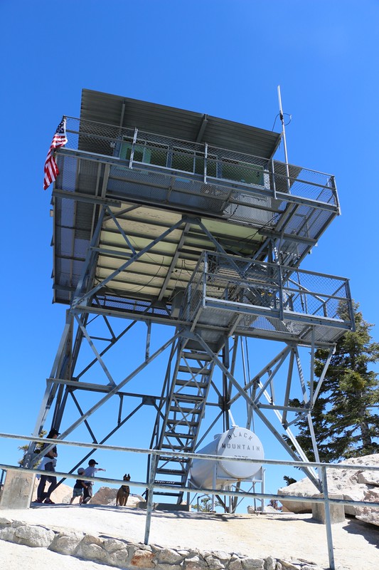


The fire tower was well worth visiting. The views from there were expansive. We were also in luck that day, as the tower was being manned by volunteers, and it was open for a quick tour. We checked out the transit, as well as the amenities. There was a bed for staying overnight, and the furniture had special insulators to keep it off the floor in case lightning struck the tower. It was hard to think of a hotel room with a better view than this, and it made us want to volunteer for duty ourselves.
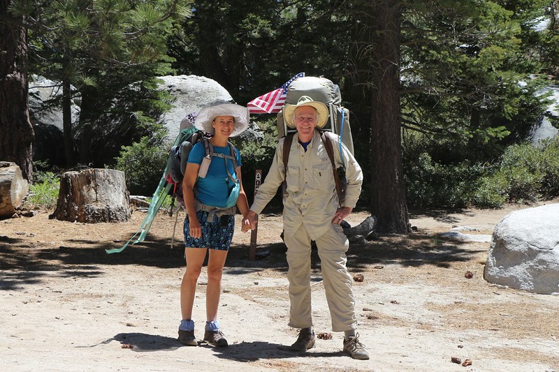
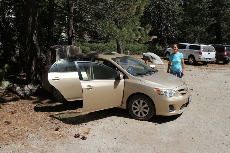
After that, we hiked back to the car and drove the rest of the way to the Fuller Ridge Trail trailhead parking lot. We parked the car and got out our gear. I wasn’t thrilled by the addition of eight extra pounds to my backpack, but I loaded that gallon of water on top anyway. That thing probably weighed about 60 pounds! Thank goodness we were only hiking a mile or so. I’d carried more weight on some of our long summer treks, so it was no problem, really. It was the first shock when I lifted it that got me.
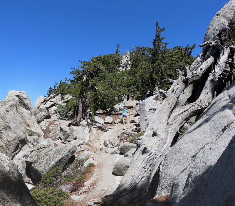
We asked a fellow hiker to take our picture and then we started hiking. As always, the views along this section of trail were stunning. The pines were tall and their scent was in the air. And the sky was the deep blue only seen at high elevation, the color Vicki calls “10K Blue.” Beautiful!


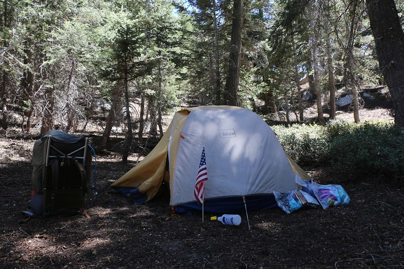
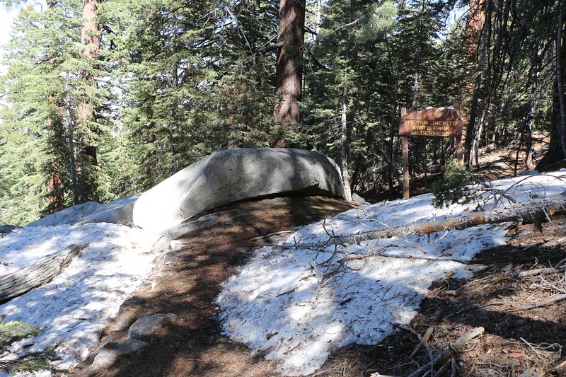
An hour or so later and we had reached Gooseberry Meadow, a wide clearing in the forest populated primarily by gooseberry bushes. It can be found directly on the trail, nestled in the saddle between Peak 8462 and Castle Rocks (8600 feet). This was our planned camping spot. Somewhere back in there, at any rate. So we hiked along an obvious path, pushed through a few gooseberry bushes, and discovered a number of excellently-flat spots within the pines. Perfect! We were far enough from the trail to be invisible to the average hiker, and there was plenty of shade to keep the tent cool and comfy.
We set up camp and stowed our gear in the tent. Then we explored a bit, uphill to the west, and crested the ridge. There were fine views from there, down toward Idyllwild and Pine Cove. I even got cell phone signal, and sent out a text to the kids letting them know of our change in plans. Then we went back to the tent to take a quick nap. Just in case we might need one. Let’s just call it a “pre-emptive” nap.

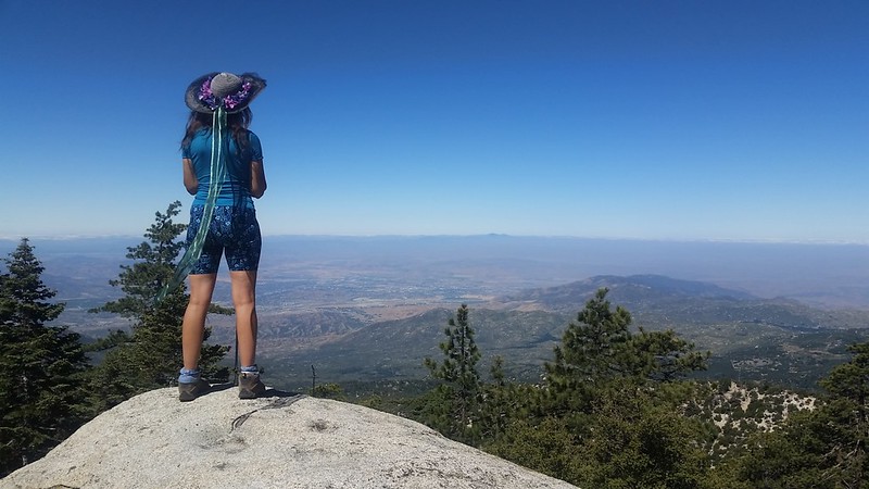
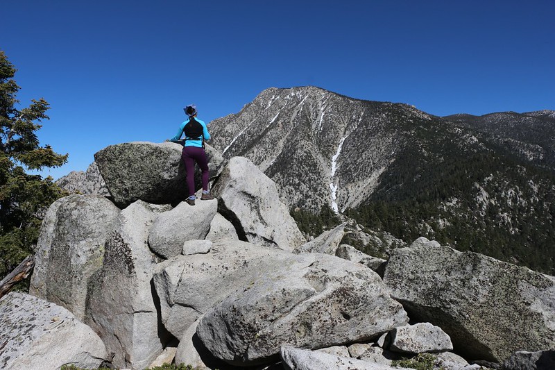
But we didn’t stay long. We had a peak to bag! We were only a mile or so from Castle Rocks, an 8600 foot peak featuring towering granite monoliths. From certain directions, they appeared to be similar to turrets and towers of a castle, and they dominated Fuller Ridge and the valley below. In the past, whenever we had passed this spot on the trail, we were either too busy heading to camp at Little Round Valley, or were too tired heading back to the car. Today was our perfect lazy-day chance to summit this excellent peak.
We hiked down the trail until my GPS said that we were directly below the summit. Then we began the slow process of climbing the extremely steep slope. The forest was open, full of tall pines, with no real bushwhacking. And the route-finding was relatively simple: Follow the The Rule of Up! And that’s what we did. Soon enough, we were up on top of the ridge, scrambling on big granite boulders. Vicki was first to spot the summit register, a plastic screw-top jar tucked safely between some rocks. We signed the register and hung around on the peak for a while. The view was truly excellent. We could see the Coachella Valley to the east, San Gorgonio to the north, Los Angeles to the west, and could even make out some of the San Diego peaks far to the south. Ah, yes. There’s nothing quite like standing on top of a mountain.


Panorama video from the summit of Castle Rocks
Soon enough, however, it was time to go. The afternoon was getting on and the temperature was dropping. We descended via the same route we’d taken on the way up (no, not by using the non-existent Rule of Down) and re-joined the Pacific Crest Trail, then hiked back to camp.
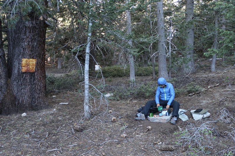
We changed into our warmer night clothes right away, before we had a chance to get chilled, then went back out and had some freeze-dried dinner. After that, we retired to the tent and read our books from inside our sleeping bag until sunset. All in all, it had been a long day, and we were sure glad we hadn’t gone back home after discovering that all the campgrounds were full. This spot was quite pleasant!
Day 2:
The next morning we woke up late. Actually, we woke up early enough, but it was cold so we decided to stay buried within our toasty goose down sleeping bag. We had nothing imperative to do that day, so why hurry? We thought that we might day-hike south on the PCT toward Deer Springs, then (possibly, if we had time) climb up to visit Joyce Peak and Mount Saint Ellens (these are colloquial, local names for the two 10,000-plus-foot bumps on the map just northwest of Marion Mountain). Since we had met both Joyce and Ellen in our travels, it seemed like a fun thing to do.
Eventually, we made breakfast, got dressed, and put together a daypack. We packed the water filter in case we decided to spend another night, as there was a stream several miles up the trail. Then we set out. And we knew that it would be a beautiful hike. It was!


We hiked along the ridge, enjoying the views both east and west. The PCT in this section, as in almost every section, goes up and down and up and down. It’s as if the trail designers purposely made it “fun” that way. For many, wasting hard-won elevation gain by going downhill for no reason is a cause for outrage. But not for us. We knew better. The PCT behaves like this for its entire 2660 mile length, so why should this section be any different?
After two miles of hiking, right when the trail left the main ridge (which continued all the way up to Folly Peak) and began to side-hill its way toward Deer Springs, Vicki realized that she no longer had her sunglasses with her. She’d had them in her hand earlier, but now they were gone. We tore apart the big daypack, emptied all of our pockets, and spilled our gear out for inspection on a granite boulder. No sunglasses. And these were prescription sunglasses, so their loss would prove to be quite expensive. What to do? We both realized that if we turned around now, we would lose too much time, and would never be able to make it all the way to the two peaks we wanted to climb. If we didn’t turn around right away (choosing to look for them hours later on our return journey), then some other hiker might try to be “helpful” and bring them who-knows-where, like the trailhead or the Ranger Station. This was intolerable to Vicki; she really needed those glasses. Therefore, following the old rule of “The Mountain Will Always Be There” (while the sunglasses wouldn’t) we turned around and headed back toward camp. A mile and a half later, right at the spot where we had climbed up to Castle Rocks, we found the glasses, sitting on a flat boulder, tucked inside Vicki’s favorite wool hat. Hooray!
We arrived back in camp around noon, so we decided to make the best of it. We took out our lunch and climbed up to the ridge behind us. We found some comfy granite boulders to sit on in the shade of a pine tree. Then we read our books and ate our lunch with a fine view west. This was OK with us. It was quite pleasant just sitting around doing nothing whatsoever. We decided that we should do that more often.
So we did. We walked back to the tent and went inside. It was shady under the pines by that time, so it was a perfect temperature inside for relaxing. We stretched out on our air mattresses and got out our books, but we discovered that reading books took far too much effort, so we took a nice long nap instead. It turned out to be a wonderful day for sleeping.

Ah, but even pleasant naps must pass. Eventually we woke up and realized that we really ought to be packing up our gear. We’d never made it to the stream earlier, so we had very little water left. Hiking back to the car to get more water seemed rather lame. If we were going to go to the car, we might as well go home.
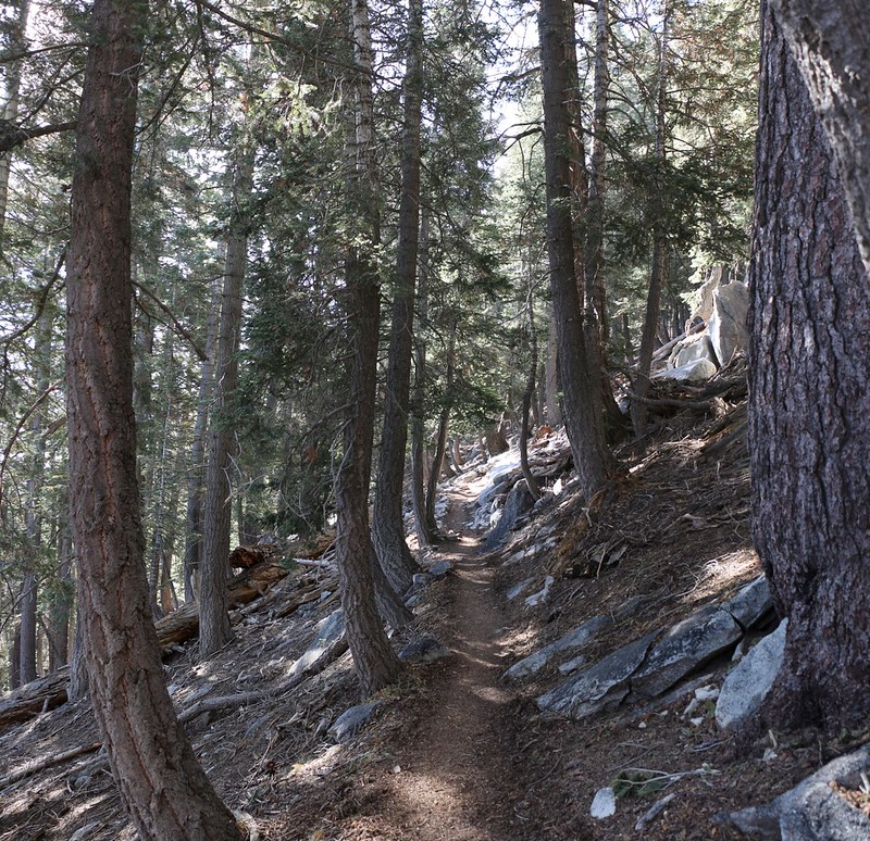
And that’s exactly what we did. We packed everything into our backpacks and double-checked the campsite for errant prescription sunglasses. Then we shouldered our packs and began the easy hike back to the car. It was almost entirely downhill, and only a mile or so in distance. As always, the Fuller Ridge Trail was excellent, with its tall trees, granite outcrops, and distant views.


Then it was time to drive home. We decided to have a barbeque in the backyard when we got there. And maybe another afternoon nap!
For many more photos and videos check out my Flickr Album Page
For a topographic map showing our GPS Track see my CalTopo Page
