Summary: We backpacked up the Momyer Trail and camped at the Alger Creek Campsite, and on the second day we hiked onward to the Dobbs Cabin Campsite. Then we set up the tent, and day-hiked cross-country up Falls Creek to visit Allison Falls and Lone Warrior Point.

Well, we made our summer hiking plans a bit later than usual this year, so we had a bit of trouble getting a permit for this hike. In fact, I had to fax the request in twice, as a month’s lead time wasn’t enough to score a spot on a Saturday night at either the Alger Creek or the Dobbs Cabin sites. We ended up settling for a Thursday-Friday overnighter, which meant that I had to take an extra day off from work, which was sad. However, there was a silver lining, in that the trails were almost completely empty of other hikers, and we truly had the wilderness to ourselves, which is exactly the way we like it. So it was worth the extra vacation day, in the end.
Day 1:
We left San Diego at two thirty AM and arrived at the Momyer Trailhead at dawn. It was predicted to be a warm day, with the next two days a bit warmer still. So our initial goal was to get hiking immediately while it was still cool. It didn’t help that this entire side of the mountain faced south. Unfortunately for us, the northern slopes burned in the “Lake Fire” the year before, in 2015, so that entire section of the wilderness was closed. That’s also why there was so much competition for the few remaining campsite permits.

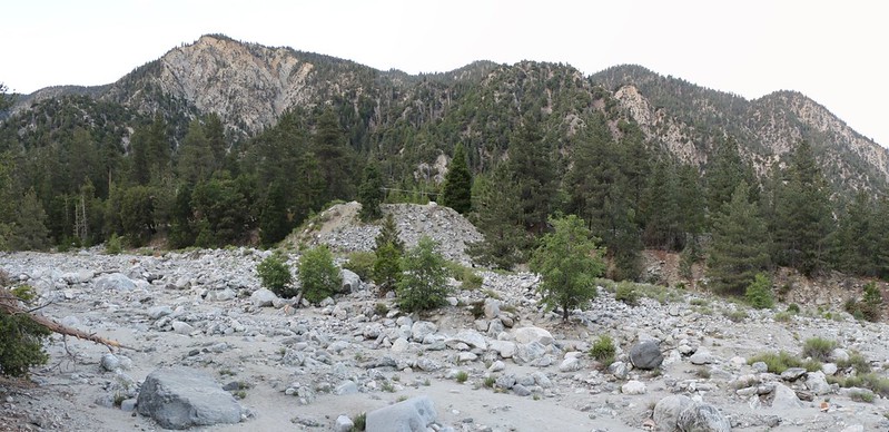
Our gear was ready to go, so we started hiking immediately. The first section of trail consisted of getting across Mill Creek, which was wide and rocky. The creek itself was small, so it made you wonder about all those bare boulders in the otherwise dry creekbed, until you thought about what must happen during large summer thunderstorms and the flash floods that derive from them. If a flash flood happened while we were heading out, we’d just have to stay on the other side and wait until the flood waters receded. Every year you read in the news about some fool who drowns while crossing a swollen raging river, and it wasn’t going to be us. Especially not this weekend, which was predicted to be hot and sunny.
Panorama video of Mill Creek at the Momyer Trail
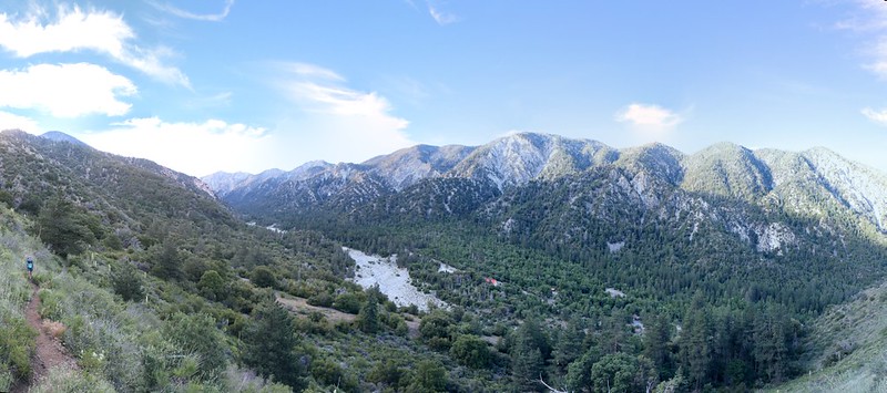
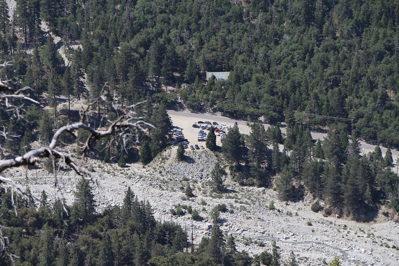
After that the trail began climbing, switchbacking up the mountainside. At first the trail was exposed, with only low shrubs and chaparral, but we were OK because it was still early and shaded. We hiked onward, enjoying the views. We could see up and down the valley, and over to the opposite side, on Yucaipa Ridge. The town of Forest Falls was directly beneath us, and there was only a small amount of traffic on the road this early. As we climbed, we kept getting views of our car far below us, and we noticed that we were still the only people parked there. Nice! We decided that hiking on a weekday was amazing.

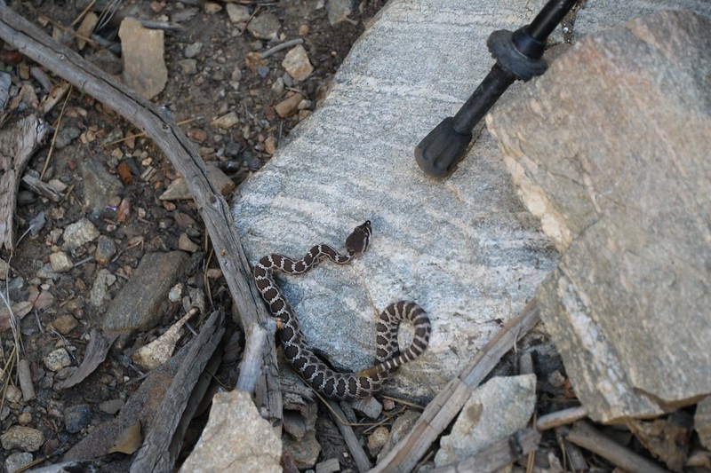
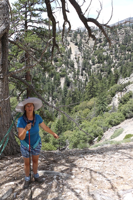
The only downside to hiking when it isn’t crowded is finding dangerous wildlife directly on the trail! And that’s what happened to Vicki. She almost stepped on a tiny baby rattlesnake. It was less than a foot long, and its head was less than one half inch across. Based on the coloration, I think it may be a Mojave Rattlesnake. But a bite from one would ruin a hiking trip very soon, so Vicki was glad she spotted it in time.

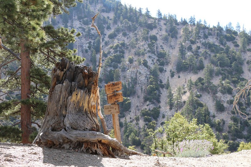
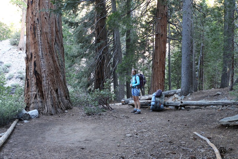
Soon enough, we reached the San Gorgonio Wilderness boundary at 7000 feet elevation, and not far beyond that was the end of our uphill climbing, as the Falls Creek Trail headed off to the east. The trail side-hilled along for a mile or so, passing Cedar Spring along the way, and brought us to our campsite at Alger Creek. It wasn’t even noon, and our hiking day was over! And that suited us just fine as the temperature had begun to climb.


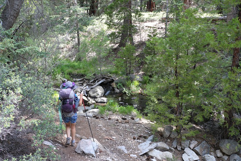
Alger Creek was a well-developed campsite, and had plenty of room for tents. It helped that we were the only ones present that day! We set up the screened section of our tent in the deep shade of some pines and took a well-deserved nap. After that, we woke up and headed up the creek a bit to filter a gallon or two of water for dinner and breakfast. It was peaceful hanging out near the creek, which was flowing well, and we were looking forward to hearing the sound of water that night from our tent.
Video of a small waterfall and bubbling pool on Alger Creek
Whimsical video of an imaginary kayak going over the small waterfall into the bubbling pool


We hung around camp, then ate dinner. By then the temperature had gone down, so we decided to take our evening constitutional, by hiking further up the trail to the spot marked “Campsite” on the old USGS Topographic Maps. And it was, indeed, a nice flat area, but was no longer used. Plus, it had no water sounds nearby. So we were glad to hike back to the tent and get to sleep early. All in all, it had been a peaceful day in the wilderness.
Day 2:
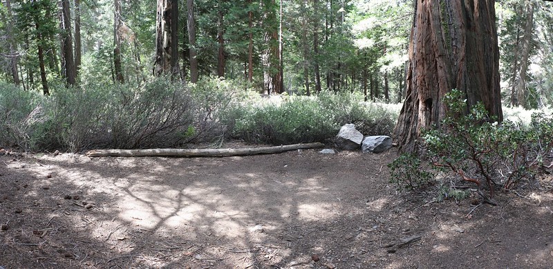
We woke up somewhat early, but not extremely so. We had an easy hike to do, only a couple of miles, and the miles were relatively flat. We were heading for the Dobbs Cabin Campsite, although we decided that it was mis-named, as we’d heard that the cabin itself was gone, and that its timber had long since been used as firewood.
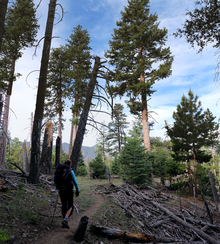
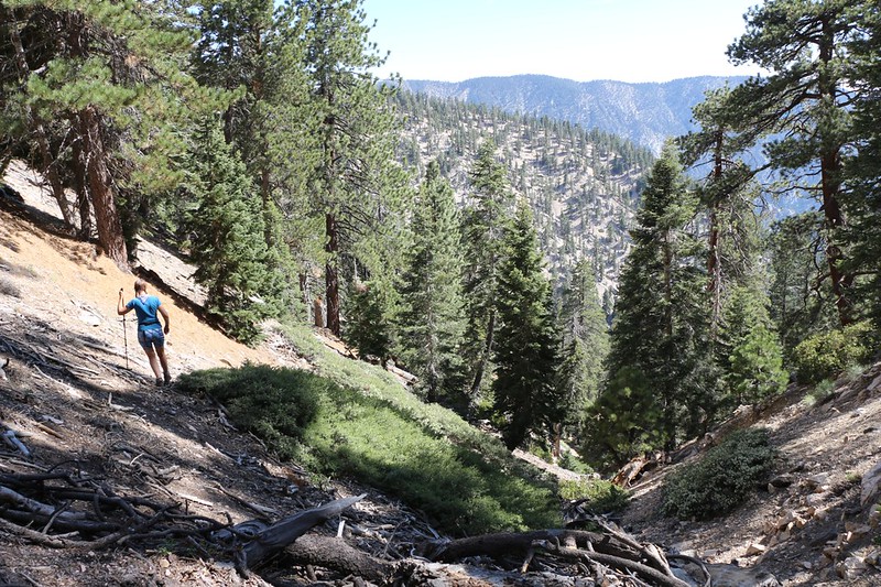
After eating breakfast, packing up our gear, and making sure the campsite was clean, we donned our backpacks and started hiking The trail climbed uphill out of the Alger Creek valley, but not long afterward the trail leveled off once again. It was pleasant, and the high cirrus clouds made the scenery even better. It was only a mile or two before we intersected the Dobbs Cabin Spur Trail. The main Falls Creek Trail continued steadily upward toward Dollar Saddle, and we were happy to be heading downhill instead. But first we took a relaxing rest at the viewpoint. Why not? We were in no rush; we were on vacation! So, Vicki took a nap and I read my book, and then we lazily decided that it was time to head for Dobbs Camp.
Video of Falls Creek flowing at Dobbs Camp
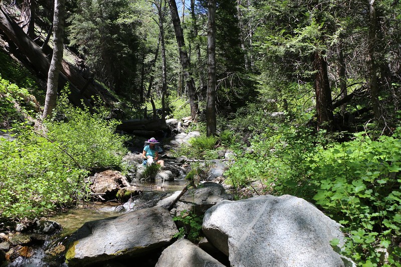
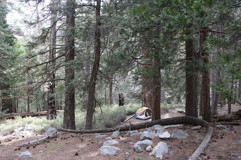
Vicki filtered some water from Falls Creek while I set up the interior of the tent. And then we got ready for a long day-hike, using Vicki’s empty backpack as a daypack. We packed it with lunch and water and the ten essentials, with the understanding that I would be the one who would carry it. It was so much lighter than my big backpack that it felt nearly weightless to me, so no problem!
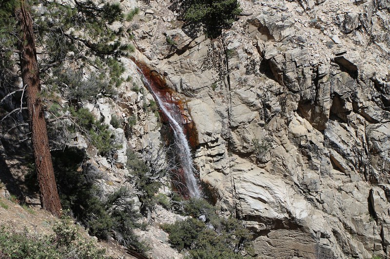
Our big plan for the day was to reproduce a crazy bushwhack adventure that Hikin’ Jim once did, climbing up the Falls Creek Drainage to visit Allison Falls. I’d first heard about the falls on a forum post in November 2015, and I guess it must have stuck in my head. Of course, it was also one of the only “highlights” along the Momyer/Falls Creek trail system that didn’t require a visit to the 10,000 foot mark, and Vicki wasn’t having any of that. So Allison Falls was to be our goal. It helped that Hikin’ Jim also documented the location and route on an online topographic map. Thanks, Jim! I had texted him a cell phone photo of the view over Forest Falls yesterday, along with a description of our plans for visiting Allison Falls, but I never received a reply as I immediately put my phone on “Airplane Mode” and shut off all outside communications. One important part of the enjoyment of a visit to the wilderness is the satisfaction of knowing that the outside world can’t annoy you while you’re there!
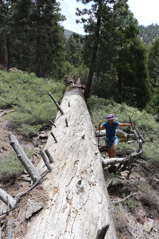
So we set out directly up the ridge that arose in Dobbs Camp. We knew we had about one thousand feet to climb, hiking cross-country without a trail. The plan was to hike directly up the ridge until we reached 8400 feet, at which point we would side-hill over to a promontory on a nearby ridge that Jim swore was named “Lone Warrior Point.” It was a great name. and sounded seriously cool. It made me want to stand on it. Note that this name wasn’t on any map that I know of, but there you have it: If one of the foremost authorities on the San Gorgonio Wilderness calls it something, then the name has already acquired enough merit in my book.
At first the hike consisted of a gentle slope, with some easy trail finding, as we climbed over or around various deadfalls. But soon enough it became seriously steep. Sometimes the ground was covered in pine needles, which were often deceptively slippery, and other times we had to force ourselves through thick patches of low, tough oaks. Other times there were loose rocks, or sand. And almost always there was the sun, baking us as we sweated our way uphill. We often chose our route in order to take advantage of any and all shade patches, where we would pause to breathe and let our hearts have a chance to slow back down. But all of the suffering was counterbalanced by the views which continued to get better and better.


We made it to a pleasant rocky outcropping and Vicki took a nap. I sat down with my shoes off, cooling my feet while reading a book. It was a great place to take a break. Vicki woke feeling refreshed. We ate some lunch, put on our shoes, and continued on.
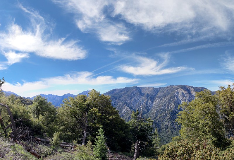
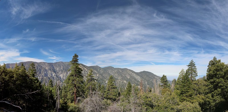
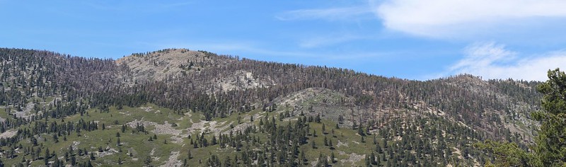
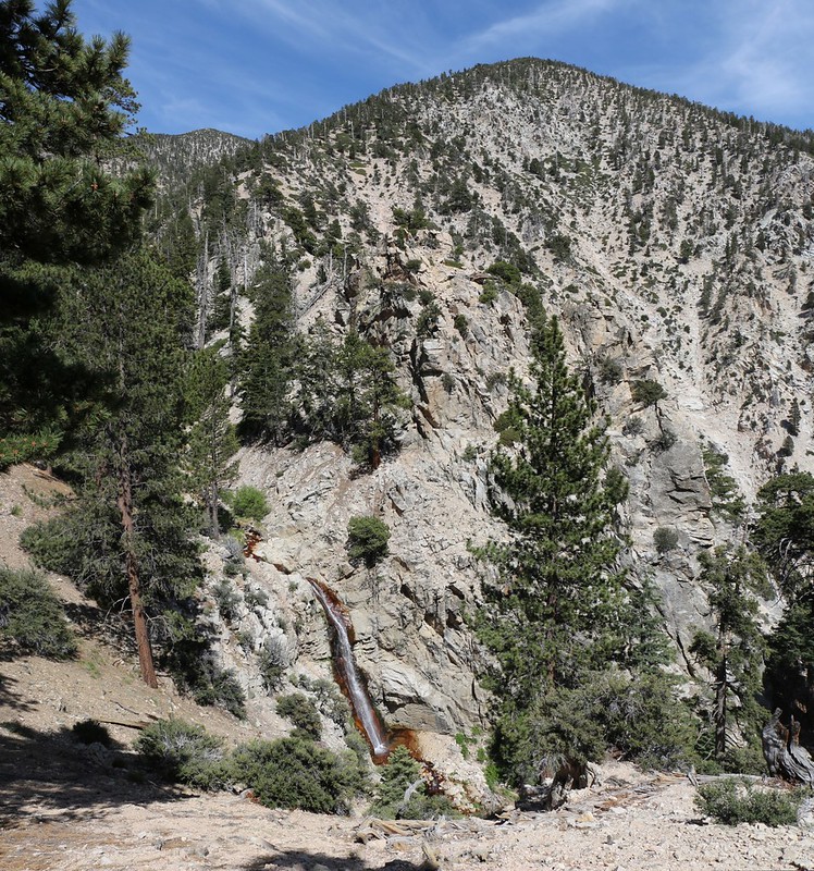
We climbed a bit more and the ridge mellowed, so that we were able to check out the view to the northwest of the high ridge. We saw where the Lake Fire had burned over the top of Shields and Alto Diablo Peaks onto the south side of the range. I took some photos, and then it was time to side-hill around the ridge to Lone Warrior Point. It figured: Right when the ridge got easy to climb we had to leave it for some annoying side-hilling. But at least we didn’t have to go uphill any more, so it wasn’t all that bad.
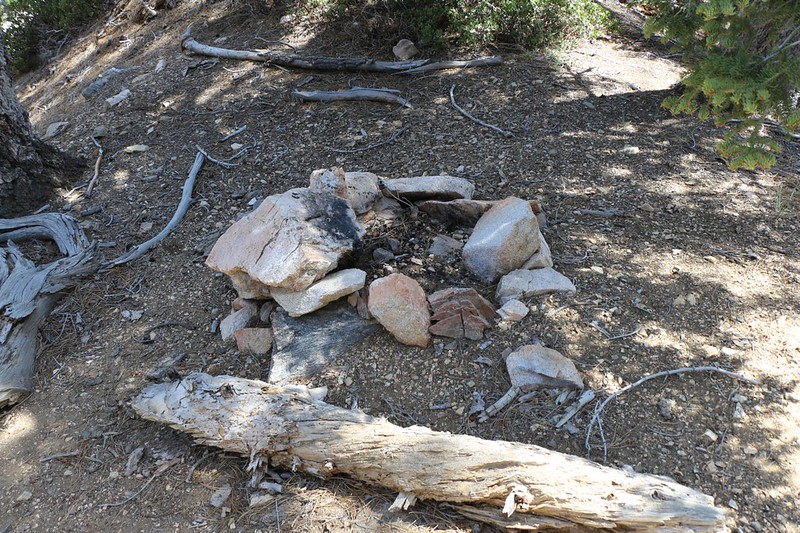
It didn’t take long to reach the small ridge that forms Lone Warrior Point. Upon arrival we immediately noticed an old fire ring next to a nice camping spot, and groaned when we thought about those poor devils climbing that ridge with a full backpack. Or, even worse, descending it!
And then our attention turned to the highlight of the day, and the ostensible purpose and goal of our trip: Allison Falls. It wasn’t flowing all that full during this drought year, but it was flowing well enough to be called a waterfall. There was a use path down to the top of the falls but we decided to simply enjoy the view from the point. Let’s face it: Waterfalls rarely look like much from the top; it’s the view from below that’s better. And the view from Lone Warrior Point was best as it was directly across the way.
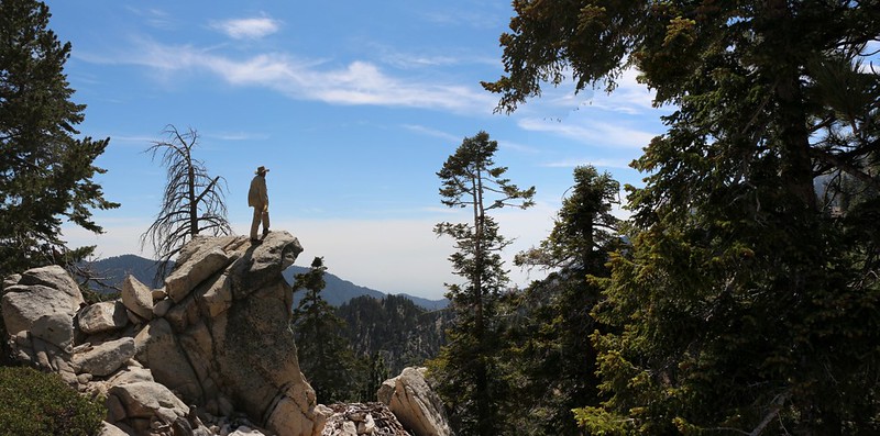
We took a small break up there and enjoyed the view, and we climbed up on a large granite outcropping, posing for photos, so that each of us could be a “Lone Warrior” silhouetted against the sky.
Video of Allison Falls from Lone Warrior Point
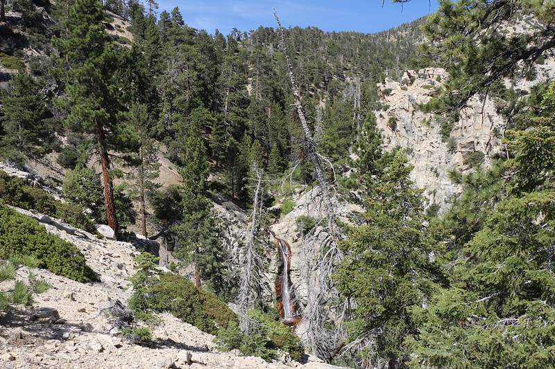
And then we sat down and got out the map. It was late afternoon and we needed to head back to camp, but we weren’t sure about our route. We knew that almost anything had to be better than downclimbing that insanely steep ridge we’d just come up. We wanted to avoid any injuries, especially to our knees, which don’t like downhill all that much. In the end we decided to head down a ravine rather than a ridge, because if we slipped at least we’d be near the bottom of the slope, deep down in the “V” of the ravine. We stuck to a dry wash, as we knew that following Falls Creek down via it’s bed would be extremely difficult, with lots of slippery rock scrambling and soggy shoes.


And that’s exactly what we did. The trip down was stress-free, and we arrived in camp much sooner than we’d expected. It had taken us hours to climb to the falls, and less than an hour to descend. So we had a bit of time on our hands, which we spent reading and wandering around Dobbs Camp. A group of three people arrived at the camp, and they were the first folks we’d seen in over a day. We made the usual social pleasantries of the trail, and then they wandered off and found a campsite out of sight of ours, and that’s the last we saw of them. Soon afterward, we ate our dinner and went to bed. It had been a tough day of hiking.
Day 3:
We woke up at our usual time: Oh-Dark-Thirty. The sky was just getting light as Vicki went out to make breakfast, leaving me to deflate the air mattresses and stuff the sleeping bag away. Soon enough it was time for a cup of coffee and some freeze-dried Biscuits and Gravy. Stoking up for another day. We finished packing our gear and headed out as soon as we could, as the first part of the hike was uphill. As always, we wanted to beat the heat. After that the trail would be sideways for a few miles, followed by the main downhill blast to the car.
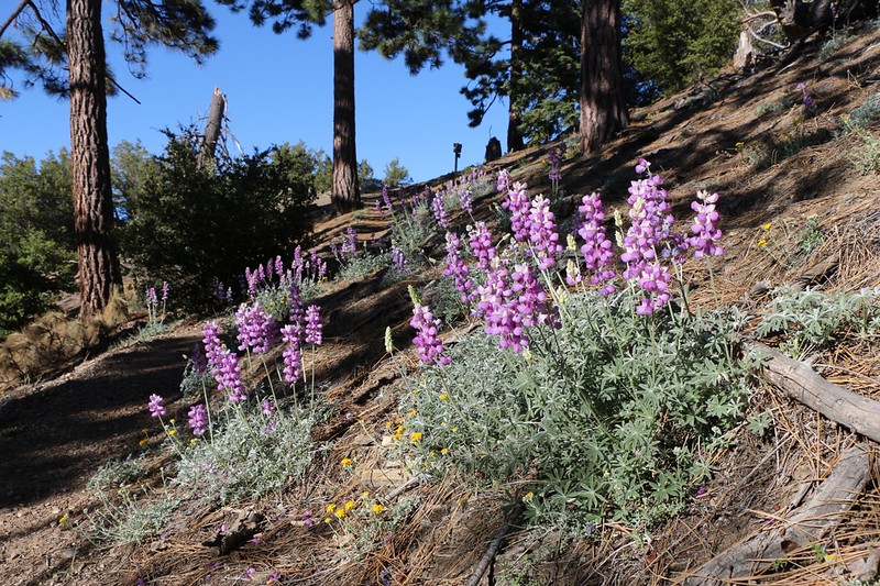

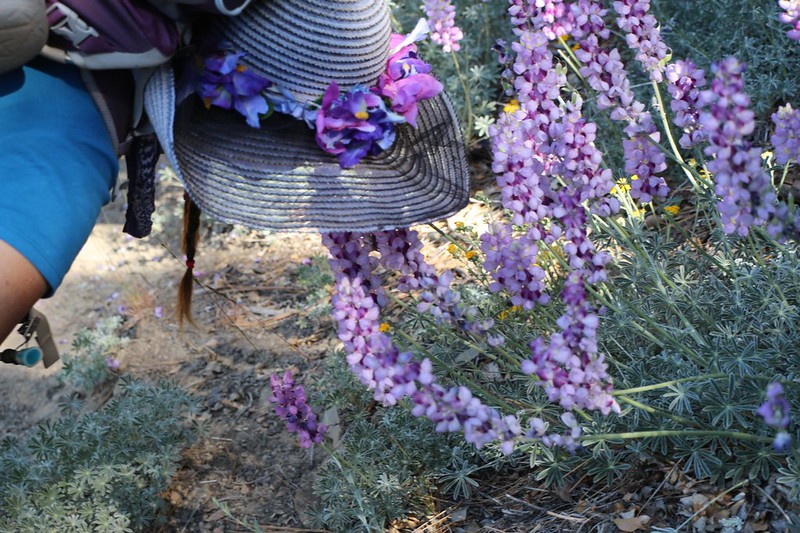
The scent of blooming lupines was everywhere. If there was one word that summed up the weekend’s hike, it would probably be lupine. They smelled sweet and strong in such numbers, almost like candy.
The hike out was relatively uneventful. The main difference we noticed was that this was now Saturday, and the trail was semi-crowded with hikers, all of them hiking uphill. Many were attempting to reach the summit of San Gorgonio Mountain, which was many miles and many thousands of feet of climbing away. Based on our limited impression of their levels of fitness, a whole lot of these people were either going to turn back without summiting or would be hiking back to their cars in the dark. But they weren’t all out of shape. Still, it was over twelve miles to the summit via this route, making it a 25 mile day, plus roughly 6000 feet of climbing, which only the hardiest of hikers should ever attempt. Either way, summit or no, these folks would still be having a great day in the mountains, so it was all good.
When we reached a viewpoint that looked down into Forest Falls, I turned my phone back on, just to see if anything interesting had happened while we were gone. Right away, a few text messages arrived. I sighed and decided to view them. I figured I could always turn it off again if I didn’t like what I saw. One was from my son, asking how the trip went; I noticed that he sent it out two days ago. It was a preemptive text. He was hoping I’d reply when I saw it, so that he’d get warning of our imminent arrival, thereby gaining extra time before having to clean up from any wild parties he may have been having. I know his style, so I didn’t reply. Not yet. I’d wait until we were almost home. The other text was from Hikin’ Jim: “I’m over on the San Bernardino Peak Trail. Allison is neat, but difficult. Very Steep.” Hoo boy. Maybe I should have left my phone on a bit longer the other day! But it probably wouldn’t have changed my mind, now that I think about it. We really wanted to see Allison Falls. And we did! It was only sad that the two of us were on opposite sides of the mountain, or we could have hiked together. Oh well, maybe some other day.

The temperatures climbed higher and higher, and the sun was strong. The weather service was correct in their prediction of higher temps, and we were glad to be hiking downhill. Unfortunately, one of the lower sections of trail was totally exposed to the south, and Vicki still got overheated. She gets surly and irritable when she’s baking hot, so something had to be done, if only for my own sanity. We stopped several times in the shade of a lonely pine tree to cool our roasting feet and let the occasional breezes work their magic. And those trees were few and far between on that stretch of switchbacks.


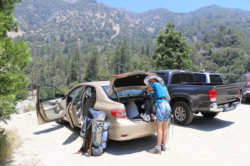
Crossing Mill Creek in the sun, coupled with the small climb to the trailhead parking lot almost did Vicki in, but she made it. We turned on the car and blasted the air conditioning for a while, and Vicki regained her composure. We got our gear ready for the long drive home, and thought about where we might stop for lunch along the way. As we left the mountains we talked about the trip, about what was fun and what wasn’t, and in the end the positives far outweighed the negatives, which is how it should always be. The steepness of the climb to Allison Falls and the exposed section of trail on the way down were rated poorly by both of us. On the other hand, the trails were in good shape, the views were awesome all along the way, and it was really nice to camp near water, and to hear it running nearby as we slept. All in all, it had been an excellent three days in the mountains.
Many more photos and videos can be found on my Flickr Album Page
An online interactive topographic map of our hike and GPS tracks (in red) can be seen on my CalTopo Page
