As Pacific Crest Trail “Section Hikers” we differ from the true “PCT Through-Hiker” in that we can hike the trail in any order and in any direction that we please. This is the kind of freedom we like. Our previous two hikes in California Section C were both Northbound, but this hike was planned from the outset to be Southbound. Why? Because we did our homework and checked the elevation profile of the trail. We made darn sure that we started at a significantly higher point than the finish! As we stated to the other hikers that we met along the way (all of them sweating and puffing up the trail): “We take our PCT hikes downhill – both ways!”
And this section was truly a whopper of a downhill, with over 6500 feet between the highest and lowest points. Being the ever-changing PCT, there was also more than 3000 feet of uphill climbing here and there along the way, which yielded a total descent of 9500 feet! This was nearly two miles of elevation loss! And it would have been a true knee-destroyer if it weren’t for the fact that it spread the change out over a total of more than 35 miles. True, some sections were steeper than others, but all in all, the PCT is known for being a well-graded trail. Just the same, we sure were glad to be hiking southbound this time!
Now, the biggest problem we had on this trip was figuring out how to leave our car down at the southern end, at the Whitewater Preserve, while also getting ourselves and our gear up to the northern end near Big Bear City. There were no roads out there, and the shortest route by car was 70 miles long, over twice the hiking distance, on roads that would be difficult to hitchhike on. And, as always, money came to the rescue: We rented a car. Our son graciously volunteered to spend the day helping us out, by driving the rental car. Thanks! It was a long day for him, as it was a four hour drive from San Diego to our starting point.
Day 1:
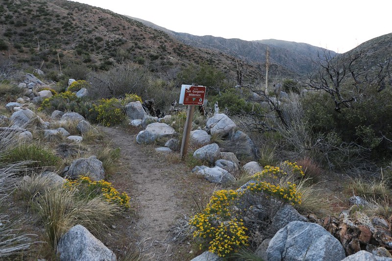
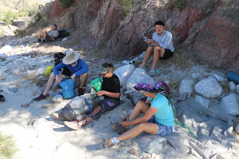
We arrived with two cars at the Whitewater Preserve at 8am, right when they opened, and those nice folks gave us a special permit to park our car in their lot for the next four days. We loaded all of our gear into the rental car and drove up into the mountains, eventually arriving at Onyx Summit on Highway 38, where there was a short dirt road that led directly to the PCT at mile 252. This was the same spot that we’d started from last year when we’d hiked northbound. We got our gear out of the car and double-checked that we had everything, because we wouldn’t get a chance for the next four days.
And that was when I remembered that I’d left my butt-sized sitting pad at home! Arrghh! I was not amused, as I typically use that pad every single time we stop for a break. But there was no fixing it. I would have to suffer a bit, forced to sit on ice cold (or roasting hot) rocks and sharp thorns and dusty dirt. I would survive, of course, and I wasn’t about to call off the trip or anything, but it was annoying, as I rarely forget things like that.
After that, we thanked our son and sent him off to San Diego to return the car. And then we hiked off into the forest.

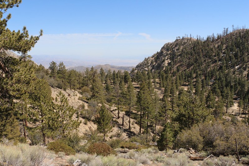
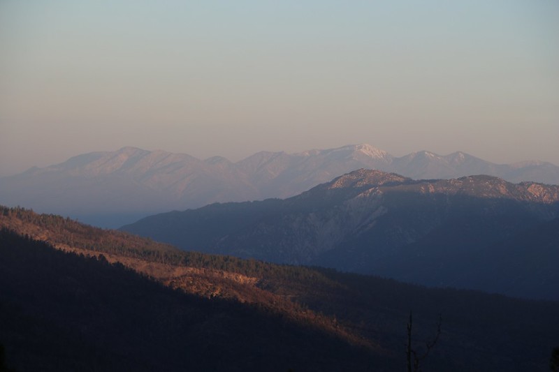
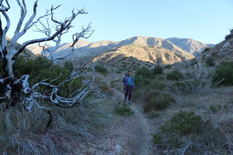
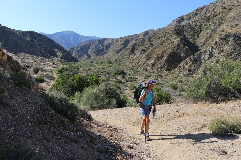
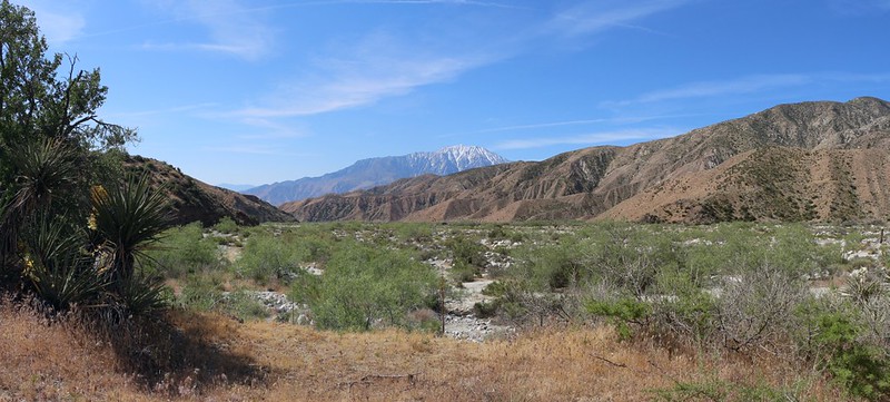
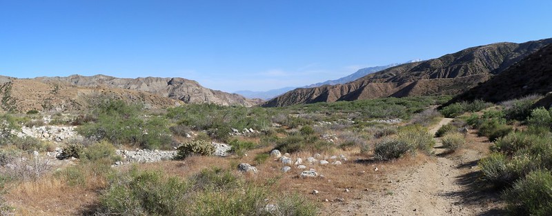
It was nearly 10am by the time we started hiking, but it was still quite cool, in the mid-fifties, and we decided to get moving right away to stay warm. Naturally, just like we’d planned, the first two miles was all downhill, and we made great time. The trail also provided excellent views of San Gorgonio Mountain, which was still completely covered in snow this year.

The second two miles, however, was uphill. We had to climb even higher than the point where we started, and as we climbed we began to sweat. Vicki and I peeled off our extra clothing layers, and soon we were baking in the sun. Vicki even decided to try out my new idea of using a water squirter to cool herself off. When adjusted correctly, it shot a pleasant spray which served to cool her down quite well.

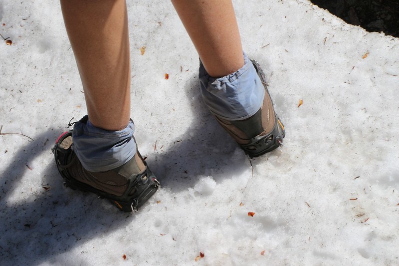
Just to be different, the hot uphill section of the trail also hugged the north slope of the ridge, and patches of soft Spring snow began to appear. We felt a bit like those people who ski in bathing suits. In fact, I had worried quite a bit about those north-facing slopes, and even went so far as to buy Micro-Spikes for each of us, just in case, because 2017 had been a big snow year in California. But it turned out that we only had to hike about a hundred feet on snow altogether, and didn’t need the spikes at all. Just the same, we decided to try them out, so we stopped, put them on, and clomped all over a small snowbank.
Soon enough, the trail headed downhill once again, and we were treated to fine views, south to San Jacinto Peak and west to San Gorgonio, which was getting closer to us all the time. Some puffy cumulus clouds began to form above the frosty summit which made for some fun photos.


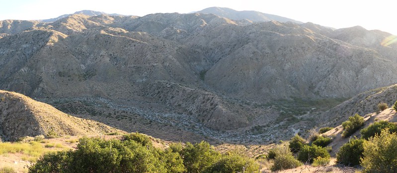
After that, the trail continued down to the Coon Creek Drop-off, which was a saddle that had a steep slope on the southern side. This spot was directly on the Pacific Crest itself, meaning that water would flow into the desert on one side and the Pacific Ocean on the other. Very cool. There was a campground there, but it was currently closed due to the Lake Fire of 2015, and it had no water anyway.
There was a PCT hiker register there, so we signed in using our “Trail Names” which most PCT Through-Hikers eventually receive from other hikers. Vicki’s name was “Nice Hat” as that was what everyone said to her as soon as they saw her. True! Her hat is amazing. And mine wasn’t really a nickname given to me by anyone except Vicki, so it probably doesn’t really count. I may have to hike more of the trail before I get a proper one. These things take time.
Video panorama from the Coon Creek Jumpoff directly on the Pacific Crest
All we had left to hike after reaching the low point at the drop-off was to climb a couple more miles (and yet another few hundred feet) to arrive at our destination for the night near mile 244. And it took longer than we thought to get there.
Along the way we walked on yet more snow, and also entered a section of the official “Lake Fire Closure Area” where we were not permitted to camp, but only hike. A lot of trail work had been done in 2016 in order to get the PCT opened in this area of the forest, and all we had to do was follow that simple rule. So we did. Thanks, trailworkers!
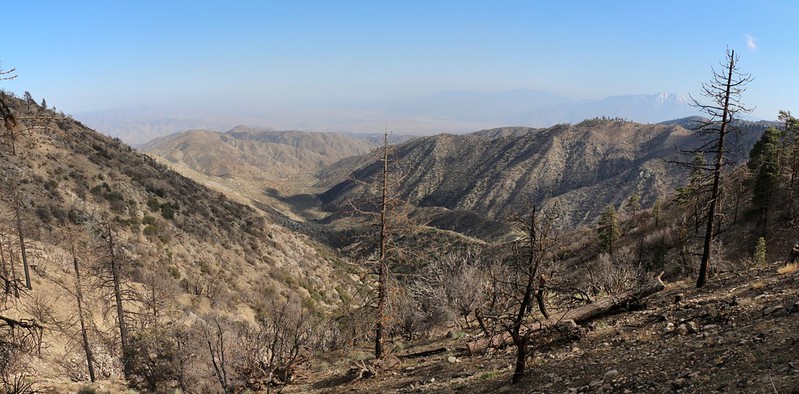
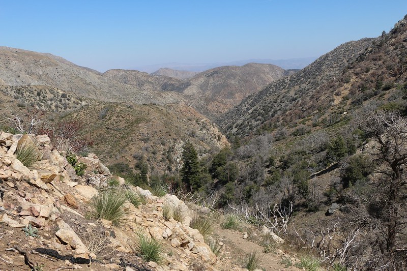
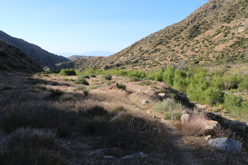
We stayed high along a ridge and looked down to the south where the North Fork of Mission Creek was flowing. The PCT followed that creek for many miles, and we knew that we would be hiking down there not only tomorrow, but the next day, too. It looked so close on the map, but it was a very steep canyon, and we had no problem deciding to follow the gently sloping trail even if it meant more miles of hiking.
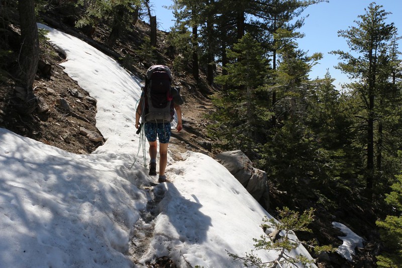
LONG Video of hiking across the soft snow on the north-facing slopes. I post-holed on one tricky spot.
Eventually we made our way out along a skinny ridge and neared the place where we planned to camp. Part of our plan was to carefully to avoid the official closure area. Another part was to find a spot that worked within our hiking abilities, which for this trip was roughly eight miles of hiking per day. The final part was making sure it worked in regard to water availability. In fact, this entire day was known to me beforehand to be essentially devoid of water sources. Sure, there were two stagnant pools of slimy water about two miles from the beginning, and I figured that there would probably be dirty, debris-laden piles of snow here and there along the way, but I didn’t trust any of that. In fact, I had been carrying a full gallon of extra water in my pack the entire day. Yes, that’s an extra eight pounds of weight added to my already heavy backpack. But it was worth it in the end.
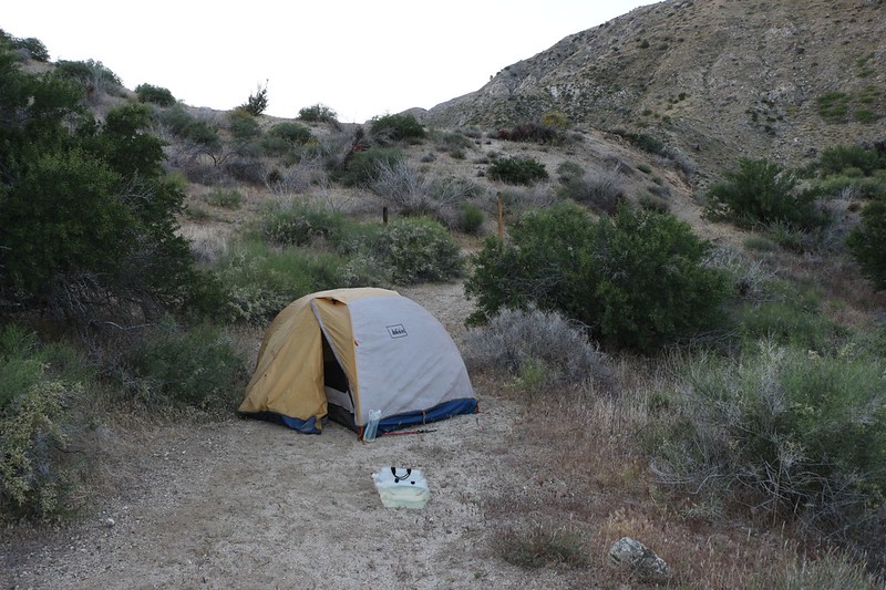
We climbed off-trail up to the top of the ridge and discovered a broad meadow-like area. There were camping spots everywhere you looked! And views in nearly every direction! It was far better than I had ever dreamed of. In fact, we were able to see the “Big Three” mountains of Southern California from our location, namely: San Jacinto, San Gorgonio, and San Antonio (Baldy).
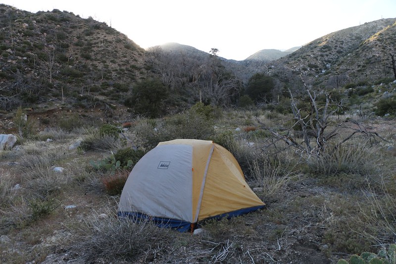
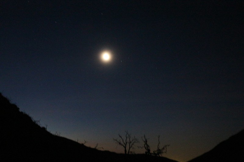
We placed our tent in the lee of a juniper tree and got ourselves ready for the night. I prepared the inside of the tent and Vicki whipped up some freeze-dried dinner. As the food hydrated, we jumped in the tent and changed into our night clothes, as the temperature began dropping precipitously. We knew from the forecasts that it was likely to be in the upper 30’s by morning, so we put on our warmest gear. Then we went back outside to eat the dinner and enjoy the sunset. Warm and fed, we walked around our private meadow looking at the wilderness all around us, completely at peace with the world. It had been a great first day!


Day 2:
We woke at dawn but stayed in the sleeping bag for a while. It was cold out there! And the two of us had spent a comfortable night, what with all the extra clothing we were wearing, so we were happy. And, as we only had eight miles of mostly downhill hiking in front of us that day, we were in no huge rush to go outside and freeze our butts off. So we waited until the sun hit the tent, which happened all-too-soon after dawn anyway, but at least we were able to get some solar heating while we sipped our hot coffee and ate breakfast.
We packed up and checked our water supply: We still had over three liters left, which ought to be enough to make it another four miles to the nearest spring. In other words, we had carried the right amount of water with us yesterday, so we were happy. Then we grabbed our packs and started hiking. It was looking to be another beautiful day on the trail.


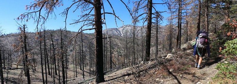
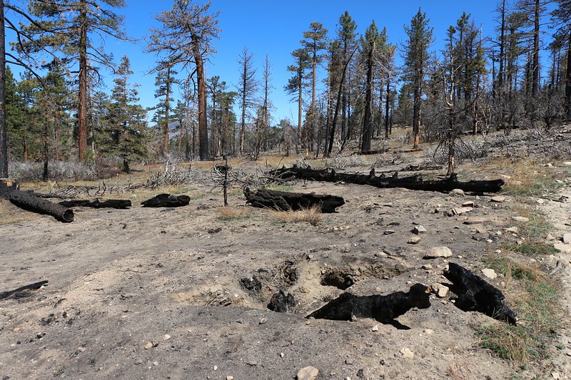
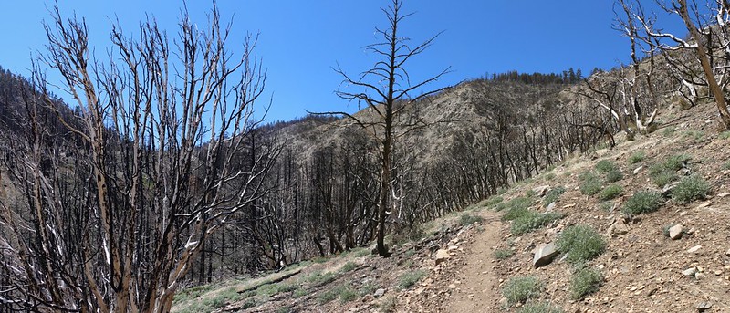
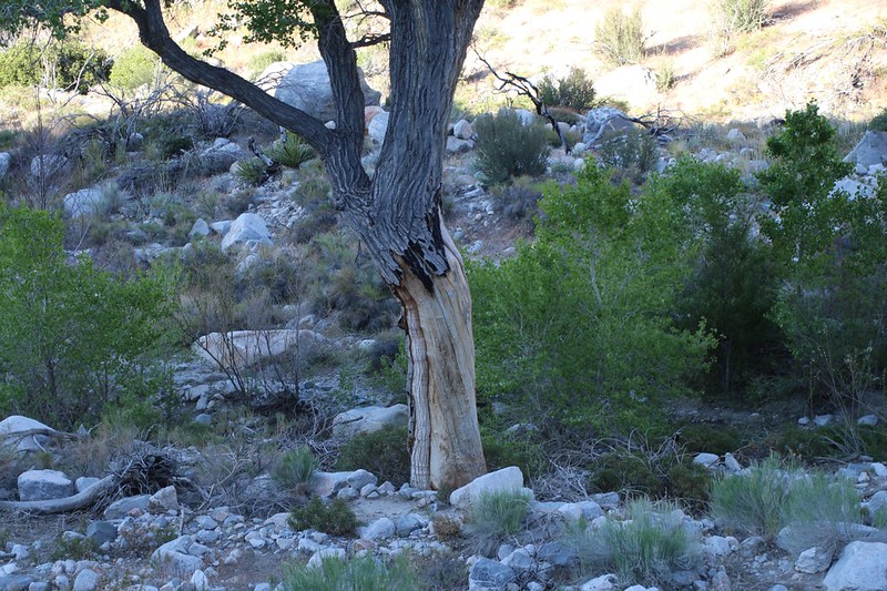
After two miles of easy hiking we arrived at the Lake Fire Closure Area. It was quite obvious, as there were burnt trees everywhere. It was sad to see so many dead pines, but at the same time it was amazing that any of them managed to survive and not get completely burned. Some areas had more live trees than others, due no doubt to luck and wind and the help of the firefighting aircraft. Some pines were dead yet still had their needles, while others had none, indicating that the fire had “crowned” and burnt them completely. Nearly all had carbonized scorch marks on the bark of their lower trunks. Trees that had been dead to start with had burned much more thoroughly, and we could see many charred stumps standing lonely here and there. Still other dead trees had burned completely, all the way into the ground, and the fire had even consumed their roots! There were deep holes in the ground where the stumps and roots had been. These root fires are the ones that often smolder and burn for weeks after the fire, and can even cause a fresh outbreak if the fire surfaces near another susceptible fuel source. All in all, it was very sobering to hike through this once-pristine pine forest.

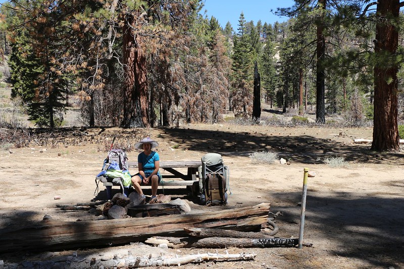
Eventually we reached the Mission Springs Campground at mile 240. This oasis supplied our first source of flowing water. We put down our packs at one of the picnic tables (even the trees in this small area remained unburnt, thankfully) and headed for the spring itself, which poured out of the ground from under an overhang into a blue bucket. With plenty of snow yet melting above us, the spring was flowing quite well, and we filtered water outside of the little cavern, as it was far too wet and splashing in there. Then we headed back to our packs and had an early lunch followed by a long nap. Well, Vicki napped while I read my book, and I also directed a few through-hikers to the spring. Since I’d just come from where they were all heading, my advice was sought after. The main advice: No water for the next ten miles, unless you liked melting dirty snow, or sixteen miles if you didn’t like drinking from the two shallow pools at mile 250. They were also happy to know that most of the 6000 foot uphill climb was finished.
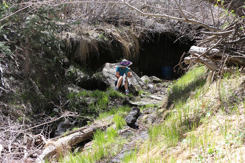
Video of the water flow at Mission Springs
After that, it was time to pack up and get hiking. Unlike the Through-Hikers, we had a lot of downhill hiking to do, and we were happy knowing that we’d be following the North Fork of Mission Creek (of which Mission Springs was the headwater) for the next fourteen miles, and that we’d have no problems with water availability for the foreseeable future.
Meanwhile, the trail continued down the canyon through the Burn Zone. Dead trees and black dirt still full of ashes surrounded us. But the creek kept flowing down below, so there were green areas here and there. As we descended we entered what must have been a peaceful oak forest, but it was all bare sticks right now. Still, if you looked closely near the ground by the stumps you could see the hundreds of new live shoots coming up all around. The oak roots hadn’t died! The forest was regenerating itself right before our eyes. Indeed, in a few short years there might even be shade along those sections once again. It was heartening to see this rebirth in action.
Video of the North Fork of Mission Creek as it flowed next to the PCT within the Lake Fire burn zone

All in all, it was pleasant to be hiking downhill, but some sections still managed to be steeper than Vicki liked. Her knees began to signal her that all was not well, or at least that there might be trouble soon if she didn’t do something. So we stopped and got out the two stretchy knee supports we’d brought with us. This is a crucial piece of gear when you know you’re about to descend 6000 feet in three days time. And it turned out that we’d gotten them on in time; by the next day her knees were fine, and no damage had been done.
There was one short section where the trail actually climbed a hundred feet or so. Vicki’s knees may have enjoyed it, but Vicki herself certainly didn’t. It was hot out there under the afternoon sun, and we had to whip out the sprayer for some extra cooling. The trail, for some odd reason, climbed up and out of the creek’s valley and crossed over into another parallel, tributary valley. Somewhere down in that valley was our intended camping spot, at PCT mile 235. We could see the grove of trees down in the bottom, lush and green with water, and it made us want to hurry. But the knees didn’t allow for any speed. So it seemed to take forever to descend the many switchbacks on the trail.
But of course we arrived at the “official” campsite eventually, and naturally, it was already full of tents! A large group of people had taken all of the good sites. Vicki and I looked at each other. We didn’t need words to know that we had absolutely no interest in camping near a crowd of potentially noisy kids.


Just the same, we put down our packs right in the middle of the campsite. That made them a bit nervous. Would we really try to pitch a tent in there? Vicki sat down and slumped over onto her pack. She was ready for a nap. But then I made them all happy by saying that I was going to head out to find a nearby spot. I also made them laugh when I said that I was doing it for their sake, as Vicki snored really loudly! This isn’t really true (maybe the snoring but not the loudness), but it certainly sounded better than flatly stating that I had no intention of camping near them and their noise at all.
I took a short walk and had very little trouble finding a flat spot for the tent about a hundred yards downstream. I went back and woke Vicki, then wished the crowd good luck on their big adventure.
Vicki and I had a peaceful dinner, and headed into the tent a bit before dark. Vicki slept while I read my book by headlamp, listening to the faint sound of the nearby creek. It had been yet another good day on the trail.
Day 3:
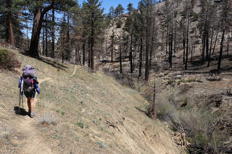
My phone’s alarm went off at 4:30am and it was still quite dark out. But that was all part of our plan. We knew that the weather was supposed to get quite warm that day (and even warmer the next) and meanwhile we’d be descending roughly 3000 feet of elevation, which meant at least another ten degrees of temperature rise all by itself. Our plan was to get as much hiking done during the cool of the morning as we possibly could. If need be, we’d find some shade and take a long siesta during the heat of the day, then continue to our planned camping location in the late afternoon. We had about ten miles to hike, a bit longer than the eight mile days we’d done so far.
It took us a bit over an hour to eat breakfast and pack everything up. We ended up leaving camp at about 6am, right at dawn. We could see the sun just touching the highest peaks up above us, but we were still cool down in the shade of the valley. What with the gentle downhill grade, we made great time, and the miles flew by.
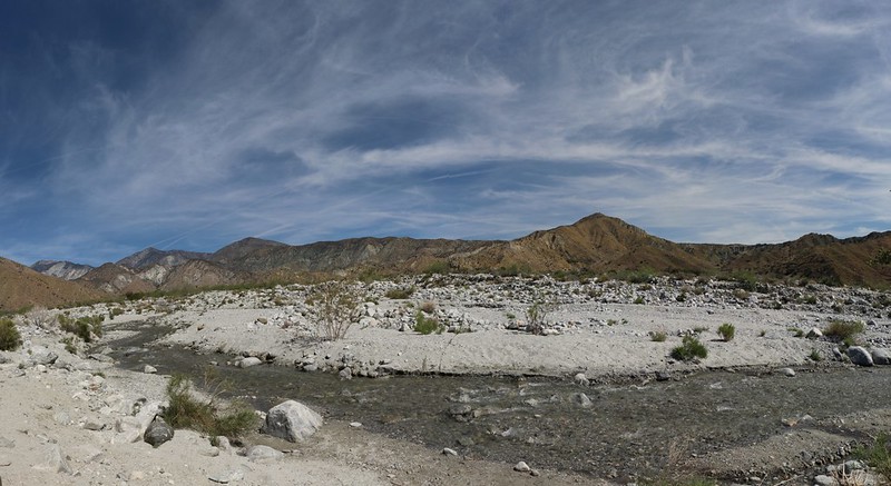
Along this section of the PCT, the trail made at least a dozen creek crossings, and they were all pretty fun. Some were mucky and muddy and very long, so that we had to step carefully on the high ground along the edges of the path through the dense willows and cottonwoods, while others were simple jumps or rock-hops with limited undergrowth. We enjoyed it all; in Southern California it’s always great to see running water.
As it turned out, our early-waking plan paid off: We had shade for a couple of hours. But eventually the sun rose high enough to shine down into the valley, and we emerged into the sunlight. This made things a bit warmer, but it was still early and the air had yet to get truly hot. So on we hiked.
Video of the North Fork of Mission Creek near PCT mile 234
LONG video as we crossed the North Fork of Mission Creek at PCT mile 232
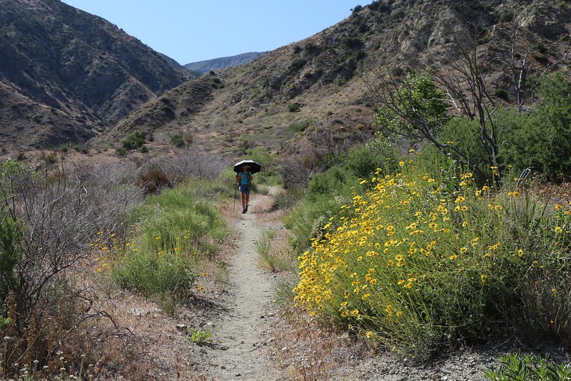
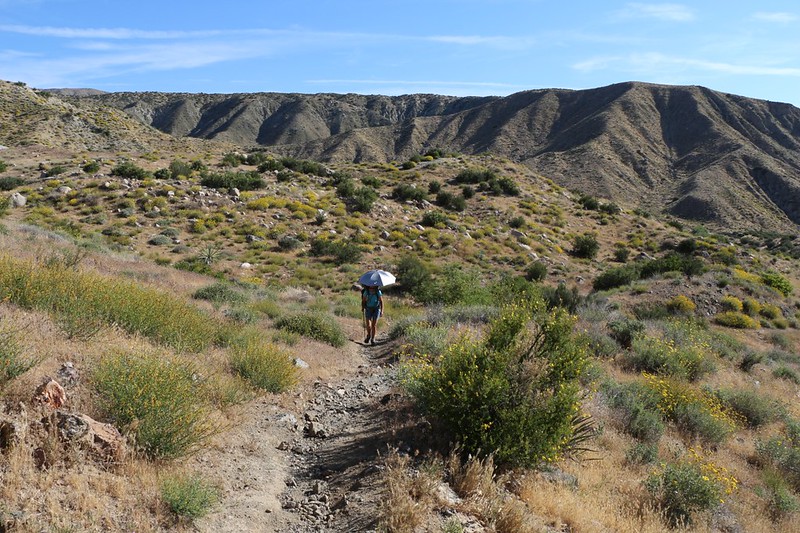
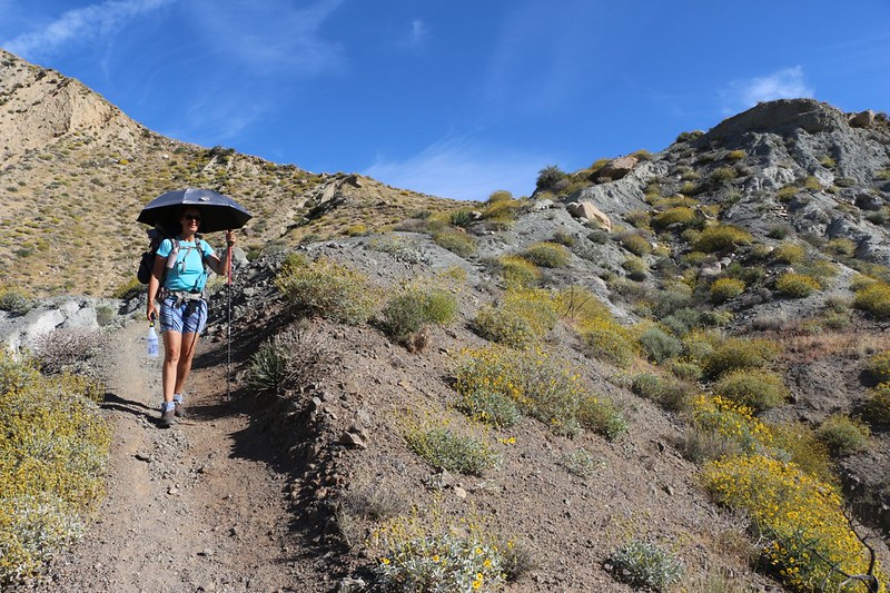
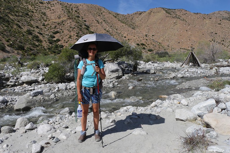
It finally got hot enough that we decided to stop for what might be called “preventative maintenance.” Vicki sat down and figured out how to attach her new ultralight silver-topped umbrella onto her pack. She didn’t want to hold it in her hand the entire time, so she figured out a way to rig it up to be easily adjustable using some cords and ribbon. She also got out our new squirt bottle, and kept it in a handy spot. Between the two devices, we thought we had a chance of hiking comfortably in all this heat. Vicki’s bodily thermostat doesn’t seem to work quite right, so we had to resort to artificial means to keep cool, whether it be adding portable shade from the sun or self-applied “perspiration” from a water sprayer. We just wanted something that worked, because there’s nothing funny about heat stroke.


All in all, the plan worked, and Vicki stayed relatively cool. Of the two items, she probably enjoyed the sprayer the best, primarily because its cooling power was instantaneous and easy to apply. The umbrella required much more fussing with the heights and angles on the pack, and you had to be extra careful when hiking near low-hanging tree branches. And lets not even talk about what happened when the gusty late-afternoon breeze kicked in!
As the day progressed, we began taking more rests. It was hot, and the shady spots were so pleasant, that it seemed such a shame to leave them behind. So we stopped when we wanted to, taking off our shoes and letting our hot sweaty socks dry out in the dry desert air, wiggling our toes in the cooling breeze. We spent time reading our books. Sometimes we even put on our camp shoes and stood in the cold creek water, saying “Aaahhhh!” to each other. We weren’t really worried, because we’d been smart and gotten such a big head start before dawn, so we had hours and hours to hike the final couple of miles.
Panorama video from our primary siesta spot on the North Fork of Mission Creek at PCT mile 228

And it DID take us hours! We took some very long breaks, and even a couple of naps on some soft sand in the shade along the creek under some tall cottonwood trees. These rests turned what would have been a brutal day into a fun one. True, plenty of the hiking was hot, but we had the sprayer when we needed it.
Eventually we reached the campsite at the crossing near mile 226. We planned to camp nearby. There were already some folks chilling in the shade at the main camp, so we decided to go a bit further if possible. The map showed us that if we hiked another half-mile or so we’d be at the point where the trail made a significant climb up and out of the Mission Creek drainage. Our plan was to tackle that long climb in the early morning, so camping as close as possible to it made the most sense.
Vicki wasn’t exactly thrilled about tacking anything extra onto what had already been a very long day, but she followed me anyway, and we found a good spot on an old roadbed just off the main trail. Unfortunately, the creek had meandered over to the far side of the valley at that point, so we had to hike part way back with our jugs and water filter in order to get enough for the night, as well as enough for the next six miles of tomorrow’s hike. We filtered two gallons total, and carried them back to camp.
After that, we set up the tent, cooked dinner, and set the alarm for 3:45am! We planned to be hiking in the dark the next morning, because we had to climb an east-facing slope. And we knew that the weather was expected to be positively roasting, with temperatures soaring into the 90’s.
Then we got into the tent and fell asleep right away, even before full dark. We’d need all the sleep we could get.
Day 4:
I think I must be getting used to waking up early, because I woke up about five minutes before the alarm was due to go off. I turned it off, put on my headlamp, and got out some caffeine pills (a convenient form of dehydrated coffee). I took one and gave a half to Vicki. We sat quietly in the tent for a while, our legs still warm under the sleeping bag. It took a few minutes before we were ready to talk about anything, and that was OK with us, so we sat there listening to the lack of noise outside. The air was cool but comfortable. We decided that making coffee and breakfast was too much trouble and took too much time, that what we really wanted to do was get packed and start hiking as soon as possible. We could eat later, if we really wanted to. And that’s what we did.
We hustled. We got dressed in layers, so we could peel them quickly as the air warmed up. We deflated the air mattresses and packed up the tent. We stuffed everything into our backpacks, and found a spot for every last bit of water that we had. The next water on the trail was at the Whitewater River, at mile 220, and we had to go up and over two ridges to get there. The first ridge, the one we were at the base of, entailed about 700 feet of climbing, which was significant. It took us about an hour to pack, which was fast for us, and we managed to start hiking by 5am.
It was still dark, with sunrise about an hour away. So we hiked up the trail using our headlamps, following the many switchbacks as we rose higher and higher above the valley floor.


Panorama video just before dawn from the ridgetop near PCT mile 225
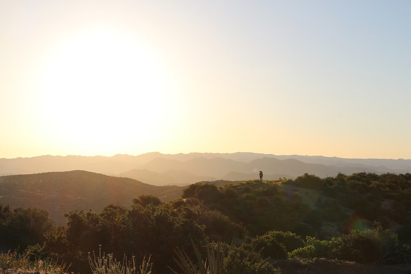
We took a short break up on top of the ridge, and we were seriously stoked to have made it all the way there before the sun came up. Within five minutes of sitting down it rose above the next ridge to the east, bathing ourselves and the hilltops around us in bright orange light. We laughed, as it felt good to know that our timing was perfect.
Just the same, its heat made us realize that we’d better get a move on, as we had five more miles to hike until the next water source. There was one additional uphill section, but it was small, and nearly all of the hike was going to be that same gently downhill slope that we knew and loved. You can take some long strides on a gentle slope, unlike a steep one where you have to watch your footing constantly. Easy hiking, and the miles fly by.

When we reached the first small valley, we stopped in the shadow of the big ridge for a break. This was where we found the last bit of shade we’d see for quite a while, so Vicki spent some time re-attaching her umbrella to her backpack. It was only 8am but the air was already getting warm.
The trail wandered down and around into the first valley and then hung a sharp right and began to climb once more. Unfortunately, we didn’t have the cool darkness to make it pleasant. Oh, no. It was a regular oven this time. The air was relatively still and our body temperatures climbed as we powered up the grade. We were sweating out our precious water, or at least I was. Vicki was spraying herself liberally with the squirt bottle every minute or two, and seemed to be doing OK. I waited until she caught up to me and said “How about spraying me?” She was happy to comply. Soon, my long pants were soaked, as were my arms, and I felt immediate relief as a cool breath of air passed by. Oh, yes, that sprayer was passing the test with flying colors! It was truly amazing how good it felt.

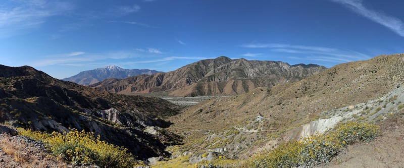
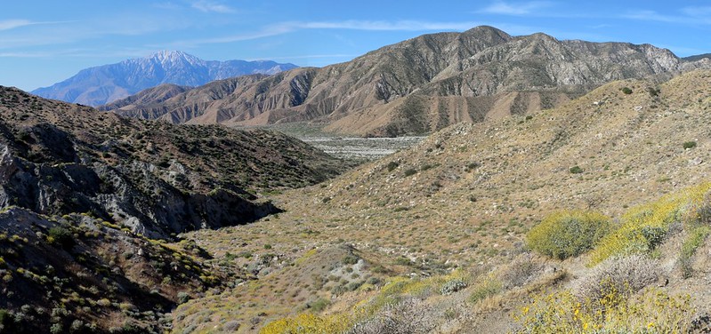
We crested the small ridge and were rewarded with stunning views. San Jacinto Peak towered in the distance to the south, and down below us was the broad valley of the Whitewater River. All along the trail (at this elevation) were countless thousands of flowering shrubs. They lit up everything, and lined the canyon walls, waving in the breeze as we descended through a cloud of vibrant yellow. It was 2017, the year of the California Superbloom.
Eventually we reached the valley floor. Here the flowers had already shriveled and the grasses were rapidly going to seed, turning brown for the long, hot summer. We were too late for the big bloom down here. But that was OK.
We followed the trail, slogging through the deep sand of the wash. It was hot, and slow, and tiring. And there was no breeze. Vicki and I took turns squirting each other. It was kind of fun, really. But it was too hot to laugh very much. It was a very broad wash, and we imagined what it must have been like during the flash flooding that happened a few months ago. Just the same, it didn’t take all that long to cross, and soon enough we arrived at the Whitewater River itself, which was located on the far side of the wash. It was flowing strong and clean and clear. All in all, it was a joy to behold.
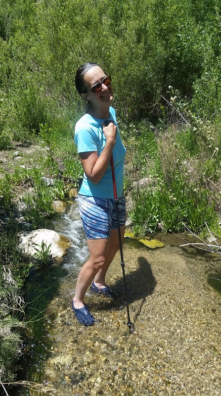
The river was also a bit larger than we’d expected. True, there were folks that found a way to rock-hop their way across while keeping their boots dry, but Vicki and I knew better. We wanted to cool our feet right away! So we stopped and put on our water shoes, then crossed the river the slow way, by walking down it and oh-so-gradually making our way across. Or at least I did. My feet were so happy that I didn’t care if they went numb from cold, and I didn’t leave the river until I arrived at a large shady spot next to a towering boulder.
Video of the two of us crossing the Whitewater River on the PCT
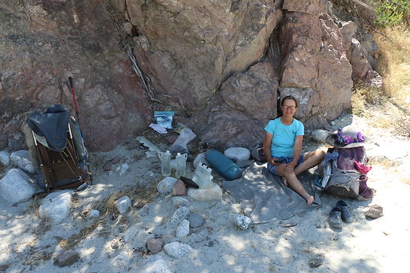
This shady zone was destined to become our siesta spot. Our plan was simple: We’d lounge around in the shade for hours, if necessary, waiting until late afternoon, until the sun got lower and the temperature began to drop. It was much too hot out for hiking, at least for us. This method had served us well on a PCT hike last Summer, so why not repeat it?
True, the river had cooled us down, but that wasn’t the end of our problems. We were also quite hungry and thirsty and tired. So we set out to cure those ills. And we had all day to do it. We ate lunch, we drank water, and we took a nap. We ate some snacks, then filtered some more water, and took another nap. We read our books, lounging on the soft sand of the riverbottom. The river ran past us, just far enough away that its noise was soothing. As the afternoon dawdled by the air got hotter, but the breeze also picked up and kept us cool. It was truly idyllic.
It was also true that we only had two more miles to hike and we’d be at our car, but we had no interest in ending the trip prematurely. Why leave this beautiful spot, when the alternative was being stuck in freeway traffic for the next three hours? Surely, we could wait just a little bit longer.
So we waited. Other hikers arrived as the afternoon progressed, almost all of them through-hikers heading northbound. All of them stopped here for a break. Some put on swimsuits (ultra-light, of course!), bathed in the river, and sunned themselves on the sand. Others sat down next to us in the shade. Another set up his tent and declared that he was spending the night right there.
We hung out with them for a while, and it was truly inspirational to see how they worked together and helped each other on their respective journeys. One hiker whose trail name was “Sticks” had just spent a couple of days hiking far up the Whitewater River seeking a tall waterfall. He was back here because he no longer had enough food to make it all the way to Big Bear City, and was going to walk all the way south to the freeway to resupply. A fellow hiker called “Jumper” started digging in her pack, and began handing him packets of food. She apparently had more than enough and was willing to share. I didn’t have much left but I also threw an apple dessert into his new stash. Sticks got more excited by the minute. He would be able to continue onward! He was a fast hiker and wanted to catch up to some of the other folks he’d met earlier on the trail, and now he would have the chance to do it. Seeing good people doing good things really made me want to be a through-hiker, too. It was the kind of camaraderie that makes the PCT even more awesome.
Eventually, however, we had to bid them goodbye. The afternoon was waning, and even though the temperature was still in the 90’s, Vicki and I decided that we really needed to get going, or else we’d be driving home late into the night. We would use our water sprayer to beat the heat. And that’s exactly what we did. We sprayed each other every five minutes for the next hour or so as we hiked the final two miles to the Whitewater Preserve.
The preserve wasn’t actually ON the Pacific Crest Trail, but it had a decent side-trail of its own. Not only did they allow us to park our car there for free, they also welcomed the through-hikers and allowed camping on their property. Very generous. And the place, which used to be a trout hatchery, was truly an oasis in the desert, with huge trees, green lawns, and large pools of water.


We hiked onward to the car, across the big wash once more. I don’t know why, but it seemed that our legs and bodies knew that this was the end. They got more and more tired as we approached the parking lot, as if they had no more energy left. We reached the car and discovered that we had misjudged the angle of the afternoon sun the other morning, which caused us to park in the wrong spot. The car was sitting out there, baking in the sun. I put down my pack in the shade, and got out the car key. I jumped in the car, immediately opened the windows, then backed up into a new spot under some big trees. I left the car running with the air conditioner on full blast, then got back out and dealt with my gear. We had stashed some special snacks and drinks in the trunk, so we grabbed them greedily, then sat down in the comfy seats and relaxed in the cool breeze. We were finished hiking, but we still didn’t really want to go home, so we didn’t. It was very peaceful there.
Eventually, of course, it really was time to go home. So we did. But not before we discussed our trip, about how almost everything had worked out well, and that nothing important had broken or gone wrong. I’d even managed to survive without my forgotten foam butt pad. And both of us had to agree that the absolute best part of the trip was that we were able to hike this section in the downhill direction. Yes, it was truly great being PCT Section Hikers, because we had our choice. And let’s face it: Downhill is the only civilized way to hike.
For more photos and videos of the hike see my Flickr Album
For a Topographic Map of the hike see my CalTopo Page
