On the eighth day of our nine day backpacking trek, we hiked southbound on the Pacific Crest Trail from Holman Pass to Windy Pass, climbing two thousand feet in eight miles. This was one of our more difficult days this trip.
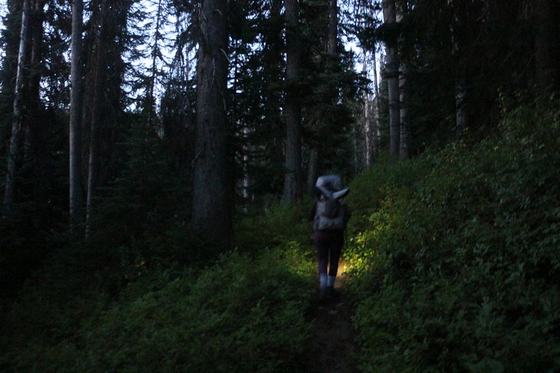
That’s why we woke up before 3am. We packed quietly in the dark, so as not to wake our neighbors, then tiptoed through the Holman Pass campsite with our headlamps turned down low. No need to disturb anyone, and we’d been on this section of trail already, so there was no need to take photos, either.
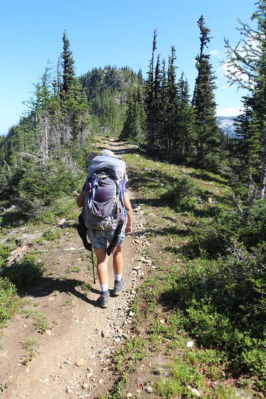
That didn’t stop me from snapping a couple. Luckily my headlamp had a super-bright mode which helped my DSLR camera’s persnickety auto-focus. We turned right at the trail junction, and trudged along, uphill through the soggy forest, and watched as the dawn’s first light began turning everything from gray to green.

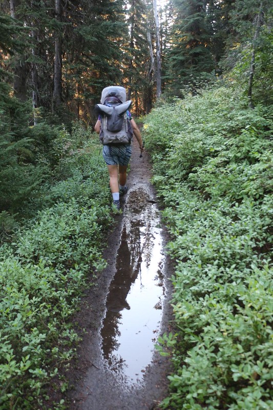
By the time the sun came slicing horizontally through the trees, we were already most of the way through the first one thousand foot climb. The trail flattened out, and Vicki was much happier. We cruised right along. The forest and air had just received a thorough cleaning, and the smell of the pines was heady. Not surprisingly, the mosquitos also came out, but not too many, and we applied some DEET to repel them. That stuff is great!

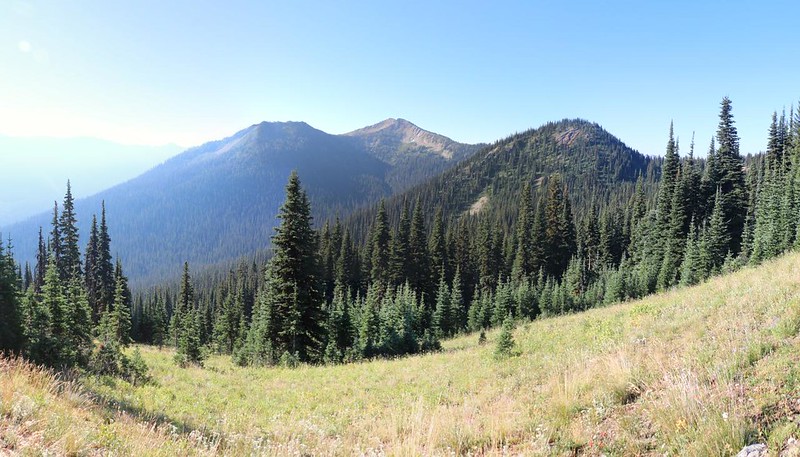
We continued on, and slogged our way up another 400 foot section of trail, arriving at the nice campsite on the Devils Backbone. We stopped for a short break in the sun, but didn’t stay long as the ground was still muddy. After that, the trail was relatively flat, climbing uphill in small spurts, interspersed with mellow downhills, as it traversed along the eastern flank of Jim Peak. We always hate going downhill in the middle of a long climb, as it seems like such a waste of energy, but the easy slope of the trail made it hardly noticeable.
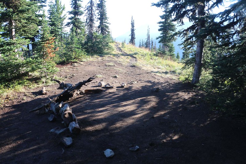

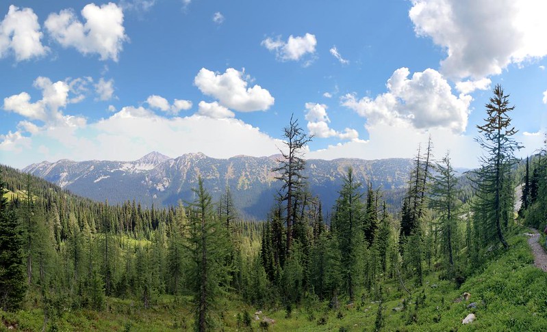
When we arrived at Jim Pass we could see the final ridge ahead of us that I wanted to climb. There was also a nice campsite just before that, if Vicki wasn’t feeling up to yet another 500 feet of climbing. It was nice to have a secondary plan, which made Vicki less anxious. By this time, it was getting hot in the sun, and that climb might prove difficult. But meanwhile, the trail traversed onward in its non-threatening (and non-sweatening) way. We continued on toward the next milestone, Foggy Pass.
As we hiked along, we met a northbound PCT thru-hiker. She was fast, and started that morning at Harts Pass. She happily informed us that they had re-opened Harts Pass Road! Now that was good news, indeed, as our car had been stuck up there. It was nice to see the forest service fixing a road, rather than closing it for the season, but I suppose they had no choice when people are trapped on the wrong side of a big washout. We were heartened by this. Tomorrow we would arrive at the pass, and we had a pre-paid motel reservation down below in the town of Mazama. The good news lightened our steps after that.


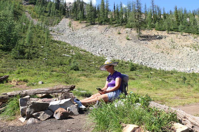
We arrived at the Plan B campsite, and it was still mid-morning. We stopped for a boot-off break while Vicki decided what she wanted to do. We could see the offending ridge off to our right. Did she really want to climb it today? She said yes, but not until after a nice long break. I was overjoyed. The ridge was about a mile away, and our old campsite on the other side was another half mile. We could do this. After the break, Vicki soaked her hair and clothing with her spray mister in order to stay cool, and away we went. Excelsior!

After a break on top for some photos, Vicki was ready to continue on, downhill into camp. There were a few other hikers taking a lunch break there, lying on their foam pads in the grassy area, napping in the sun, or simply lounging around. We walked beyond them, up to our old camping spot, where we stayed on the first day of the trek. We put down our packs and I got out our books and some lunch. We, too, lounged around. It was the proper thing to do.

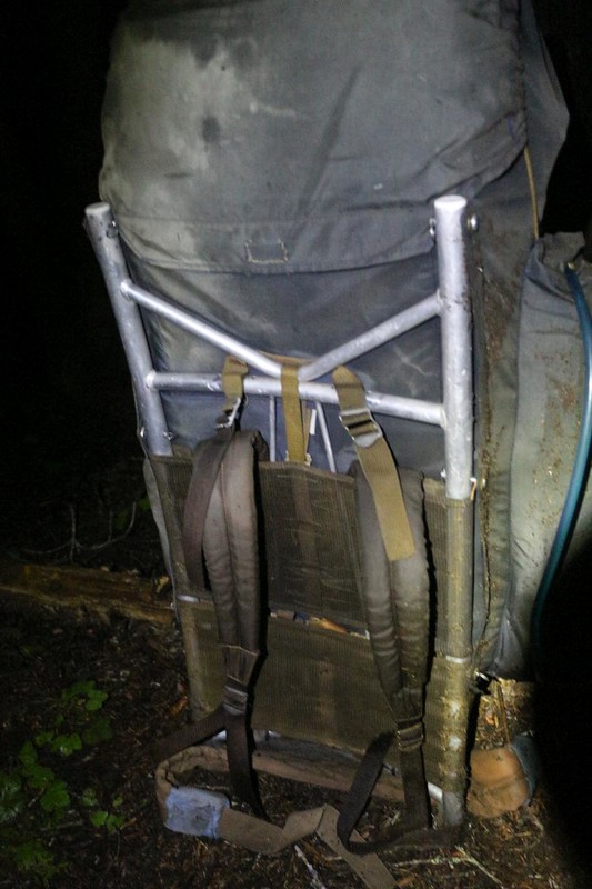
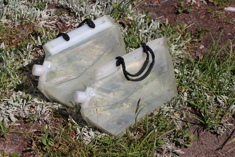
I hadn’t bothered getting the tent out yet. The longer we sat there, the more we remembered how hot it had been that day, especially inside the tent under that roasting noontime sun. We weren’t looking forward to doing it yet again. This is the main problem with waking up super-early to hike: You arrive at your destination super-early, as well. I checked out the map on my phone. The PCT app said that the campsites at Windy Pass were less than a half mile away. Downhill. And they were hidden in a grove of pines, which meant shade. Plus, we’d be closer to the car tomorrow morning. Did Vicki want to try, for one last time today, to carry that heavy pack? She wasn’t thrilled, but at least she entertained the idea. I finally won her over when I told her that we’d have to get our drinking water here, and that I would carry both gallons. So we put our packs on and headed for Windy Pass.

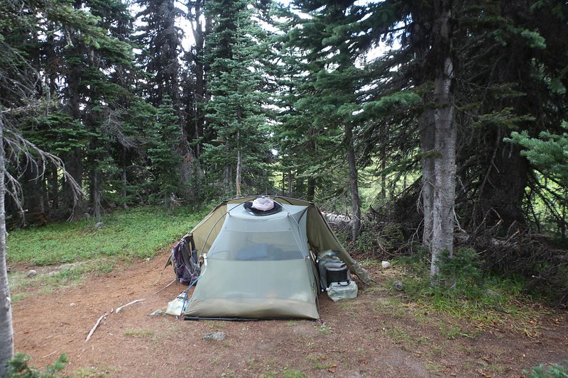
It didn’t take long to get there. We headed left, into the trees, and put down our packs in the first spot we saw. There were plenty of tent sites in there! We walked around, checking them out, and eventually picked one with good drainage and plenty of shade. It looked like the cumulus clouds were building up again, like yesterday, and we didn’t want to get flooded out. I got out the tent, which was still soaking wet. We turned it upside down and spread the tarp out over some bushes to dry. It didn’t take long, but we were also in no rush. Except that Vicki really wanted to take a nap in a bug-free environment. Soon enough, we had the tent set up and the air mattresses inflated. We both went inside the tent, and I read my book while Vicki napped. Life was good again.


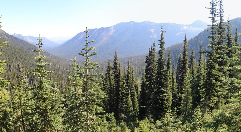
As we hung around, the clouds continued to build up. Soon, they blocked the sun, and their bottoms were getting quite dark. Even though it wasn’t dinnertime yet, we decided to cook ours anyway. We didn’t want to get stuck in the tent like yesterday, waiting for the rain to end. We put away the stove for the final time (tomorrow’s breakfast was a no-cook meal) and walked north to eat our supper, to a spot where we could look down into the Pasayten River Valley. When in doubt, we will always choose a nice view to eat by.
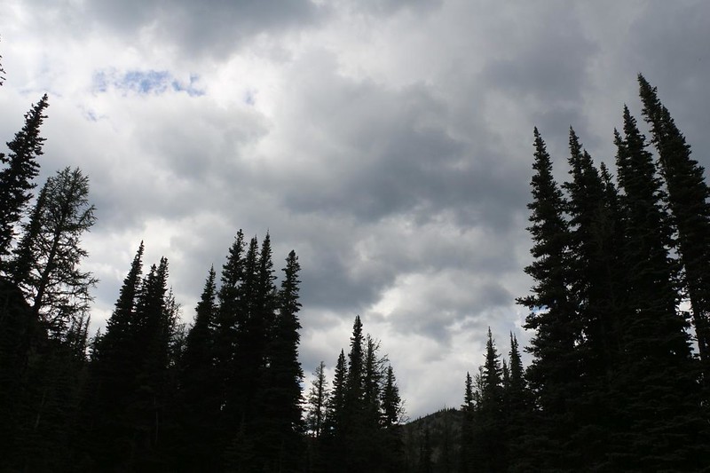

Afterward, we heard thunder booming in the distance. We waited to see what would happen, but no rain fell on us that afternoon. We think that it probably rained again at Holman Pass, just like yesterday. Some spots seem to attract thunderstorms. Or maybe some mountains tend to generate them, like Mount Whitney, which was known for making its own weather. The good thing (for us) was that there was still blue sky to the south, as that’s where Harts Pass Road was located. We didn’t want any washouts to close the road today!

As it turned out, even though there were plenty of camping spots nearby, we were the only ones there that night. But that was OK with us. We only had four miles left to hike tomorrow, with about 800 feet of elevation gain. This wasn’t much, and even Vicki wasn’t worried about it. We decided to wake up whenever we felt like it; no alarms for us! As evening drew closer, most of the clouds dispersed. We took a brief walk in the meadow to the south of the pass, as our evening constitutional, then headed for bed when the air grew cool. We were quite tired thanks to getting up so early, even including the afternoon nap. While we lay under the down quilt, we began to think about our plans for tomorrow, for what we would do in the civilized world, and what we would eat. So many choices! But for now, we would be content with one more night in our cozy little home away from home.
For a topographic map of the hike see my CalTopo Page
For LOTS more photos of the trek see my Flickr Page
 << Back to Day 7 Onward to Day 9 >>