I hiked solo on the Pacific Crest Trail from the Fuller Ridge Trailhead in the San Jacinto Wilderness down to Snow Creek, then across the desert at San Gorgonio Pass to the Whitewater Preserve near the Whitewater River.
This trip was planned fairly recently, when I realized that these 28 miles were the only parts of both PCT Section B and Section C that I hadn’t yet hiked. I had originally planned never to hike this piece of trail, as the first part entailed a blistering 6000-foot knee-busting descent into the desert, and the second part crossed the busy I-10 corridor in the middle of that very same hell-roasted desert. Life was far too short to submit myself to such nonsense. Then I finished the northernmost part of Section C in April, and I suddenly felt this nagging sense of incompleteness. I could bag two sections with one hike!
So I contacted Florian at the San Jacinto internet forum, and he replied, stating that the PCT was closed due to the 2020 Snow Fire, and Black Mountain Road was still closed for Winter. I sighed with relief. I didn’t have to hike it after all, because I couldn’t! And then a few weeks later I got yet another email from good old Florian. They had reopened the PCT, and the road was also open, but it still had snow and ice on the final, north-facing mile. Hmmm. This was doable. And so I waited, checking the weather for a good window, as I absolutely wasn’t going to cross the desert with temperatures in the nineties. A couple of weeks later, my window appeared. There would be one day in the mid-seventies, bracketed by two days in the eighties. I decided to hike downhill on the first day, then cross the desert on the low-temp day. If something went wrong, I would continue on the third day. And that was my plan. All I needed was to beg my wife to pick me up at the far end. Luckily, she agreed, after I promised her daily foot rubs for the rest of the month!

I stealth-camped in the back of my car in the trailhead parking lot. There were other people camping at the yellow post sites, and both groups had campfires lit. Very naughty. But I wasn’t that worried, as campfires almost never get out of control, and I certainly wasn’t going to make a stand and mention that this was currently forbidden by the USFS. Personally, I thought that the smoke smelled kind of nice. And then I went to sleep early.
Day 1: Fuller Ridge to Snow Creek
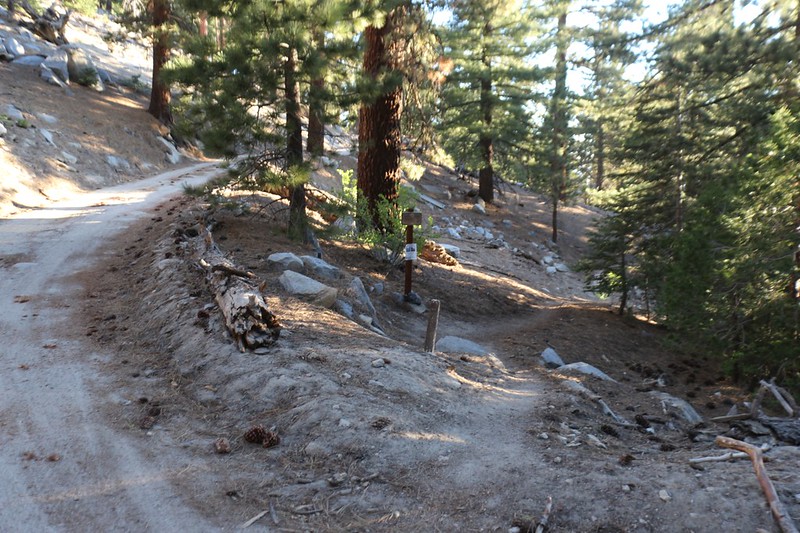
The next morning I woke up at first light and started getting ready. As I headed out, a PCT Thru-Hiker came into the area, so I offered him some water. I had plenty in the car. Then I started hiking, and discovered a number of other backpackers camped near from the trail. I walked back to my car and distributed some more water. It was my way of providing some “Trail Angel” blessings.
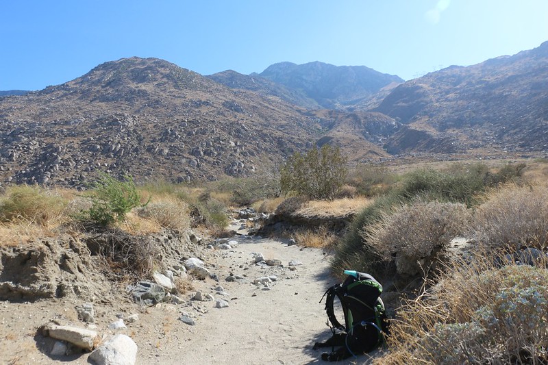
And then I started hiking downhill in earnest. It was a long fifteen miles and 6000-plus feet to the desert floor and the next water source near Snow Creek.

I met up with two PCT Trail Angels on the way. They had driven down the crazier section of dirt road beyond the Fuller Ridge side road. I’d never dared to go down there in my own car, as it isn’t plowed, to my knowledge. I declined the Magic, since I’m not a proper thru-hiker, just a section hiker, and told them about the other folks that should be heading down there soon. The PCT certainly has brought a lot of excellent people together over the years, and made lasting friendships and memories for most of them.


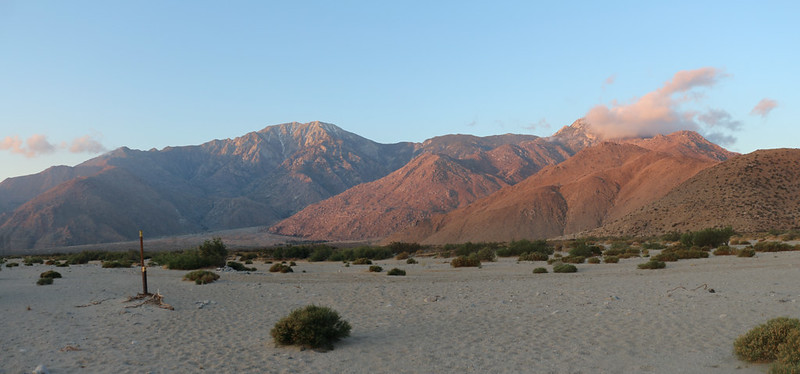
Soon enough, I reached the Snow Fire’s burnt zone. Dead, blackened branches poked up all over, but there were also plenty of wildflowers, which is typical after a wildfire. The PCT was recently reopened in the burned area, but, technically, only the ground under the trail itself was opened. No camping was allowed. My original plan had been to hike the thirty-odd miles in three ten-mile days, with the first night spent camping up on the ridge, and the second across the valley beyond the San Gorgonio Pass. So now I had to do it in two fifteen mile days. My feet were not amused.
Full panorama video of the burnt zone


I was well-past the ten mile mark by this point, and my feet were getting toasty. It was hot in the sun, and the sand under my boots was hot, too. I stopped more than once to air out my sweaty socks, and to keep on drinking that four liters of water I was carrying. If things worked out right, I wouldn’t have much left when I got to the bottom.


After fifteen long miles of hiking, I finally arrived down at the desert floor along the Snow Creek outflow wash. I took off my pack by the water fountain and got out my empty containers. I had already drunk four liters of water, and I was still thirsty. The water fountain was totally stupid. When you turned it on, the water shot four feet into the air! And the sign said that it wasn’t potable, that I had to filter it or treat it in some way. So why was it a drinking fountain? It made no sense, and it turned out to be quite difficult and time-consuming to fill up my two-liter water bag (twice). Far more water was wasted than went into the bag, because it didn’t aim downward or sideways like it should have. Those idiots really needed to rethink this fountain idea. And fix it by installing a proper faucet. But I don’t think they will, as I believe that they don’t really like hikers, and wouldn’t let them on the property except that they were forced to by the PCT’s Right-of-Way.

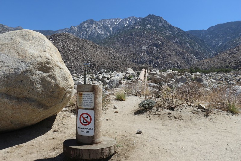
Their attitude toward hikers was exemplified by the Desert Water Agency’s security car, which was hovering just up the road from the faucet. It made me feel uncomfortable about camping nearby. It was intimidating. So, after collecting my gallon of water, I put on my pack and continued down the road, the pain in my feet notwithstanding. I was thankful for the water, but I’d be even more thankful if they changed not only the faucet but also the agency’s senior management that treats innocent hikers like terrorists and/or suspected criminals. Shameful.
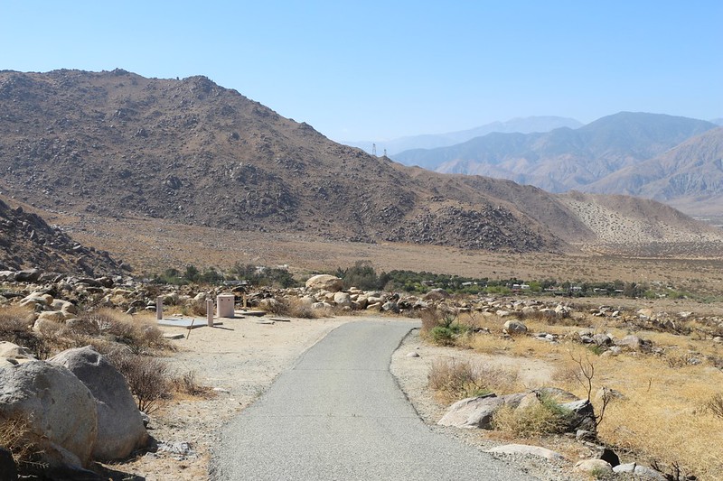

After I passed the village, I was out on the desert floor, and the wind was quite strong and gusty. It certainly wasn’t optimum for tent camping. But I needed to stay somewhere. About a half mile beyond the village, a small wash, about three feet deep, crossed the trail. It had a flat, sandy bottom. Would it work? I’d already hiked an extra two miles thanks to the DWA, so I really wanted it to work. I tested it by sitting down on the ground. Yes, there was definitely less wind down there. It seemed that the main blast of air passed by up above, leaving a zone of calm in the wash. Relatively speaking, it was calm. But it wasn’t really calm at all. Just the same, there wasn’t anything better, and I was SO done with hiking.
So I carefully set up the tent, using rocks to hold the stakes in the loose sand, and to keep the corners of the tent from lifting up and blowing away. I put my gear inside and climbed in myself. I zipped up the door. It felt great to be out of the wind. It was mostly calm within, even though the tent itself was shaking. I got everything ready for the night, and ate a cold dinner (I didn’t bring a stove to save weight). I also drank another liter or more of water. I drank over five liters that day, and I was still dehydrated. I think the hot sun and the wind just sucked the moisture right out of me. I brought out my book and read it until it got dark, then turned off my headlamp and tried to sleep.
Video of my Copper Spur UL1 tent in gusty winds

I was really hoping that this spot would work out for me, but let’s be honest: It was horribly windy all night long. My tent shook and jumped and flapped continuously. It would have blown away entirely if I hadn’t weighed all six stakes down with large boulders. I quickly learned to curl up in the dead center of the tent so the sidewalls wouldn’t whack into me and wake me up. The snapping noise of the tent and the load roar of the wind up above never really let up. I think I got a few hours sleep after midnight, but it surely wasn’t enough.
Day 2: Snow Creek to the Whitewater Preserve
Just the same, I had set my alarm for 4am, and when it went off I figured that I might as well wake up since I wasn’t getting much sleep anyway. I ate some pop tarts for breakfast and put away my gear. I moved one boulder and the tent suddenly took off for parts unknown! Or it would have if I hadn’t gripped it reflexively with one hand. The whole tent was flapping and waving up in the air as if I’d grabbed a giant eagle by its foot. It took everything I had to wrestle it back to earth again. I replaced the upwind boulders, none-too-gently, and proceeded to unclip the tent and tarp from the poles. I knew that there was no hope of rolling it up properly, so I simply grabbed each section and wadded it up the best I could, then crammed it into the stuff sack. It was still dark and I had to feel around in the sand for the stakes that had been flung into the air. I’m pretty sure that one of them is gone for good. Better that than chasing a flying tent across the desert at thirty-plus miles an hour!
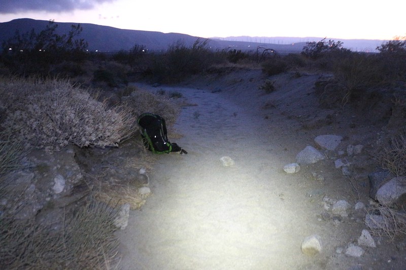

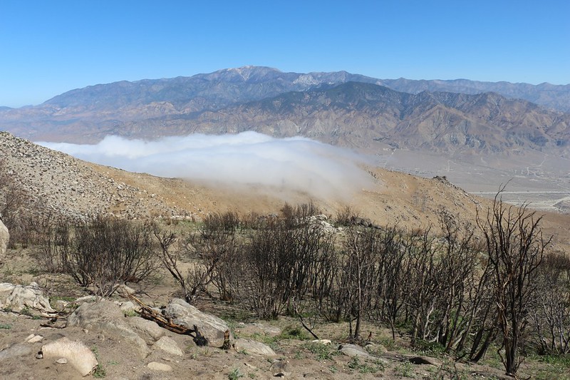
That morning, the marine layer was blowing in solid from the L.A. basin, and there was plenty of cool air along with it. The clouds evaporated further east when they hit the dry desert, but the pass was full of chilly, moist air. Just the way I’d planned it. Except for the windy part, that is. Big oops!
After hiking two and a half miles, I arrived at the Interstate 10 overpass that I’d seen the day before. The freeway, Route 111, and the railroad tracks all crossed the wash at that spot. Many of the thru-hikers I’d met the day before were camping under the bridges. They were just waking up when I arrived. There was a cooler full of Trail Magic and extra water jugs on the side, generously provided by “Mama Bear,” a trail Angel of some renown. I didn’t touch the magic, but I was happy to fill up two of my four liter containers with water. I’d really gone through a lot yesterday. I spoke with the hikers, and they said that there was hardly any wind under there, and that the traffic noise wasn’t all that bad. It made them feel better when I described my miserable night. And then I headed onward.

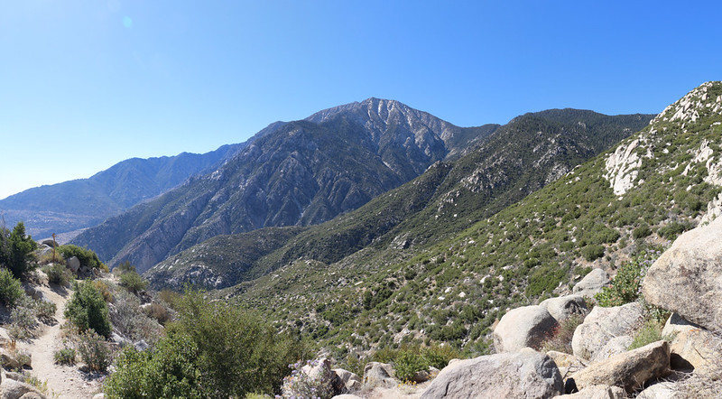
There was a lonely housing development just north of the freeway, and the PCT skirted around it to the north and west. Some of the land was private, and other areas were part of the Sand to Snow National Monument. The trail climbed gradually up a long curtain of ground, and the views looking back at San Jacinto Peak were quite pretty in the morning light. As were the marine layer clouds that continued moving eastward overhead.


I eventually made it to the upper slope above the pass, and arrived at the Cottonwood Trailhead parking lot. This was where I had intended to camp on the second night, under my original plan. I was going to stash a gallon of water there beforehand. But not now. I had all the water I needed, thanks to Mama Bear.

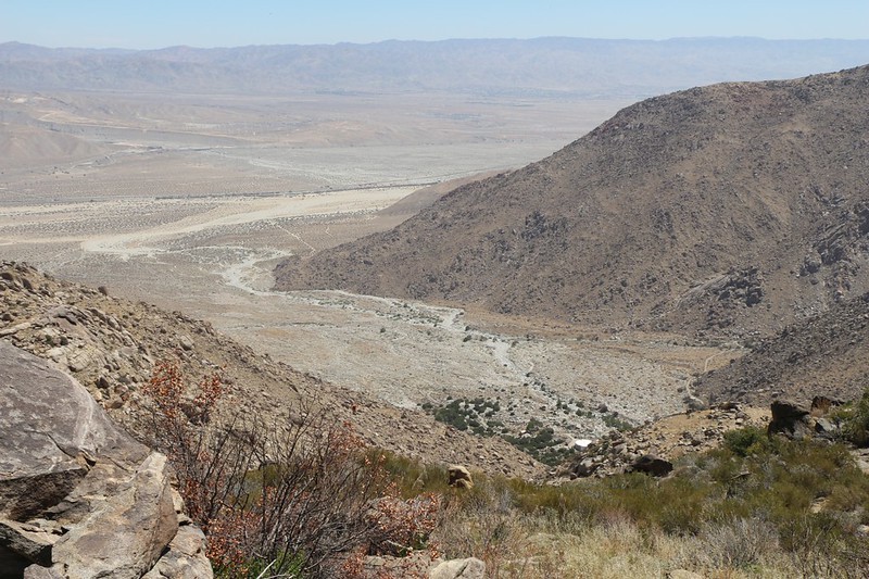
The trail entered a long, east-west canyon and soon the view of San Gorgonio Pass was over. Cell phone signal also disappeared, which I realized too late. So I got out my InReach satellite device and let Vicki know my progress. I told her that I would surely be at the destination well before 2pm. Meanwhile, the incessant wind blasted directly up this canyon, but luckily it was at my back. It’s almost as if it wanted to help me up the hill!


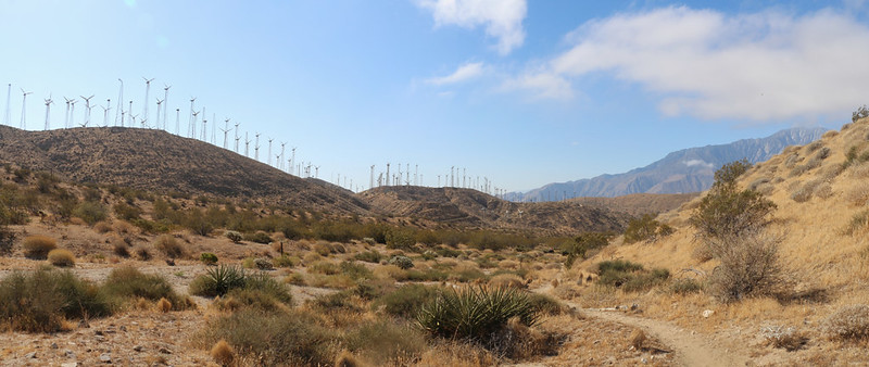
This canyon headed east toward the Mesa Wind Farm. I noticed that most of the windmills up above on the ridges were the smaller, older versions. None of them were spinning, and many had no blades or generators. They were obviously being decommissioned one by one. Maybe they’d be installing the modern, giant-sized towers up there next. More green power!

Eventually, the canyon turned to the north and the wind grew less intense. Clouds continued to blow over the ridge to the west, but they evaporated just as rapidly. I climbed on up and out of the long canyon, went over a saddle, and headed northeast, down into yet another canyon. I was happy to notice that this one eventually drained into the Whitewater River.

Panorama video of the upper canyon with clouds forming and the breeze blowing

My tired feet wished that the trail would head downhill, all the way to the Whitewater River, but it wasn’t meant to be. It went up and down just like the PCT always does. I met a trail crew along the way, and thanked them for the service. Then it was up and over yet another ridge before the final drop down into the big valley.


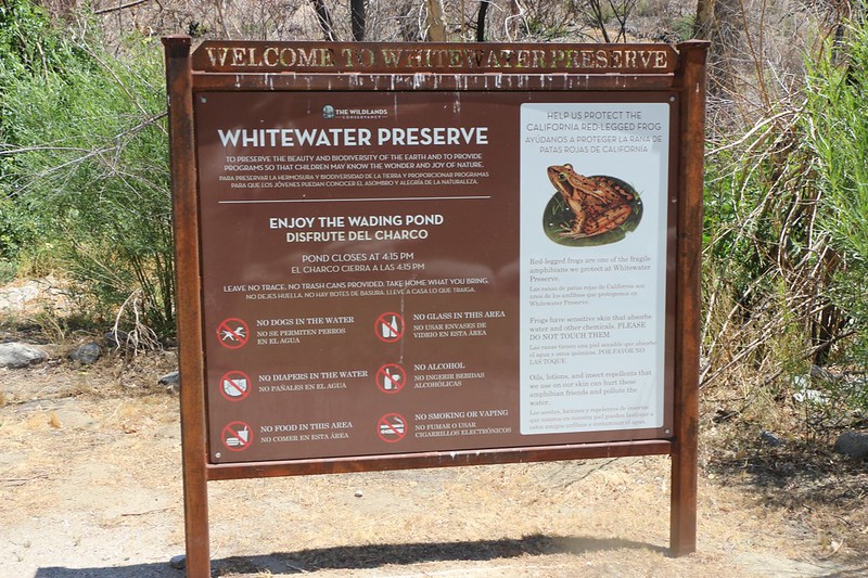
After reaching the valley floor, I took the half mile side trail toward the preserve. I was finished with the PCT for this trip. This was the place we’d turned off back in July 2016 after hiking down the long route from Onyx Summit, near Big Bear Lake, in the north. It had been a brutal 97 degrees down here that day. It was so much nicer now! I took off my pack and sat down next to the river, then removed my shoes and socks and simply soaked by poor feet in the wonderfully cold water. I soaked them for a very long time, until the skin on my toes was wrinkling. They really needed it.
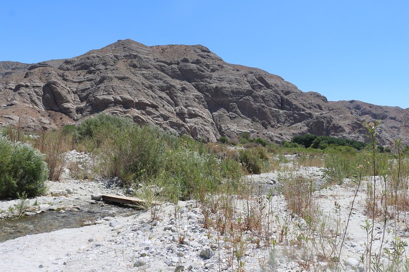

There was no cell phone signal at the preserve, so I texted Vicki to come and get me via satellite, using my InReach. And then I hung out in the shade of the big cottonwood trees and generally enjoyed myself. That place is truly an oasis in the desert!
I had to wait a couple of hours, thanks to drizzly rain on the L.A. side causing traffic issues, but eventually I was picked up. We drove back to Fuller Ridge where I started. We had thought about staying in the car that night and day-hiking toward San Jacinto Peak from there the next day, but my feet were totally shot. I had three blisters, which was very unusual for me, and I decided that the best thing to do was to head on home and keep off my feet for a day or three. And that’s what we did.
Just the same, I was quite pleased with myself. I had cranked out two very long and difficult days of hiking. And, most importantly, I had finally finished hiking PCT Sections B and C! It was a done deal. Now all I had left was the last part of Section D, and Southern California would be complete. But further challenges remained: There was still that small matter of the other 1800 miles of PCT that I hadn’t hiked. Ha ha! At least there’s something left for me to look forward to!
The rest of the trip’s photos and videos can be found on my Flickr Page.
For an interactive topographic map of our hike, including GPS Tracks, please see my CalTopo Page.
