I did a solo section hike on the Pacific Crest Trail, starting at Cloudburst Summit, heading south, and ending at the Burkhart Campground on Angeles Crest Highway. This hike was interesting in that I used an eBike to deliver myself to the uphill trailhead, and picked it up afterwards using the car, which saved me a long road walk.
I drove up Highway 2 from Glendale late on a Sunday evening. There was almost no traffic at that hour, especially since the Angeles Crest Highway was still closed due to snow from Vincent Gap to Islip Saddle. I thought about parking at Cloudburst Summit, but it was too windy up there, so I drove down the hill to a larger spot near the Buckhorn Campground. The pavement was dry, but there was plenty of snow on the surrounding hillsides, and it was shining bright under a big moon. Very pretty. I crawled into the back of the car and slept just fine in my 20 degree down bag. It’s a lot nicer to be inside a car on a cold, breezy night. Technically, I was “Stealth Camping” where no camping was allowed, but that didn’t stop me. Where else was there? Everything was closed for Winter.
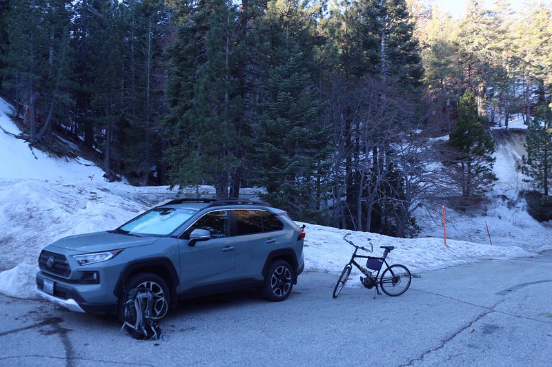
It was 42 degrees that morning, but at least the gusty winds of last night were gone. It was supposed to get into the upper 50’s later on, which sounded like perfect hiking weather to me. After eating a couple of pop-tarts for breakfast, I got my small daypack in order, took my old electric bike off the bike rack, and locked up the car. It was time to ride! The plan was to ride it up to the beginning point of the hike, about two miles, but with 500 feet of elevation gain. Was I being lazy? Yes, I was being lazy. And the eBike powered me up that hill fast!

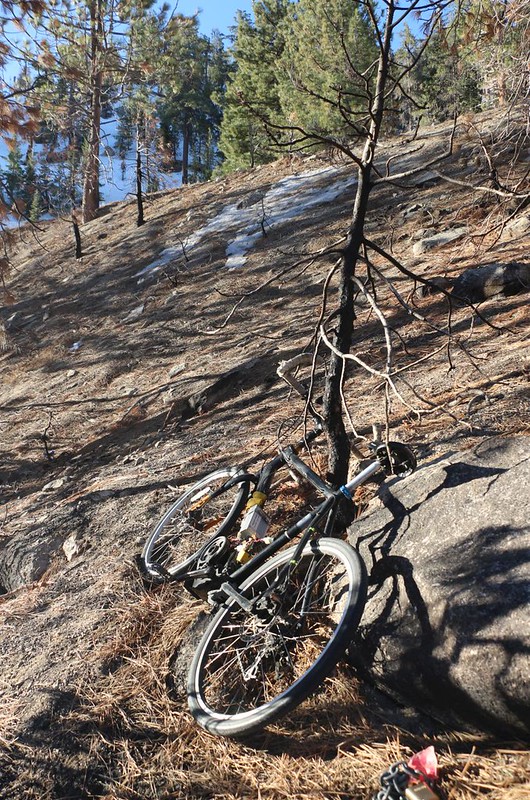
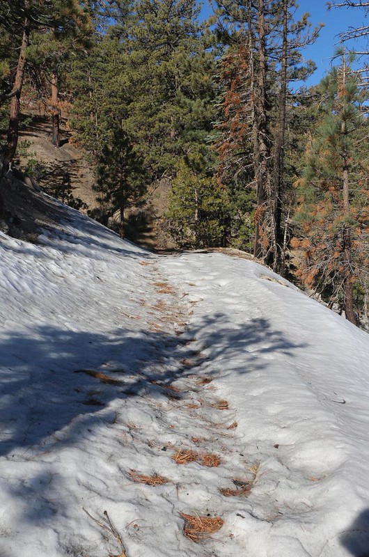
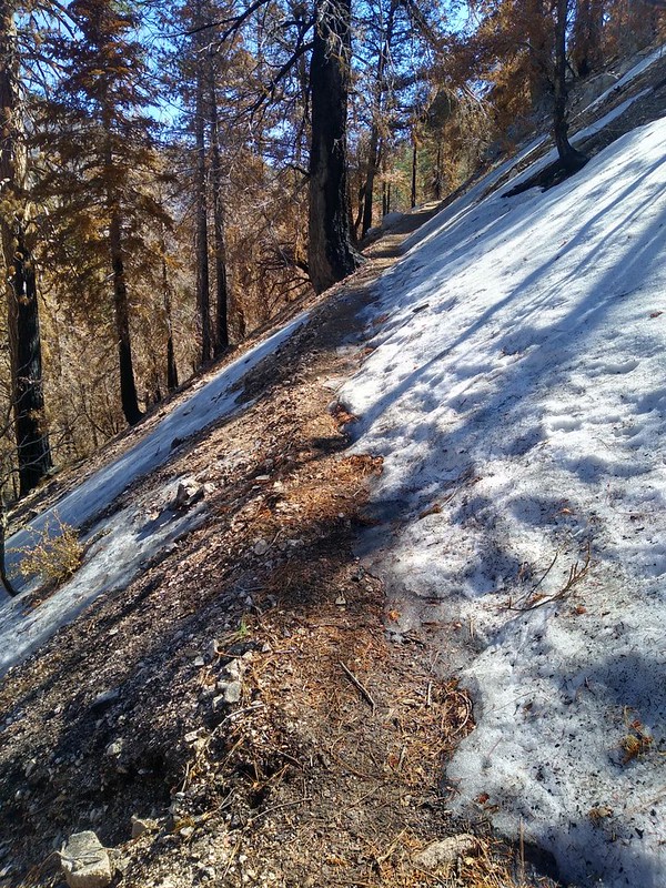
I locked the eBike to a tree, and hid the battery behind a big rock. There was nobody around anyway, on a cold Monday morning, but why take chances? Then I started hiking. There was some snow, but it was all on the north-facing slopes. The trail itself only had a little, and it was easily avoided.
This area had burned back in 2020, in the Bobcat Fire, and had been closed for the past two years. It was about to reopen in a couple of weeks when the NFS let the closure order expire. So I was technically guilty of violating the rules, but nobody cared either. And I needed to get this section of PCT California Section D “bagged” as Vicki and I didn’t bother to finish it back in May 2020 (just before the fire) thanks to rain and cold. When the Bobcat Fire happened, I was sad to see that this tiny piece of trail was in the burnt zone. And now that I was here again, I could see that the fire had hit this area somewhat sporadically, and that it could have been a lot worse.


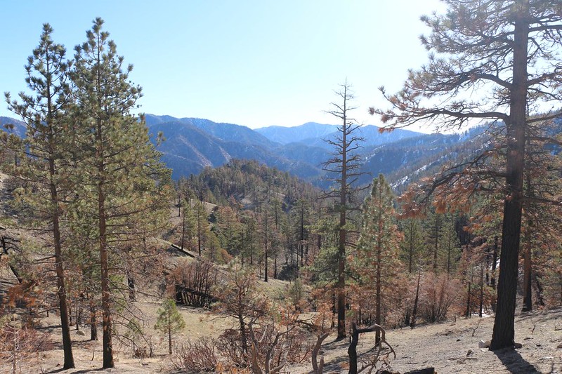

The fire killed pines more easily than other trees. Once the upper needles and growth tips got burned, that was the end of the pines. Oak trees simply regrew from their roots, albeit slowly. So the recovery was progressing. Sometimes the fire roasted everything in its path, while in other places it avoided “crowning” the pines, and stayed low along the ground like we wish all wildfires would.
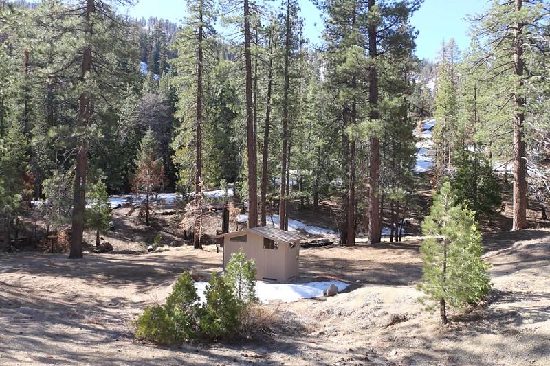
The trail descended into a canyon, and I came upon Cooper Canyon Trail Camp (many PCT hikers camp there) . It looked like a nice place to stay, and most of the trees remained alive and capable of casting shade, which is always a desirable thing to have. Down below, the creek was flowing fine, so there was plenty of water. The pit toilet was locked, with a sign saying that the pump-out truck couldn’t get down there because the road was damaged. Yet I saw fresh tire tracks nearby. Maybe they fixed the road? Or maybe they were getting ready to reopen it for the 2022 hiking season.
The trail continued down the canyon, paralleling the creek. There were new willow branches springing up from the roots below the burnt trunks, and they were just beginning to bud. Also, there was melting snow on the opposite side of the canyon. A pleasant juxtaposition.


A bit further on, there was a freshly fallen cedar tree across the creek, and it obscured the trail crossing. It took me a while to figure out where it went, but I eventually spied a wooden trail sign up above on the opposite shore, so I rock-hopped across the creek and climbed up the steep canyonside to get back on the main trail.
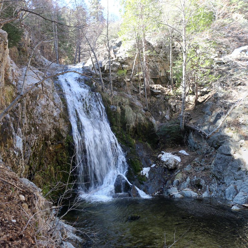
I decided to head further downstream to check out Cooper Canyon Falls,

I continued a bit further down-creek on the PCT, hoping to reach the trail junction at Little Rock Creek where the official “Frog Closure” ended, but the trail hadn’t been maintained at all, and the fun was gone. So I turned back. I had expected this, as the Guthook PCT App on my phone had comments from last year describing how miserable it was to bushwhack on that overgrown trail. Some hikers show absolutely no respect for the idiotic “Frog Closure” I’m sad to say. Whoever imagined that hikers on the PCT would hurt frogs in a creek was probably delusional anyway.
This was the lowest elevation point of the day, and after that I headed uphill on the Burkhart Trail (10W02). Technically, northbound PCT hikers are asked to hike a few miles along the highway west of Islip Saddle until they reach the Buckhorn CG and the Burkhart Trail, which has now been designated as a “PCT Alternate” by the PCTA.


After several hundred feet of climbing within the next two miles, I arrived at the official Burkhart Trailhead parking lot. It was largely covered in snow, and was situated down at the far end of the Buckhorn Campground. I already knew that the campground was closed, as I had parked my car just outside the locked gate, and the road was obviously covered in snow. It turned out that much of the campground was snowbound, as well.


Luckily it was warm and the snow was softening, so the footing was fine. I had brought a set of Microspikes with me, just in case, but I never needed them, even though the snow had been crunchy and glazed in the early morning. Better to have them and not need them, I figured.
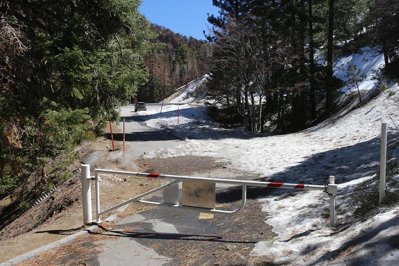

Just as I reached the car, an official Angeles National Forest pickup truck drove by, heading east. He looked at me, but he didn’t stop. I was quite glad that he hadn’t seen me a minute earlier, on the wrong side of that gate!
Just the same, I got in the car and headed west right away, back to retrieve the eBike.

It had been a successful hike thanks to the eBike, and the weather had been perfect all day. This little stretch of PCT was one of the last sections of “PCT CA Section D” that I hadn’t finished, so I was pretty happy. I also hadn’t been hiking in the San Gabriel Mountains in over a year, and it felt good to be back.
For even more photos and videos see my Flickr Page.
For a topographic map of our GPS track see my CalTopo Page.
