We arrived at the Sunrise Visitor Center in Mount Rainier National Park at sunrise (of course), then day-hiked the Sunrise Rim Loop Trail, and got stunning views of Mount Rainier and the Emmons Glacier, on a blustery late Summer day.
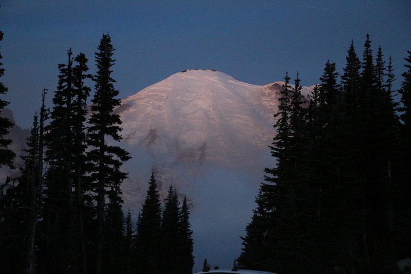
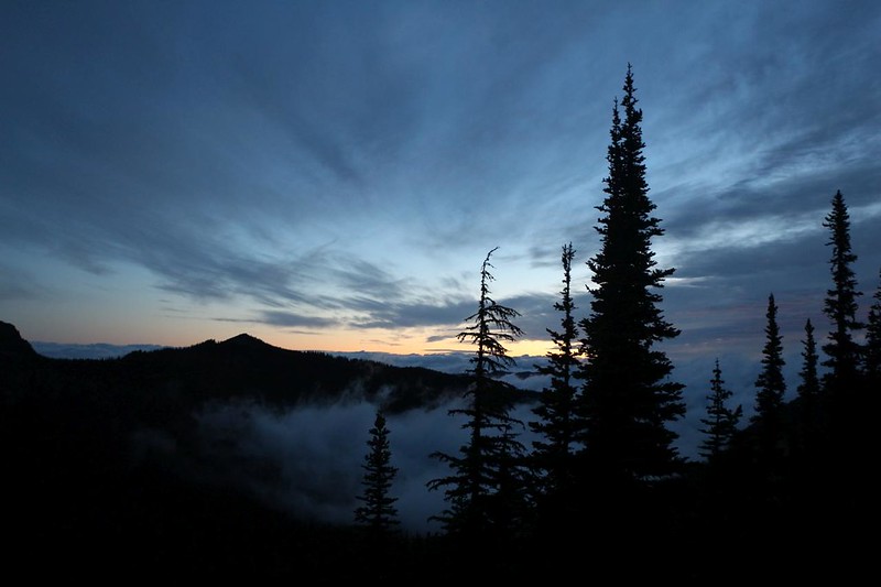
We decided to arrive before sunrise, just to see what all the excitement was about. Maybe there was a reason for the name. And we weren’t disappointed, as alpenglow lit the glacier-covered mountain. First stop: Sunrise Point. We took a short hike out toward the point itself, and checked out all the clouds that were drifting in the breeze down below in the valleys. It was cold out there, so we didn’t stand still for long. After getting some good photos, the mist rose up and covered the parking lot, so we decided to move on.
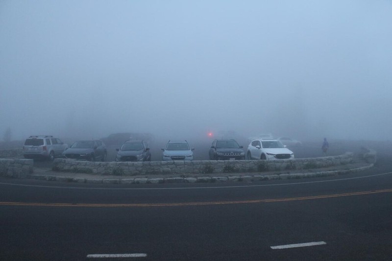
We parked in the big lot near the Sunrise Visitor Center, and got ourselves ready, staying inside the car as long as possible. We kept the heat on while we got dressed in layers, and packed the big daypack with water and food. We had already purchased the National Geographic Map of the park and also a Falcon Guide with the Best Easy Day Hikes, so we already had a plan for the day’s adventures. Sunrise Point was first, and the second stop was also easy: The Emmons Vista Trail. It was just south of the parking lot, and overlooked the Emmons Glacier and the White River valley. Or it would have if it hadn’t been so darned cloudy down there! All we saw was blowing mist. It was beautiful, of course, but the glacier was still hiding. We went back to the car and decided to try it again later, on our way back.


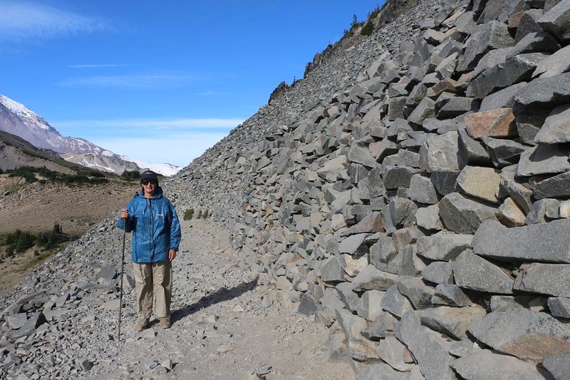
Then it was time for the main course of our hiking day: The Sunrise Rim Loop Trail. It climbed about 900 feet over a distance of five miles, on smooth trails (according to the book) so we figured it would take most of the morning at our typical leisurely hiking pace. When we came back, we would check out the visitor center, which was still closed. We weren’t the only ones with a desire to start the day early. There was already quite a crowd heading uphill toward the Sourdough Ridge Trail, and the trail was very wide.


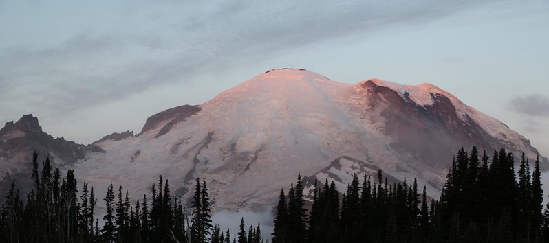
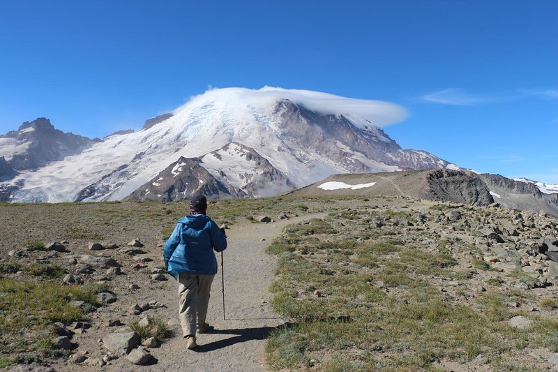
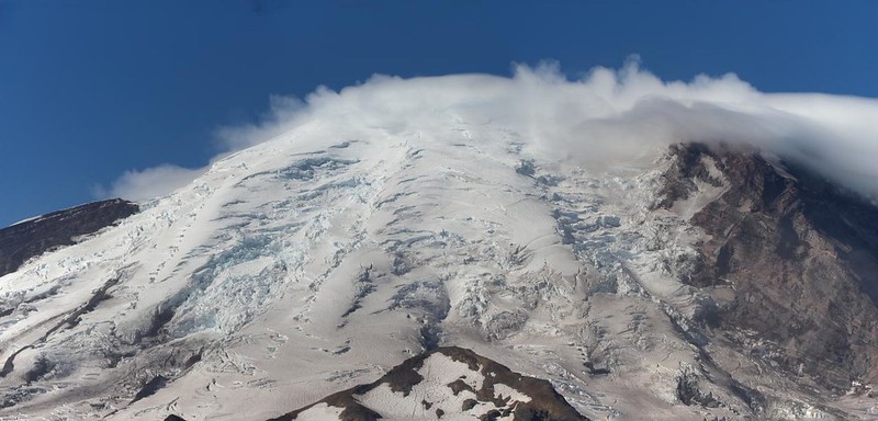
We arrived at the top of Sourdough Ridge and the cold wind out of the north really made itself known. The views made up for the discomfort, and we were dressed for it, but just the same, we headed west at a brisk pace until the trail ducked behind a higher section of rock. By this time, there were still some clouds lingering down in the valleys, but Mount Rainier was stunning in the sunshine.


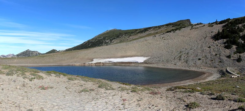
We arrived at Frozen Lake, at the junction of several trails. The 92-mile looping Wonderland Trail came up from the valley and continued northwest around the mountain, and the Mount Fremont Lookout Trail headed north. Our loop continued southwest, taking the Burroughs Mountain Trail. It climbed another 400 feet to the top of First Burroughs. Vicki groaned at this additional bit of climbing, but the cold breeze made it much more tolerable. There was little chance of overheating that morning!

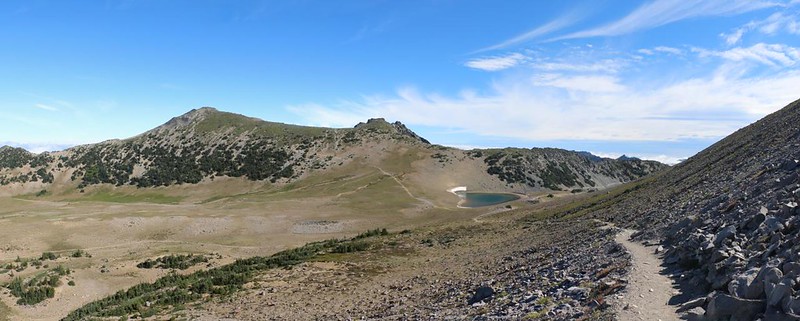
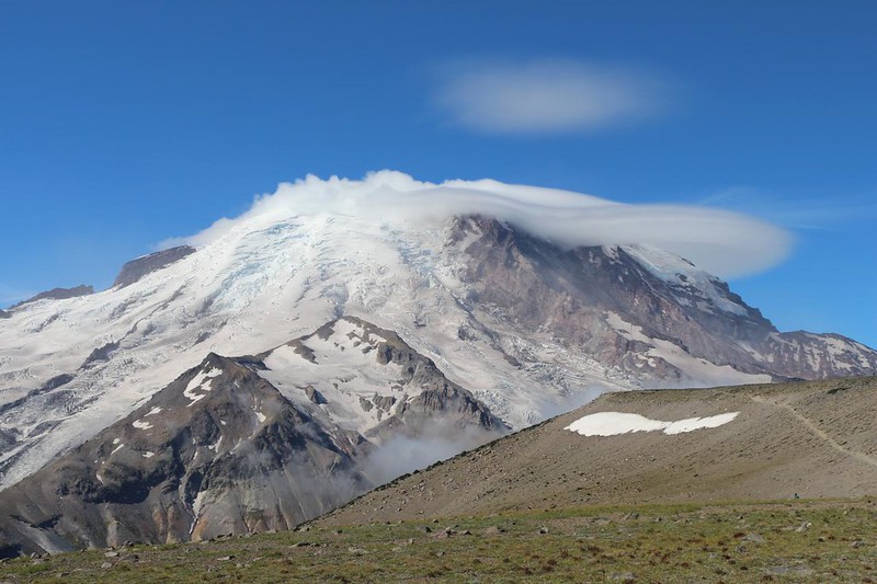
Up on the flat summit, the views of Mount Rainier were truly stunning. The strong wind had formed a lenticular cloud above the northern slope near the mountaintop. Plus, we were much closer to the glaciers now, being up above 7000 feet elevation. The crater at the top of Rainier was another 7000 feet above us, and we were glad not to be hiking there! It must have been freezing, and even windier than down here. Brrr!

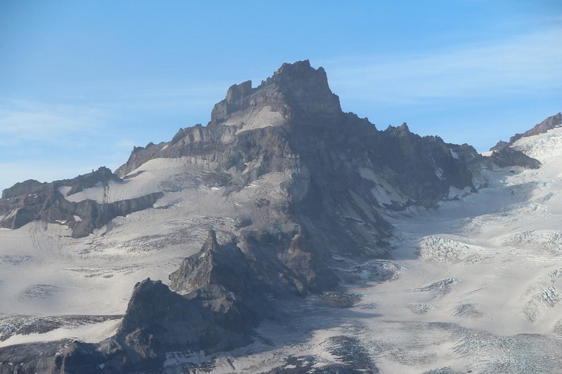
We continued southwest until we reached the junction with the trail to Second Burroughs. I asked Vicki if she wanted to climb it, as it was only another mile away, and a mere two hundred feet higher, but the answer was an emphatic “No.” We’d climbed quite enough already, thank you very much. Since this was about as close as we were going to get to the summit of Rainier, I took some additional photos and videos. The challenge of uphill hiking is one thing, but the views are really why we climb these mountain trails.
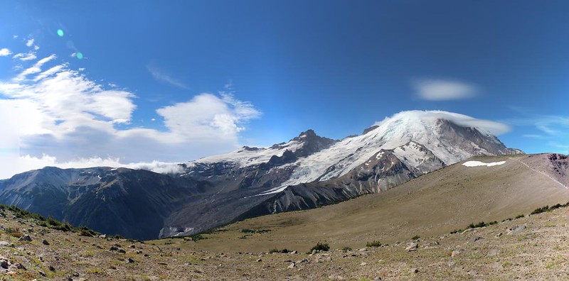
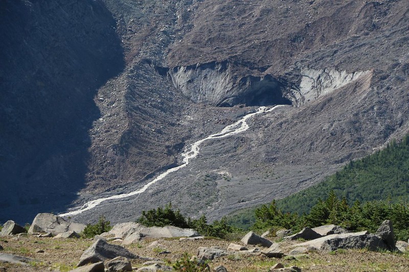
After that, the trail began to descend to the southeast, along the edge of the mountain. We finally got the views we wanted of the monstrous Emmons Glacier and the silty meltwater gushing out from beneath it, forming the visible headwaters of the White River. We also stopped to exchange photo-taking with another group of hikers. We like to get at least one good shot of the two of us on every trip, but it doesn’t always happen. This time we succeeded!

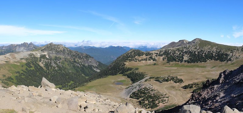
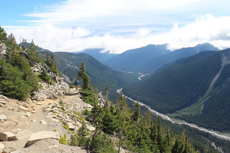
As we rounded the southern side of First Burroughs, the air got warmer and the breeze lessened significantly. It was turning into a genuinely nice day. And the views down into the White River Valley were spectacular!


Eventually, of course, the killer views had to come to end. We descended 900 feet, losing all of our stored energy, and entered a bowl containing both forest and meadows. This was the location of Sunrise Camp. We stopped and ate our lunch on a log in the shade. It was warm in the sun. The cold wind of the morning was long gone, and so were our extra layers. Then we continued on, checking out Shadow Lake on the way. After that, we climbed back up an easy grade to the Emmons Vista spot that was too cloudy earlier that morning. Those clouds were long gone, and we finally got the view we wanted.


We headed back to the car, put the big daypack inside, and went over to the Sunrise Visitor Center. There were a lot of informative exhibits inside, telling all about Mount Rainier being an active volcano. Supposedly, steam still rose from the crater on top! But all we saw was clouds up there. I bought an official T-Shirt in the Gift Shop, and joined Vicki by the big fireplace for one last blast of heat, to drive the morning’s chill out of our bones.


Unfortunately, the snack bar in the lodge was closed for renovations, so we couldn’t get any treats, but that was OK. We had plenty in the car. After that, it was time to consult our trusty hiking guidebook and find more fun things to do that afternoon. We were busy tourists, and there were plenty of natural wonders left to explore in Mount Rainier National Park.
For a topographic map of the hike see my CalTopo Page
For LOTS more photos of the trek see my Flickr Page

