We went on a fun dayhike at Mount Rainier National Park on the Skyline Loop Trail, out of Paradise Park, on a beautiful day in late Summer.
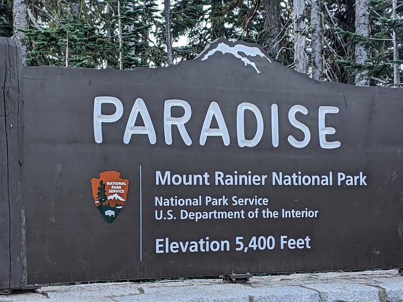
We had read that this trail was extremely popular, so we woke up early and drove up the road from our campground to the Paradise Visitor Center. We arrived just after 7am, and there was still plenty of parking, although spots were filling fast. We had already purchased the National Geographic Map of the park and also a Falcon Guide with the Best Easy Day Hikes, so we had a pretty good idea of what we wanted to do that day. The visitor center wasn’t open yet, but that was OK with us. We would check it out later. We prefer to attack the uphill portions of a hike in the morning, while the air was still cool.

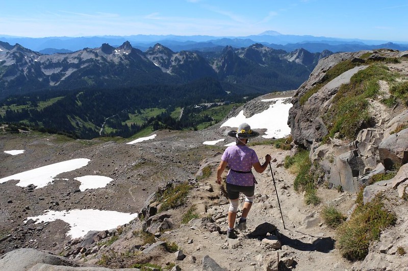
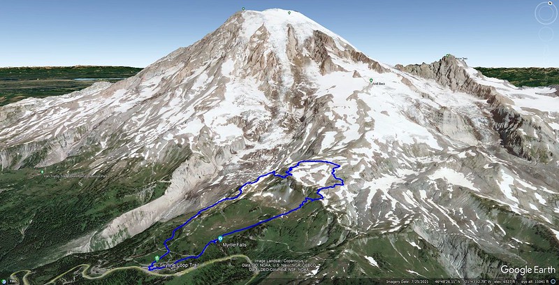
After getting our gear ready at the car, we headed over to the trailhead. We realized just how busy this trail might be when we discovered that it was paved with asphalt! There were already people ahead of us, and more on the way behind us, as cars continued to arrive. But that was OK. We were in no rush, and when you choose to hike a busy trail there’s no point in complaining that it’s crowded, for you are also part of the crowd. To solve this problem, we decided early on that we would hike our own hike, and so we immediately left the main Skyline Trail for the Dead Horse Creek Trail, which stayed further west. We hoped to get better views of the Nisqually Glacier from there. And it wasn’t paved.
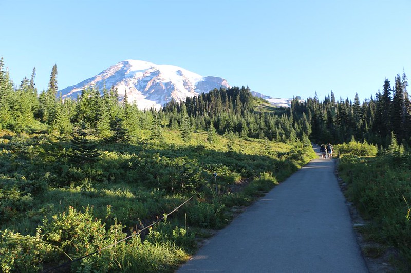


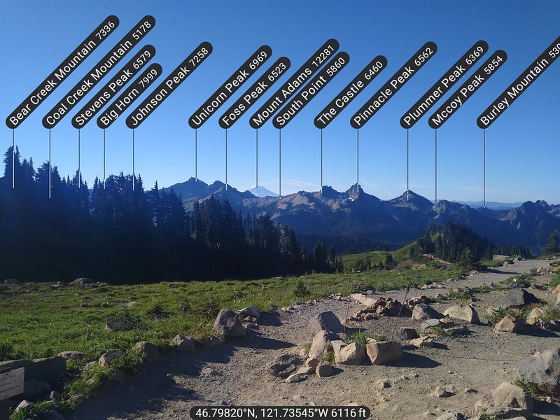
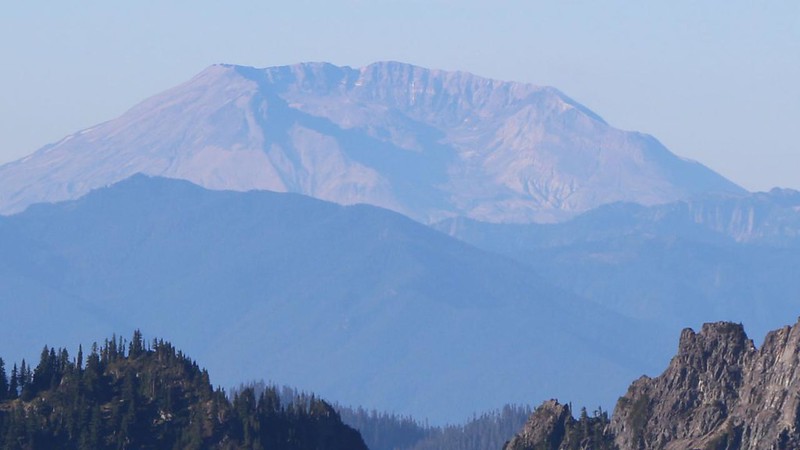
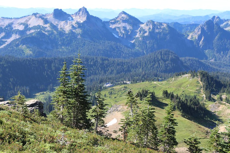
It was still a well-frequented trail, and we were happy to see that the park did a great job on the trail signage. Not much chance of getting lost around here! As we climbed higher, the views got better. I took tons of photos and videos, as usual. Looking back down the hill, we realized that there were plenty of peaks in the distance. It was easy to forget about them, what with the overwhelming massiveness of Mount Rainier so near at hand. I got out my PeakFinder app and identified the big peaks to the south, like Mount Adams and Mount Saint Helens. We had plans to visit them in the weeks to come, when we headed back home. But not yet!

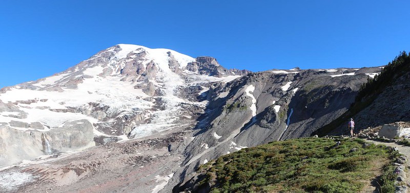
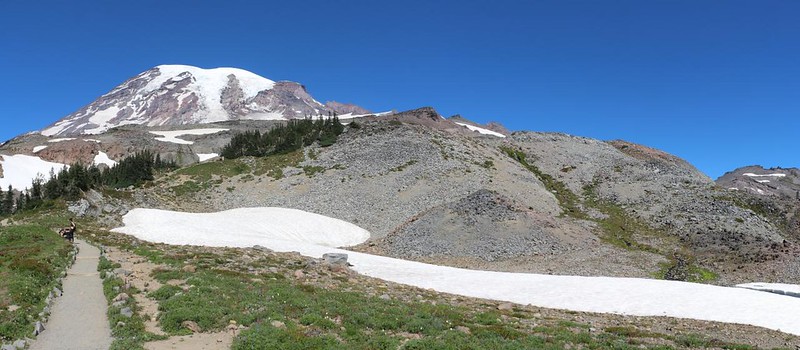
The Dead Horse Creek Trail rejoined the Skyline Trail, and we continued steadily uphill. The pavement was long gone by this time. I guess they only do that near the visitor center. Serious climbing weeds out the wannabe hikers. There was one additional side trail we wanted to take, and that was the Glacier Vista Trail. With a name like that, could we possibly refuse? And it turned out to be aptly named. We were able to check out the Nisqually Glacier in its majesty, from brilliantly white snowfields with crinkly cracked icefalls, to dirty dark ice covered by rockfalls, to a stream arching out in a stunning waterfall, it had it all. Below it was the tremendously eroded valley carved by the Nisqually River, which was white with silty glacial meltwater. We were extremely glad that we came this way.


Not surprisingly, the Skyline Trail kept on climbing. It was well named. We left the glacier behind as it made its way east along the steep face of a ridge. Far below, we could see the Visitor Center where we started. Had we really climbed that far? Yes, indeed.
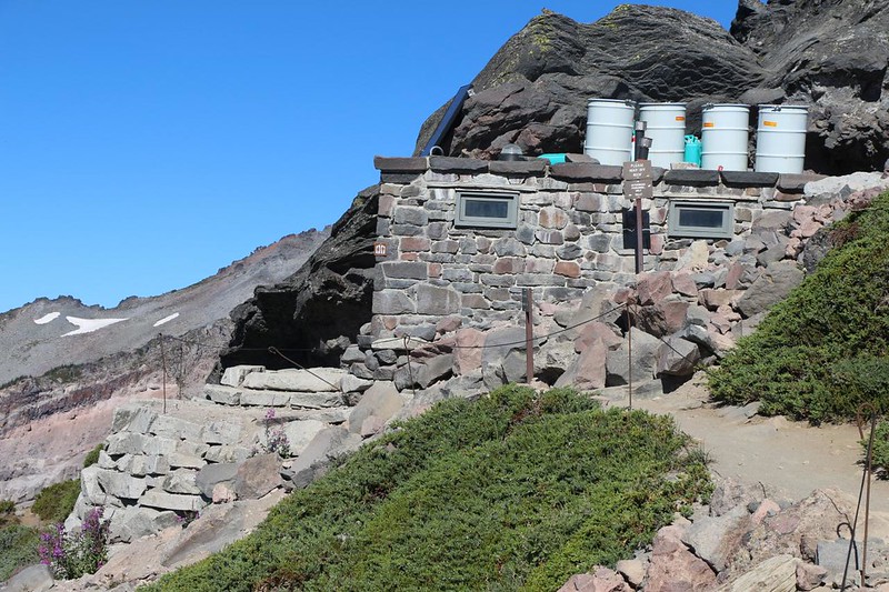
Inspiration Point was just around the corner as we climbed the last few steps. There were plenty of people hanging out up there, as the views were great. It was a fine place to take a well-deserved break. We didn’t stay long. There was more climbing to do! Vicki, however, wanted to check out the only bathroom on the trail, and it was impressive. It was made of cemented stones, a significantly sturdier version of its proverbial cousin, the Brick S—house.
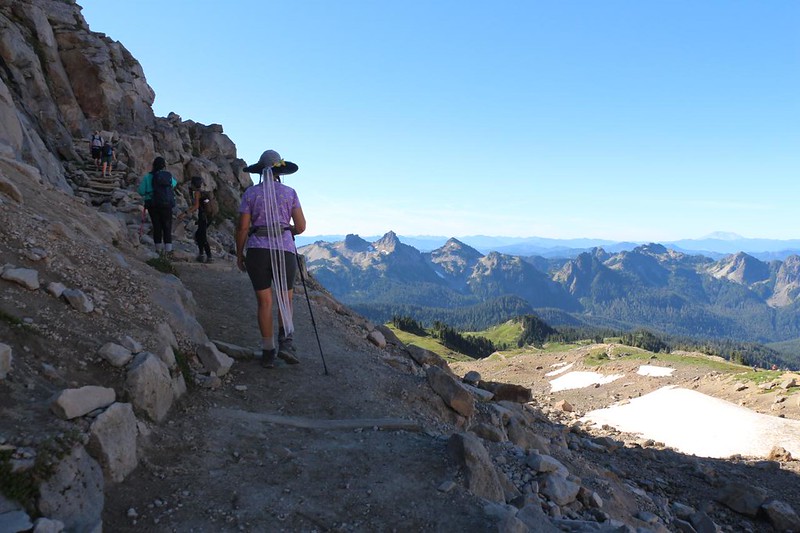
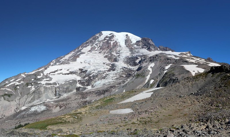
Just to annoy Vicki, the trail continued climbing. She’s never liked that “up” word much. But she also knew that the views would make it worth climbing, and, high on the side of Mount Rainier, the vistas were awe-inspiring. We topped out on a ridge, and there was the mountain again. We took turns taking photos with another hiker, and finally got a shot of both of us together. We try to get at least one on every trip.


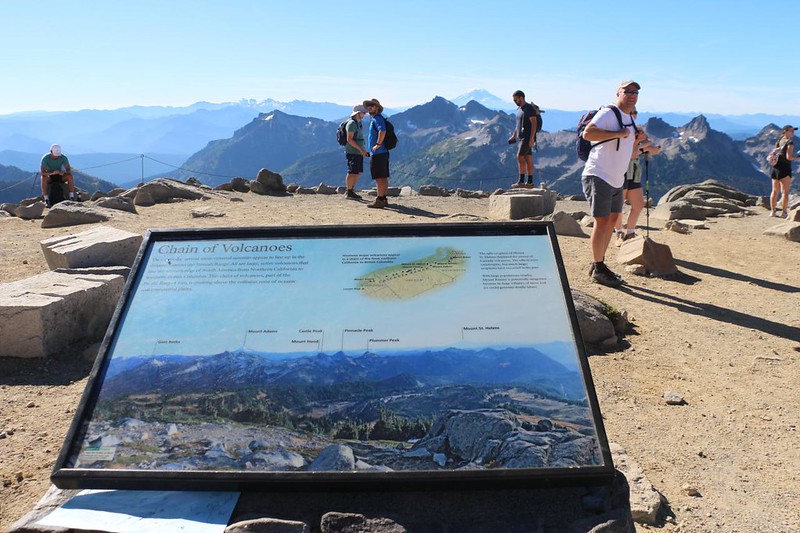
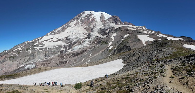
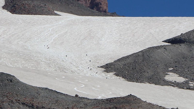
Up at the highest part of the Upper Skyline Trail, we came upon some mountaineers carrying full backpacks up the mountain. We knew from the map that they were heading to Muir Camp, up at ten thousand feet elevation. They still had three thousand more to go! And then we noticed, way up higher on a huge blank patch of snow, tiny black dots that were moving. Yes, they were also mountaineers, and must have gotten an Alpine Start, leaving Paradise in the pre-dawn darkness. Impressive. They spend one night at Muir Camp, then make a big push for the summit the next day, and almost everyone had hired a guide service to help them. Rainier is a very unforgiving mountain, and if the weather goes wrong you could be in big trouble, even during the Summer.


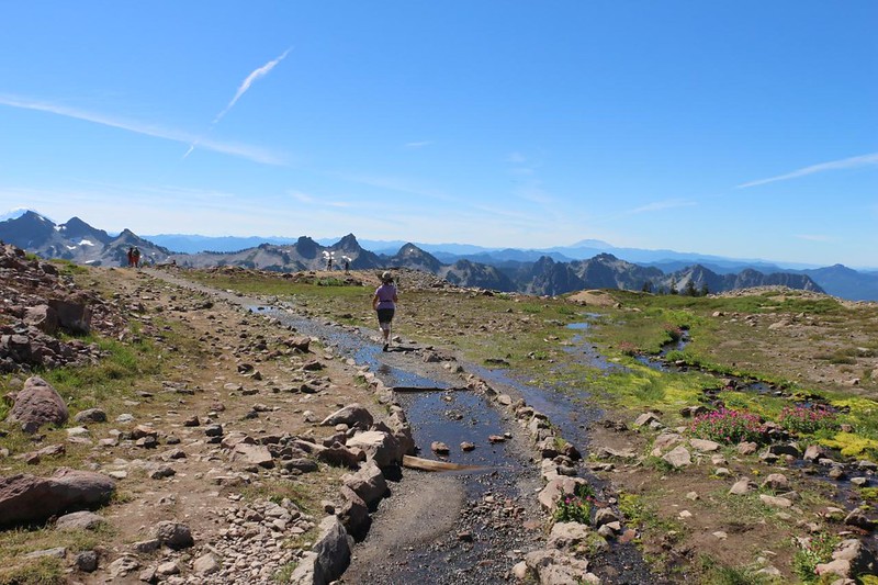
We also passed by a large snowbank, and Vicki put some inside her hat, to keep cool. Just after that, we began our descent, and there was less need to cool off, but she liked it just the same. Almost as much as heading downhill! The trail continued, heading south, and we passed through some soggy meadows full of snowmelt.
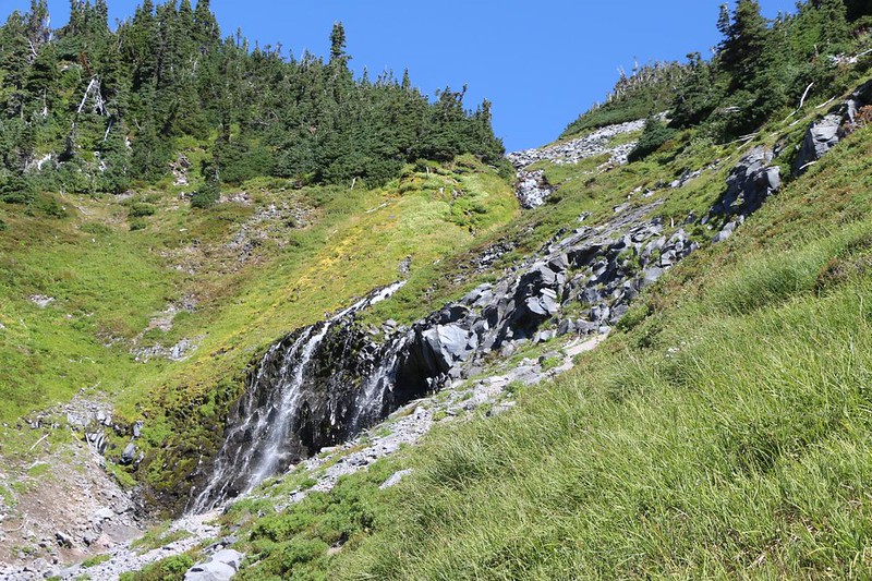
Yet again, we decided to change our plan, and leave the Skyline Trail. This time, however, it wasn’t to get better views. We simply wanted to get back to Paradise sooner. So we took the Golden Gate Trail, which was about a mile shorter. And we were glad we did. We could see where the Skyline Trail went, and it wasn’t particularly promising. There were no glaciers over there. Instead, we hiked through a lovely meadow, complete with waterfalls and wildflowers. Beautiful.


The descent proceeded rapidly, as always. Before we knew it we were nearing Paradise Park. But there was one more sight Vicki wanted to see, and that was Myrtle Falls. It seemed that everybody else wanted to see it, too! The place was packed with tourists. Just the same, we got a turn at the viewpoint and took our photos and videos. We knew how to be tourists, and I even had a big camera around my neck! Perfection.


We rejoined the Skyline Trail for this last section, and soon arrived at the eastern end of the big parking lot. The Paradise Inn was on this side. We had a feeling that it might be a bit pricey by our standards, but we figured that going inside for a look couldn’t hurt. And it was really impressive, a perfect example of a high country lodge.


Then we continued across the parking lot to the main Visitor Center. It was excellent, with many informative displays. We learned all about Mount Rainier, or at least enough to make us want to discover more. This was one of the oldest national parks, and it had quite a history. Our stomachs also had a history, and the snack bar was perfect for repeating the mistakes of the past! We had ice cream, and sodas, and a new item: A can of Rainier Beer. We’re not big drinkers, but we figured that, just this once, we could celebrate our day once we arrived in our campsite down the hill.


After driving back down the road, we realized that our campground was situated along the Nisqually River. We pulled off and parked, in order to check out the silty glacier water up close and personal. And it was roaring right along! The late summer sun was doing its magic on the glacier, high above us, sending icy water down the valley at breakneck speed. We even got to cross it on a log bridge, which was really fun.


After that, we went to camp, ate some dinner, and drank our tasty beer. We were glad it didn’t have any of that glacial silt in the can! And then we went to bed, making yet more plans, not only for exploring this park, but also for our month-long road trip through the state of Washington. Maybe we’d stay up here even longer!
For a topographic map of the hike see my CalTopo Page
For LOTS more photos of the trek see my Flickr Page

