Today we climbed up and over Spider Gap. We started on the Lyman Lakes Trail, hiking alongside the Upper Lyman Lakes and Lyman Glacier, and then we followed the Spider Gap Snowfield Route, climbing up a snow-filled chute and glissading down the Spider Glacier. It was a short, yet challenging and beautiful hike.
Our original plan was to get up super-early, so that we could pack up in the dark and leave by dawn. But grand plans and intentions weren’t enough. The eight mile day we’d had yesterday must have taken a bigger toll than we thought, because we didn’t bother waking up until long past dawn. We were pathetic, I know. But it was all OK, as we only had three miles to hike to reach our next campsite.
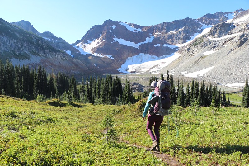
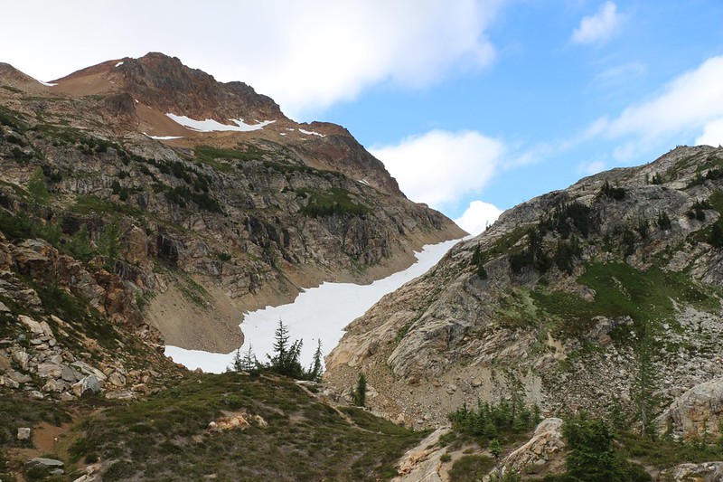
It was already sunny by the time we crawled out of the tent. But we got down to business once we got started. We packed everything rapidly, ate some breakfast, and started hiking. The air was cool, the sky was clear, and there was a gentle breeze from the west. We re-joined the Lyman Lakes Trail and headed south, downhill off the ridge toward the Upper Lyman Lakes. It felt good to hike downhill, but we knew it wouldn’t last. Spider Gap, at 7100 feet elevation, was about a thousand feet higher than the basin, and it looked like half of the climb would be on snow. Snow! That was exciting. This day seemed certain to become one of the “highlight” days of our trek.
We hiked past the side-trail to the official campsite, and saw the two men we’d met yesterday. They were still packing up their gear, so we figured that we’d be the first ones to hit the snow slope. It looked like they were just as lazy waking up as we were.
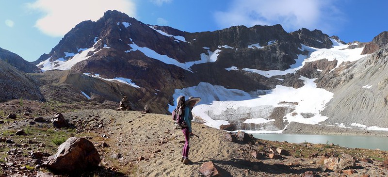
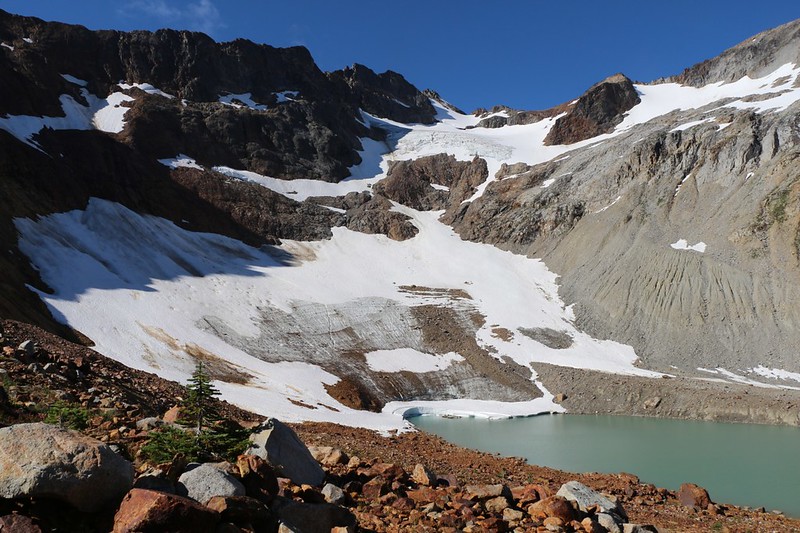
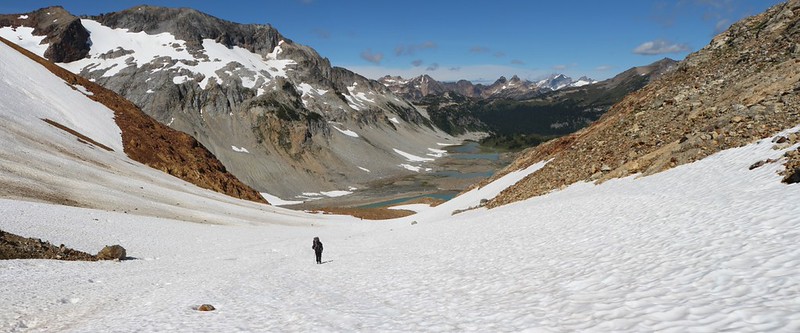
Down in the basin the trail was essentially flat. It wandered through rocky piles of glacial moraine and generally stayed on the east side, just below a long apron of talus below a line of granite cliffs. The rockfall was a colorful mix of red and white granite. Meanwhile, off to the southwest, the Lyman Glacier was shining white in the morning sun. As we got closer, we could see that it was cracking and calving near the bottom as it met with the uppermost of the Lyman Lakes. The floating icebergs that we’d seen two days ago from the Cloudy Peak summit had already melted.
The flat section of trail ended as we came upon a tall cairn of stacked rocks. One mile out of three was finished already! Too bad we had a 20% Grade to climb for the next mile. 1000 feet. We took a break and ate some snack. I took some photos of the glacier. We were in no rush to start suffering.

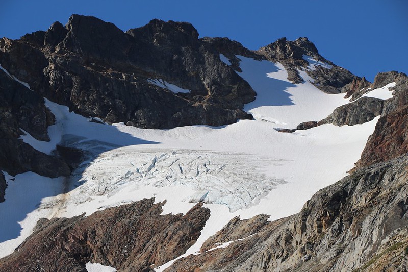
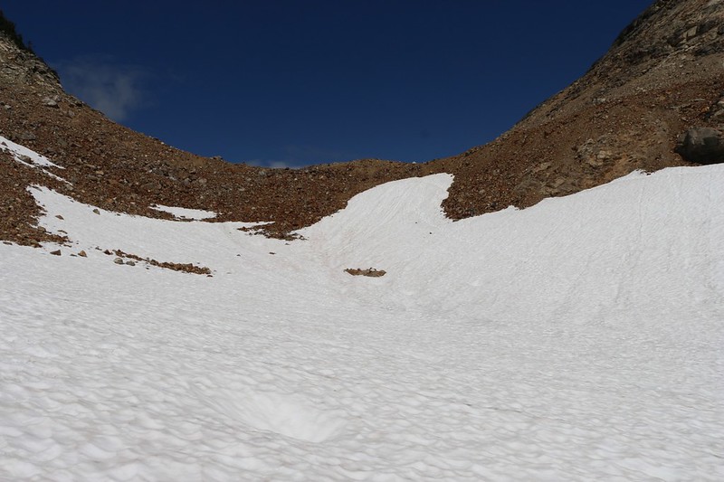
The huge cairn marked the spot where the obvious trail ended. After this the route climbed on a slope of tumbled rocks, and it was difficult to be certain precisely which way to go. Besides up, of course. We had spoken to other hikers the day before, and they assured us that there were smaller cairns, or “ducks” that we would be able to follow, and that’s what we kept our eyes out for. They were easy enough to find, with the main problem being that more than one helpful hiker had placed them along the route, and not always on the same obvious path. But that was OK. The real truth of the matter was that the route mainly followed along a rocky watercourse that originated in the melting snow high above.
“The higher you climb the better the views.” That’s the rule, and this was no exception. The other rule is: If you want to get warm, start climbing. And soon enough Vicki was down to her final layer of shorts and a t-shirt. The sun was climbing, too, and Vicki began grumbling a bit, saying that we should have gotten up earlier instead of being so lazy. I decided to shut up and keep a low profile. If I foolishly mentioned the fact that she had been the primary slugabed, then her mood would get a whole lot worse, really fast. Still, it was hard to be grumpy with views like these.
Video looking up at Spider Gap following its outlet stream
GoPro video panorama of us above upper Lyman Lake on the way to Spider Gap
Yet another video panorama – I couldn’t help myself
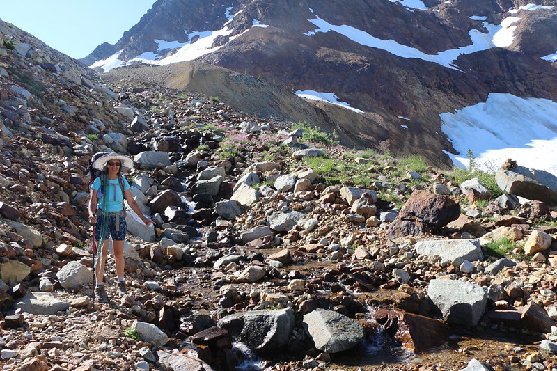
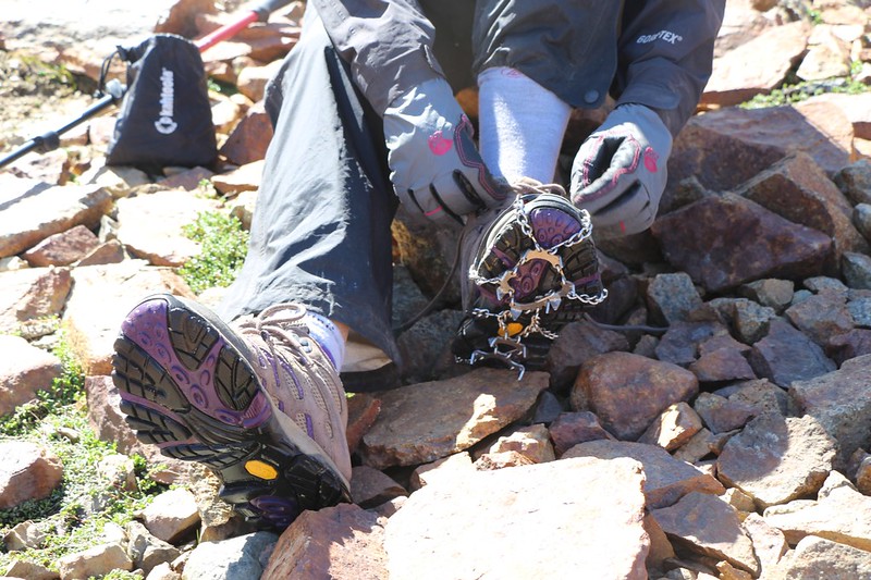
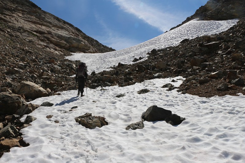
The small creek headed off to one side, while we climbed a final steep slope of loose talus and scree (which had an obvious cairn at the top) and eventually reached the snow line. Finally! This was what we had been waiting for! It was time to unpack the two sets of microspikes that I had been patiently carrying all over the wilderness for the past nine days.
And that also meant that it was time for a break.
So we set down our packs and began to get ready. We realized that we barely had enough water (because we hadn’t filtered all that much from the tiny pond the night before) so Vicki got out the pump. Meanwhile, I brought out the spikes, as well as a walking stick that I’d also been carrying on my pack for nine days. We couldn’t help but notice that the breeze had been picking up significantly as we climbed higher, and once we’d stopped actively climbing, the wind chill began to set in. Both of us put on some extra layers, including our raingear, which acted as a great windbreaker. The time for short pants and t-shirts was over. After topping off our water and eating some snack, we sat down to put on the microspikes. We’d only worn them once before, earlier this spring on the PCT, but there hadn’t been enough snow to really test them. There was more than enough snow now! Miles of it.

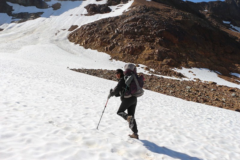
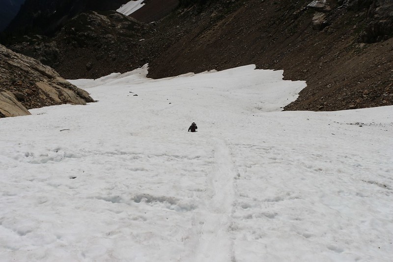
We put on our packs and started up the slope. The snow, at this time of year, after months of melting by day and freezing by night, was well-compacted and firm. Even with heavy packs, our feet didn’t sink in much at all.
We started out treading gingerly, of course, keeping our balance with our hiking sticks. We weren’t exactly experienced mountaineers. The snow was a bit crunchy this early in the morning, and the microspikes provided good footing. It didn’t take long before we grew more confident in them, and soon enough we were trudging uphill once again. And, like most mountaineers, we came to the conclusion that it was a lot easier to climb some nice solid snow than pick our way uphill over loose boulders and scree. On we hiked, pausing for breath (and yet another photo or three) every so often as we felt the need.
GoPro video panorama as we climbed the snowfield on the way to Spider Gap
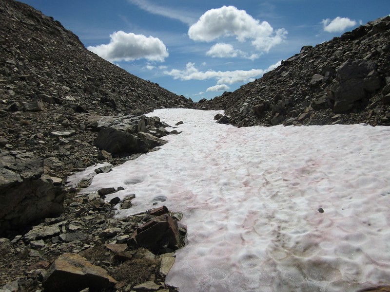
As we climbed, we noticed a number of rocks in the snow. Some were embedded in holes and were melting their way downward, while others were sitting pretty right on top. We looked upward on either side of us, at the steep rocky slopes high above, and realized that every single rock in the snow had fallen from way up there. Recently, too! We subconsciously drifted toward the section of slope that was furthest away from danger. We headed left, as the right side was much higher, steeper, and full of what looked suspiciously like loose rocks.
And that was when we heard the sound of cracking, tumbling, and bouncing boulders! Rockfall! Our heads turned toward the sound like lightning, our eyes scanning for movement. Was it heading our way? No, thank goodness. We’d already climbed high enough to be safe. For now. This mountaineering business could get scary! Just the same, fear didn’t prevent us from whipping out our cameras and taking videos of the rocks as they bounced down the slope.
After the excitement, we noticed that the snow in that area was a much darker shade. It had a lot more rocks and pebbles and dust on its surface than the pristine white section that we were standing on. This made us feel quite a bit safer. Sure, there were a few head-sized (and larger) boulders here and there on this side of the slope, but we felt that we were taking an acceptable risk being here. All we had to do was keep our wits about us. It would have been nice to be wearing a helmet, like real mountaineers, but I was still glad I hadn’t carried two helmets around with me the entire trip. I decided that the microspikes were worth it, however. True, they were taking us into trouble, but they would also help us get out of it.
Windy noisy video as we watched some rockfall come down nearby
GoPro video of the snowfield as we continued climbing
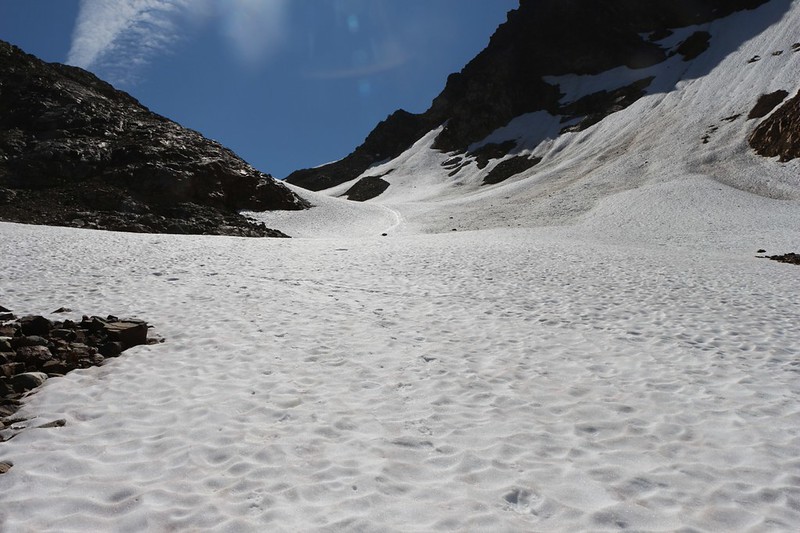
We continued climbing up the snow. It was beautiful, and the views got better and better. The wind got stronger, too, and the air felt cold. We were nearing Spider Gap, and all that air was being forced through the gap like a gigantic venturi, whipping through the narrow pass to make way for yet more air racing up behind it. We had to shout to each other in order to make ourselves heard.
Interestingly, the continuous climbing was making us hot and sweaty under our windproof raingear, while the breeze was freezing our faces and hands. The only way to balance this dichotomy was to stop climbing, unzip our jackets, and face downhill, directly into the wind, thus allowing it to cool our cores. It didn’t take long to cool off, and then it was time to repeat the process yet again.

GoPro video panorama from just north of Spider Gap looking back at the snowfield we just climbed
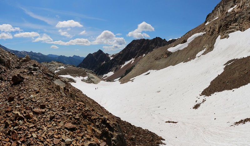
Eventually we neared the Gap itself. The canyon and snowfield became narrower, and there were even a few places where we had to walk on rocks once again. Vicki was nervous about walking on them with the microspikes, thinking that they might slide on the rocks rather than gripping like rubber, but it turned out OK. Some careful foot placement was all that was needed. And then we were back on the snow again. The slope got easier as we reached the top but the wind grew even stronger. It was positively whipping. We thought about stopping for a break and some snack but there was no place that offered enough shelter, We decided to wait until we found a better spot on the other side of the pass.

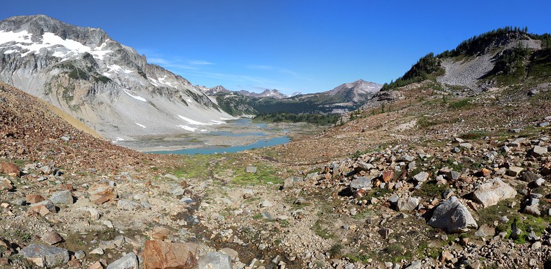
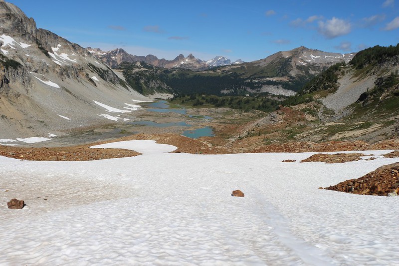
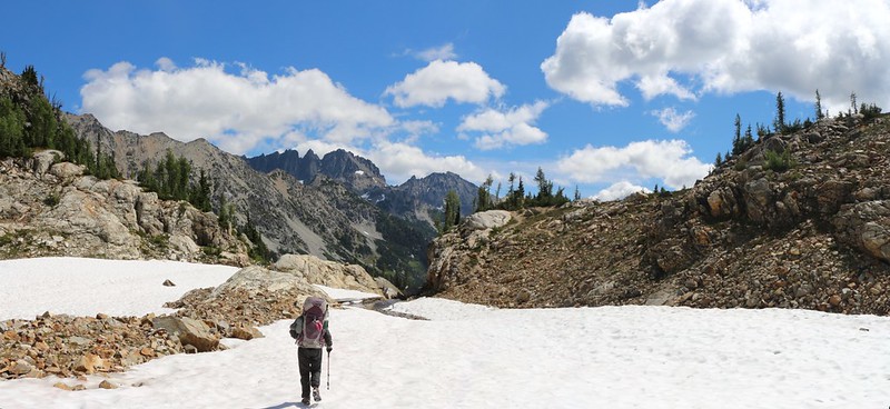
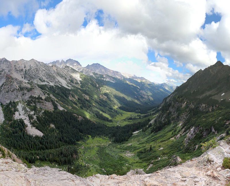
We reached the top and took a final look back, out across the Lyman Lakes basin. What a beautiful place! Tonight was our last night in the wilderness, as we would be hiking out to the car tomorrow, so we were a bit sad to be leaving. But this feeling didn’t last too long. The wind was blowing us over the pass, and we knew that this next section of the hike was going to be awesome as well. This trip wasn’t over yet! There was still plenty of beauty ahead of us, and miles of trail to be hiked.
Next stop: The Spider Glacier.
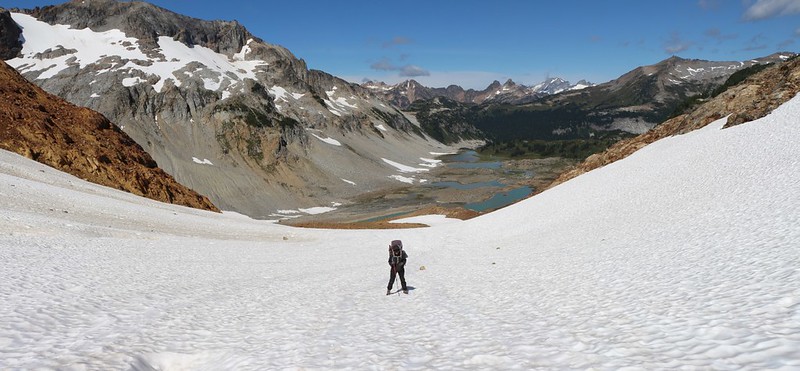
Except we didn’t stop. In fact, Vicki took one look at the view south, then immediately sat her butt down on the steep snow slope, and started sliding downhill with a loud whoop! She’d been talking about glissading on this glacier for months, and the time was long overdue.
Video of Vicki as she immediately decided to glissade down Spider Glacier from the Spider Gap summit
That first slope was the steepest part of the entire glacier, and I have to admit that it was a fun ride. After that, however, the slope was shallow for a while, and we hiked along. We met other people hiking uphill, and they were all sweating. Now that we were over on this side of the gap, the wind was much less severe, just a mellow breeze. There were puffy cumulus clouds forming to the south of us, and it made everything quite picturesque. So I took plenty of photos.
And videos. Some parts of the glacier were significantly steeper than others, and when the occasion arose, we sat down and slid on our butts. We took lots of videos of snow-sliding. The surface was quite bumpy this late in the season, and boy did our butts get a pounding. I started looking forward to the shallow slopes simply to give my buns a rest! Vicki, however, was an avid glissader, and tried every tiny slope she could find, even to the point of scooching along using her hands and feet. I couldn’t help but laugh, because walking was often faster. But she didn’t care. She was having a great time.

GoPro video panorama and first-person glissade as I slid on my butt down the Spider Glacier
Vicki took a video of me glissading downhill toward her
GoPro video panorama near the middle section of the glacier
All good things must come to an end, and so did the Spider Glacier. We’d dropped a thousand feet in a bit less than a mile, and it was over before we knew it. I thought about hiking back up and doing it again (without the big packs) but Vicki wasn’t having anything to do with it.
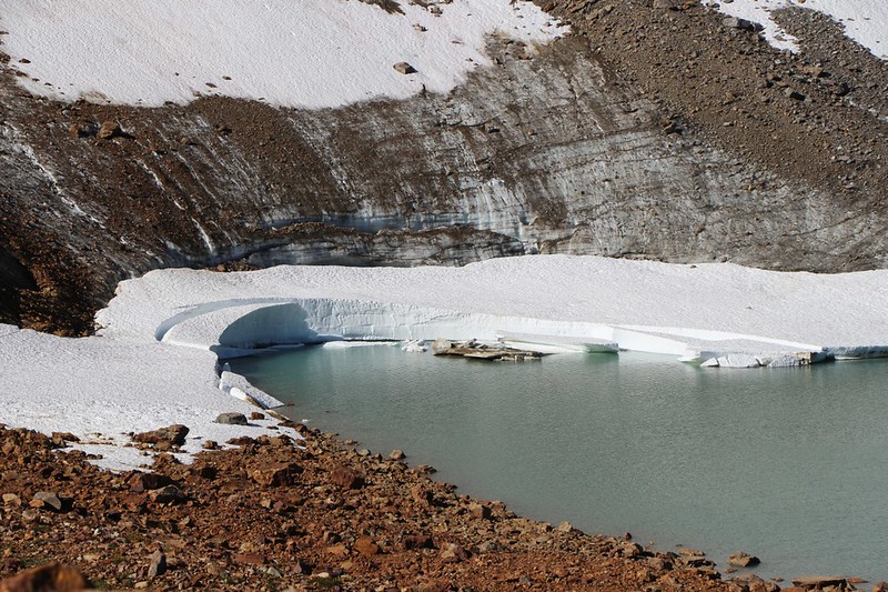
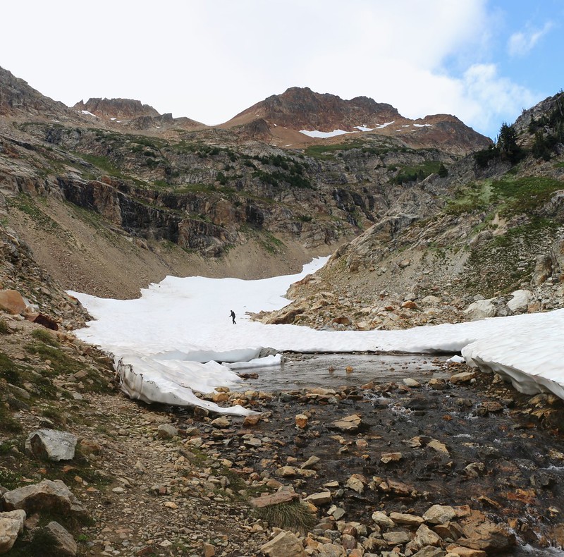
We avoided stepping into the water of the glacier’s outflow stream (or plunging through the snow into it from above) and stepped out onto dry land. We found a nice spot and took off our microspikes. We wouldn’t be needing them again this trip. I hung them on the outside of my pack to dry after smacking out any residual ice in the chains and spikes.
The view was fine right here, and we decided that this was the perfect time for a lunch break. There were quite a few other hikers, including a number of children hanging around at this end of the glacier. Some of the smaller kids were exploring the stream and scrambling on rocks, but the bigger ones were experiencing that sublime rarity known as a Snowball Fight In August.
Panorama video of the outflow stream from the Spider Glacier as it headed steeply down to Spider Meadow
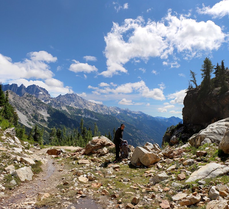
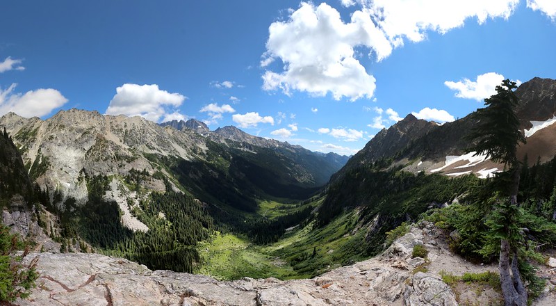
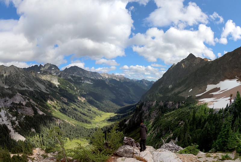
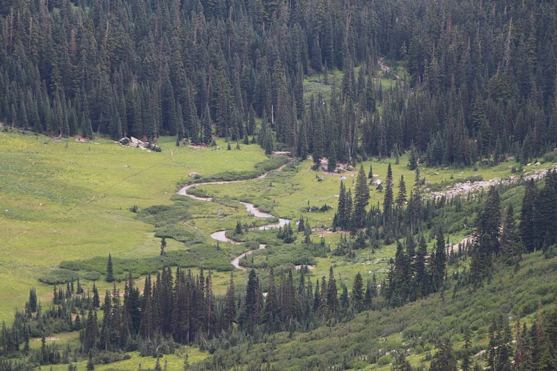
After lunch, it was time to find the perfect campsite. I had read that there were only a few spots up here, and we wanted to be sure to get one of them. This spot was known as “Larch Knob” and it wasn’t marked on the map. I’d only read about it in trip reports on the internet, so I wasn’t quite sure what to expect. Most of those reports said “Oh how I wish that we’d camped at Larch Knob!” And that was why I had planned to camp here as part of our itinerary. The views down into the valley below were reported to be absolutely stunning. And they were!
We left our packs by the glacier and started exploring, looking for the best spot. And we found it! It was right on the edge of a cliff overlooking Spider Meadow, which was green and lush, over a thousand feet below us. Now this was a worthy spot to spend our final night in the wilderness. We grabbed our packs and set up the tent immediately.
GoPro video panorama looking down on Spider Meadow from our campsite at Larch Knob
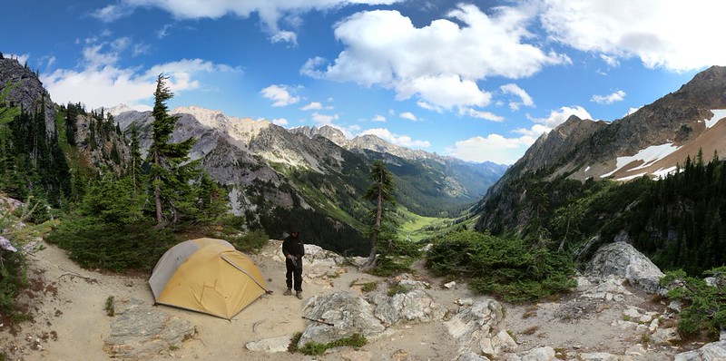
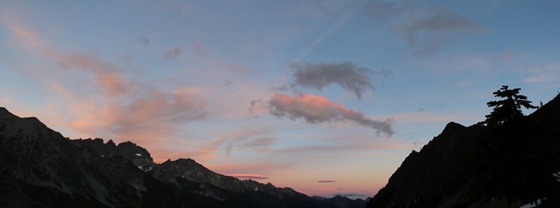
We spent the rest of the afternoon either sitting outside the tent looking out over the meadow, watching the clouds drifting by up above us, or else inside the tent taking naps and reading our books. When we got tired of doing nothing in one place we’d switch things up and do nothing in another place. What a great way to spend an afternoon.
But eventually, even lazy people get tired of all that laziness.
We decided to head back to the glacier and check out the other, higher location for camping. It was across the creek and significantly uphill. It also turned out to be a better spot than the one we were currently at, which was a bit sad. Why? Because there was more grass, and less dry, dusty ground. The views from up there were similar, so we weren’t too upset; our spot was still quite excellent. We met a nice man already camping up there. He said that he’d been coming up here every Summer for many years. It was his way of rebooting after the stresses of his job. He’d been spending his afternoon just sitting and staring out over Spider Meadow, just like we’d been doing. In a way, I was glad that we hadn’t taken his favorite spot, even though it was obviously better than ours. He had seniority, and that was OK with us. We wished him well and headed back down to camp.
On the way back we stopped at the creek and filtered some water, enough for dinner, breakfast, and tomorrow’s hike. We were worried that it would be all silty and milky from the melting glacier, but it wasn’t. It must’ve been from snow melt, not glacier melt. But either way, it was icy cold! Vicki tried her best to keep her hands warm while filtering it, but it didn’t work. We headed back to camp and the first thing we did was boil water for some broth, and she held the steaming cup in her hands until they were happy again. We carried the broth, the dinner packet, and our books down to the edge of the cliff below our tent. We sat down and enjoyed the view of Spider Meadow while the dinner hydrated, and after ten minutes or so we ate it.
While we ate, we talked about tomorrow, our final day on the trail. Did we want to sleep late, thereby dragging the day out as long as possible? Or did we want to get the heck out of here at the crack of dawn? It was a difficult choice, as this trip had been truly excellent so far, and we were sad that it was ending. There was so much more to see and do out here! However, when all was said and done, the motel room, hot showers, and a fine dinner in a restaurant made the decision for us. We consulted the map. We had seven miles to hike tomorrow, almost all of it downhill, and if we really hustled we might even get back to town by lunchtime. We could have two meals at a restaurant! Whoo hoo! We were beginning to salivate already.
So we packed up everything we could, including the stove. We’d eat our breakfast cold. We crawled into the tent and put on our night clothes. I set the alarm for 4:30 AM and hoped for a good night’s rest. We talked about the day and what fun it had been climbing and sliding on all that snow. It had only been a three mile hike but it sure turned out to be an excellent day in the wilderness.
For a topographic map of the hike see my CalTopo Page
For LOTS more photos of the trek see my Flickr Page
 << Back to Day 8 Onward to Day 10 >>