We spent our second layover day hiking to the summit of Cloudy Peak (elevation 7915 feet) while camping at Cloudy Pass for an extra night.
The day started out great, mostly because we stayed in bed. We decided that we didn’t need to get up early as it was a layover day. We could take our time. Another good reason for staying in bed was that it was seriously cold out there! We had woken up in the middle of the night, shivering, so we put on our jackets, hats, and gloves. After that we were able to snuggle like spoons and stay warm enough. But that didn’t mean we wanted to leave the sleeping bag at dawn.
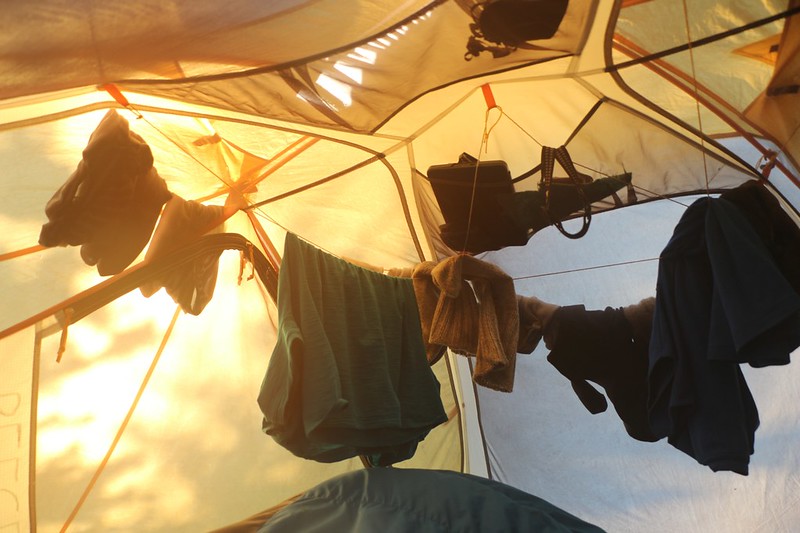
But I did it anyway, of course. I braved the elements by dressing in an extra layer, then went outside for my usual morning photo. On the way, I discovered that the outside of the tent was covered in frozen droplets! It must have sprinkled a bit in the night, and afterward the raindrops froze solid in the wind. Even the condensation from our breath had frozen in a thin layer on the inside of the tent. Cold! I took a photo or two but there really wasn’t much going on, sunrise-wise, so I headed straight back to the sleeping bag. It was warm and wonderful in there. The two of us went back to sleep, and didn’t emerge until the sun struck the tent and began to significantly warm it.
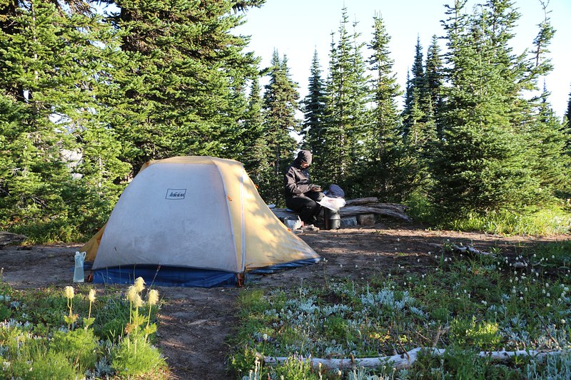
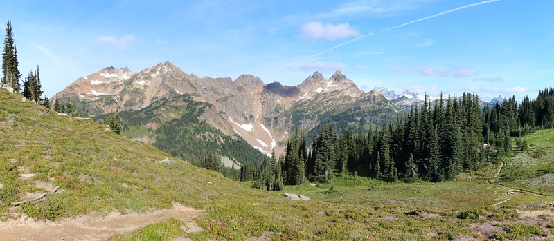
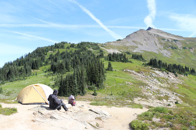
The sun made a difference and we got dressed in comfort, but we knew it was still cold outside. The wind wasn’t as bad but there was still a slight breeze. Vicki made breakfast and I didn’t have much to do so I wandered around taking photos. The low scudding clouds were gone and we had unrestricted views out over the beautiful Lyman Lakes Basin. We could plainly see Cloudy Peak, our day’s destination, less than a mile away. And west of the pass were Plummer Mountain and the double-topped Sitting Bull Mountain.


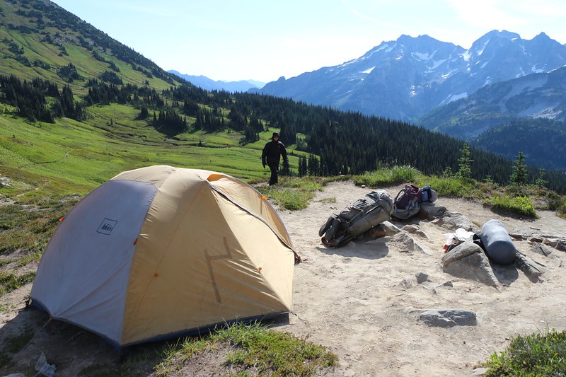
We ate breakfast, then wandered over to say good morning to our neighbors. We could see that they were packing up. They turned out to be a very nice couple, and we took each other’s photos with gorgeous backdrops. Soon enough they headed off, and we were left with our big decision of the day: Should we move our tent up here? Last night it was very windy and I was glad we were down in the shelter of the trees, but today the weather seemed to have moderated. I surmised that yesterday’s wind was simply the immediate aftermath of the storm that had swept on through the night before. As the storm moved away, I figured that the weather would mellow out. We talked about it a bit, but the awesome views we had from here won out over caution. Let’s face it: This spot was truly amazing. Certainly it ranked up there with the very best views I’ve ever had from my own tent.
And so we went back to the old camp. We took almost everything out of the tent except the air mattresses. We either stuffed the gear in our backpacks or carried it by hand as we made our way up the small rise to our new spot. Then we unstaked the tent and picked it up, fully assembled. We carried it just like that, me on one end and Vicki on the other, up the path and set it down directly on the same spot our neighbors had recently vacated. Then I staked it down. This had to be the laziest campsite move I’d ever done. And it was certainly one of the shortest.

Video of us carrying our tent to the new campsite across Cloudy Pass, taken by a helpful hiker
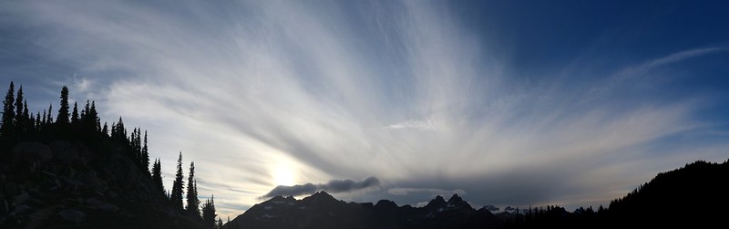
GoPro video panorama from our campsite at Cloudy Pass
We took our time getting the campsite squared away, and then we had to empty Vicki’s pack in order to re-pack it (as a day pack) for our summit hike. We put in water and lunch and snacks and the usual ten essentials. “Be Prepared” was our motto. We took so long getting ready that we didn’t start hiking until nearly 11am! But that didn’t matter, as the peak was only a mile or so away. It was the 1500 feet of climbing that would slow us down a bit. This was definitely a “layover day” kind of hike: No pressure, no rush, just fun.
And then we started climbing.
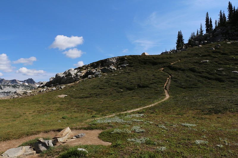
At first it was easy going, following an obvious trail through the usual wildflower-filled meadows. After a week on the trail we were starting to get used to being constantly surrounded by flowers, rather than staring, slack-jawed, at their abundance, as we did a few days ago. Since the morning’s frost, we were pleased to note that there were absolutely no Deer Flies. Weather-wise, there were some high clouds up there to make my photos better. All in all, it was looking to be a great day to climb a mountain. And the views of Lyman Lake kept getting better as we climbed. I took far too many photos, but every time I stopped to look around, it was so beautiful that I had to take yet another panorama shot.
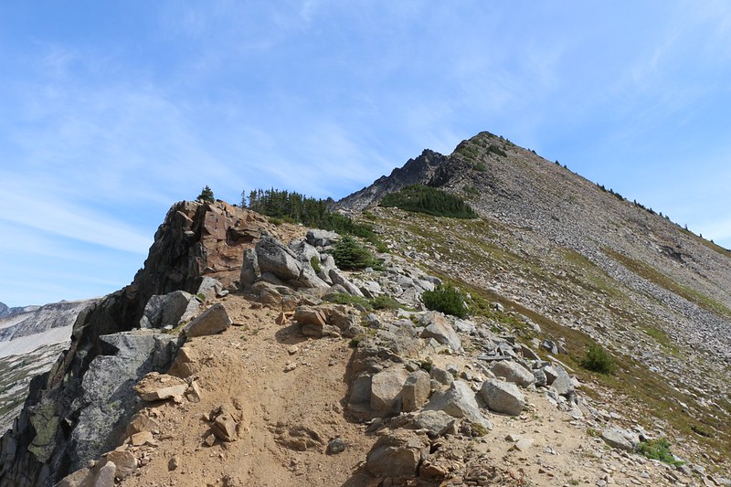
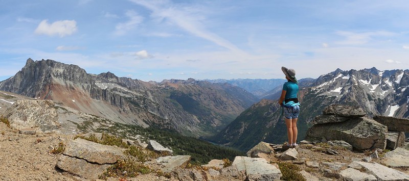
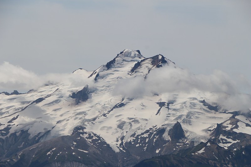
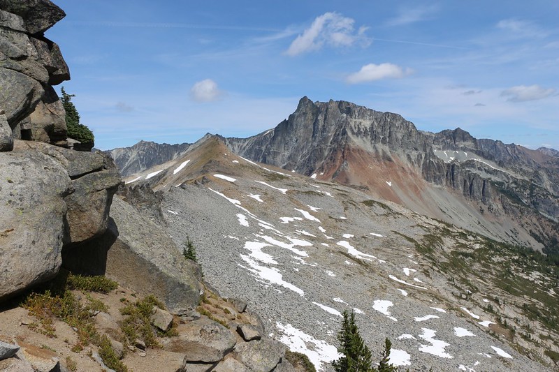
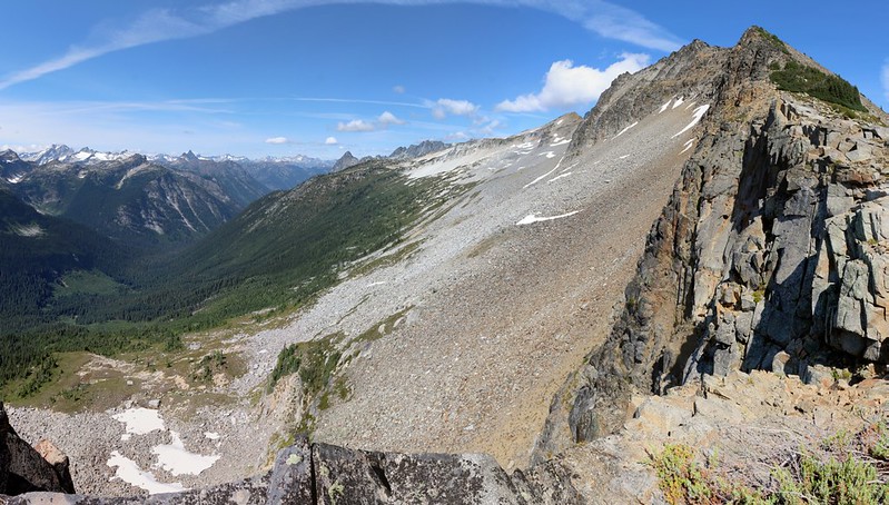
Eventually the “use” trail disappeared by splitting up into several equally bad-looking paths. We weren’t entirely sure which way to go except for the “Rule of Up” so we picked one at random and continued climbing. The grassy meadows gradually turned into rocky talus as we reached the ridgeline. The ridge turned out to be a lot of fun. There was a precipitous drop on the other side, which was truly impressive and even a bit scary. But this also allowed us to see the mountains to the north and west as well. Plummer and Sitting Bull were just across the Agnes Creek Valley, and, now that we were getting high enough, Glacier Peak itself came into view behind us. Glorious!


GoPro video panorama as we continued climbing the ridge

The ridge got steeper. The route-finding grew more difficult as we climbed, picking a path with care through the loose blocks of talus. If you chose the wrong path a large stone might shift suddenly when you stepped on it. You might slip and fall on the boulder, or the boulder might slip and fall on you. We were quite far away from rescue, and had no desire for a repeat of our disastrous 2014 Cascades adventure. So we proceeded carefully. But it wasn’t as scary as I make it sound, at least not for us. We’ve been hiking off-trail for years, over miles of similar terrain, so we had enough experience to know where to tread.
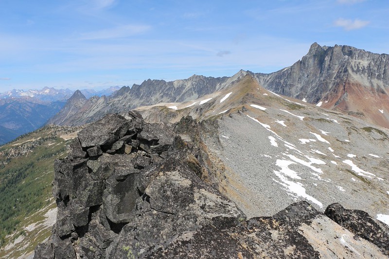
But not always. Not knowing any better, we left the ridge when a large clump of vegetation appeared. We decided to go around it to the right, rather than risk falling off the edge on the left. What a mistake! We ended up following the paths of other equally deceived hikers and found ourselves in some seriously unstable scree and talus. We tried to continue upward for awhile, but finally realized our error and headed directly back to the ridge. The rocks were solid there, dark brown with oxidation, proof that they’d been stable for uncounted years. Of course, that also meant that the deadly drop-off was right next to us, but it was much easier hiking. Plus, the views were better.
Vicki stopped along the way and yodeled, trying to get an echo to bounce back from nearby cliffs. It worked, but not as well as other places. There’s no need for anyone to go out of their way to put an “Echo Point” sign up there.
As we continued toward the summit, we were finally able to see down into the valley to the east, where Railroad Creek flows out from Lyman Lake, heading to the town of Holden, and eventually Lake Chelan. Hart Lake was down in the valley, while Bonanza Peak (elevation 9511 feet) towered over everything nearby, including us. Only Glacier Peak, the king of the wilderness, was taller at 10518 feet.

Vicki tries a yodel over the steep side of the ridge and gets an echo off the west side of Cloudy Peak

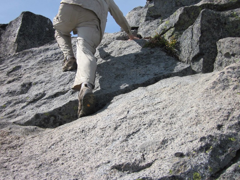
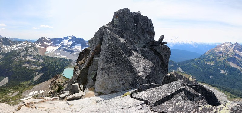
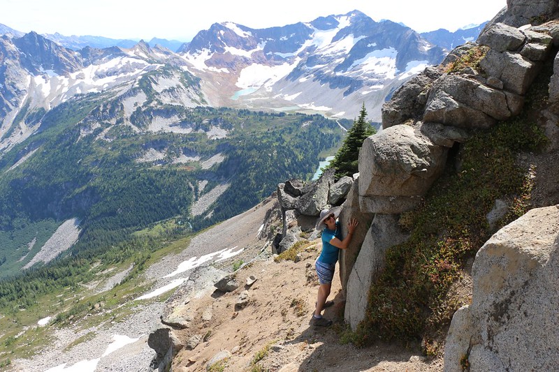
We continued climbing until we reached the large, dark granite summit block. We found a good spot to put down the backpack and continued onward. There was a distinct trail on the east side of the summit which lead to a better route to the top of the block. The trail was quite narrow, with a steep drop-off. We kept one hand on the mountain as we traversed on the trail.
We came to the obvious place to scale the summit block, a spot with convenient cracks and what looked to be good handholds. The rock here was solid, perfect for climbing. It was only the exposure that was making us nervous. One bad slip and you’d be seriously injured, or fall to your death. Vicki decided that it was too scary; this was close enough to the summit, thank you. But I decided to get a bit higher. So I climbed up to the top of the ridge just north of the final summit block. But I admit that I didn’t climb the last bit. I wimped out, in other words. It was definitely what climbers call Class 4+ to get up there, and I had read reports that some folks even used rock climbing gear for additional safety. So I didn’t truly summit Cloudy Peak, sadly. But I was close enough, in my book.
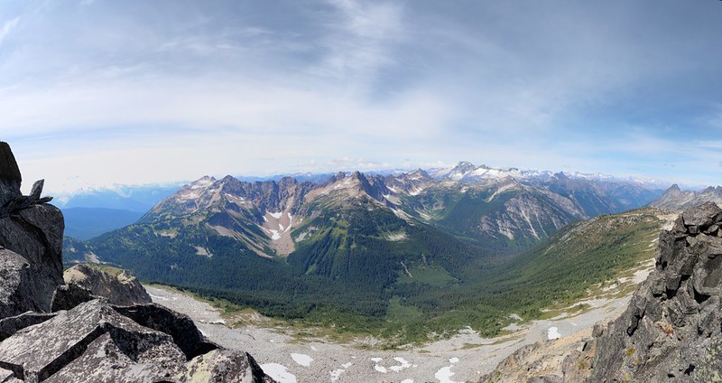
From up there I could see all over. It was truly exhilarating. I took way too many photos and videos, as usual. The air was relatively clear and there was good visibility, so there were plenty of mountains around us, stretching off into the distance. There are 67 named peaks visible from the summit of Cloudy Peak as shown by HeyWhatsThat.com or 90+ visible peaks as calculated by PeakFinder.org. I even had the PeakFinder app on my phone to help me identify the nearby summits. Great app, and worth the money.
GoPro video panorama from a spot just below the Cloudy Peak summit block
GoPro video showing the steep west face of Cloudy Peak, looking down into the South Fork Agnes Creek valley
After I downclimbed the granite, we traversed back to the main ridge and our backpack. We ate our lunch while sitting up there in the sunshine, looking down at Lyman Lake. I got out my phone and named the local peaks for Vicki. We got out the map and were able to trace our route over the past seven days. We could also see our route for the next two days, hiking down to Lyman Lake and the ridge above it near the Upper Lyman Lakes and Lyman Glacier, where we would camp tomorrow night. The following day would be our ascent of the snow-filled chute leading to Spider Gap and down the snow-covered Spider Glacier on the other side. We were really looking forward to that.

After that, it was time to descend back to camp. We could see our tiny tent, just barely visible in the distance down below, and we knew that no “layover day” was complete unless we spent some time laying down. Comfy air mattresses and an afternoon nap awaited us below.
So we wandered our way down the ridge. It was a whole lot easier hiking downhill. And now that we knew the secret of the route, we stayed directly on the ridge the entire way down. What an enjoyable hike! Views everywhere, and it seemed like we had the entire wilderness to ourselves. This day was surely one of the highlights of our trek.


GoPro video panorama from high on the southwest ridge
GoPro video 360 degree panorama from further down the ridge


It was late afternoon by the time we made it back to camp. We had a couple of hours left before dinner so we used the time wisely by taking a nap. Thanks to the sun it was warm inside the tent even though it was cool and breezy outside. This made napping even more enjoyable. Unfortunately, as soon as we lay down we realized that our heads were aiming downhill! It wasn’t a big slope, but it was noticeable enough, and we almost felt like we were hanging upside down, with our blood pounding in our heads. How annoying! And then I remembered the girl yesterday whose head was facing in the opposite direction. Darn. So, for the second time that day, we unstaked the tent, picked it up from each end, and swung it around by 180 degrees. Then we staked it back out again. Whew! That was more work than we wanted, but at least now we’d be comfortable.
And then it was time for a nap. Afterwards, we woke up and read our books for a while. We ate a bit of the uneaten snack we’d packed for our day-hike. We lay back down and napped some more. We were lazy.
Eventually, we changed into our warm clothes and ventured outside. Vicki cooked dinner while I took some more photos. Then we sat down with our backs to the breeze and ate dinner, with that awesome view of Lyman Lake down below us. We decided that this camping spot had the best view of any campsite in the entire Glacier Peak Wilderness. We still had two more nights to camp, and one of the spots had a chance to rival this one, but I didn’t mention that to Vicki. I’d save it as a surprise.


The weather cooled as evening approached. There was still a decent breeze blowing through the pass, and we remembered the icy, frosty tent that we woke to that morning. This thought chilled us more than the breeze, so we headed into the cozy tent a bit earlier than usual. We read our books and relaxed with our legs toasty warm in the sleeping bag. Every once in a while I opened the door and checked out the view, hoping for some sunset color in the sky.
It was Cloudy Pass, after all, so of course there were beautiful clouds. I put on my shoes and went outside for a final evening walk. The Lyman Lakes basin below us was deep in shadow, and there was lingering sunlight on the peaks above Spider Gap. But I didn’t remain outside for long. It was cold! I decided that Vicki was the smarter of the two of us, as she had wisely stayed inside where it was warm. I gave up on the idea of waiting for colorful clouds. I went inside and got ready for bed, then stuck my cold feet in the sleeping bag, but Vicki was ready for me. She had thick wool socks on and carefully kept her feet well away from mine. But I have plenty of heat in reserve, and she always wanted me to share some of it, so soon enough we were snuggled together and sleeping soundly, well before sunset had even arrived. Good night, Cloudy Pass!
For a topographic map of the hike see my CalTopo Page
For LOTS more photos of the trek see my Flickr Page
 << Back to Day 6 Onward to Day 8 >>