We went backpacking to Cape Alava on the Pacific Ocean at Olympic National Park, starting from Ozette Lake, on a beautiful day in late Summer, and day-hiked down the beach to view the Wedding Rocks Petroglyphs.
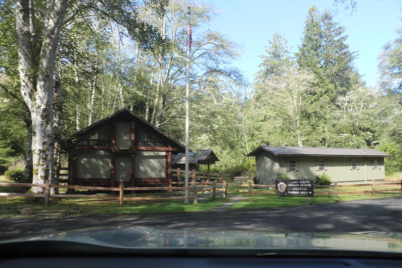
After driving from our last beach hike, we arrived at the Lake Ozette Ranger Station and parked our car in the large parking lot. We got out our backpacks and double-checked that we had everything we needed, including a gallon of water and food for an overnight stay.

The first part of the trail entailed crossing the Ozette River on a lovely arched bridge. This was a good sign, as it indicated that the trail might be well-maintained. We took some photos of the river, then hiked onward to the trail junction with the Cape Alava Trail. It was only three miles, with relatively little elevation gain/loss, so we were excited to get moving.


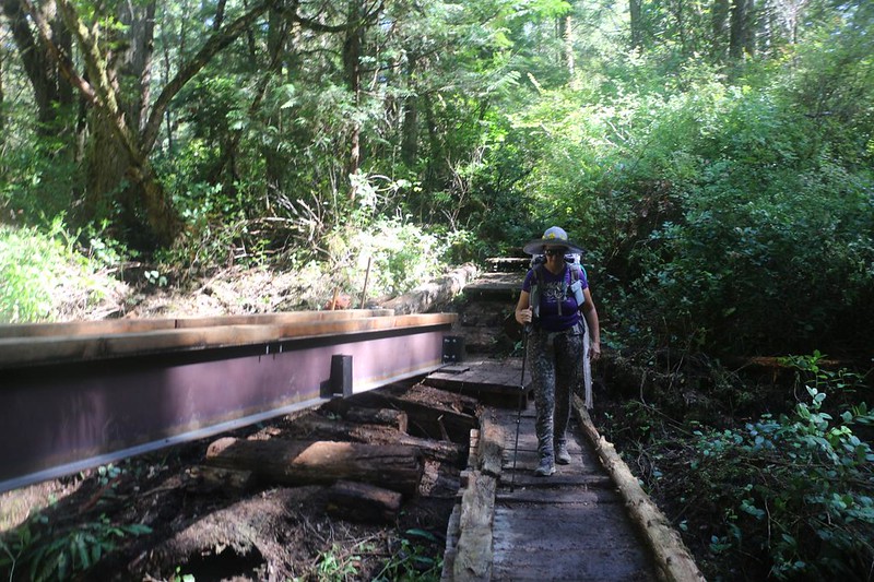
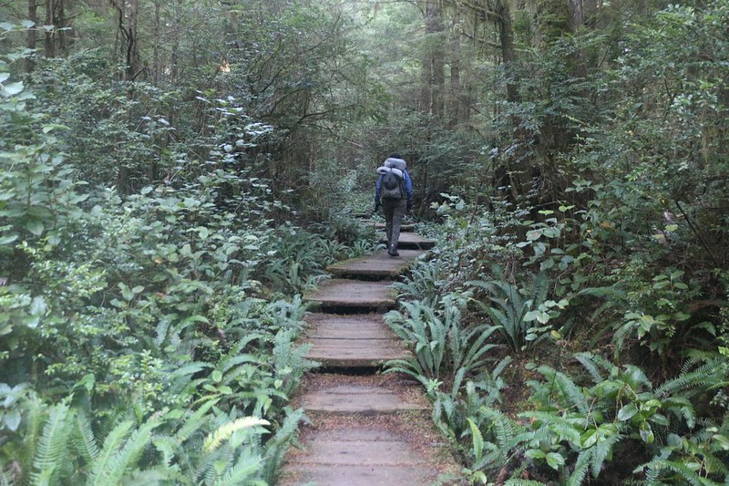
Most of the trail was on wooden walkways, which not only protect the rain forest from an onslaught of hikers but also protect the hikers from an onslaught of mud! Other sections of trail were “paved” with a bed of gravel between wooden boards. There were also several bridges across creek beds, and they were all in the process of being upgraded by trail crews. Nice!


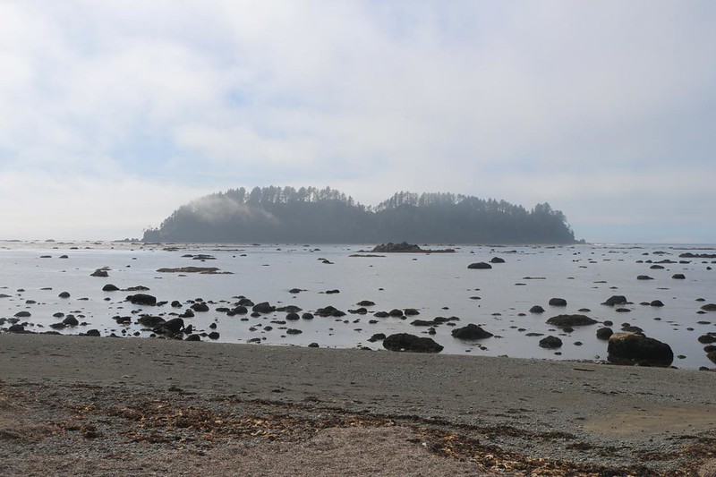
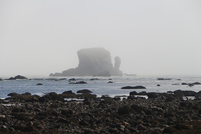
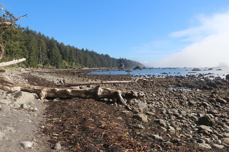
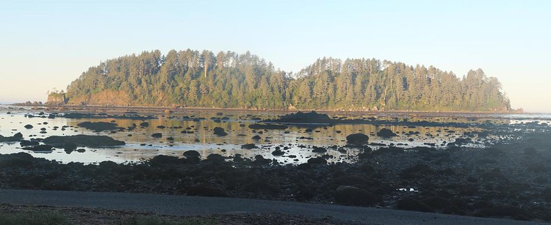
After an hour or two of hiking we arrived on the beach at Cape Alava. There was a thick offshore fog bank lurking along the coast that day. We could see a wooded island in front of us, but just barely. Meanwhile, it was time for us to head north into the campground itself. We needed to set up our tent right away, as it was still soggy from this morning’s mist at Shi Shi Beach, where we spent the night on yesterday’s hike. We wanted to dry it out before we did anything else.


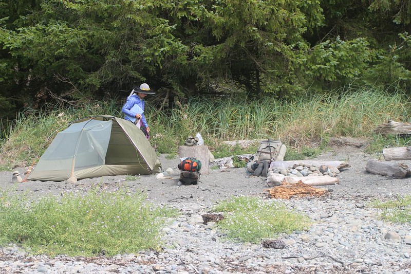
There were quite a few backpackers in the campground, so we kept on walking. Most of them were camped under the shelter of some small trees. Eventually we found a spot out on the beach itself. My attitude was “Why camp under trees when you have the opportunity to camp on the beach?” So we set up the tent, directly on the sand, up in the driftwood above high tide. The breeze would dry it out in no time. And it also served to blow away the mist! Soon there were several islands showing, both north and south of us. Time to get out the camera.


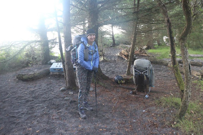
After the tent seemed dry enough, we loaded it full of gear. Our plan was to day-hike a mile or so south, following the beach to the Wedding Rocks. These were petroglyphs carved by natives in the distant past. Their location was on the map, but it wasn’t very precise. We decided to walk first and search second. We put some water and snacks in Vicki’s nearly-empty backpack and we headed out.
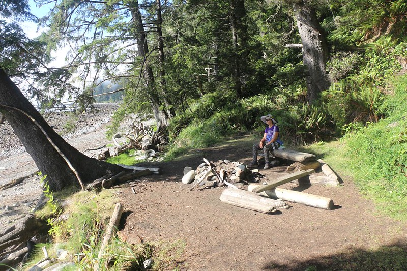
It was a good hike. The tide was low, so there were plenty of rocks and tidepools to check out along the way. We also found a couple of really nice campsites just up from the beach. I was sad that we didn’t camp there, rather than the semi-crowded campground, but Vicki didn’t sound excited. Why carry a heavy pack any further than you had to? I must admit that she had a point.
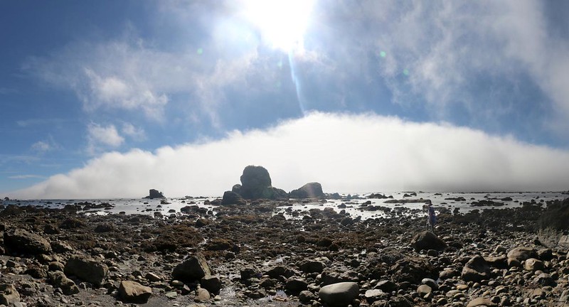


A point of land stuck out into the ocean, and that was the location of the rocks on the map. Somewhere around here. But where? This was one of those spots that the rangers warn you about, with routes that are impassable during high tide. That was why they gave us tide charts. We saw the round trail marker that showed the cut-off trail behind the point of land. Were the Wedding Rocks up there? There were some tall crags up behind the trees. So we climbed up and up and up. It was very steep, but we never saw any petroglyphs. Saddened, we continued across to the other side, and scrambled back down to the beach. But we weren’t done looking.


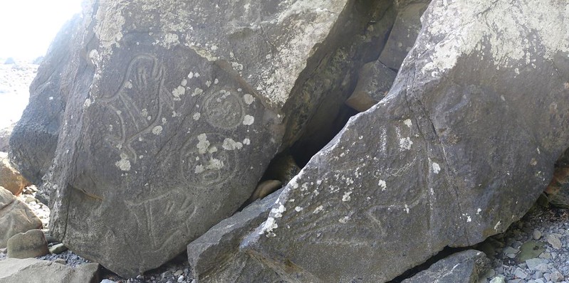
We headed south a bit further on the beach, but this was beyond what the map indicated. so we turned around. The tide seemed low enough at the moment to allow us to get around the point, so we opted for that rather than the climbing. At this point, I had given up on the petroglyphs. Suddenly, Vicki whooped out loud. She found them! I hurried over, and there they were, on big boulders right on the beach, just south of the point. The carvings themselves faced away from the surf, and it looked like they went underwater on occasion. Still, there they were, and the figures were deeply carved.


By that point, the afternoon was getting on, and the mist began rolling back in. The sun was gone. There was a stiff, steady breeze out of the north, directly into our faces. We trudged down the beach, more eager to get back to camp than explore the seaside curiosities. But that was OK; we were happy just to be here.


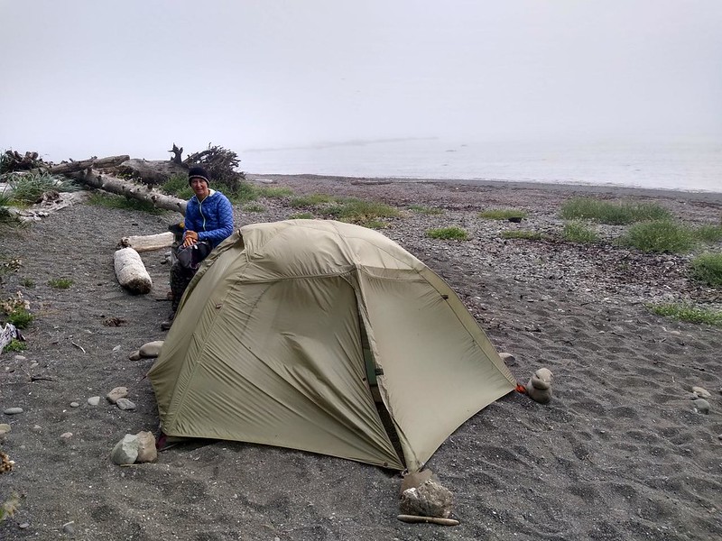
When we arrived at the tent the breeze was still blowing strong. I took a photo of it, and you could see the effect of the air pushing full blast on the windward side. We really wanted to sleep on the beach that night, but it wouldn’t be much fun under these conditions. Plus, the mist had obscured all the nearby islands so there wasn’t even any scenery. We unloaded some of the heavier stuff and brought it in under the trees. Then the two of us picked up the entire tent and carried it along the path and into the shelter of the campground. While I got the tent staked down and the gear re-loaded, Vicki began boiling water for dinner. Our usual division of labor. It wasn’t perfect, but at least we were able to eat out on the sand, sitting on a driftwood log. This would have to do.


It was too chill and damp to hang out much longer, even under the trees, so we went to bed early. It turned out to be a fairly peaceful night, although the surf wasn’t super-close like the previous night. The waves were blocked by Ozette Island, plus all the shallow, near-shore rocks. We both like sleeping with the sound of the surf nearby, as long as it isn’t too close.
The next morning dawned bright, and the mist seemed to be elsewhere. The tent was dry, at least. We cooked and ate some breakfast, then packed up everything. Once again, we were hiking out early, because we had yet another beach-backpacking trip planned later on that day, even further south, at Hole in the Wall. And it was an even longer drive to get there, as we had to go all the way inland to Highway 101.
The forest was beautiful and peaceful as we hiked back up the hill from the coast. Then the trail meandered up and down for a while within the forest. Olympic National Park was excellent! Well worth the visit.

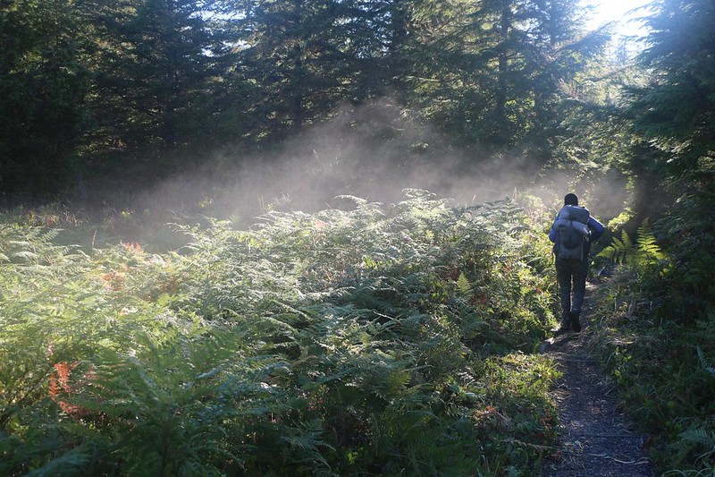
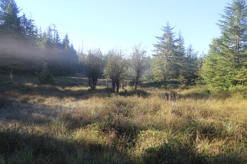
Soon enough, we were crossing Ahlstrom’s Prairie, a meadow within the trees. We were glad that there was a wooden walkway, as this place probably remained soggy like a swamp for most of the year. And we really enjoyed seeing the mist! It turned out that the missing mist must have headed inland, to meet us halfway, on our hike back to the car!
After that, the trail plunged back into the forest, and we passed by all the bridges they were upgrading. It was still early, and the trail crews were just arriving. We said hello, and hiked on into the trees. It was cool and sunny at the same time, and the morning light is always wonderful when it slants through the trunks and lights up the ferns down below.


Before we knew it, we were back at the bridge over the Ozette River, and then at the car. We didn’t spend much time in the parking lot, but we did drive over to a water faucet and refilled our five gallon jug of water.


Now we were truly ready for additional adventures in Olympic National Park. There was so much more to see!
For a topographic map of the hike see my CalTopo Page
For LOTS more photos of the trek see my Flickr Page

