We went out to Anza-Borrego to get in a night of camping, because we’d been too long in civilization. It was time to rough it a bit, and we needed to do some hiking, to burn off that Thanksgiving dinner. Also, Thanksgiving Weekend is the traditional start of “Desert Season” and we wanted to get out there as often as possible, now that the temperatures were cooler.
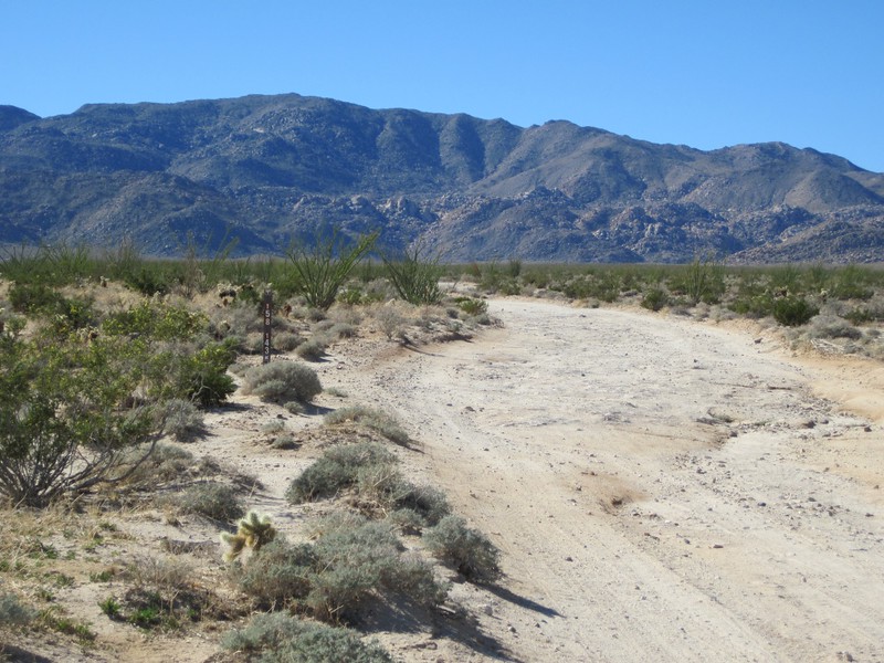
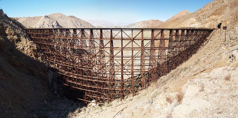
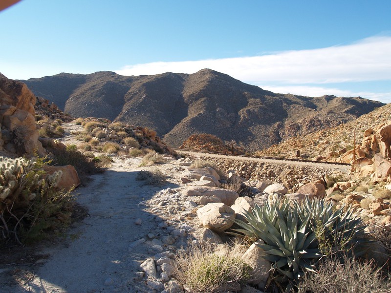
We headed east out of San Diego to the southern end of Anza-Borrego Desert State Park, intending to hike along the old Carrizo Gorge Railway to see the Goat Canyon Trestle, one of the largest wooden railroad trestles. It should be noted that we attempted this earlier in the year, by trying to hike from Mortero Palms over the top of the Jacumba Mountains and down Goat Canyon, but we ended up turning around without descending the canyon. Sure, we saw the trestle from way up above it, but seeing it isn’t the same as walking across it, and looking straight down 200 feet through the steel catwalks alongside the tracks. This time we’d do it right. But by a different route, hiking directly along the tracks.

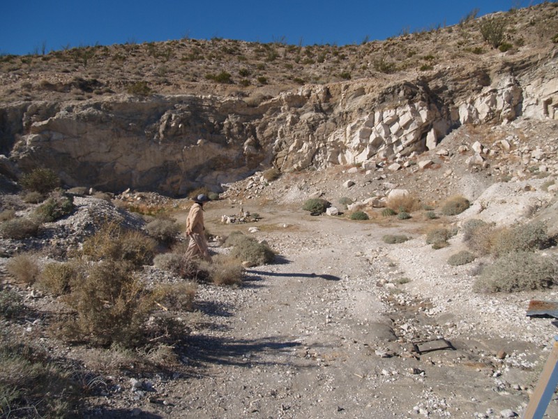
We reached the old Dos Cabezas trackside water tank about 11am, and then drove over and checked out the nearby mine. Internet searches call it an Apatite mine, but the cement marker nearby said that it was a Limestone Mine, started on Jan. 3, 1958. It isn’t a very large excavation, and there are numerous piles of tailings outside the main pit, so it may not have been worked for very long.
Video of driving on Dos Cabezas Road


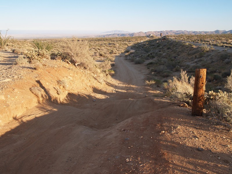
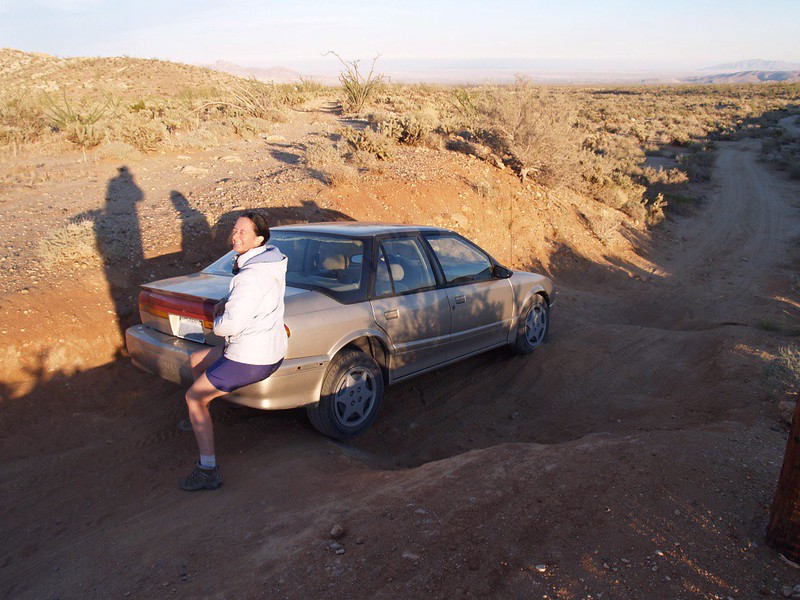
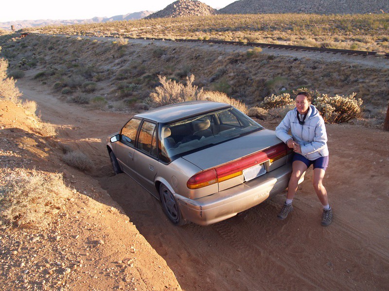
We then took the old Saturn out to the end of Dos Cabezas Road, by driving it up a short stretch of road that only seemed a little bit tricky to me at the time. Later on, when leaving, I would be amazed that I somehow managed to get the car past that point. It surely was the “crux” of that road. High clearance vehicles ONLY!
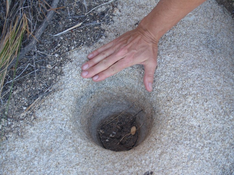
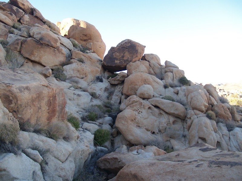
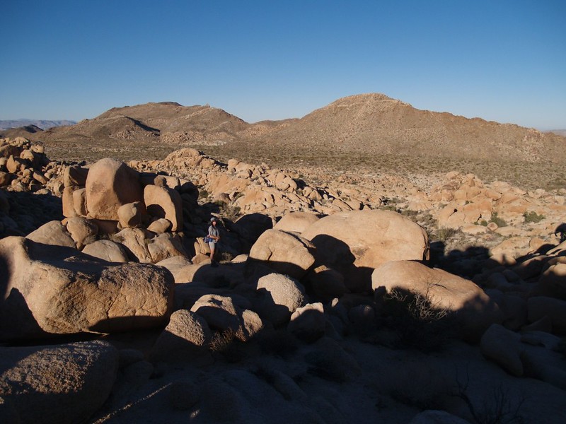
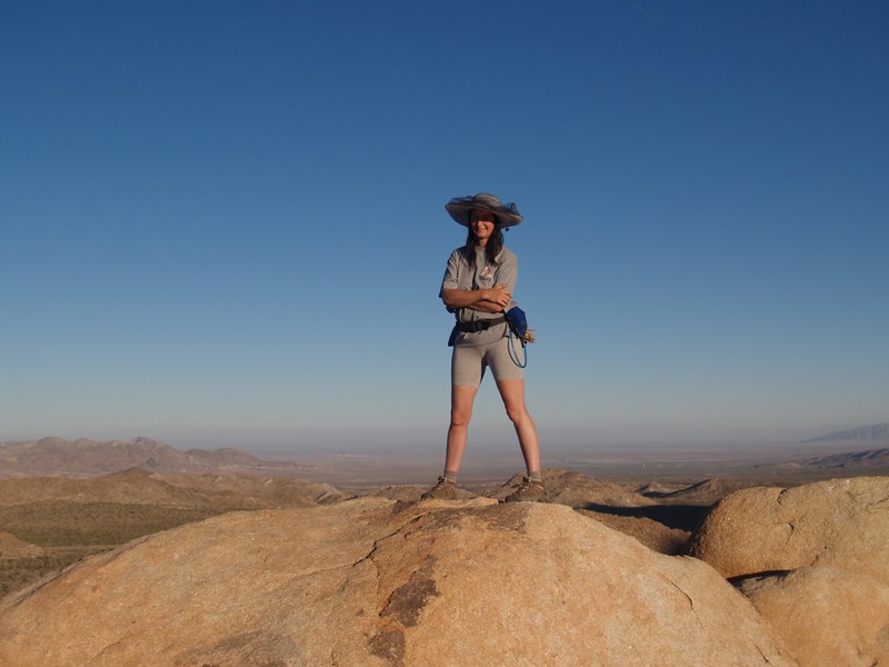
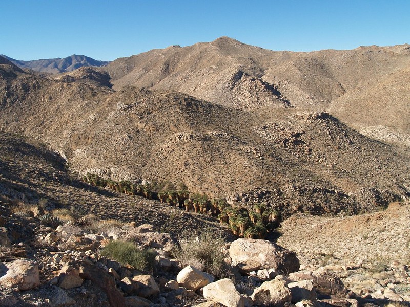
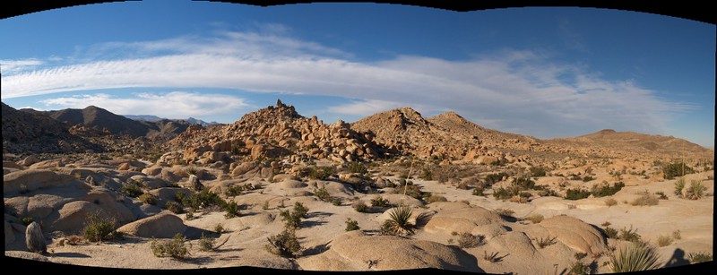
We parked the car in the most obvious camping spot and took off for a quick day-hike to Indian Hill. The only Indian sign that we saw on our hike was a single mortero not far from the hill. We tried to think like Indians, and envision where the best place to live and/or hang out would be, looking for shady spots amongst the big boulders, but we found nothing certain. It should be mentioned that Indian Hill is basically a big pile of huge rounded boulders, so there could be many possible spots for shelter in, around, and under them. Up on the top we found a summit register, with the first entry dated 1999, and the most recent a visit by Bob Burd last April. Now, Bob Burd is one of the most amazing hikers in California, and I admit that I was pleased to have my name in the same register as his, let alone on the same page. (Vicki and I had read some of his well-written trip reports about the trails we’d hiked in the Sierras the last two summers. In fact, he is such a powerful hiker that he hiked to State Peak in Kings Canyon National Park in one day, there-and-back from Roads End, a peak whose lower slopes we reached after four days of hiking with our heavy backpacks. We took three more days to get back. In other words, he did in one day what took us a full week!)


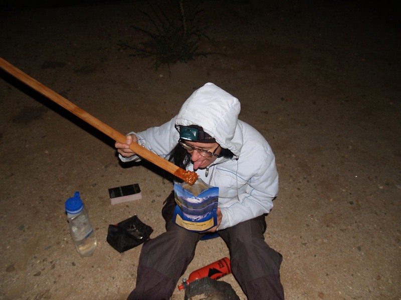
It was getting dark by the time we got back to the car, so I set up the tent and blew up the sleeping pads while Vicki got some dinner together, our usual division of labor. The tent went up OK, but there was a problem with dinner: Vicki had forgotten to bring the pot for boiling the water! And freeze-dried food doesn’t work well with cold water, so we felt as if we were staring starvation in the face. Needless to say, Yankee Ingenuity prevailed, as always. We made a small grill out of an old trackside snarl of thick, rusted steel wire, and boiled water in an empty can of soda. We needed two cups, so we boiled one cup in the twelve ounce can two times. We used a flat strip of wood we found in the trunk of the car as a makeshift spoon, and the lasagna was deposited happily into our stomachs.

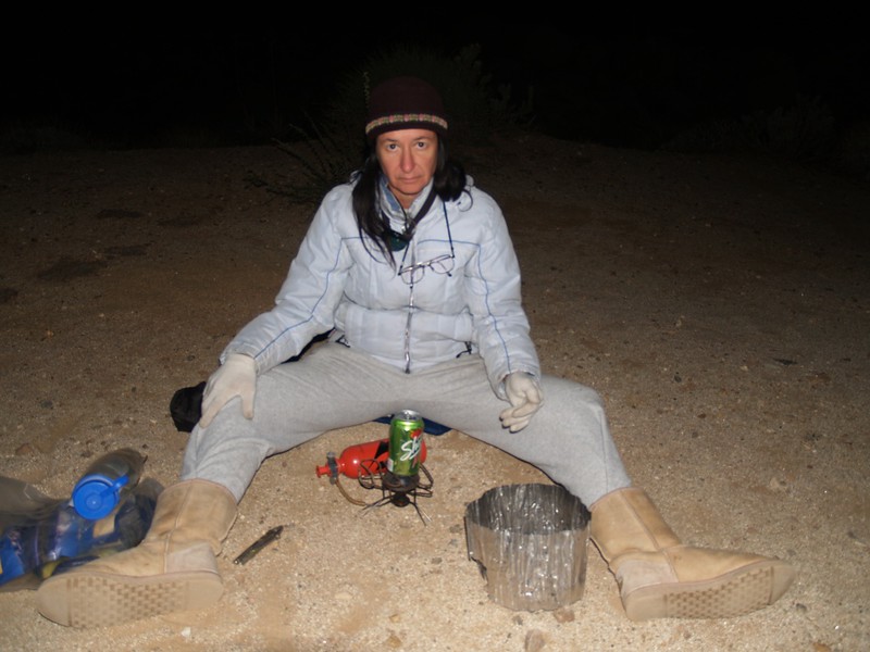
That night it was very cold in the desert. It got down into the high thirties, and there was a constant breeze blowing. Vicki and I spent a long, chilly night, cuddling against each other for warmth, constantly having to make sure the top edge of our double sleeping bag was tucked in tightly around our necks to keep out the cold drafts. Let’s not even mention the enjoyment of getting up in the crisp, breezy darkness to venture outside the tent for Calls of Nature… Yes, it was very cold, even for the desert, where a low near fifty would be more normal. I was glad we weren’t in the mountains!
We woke up and set up the soda can for more hot water and breakfast. I took some sunrise pics, then took down the tent. We got our daypacks ready for the main hike out to the trestle. It was going to be a ten mile round-trip hike, and I wanted to get back to the car before 4pm so there would still be light when we went down the “crux” section of the road; once past that point I didn’t care if it was dark. I became worried about it the evening before when several other groups in high-clearance four-wheel-drive trucks and jeeps all kept marveling that we had made it to that spot in our Saturn.


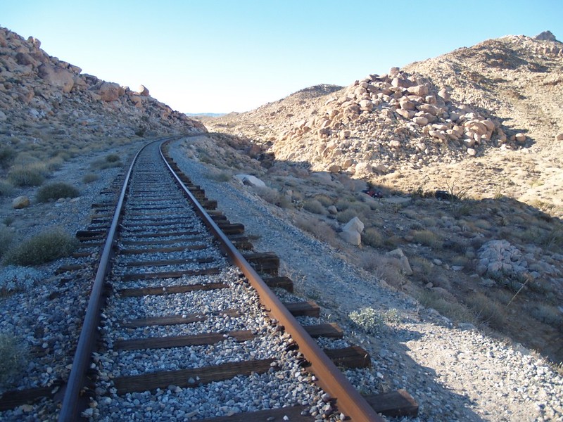
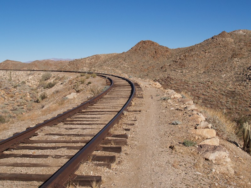
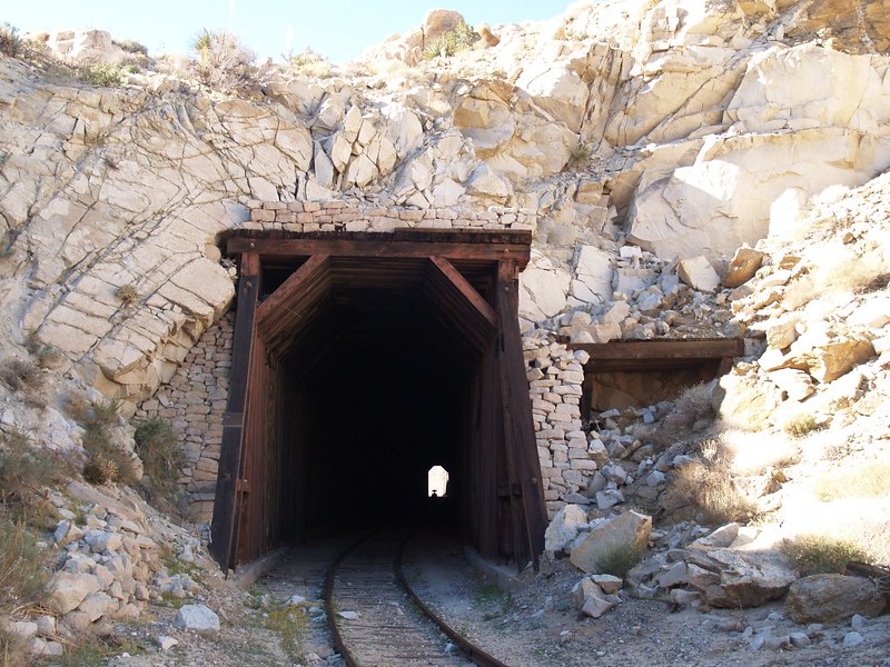
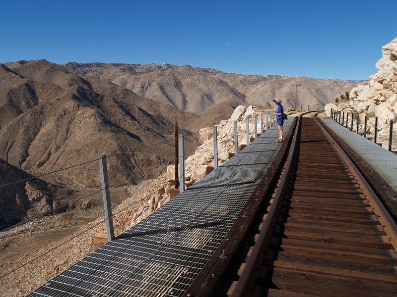
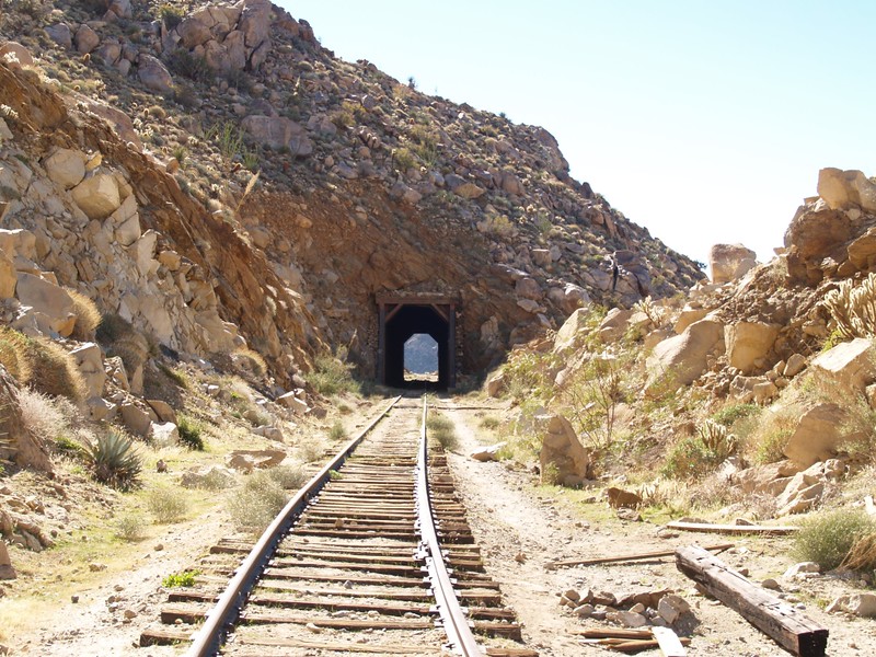
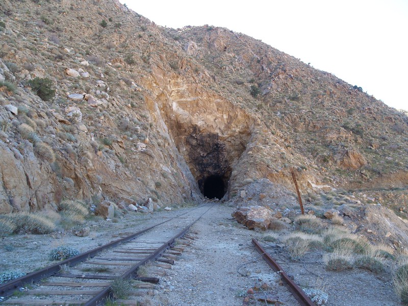
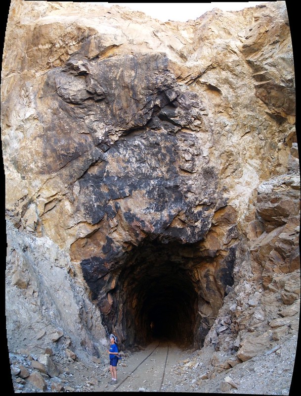
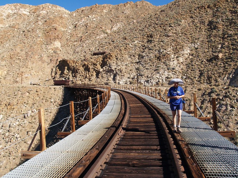
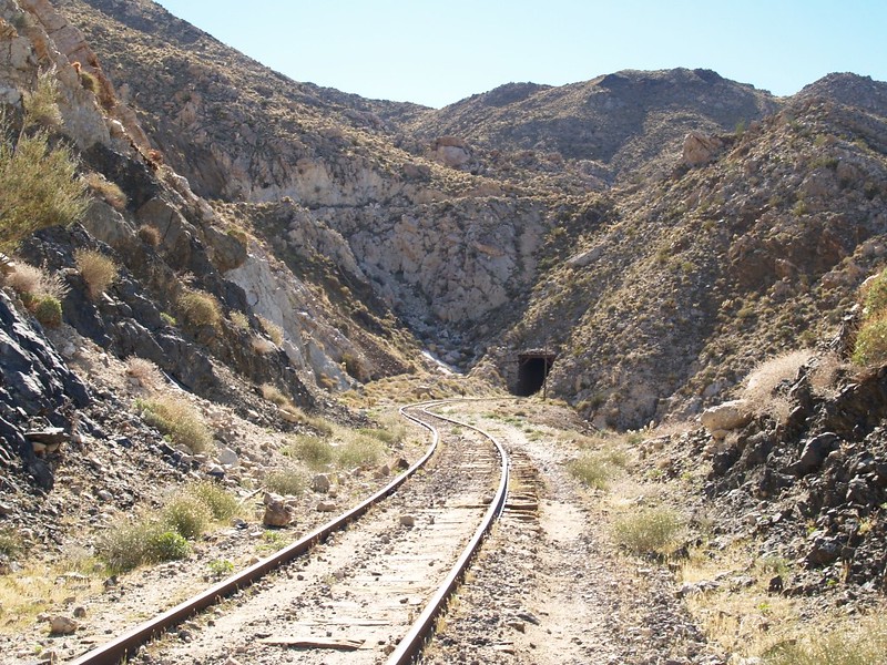
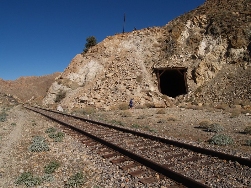
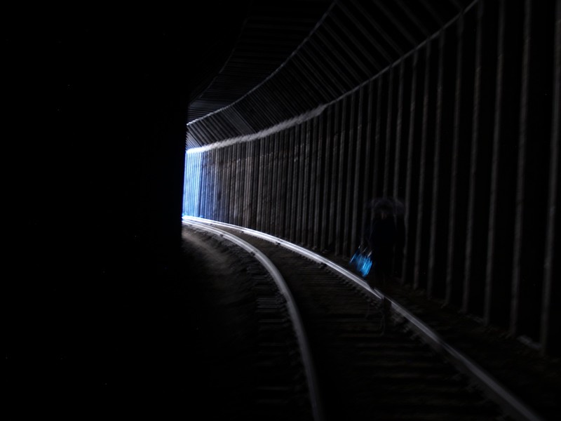
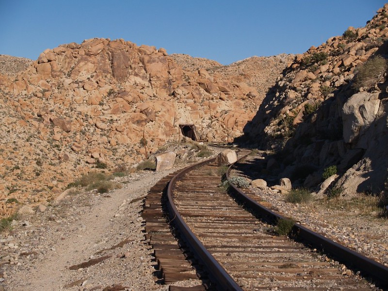
We began hiking at 8am, heading uphill on the tracks. I was told that it goes upward at a 1.5 percent grade, which was barely at the threshold of being noticeably uphill. Easy hiking, in other words. At this time, the CZRY (Carrizo Gorge Railway) was NOT operating; they were supposedly out of money (according to various unproven sources on the internet), and therefore I figured that walking the tracks shouldn’t be a problem; they wouldn’t have guards patrolling and handing out tickets on a line that wasn’t used. Still, we were a bit wary, even though the track was obviously rusty and showed no sign of recent use. On the other hand, a string of freight cars had been moved from the Dos Cabezas siding since last February when we were here, and the line supposedly wasn’t running then, either. A mile of hiking and two tunnels later, we realized the truth, when we discovered a giant boulder calmly sitting in the middle of the track. There hadn’t been any trains here in a long time. Subsequent tunnels showed additional rockfall blocking the tracks, so we hiked on, confident that we weren’t causing anyone any trouble by being here, and that some train wouldn’t surprise us while were were inside a tunnel.
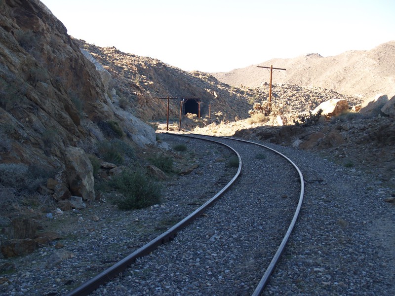

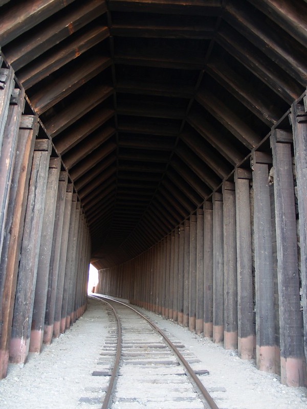
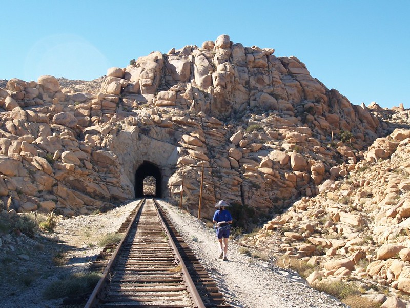
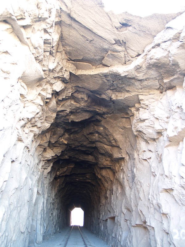

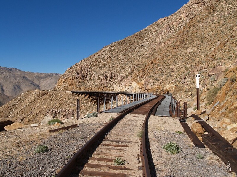
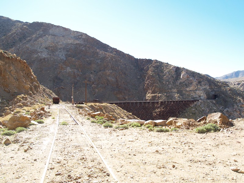
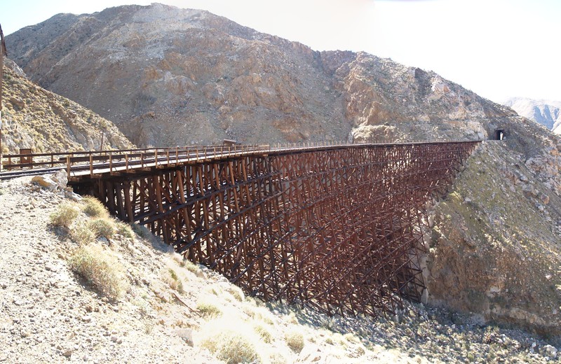
All told, we hiked through six tunnels and over a number of smaller trestles before we reached our ultimate destination, the Goat Canyon Trestle. Each tunnel had it’s own character, which depended on the type of rock that it went through. Some tunnels had significant rockfall near their entrances/exits. At least one had a damaged timber due to the rockfall. There were a number of big boulders on the tracks. Still, it wasn’t much, damage-wise, when looked at from the perspective of how tough it must be to maintain this line, and how difficult it could be to repair a major rockslide; the blockage that we saw could be cleared in a matter of hours or days, not weeks or months.


Video as I walk through Tunnel 16
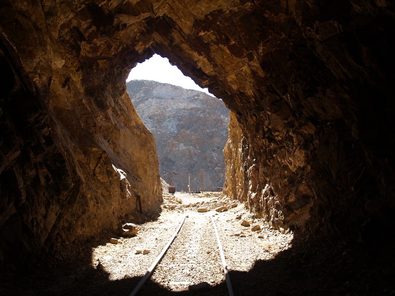
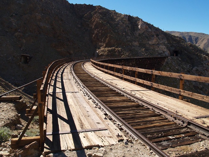
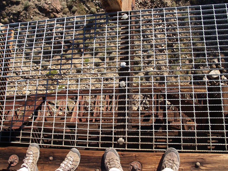
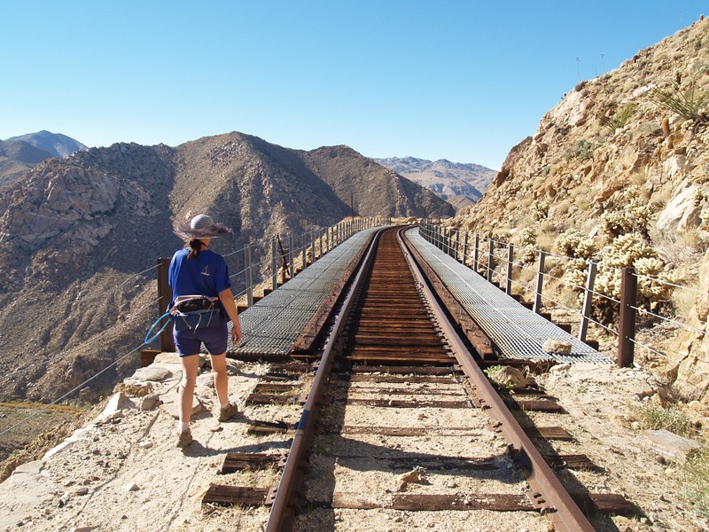
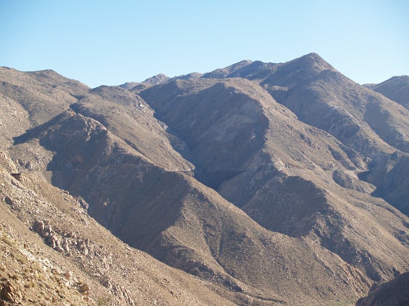
We spotted the big trestle from a couple of miles away, and it took quite some time to reach it. Needless to say, it was as impressive up close as it was from afar. It was truly an extraordinary feat of engineering. And all because their original tunnel collapsed, so that they had to make a new tunnel in another location, thus making the span across Goat Canyon a much longer, and loftier, one. Walking over the steel-grating catwalks was not for the faint-hearted, as you could look two hundred feet straight down below your feet. I decided that it was safer to walk in the center of the tracks, on the large wooden ties, especially after I saw a piece of the catwalk held together with some old yellow rope!

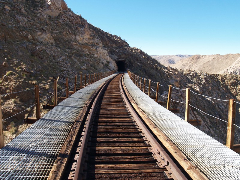
Video through the catwalk as I walk along, and the view 160 feet down!

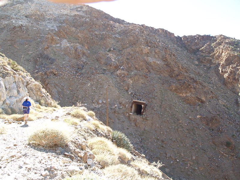
We hiked a bit further, through the next tunnel and around the corner, and looked into the other end of the collapsed tunnel. Someone had camped inside it in the past, and left an old stone fire-ring and some tattered blankets. Vicki explored deeper into it with her headlamp, until she reached the collapsed area, but there wasn’t much more to do, except maybe cause some further collapsing by speaking too loudly, so she quietly came back out.


We hiked back across the trestle and had some lunch. It was a nice view. A group of three guys arrived to check it out, and we decided that it was time to head back to the car. As we entered the first tunnel, we met up with a couple of people riding mountain bikes; they had started back by the old water tank. They told us that they had to walk the bikes fairly often, but most of the time the riding was fine, as there was a decent trail alongside the tracks for most of the distance. Only the trestles and tunnels would slow them down. Vicki decided that she wanted to rent mountain bikes for our son and me; we would start our trip all the way at the top of the tracks, up in Jacumba, and she would drive the car down to Dos Cabezas and pick us up. It sounds like a great trip, and you will probably see some pictures from it on these pages in a month or so.


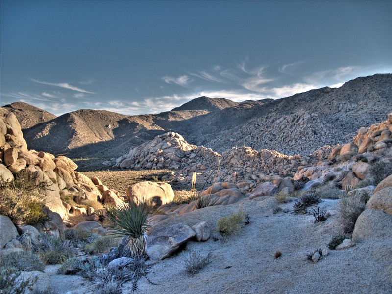
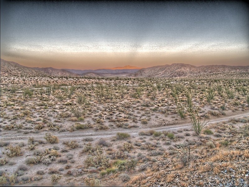
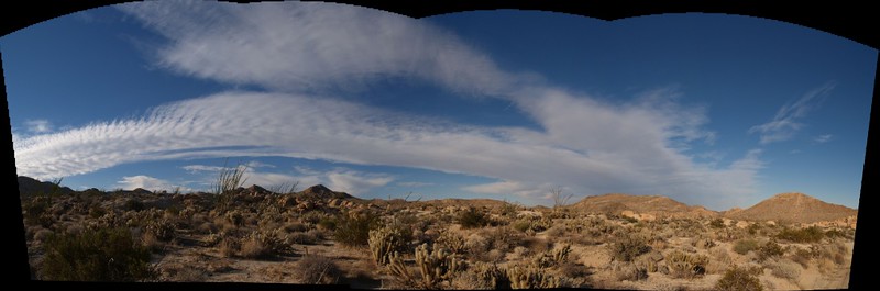
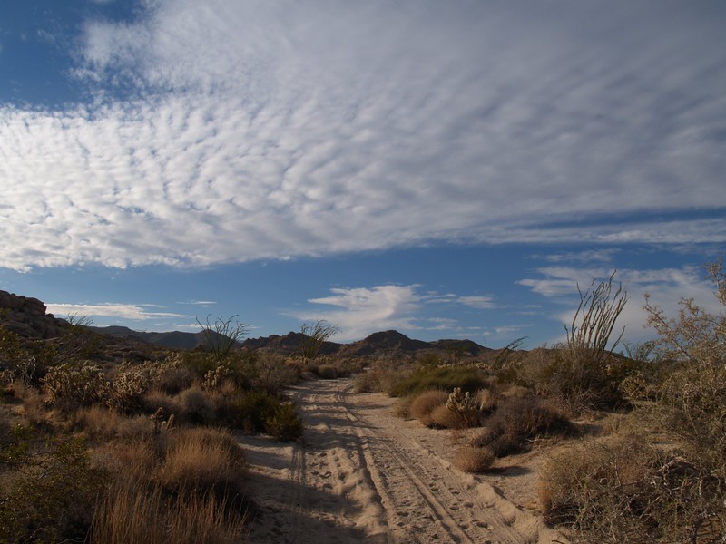
The rest of the hike back on the tracks was a merely a recap of the way out, so at the halfway point we turned off the tracks on the old jeep trail that headed directly toward the car, passing Indian Hill on the way. We saw the remains of the old railroad construction camp, and took some great photos when the high clouds moved in and the sun declined, making excellent shadows on the distant hills. The wind also picked up, and we were glad to be leaving for home; spending another cold night, with even more wind, was not part of our plan.


Panorama video of the area near Indian Hill.

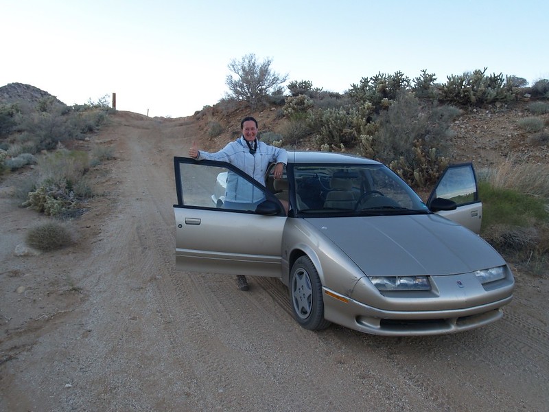
We got to the car with plenty of time to spare, and drove away, heading for the tricky section of road. We got to the top, stopped the car, and got out to plan our descent into the wash. It only dropped about fifteen feet vertically, but the big four-wheel-drive trucks that had repeatedly passed this spot over the years had produced a set of solidified standing waves in the dirt, like moguls on a ski slope. I tried to remember how I went up it yesterday, but it had happened too fast. Now I was regretting coming up here. It looked like it would be impossible to take the car on the road without it bottoming out. All paths led to a stuck car. But, we had to do something eventually, so I got in the car and gave it a shot. Vicki stayed outside to take a video. And it was a very short video. I got about halfway down the hill before it bottomed out completely. The car seemed to be sitting on a bump with all of its wheels in the air, like a turtle on top of an anthill, its legs waving about ineffectually. I had to climb out of the passenger door, as my door wouldn’t open far enough before it hit the dirt. I took some pictures for posterity, and then we got to work. We had several ideas about what to do, some of which required emptying the trunk to get out the jack, but we decided to hold that as a third-to-last resort. Our second-to-last resort was to walk back up the road to visit the three young gents we’d met at the trestle, and put their truck and/or muscles to work. The ultimate last resort was to call a tow truck. But it turned out that we didn’t have to do any of these. The idea that worked was by jamming large rocks under the left front tire while Vicki lifted and pushed from the back. Once the front tire bit the rock, I gave it some serious gas and kept it moving, as it was all downhill, and after one more minor Bang! the car was free. And so were we! We cheered and gave each other a well-deserved high-five. We looked at both the hill and the car. Nothing seemed to be damaged or leaking, so we declared it good. As long as we didn’t look underneath it we’d be perfectly happy.

Me attempting to drive the old Saturn over the crux near the end of Dos Cabezas Road. It was a short video. Fail!

The sun’s light and the mountain’s shadow was heading eastward as we drove back to the highway, and it was dusk by the time we reached the pavement. Ah. Another weekend’s adventure was nearly finished. All that was left was the drive home in the dark. And our plans for the next trip to the desert…
For more photos and videos from this trip see my Flickr Page.
For an interactive topographic map with our GPS tracks see my CalTopo Page.
