We spent four days backpacking in the San Jacinto State Wilderness and bagged four of its most obscure peaks: Yale Peak, Harvard Peak, Joyce Peak, and Mount Saint Ellen’s (all are colloquial names).
This was primarily planned to be a “Shakedown” trip. It was also the first trip of our Summer 2018 Backpacking Season, and we intended to check out all of our gear along the way, to make sure that everything was fully operational for the time when we will be far away from civilization. And if we managed to visit one of our favorite places and see some new sights along the way, well, that was all the better!
Day 1: Tram to Tamarack Valley, plus Yale and Harvard Peaks
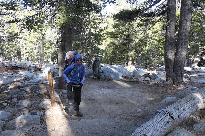
We woke up early and made the 2.5 hour drive from San Diego to Palm Springs in plenty of time to catch the first Tram up the mountain at 8am. After a crowded ride up the cables to 8500 feet elevation, we shouldered our big packs and walked outside the tram station and were greeted with a freezing breeze. It was in the low forties up there! It was bitter cold compared to the desert. But we were ready for it. We knew that a storm was passing by up in Northern California, and that today and tonight would be the coldest parts of our trip. Twenty degrees below normal temperatures is rather cold. It was predicted to warm up roughly eight degrees per day for the next four days, with the last day being well above average. And that’s why I was already wearing a pair of thermals under my hiking pants. But it was still cold. We stopped to put on our windbreaker jackets and gloves, then continued hiking. We needed to keep moving if we wanted to avoid freezing our butts off!

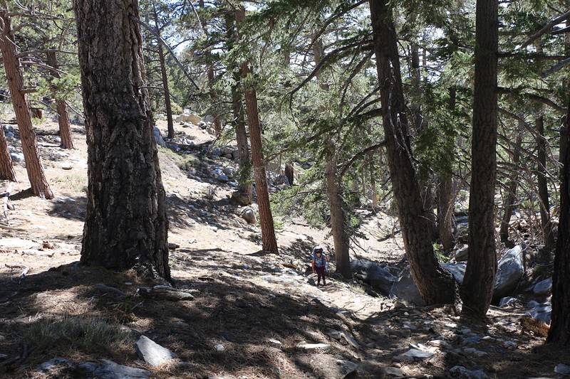
We headed up the trail to Round Valley, but turned aside and took the unofficial Sid Davis Trail directly toward Tamarack Valley. This trail is a great shortcut, but it’s steep. On a cold morning like this one, the climbing helped us warm right up, and soon enough we were shedding our windbreakers.
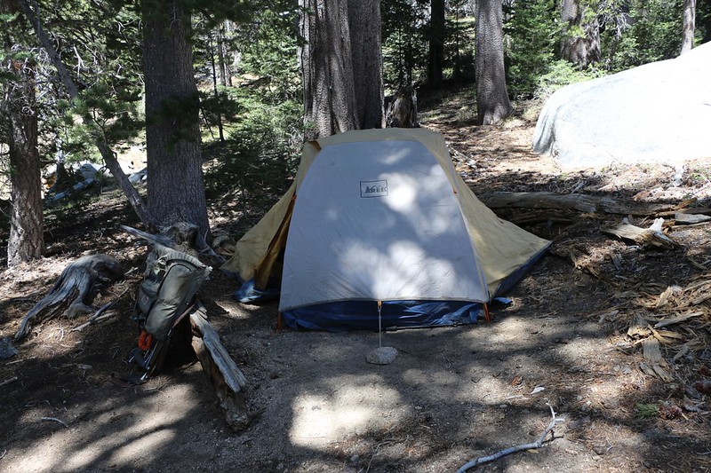
On our way to the Diorite Campsite (the most remote spot in Tamarack Valley) we met up with a volunteer park ranger who was out and about, stocking all the outhouses with toilet paper. Every campsite was reserved on this busy weekend, so it was time to get everything ready for Summer. He checked our camping permit and then we set up camp. It was only 11am and we were already done for the day! But not really.
The other part of our plan for the day was to bag to nearby peaks, Yale and Harvard. We hadn’t climbed them yet, and we always try to do something new when we can. These two unofficially-named peaks, along with nearby Cornell Peak (named on the USGS Topo Map) made up the “Ivy League” part of the wilderness.
We packed some water, snack, and lunch in Vicki’s smaller backpack, and I carried it as we made our way cross-country toward the saddle between Yale and Harvard. It was easy hiking, made easier with the use of my GPS. Along the way, we spotted an entire herd of deer, who were probably wondering about this sudden invasion of humans in their territory. By the end of the Summer season they probably wouldn’t blink an eye, but for now they ran off and were very skittish.
Video of a fawn running toward her family in Tamarack Valley
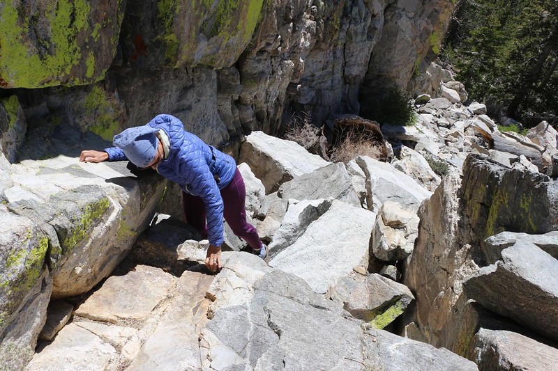
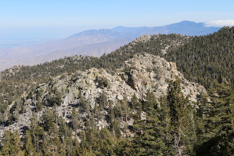
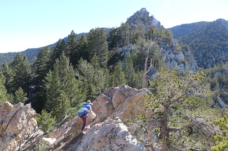
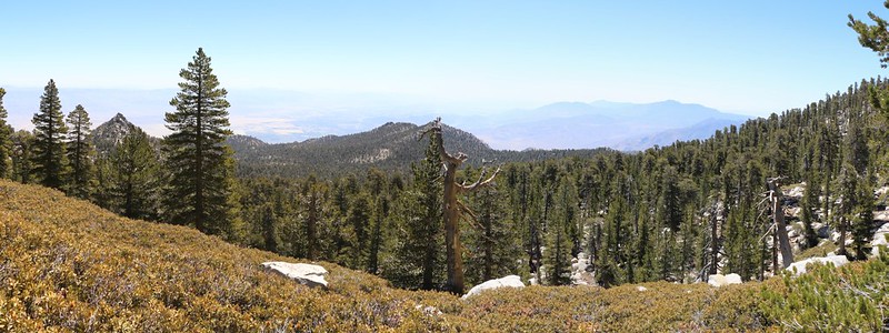
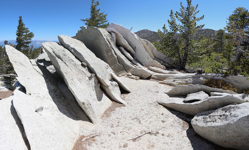
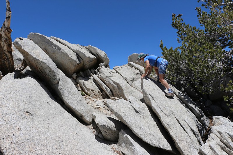
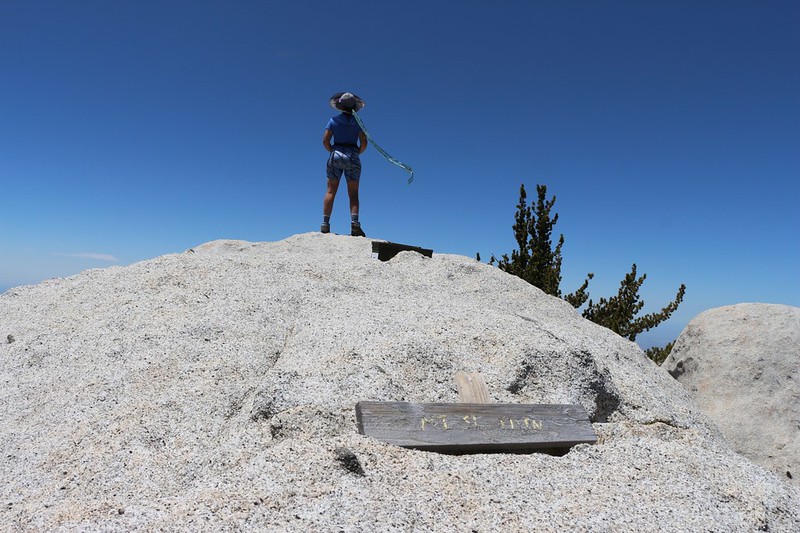
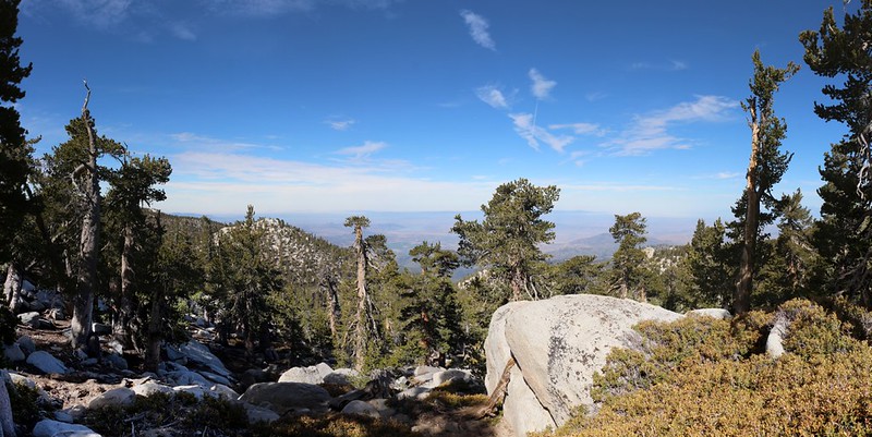
Having gained the saddle, we stopped and ate some lunch, sitting in the sunshine. We decided to bag Yale Peak first as it was closest. I’d read online that the peak had two summits, with the southerly one being the highest. If I remembered reading correctly, the best approach was to climb directly up to the tiny saddle between them, and that’s exactly what we did. It wasn’t easy, but it sure was fun! It was all granite rock, and we scrambled up a long steep notch using our hands to hold on. Definitely a Class 3 ascent. Good times. And the view from the notch was excellent.
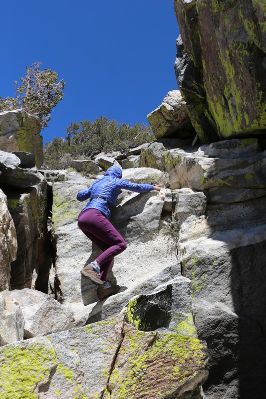
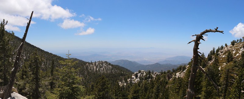
We took a bit of a breather there in the saddle, then turned right and continued scrambling upward to the Yale Peak Summit. It was well-worth the climb. Great views from up there. It’s uniquely situated in the middle of the region, giving views down into Long Valley and up to the summit of San Jacinto Peak, showing all of the area in between. We took plenty of photos and videos, but didn’t stay up there too long. We still had another peak to bag that day!

GoPro Video panorama from the summit

We descended back to the saddle below, then headed north toward Harvard Peak. While up on Yale, we decided to aim a bit to the right of the actual summit, which looked to have a cliff just below it. We would then follow the ridgeline up to the top. And that’s exactly what we did. It was steep but easy terrain through pine trees and granite boulders. The summit itself was properly rocky, with fine views. There was even a summit block with a deep wide crack, but we both decided not to bother taking the risk of standing or sitting up there. So maybe we didn’t truly bag the peak. Oh well. It was good enough for us.

GoPro video panorama from the summit
After taking plenty of photos and videos, we decided to head back to camp. But which way should we go? It would be easy enough to backtrack, but that would actually take us further from camp initially. I made a quick scouting foray along the summit ridge to the west and returned to Vicki with the news that it looked to be another fun scramble over large granite blocks. Was she up for it? She was. Especially since it meant we were travelling almost directly toward our campsite. We had a lot of fun and ended up descending along the side of Cornell Peak, and dropped down directly into our campsite. It was perfect!
It was dinnertime when we got back to camp, and the air was getting much colder. We immediately entered the tent and put on our warmest layers right away. We were fine after that. The sun sank in the west behind San Jacinto Peak as we sat in the cool breezy shade eating dinner. Then we headed into the tent before dark and read our books via headlamps as the night drew in about us.
Day 2: Backpacked from Tamarack Valley to Little Round Valley
The next day dawned bright and cold. It was in the upper thirties, so we decided to stay in bed a bit longer. We were in no big rush, after all. The only thing we had to do today was hike over the top of the mountain to Little Round Valley, less than four miles of hiking and 1400 feet of elevation gain. No worries. So we waited for the sun to hit the tent, then Vicki whipped up some tasty breakfast. We ate it in the sun, then packed up camp for the hike.

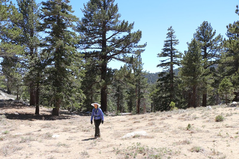
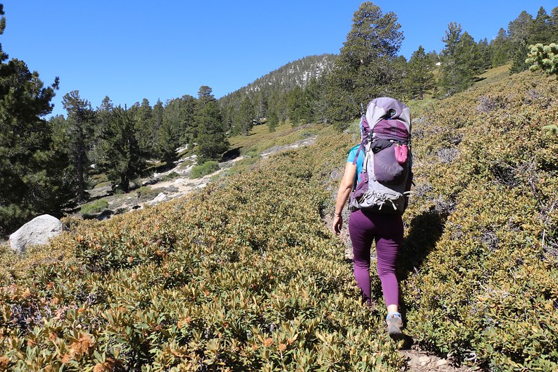
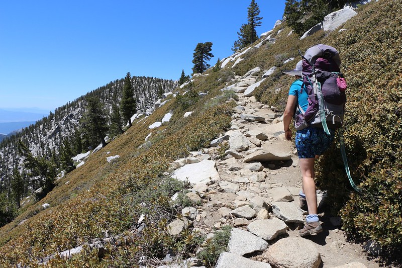
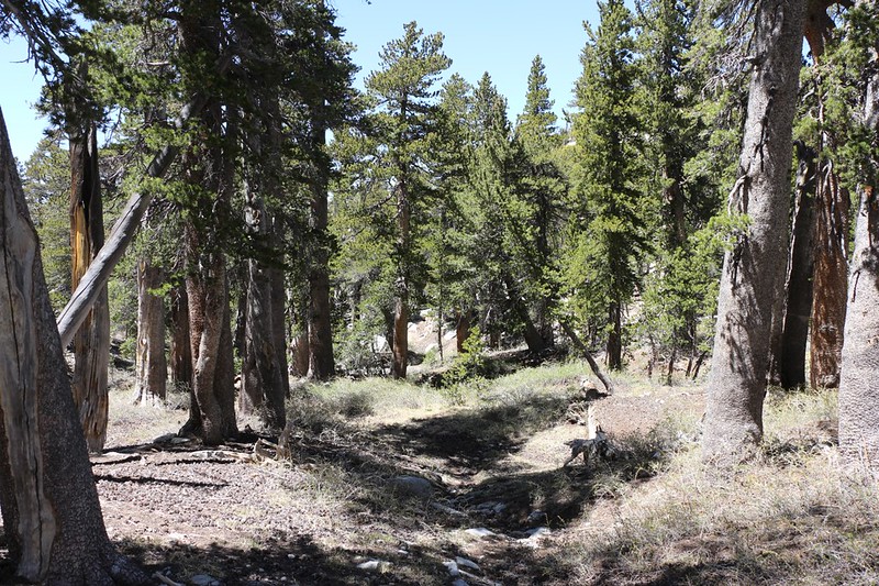
Since we were already uphill as far as you can get in Tamarack Valley, we decided to hike on the old Tamarack Trail. This trail has been left unmaintained for at least twenty years, but it was still there, if you knew where to find it. And we did. We’d hiked it many times, and the trail was present on my GPS. So we headed up alongside Tamarack Meadow until we intersected the trail. Every year the trail gets a bit more overgrown with chinquapin bushes, but we didn’t let that stop us. It was created back in the 1930’s by the CCC, and it was built to last. Easy hiking, but wearing long pants is strongly advised. It takes a bit of route-finding with the GPS to stay on course, but we were old pros at this sort of thing. And it sure was nice to be the only people on our own private trail.
Gopro Video Panorama from the Tamarack Trail
But the fun couldn’t last forever. Eventually we intersected the main San Jacinto Peak Trail, which was busy with day-hikers heading to the summit from the tram. We stopped for a break about fifty feet from the trail, and almost all of them walked right by without seeing us.
After that, it was simply a matter of trudging on up the busy trail. Everyone passed us because we were so slow and heavy-laden. But that was OK.
We reached the trail intersection just below the summit and it was crowded with hikers. There was a large Boy Scout Troop with big backpacks taking a long break there. Actually, only a few scouts were there, but a lot of backpacks. The kids themselves were taking a quick side trip to the summit. Vicki and I had been up there many, many times, so we decided to leave the crowds behind. We didn’t even take off our packs, and immediately headed downhill on the Deer Springs Trail. The Little Round Valley Campground was only a mile or so away.
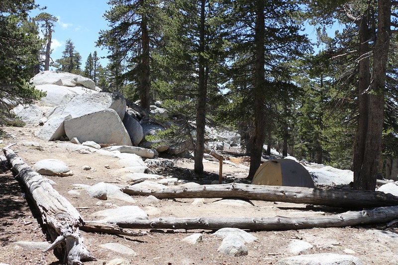
It was all downhill, and we hiked those switchbacks at full walking pace, and it still seemed to take forever to reach the valley. We passed by the first campsite, “Junco Flats,” because the name sounded junk-y. It turned out that it’s the name of a bird, as are most of the campsites in Little Round Valley. But we didn’t know that. The next spot, “Cooper’s Nest,” sounded better, so we headed down the side trail and found a good sandy spot near some big granite boulders. We took possession immediately, and set up camp. Then we sat and ate our overdue lunch (we had planned to eat it back at the trail intersection but it was too crowded), then entered the tent and took a quick nap. This is the way Memorial Day Weekends are supposed to be!
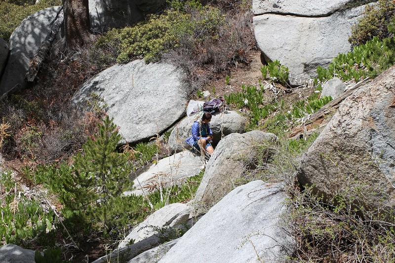
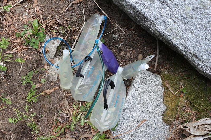
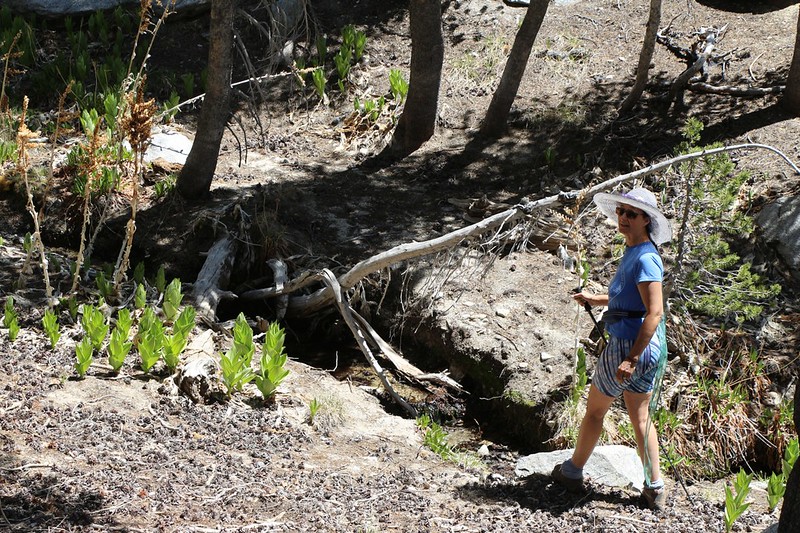
We woke up eventually. It was time to do some chores. At this point, we were nearly out of water, so the most important chore was to replenish our supply. We were planning on spending two nights here, so we wanted to get a lot of it. We emptied Vicki’s pack and re-loaded it with water containers and the filter. Then we headed down the trail a half mile or so to Lily Spring, which was a swampy hillside cienega whose outflow ran across the trail. Vicki did the filtering, as usual, and I held the heavy jugs. It took a long time, but eventually we had over three gallons of fresh clean water. Carrying it back up the hill to camp was my job.

We enjoyed the rest of the afternoon, just sitting around reading our books. The temperature was cool, so that first we’d read while sitting in the sun, then after getting overheated we’d have to sit in the shade. Like a rotisserie. But I have to admit it was rather peaceful. Eventually we ate dinner and sat around reading some more.
Little Round Valley is up at 9700 feet elevation, and it gets cold there early. After a mellow dinner we headed for bed well before dark.
Day 3: Hiked cross-country to Joyce Peak and Mount Saint Ellen’s
We stayed in the tent well after dawn. Today was going to be a fun and easy day, bagging a couple of nearby peaks, and we were in no rush whatsoever. Plus, as always, Little Round Valley was freezing cold in the morning. The thermals that carried warm air up the mountain during the day became anti-thermals at night, and there was always a cold continuous river of air flowing downhill through the valley in the morning. The only cure for this frigid breeze was time and the power of the sun. So we stayed inside until the sun lit the tent.
We ate breakfast, got dressed for the day, and put our gear/snacks/lunch/water into Vicki’s backpack. Then we set out on our hike. We didn’t get moving until 10am, which was pretty sad, even for lazy people like us.
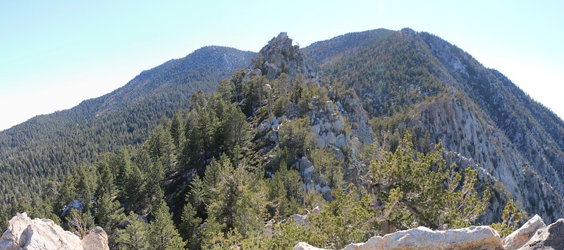
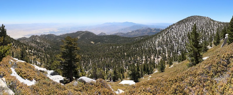
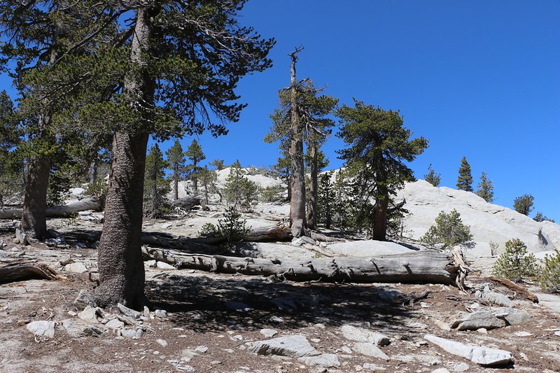
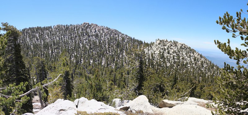
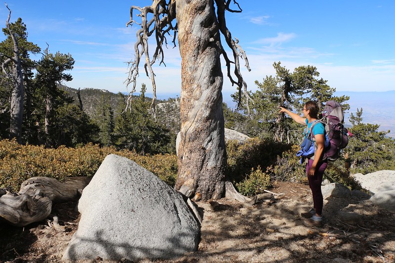
We hiked cross-country up to the saddle between Jean and Newton-Drury Peak, then continued south toward Joyce Peak. It was a pleasant country with plenty of big pines and granite boulders. Easy hiking.

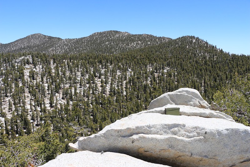
We made it to the summit of Joyce Peak in about an hour. There was a fun summit block to climb on and a nice flat sandy spot to camp on right next to the top. Not that you are allowed to camp here, of course. But it sure did have some fine views and it would be a great place to stay on a pleasant Summer night.
Joyce Peak itself was very broad and wide, and it was difficult to decide whether we were on the true summit, but we think so. The other rocky prominence nearby was hidden in trees, so it was hard to tell. But we liked the one with the view so that’s that. We felt that the real Joyce that this peak was named after would find this spot to be perfect.
We had a feeling that there might not be a summit register on this “officially” unnamed peak, so we brought one along with us. It was a small spiral-bound notepad in a zip-lock bag that was then hidden inside two cans for protection from the elements. We put a rock over the top to hold it down under windy conditions and left it there. Some day, years from now, we’ll probably head back up to see if anyone else has signed it. And if it’s gone, well, that’s OK, too. We just happen to enjoy signing summit registers, so there!
GoPro Video Panorama from atop the summit block of Joyce Peak

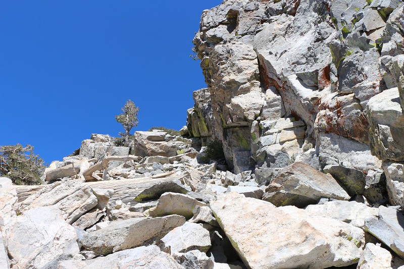
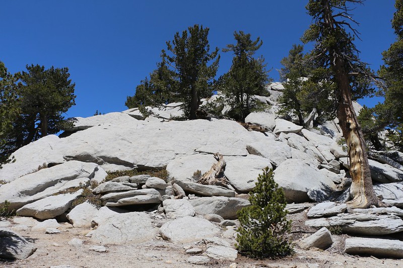
After that, it was time to head on over to the second peak of the day (and the fourth of this trip): Mount St. Ellen’s. It was only a half mile away, and wasn’t far from Marion Mountain. We were at the saddle in no time. After that, it was a matter of finding a safe scramble to the top. This peak was a giant granite rockpile! But it looked like it might be fun. And it was!
We spent some time hanging out in the sun on the summit. We signed the beautiful summit register and viewed the photos in the photo album. This peak was named in honor of Ellen Coleman, an extraordinary woman that we’d met many times over the years. She was always out there, hiking and adventuring all over, but loved the San Jacinto area the most.
GoPro Video panorama from the summit of Mount Saint Ellen’s
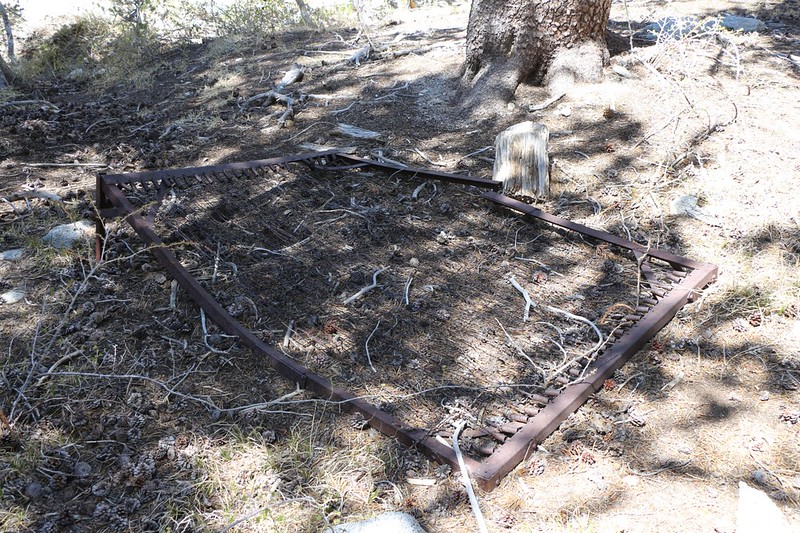
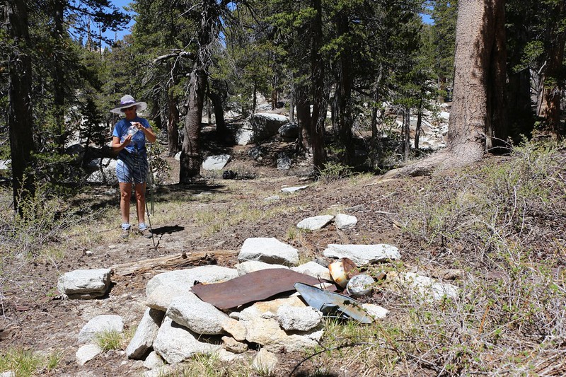
We scrambled back to the saddle and got out some lunch, then sat in the sun and read our books for awhile. It was only 1pm and we had plenty of time left on our hands. What should we do? Besides head directly back to camp. I got out the GPS on my phone and checked out the map. I saw the blue line of the North Fork of the San Jacinto River and where it crossed the Deer Springs Trail at what was colloquially called “Bed Springs.” I had read online that there was an actual bed spring somewhere along the path of the watercourse, left by some madman up here at 10,000 feet elevation years and years ago. I proposed that we follow the blue line downhill until we hit the source of Bed Springs. Vicki agreed, not surprisingly. She’s always up for something new and fun.
So we hiked up and over the Joyce Peak ridge and down into the Bed Springs Valley. It was dry as a bone up here, but it was obviously a watercourse some of the time, so we followed it downhill for quite a ways. Eventually we spied a number of green-leaved gooseberry bushes, and hoped that this was the spot. And it was. I found a double-sized bed frame, complete with springs, all rusty and lying on the ground. It was pretty darned big, and we realized that it must’ve been brought here on horseback. We looked around, The spot was quite flat, and large enough for a nice big tent, especially one of the heavy-duty, old-fashioned canvas wall tents. The kind of thing that only horses would carry. And there was also a fireplace with a couple of rusty tin cans, some old pots and pans, and a nice piece of rusty sheet steel for use as a stove top or griddle. We wondered how long they stayed up there, and why, and whether the icy Winters drove them away for good. I’m not sure whether we’ll ever find out. It’s all a mystery now. Maybe a longtime resident of Idyllwild would know, since that’s the nearest town.
Once again, we were at a point where we had to make a decision: Head back the way we came? Or head down the “river” to the main trail. I was in favor of the latter, even though it meant climbing more later, and had to work a bit to persuade Vicki. In the end, it was the thought of seeing something new that did the trick, and down the stream we hiked. And we were glad we did!
There were small waterfalls and tiny pools of water along the way. These were sights and sounds we hadn’t experienced up here in a long time, what with the recent drought years. And it was easy hiking downhill, though it was a bit steep at times. The trick was to stay out of the actual riverbed itself, and merely observe it from above.
Video of the water flow at Bed Springs where it crosses the Deer Springs Trail
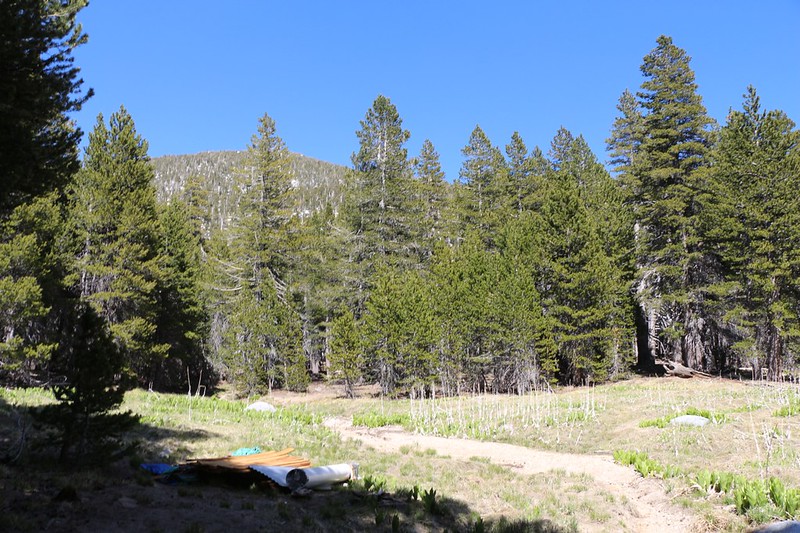
We made it back to the main trail and began the hike back uphill to Little Round Valley. It wasn’t as bad as Vicki had feared, and soon we were back at the meadow. This was a fairly low water year, and the stream in the meadow was already dry, which was a bit sad. The only interesting thing was a pile of lumber and building materials for a new wooden latrine that a helicopter had dropped off not too long ago. The meadow was the only clear place in the area so it made sense to drop everything there, and we doubted highly that they would build the latrine so close to the water source. As for me, I was glad that it wasn’t my job to carry everything to the final site. Or dig the hole.
It was mid-afternoon when we arrived at our campsite, and, once again, we spent the rest of the day taking naps in the tent and reading books in the sun. Thus far, it had been a very relaxing weekend.
Day 4: Hiked back to the Tram from Little Round Valley
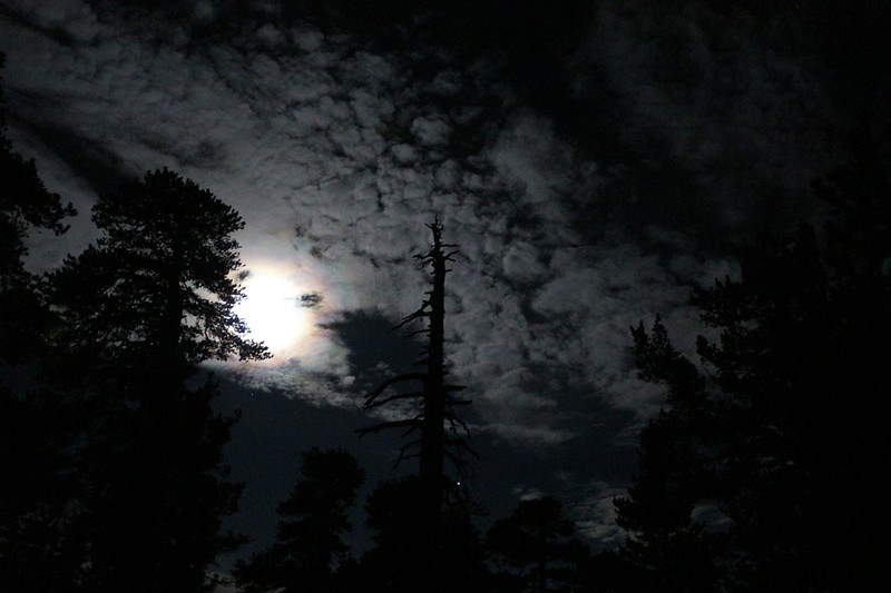
The problem with going to bed early is that I tend to wake up early. And that’s how I ended up taking a photo of the full moon shining through some high clouds at 3am. It had rainbow-like qualities, so maybe it’s a Moonbow, but it may also be called a Moon Corona. I thought about waking Vicki to see it, but she was sound asleep, so I decided that she would have to wait until we got home to see the pictures.
It was cold out there, so I ducked back into the tent and the warm sleeping bag. I was fully awake, so I read my book for an hour or so by the light of my headlamp. Eventually I fell back to sleep, but we still ended up waking up earlier than usual in the end. This was our fourth and final day, and we wanted to get back to civilization and eat some high-calorie food. We ate breakfast, packed up our gear, and managed to leave camp before 8am. Time to hike!
Part of our reason for braving the cold temperatures was that the uphill section of trail was on the west side of the mountain, and we knew that if we hurried we could climb it in the shade. Let’s face it: It’s much more pleasant to hike uphill when it’s cool. And that’s exactly what we did.
It was the Tuesday after Memorial Day, and we pretty much had the mountain to ourselves. The weekend warriors were long gone, and the day-hikers were just getting started down below at distant trailheads. This was the way we liked it.
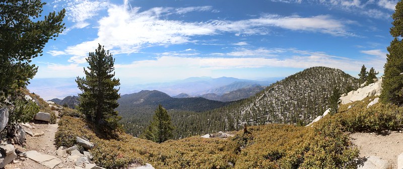
We hiked slowly but steadily up the switchbacks to the trail intersection just below the summit. Along the way the views got better, and we had one last chance to view the two peaks we’d bagged yesterday. Looking closely, we decided that, yes, the true summit of Joyce Peak was the one we’d chosen to place the register at, which made us feel much better.
We took a break at the top and relaxed for a few minutes. We had originally planned to summit San Jacinto Peak this morning, but now that we were here, it didn’t seem all that appealing. We’d been there so many times in the past. And the views from up here were almost as good (in every direction except north toward San Gorgonio Mountain). So we wussed out and didn’t go.
Instead, we tied our shoelaces tight and prepared for the long downhill trail to the tram. We decided that we’d take a longer break at Wellman Divide, and polish off the rest of our snacks, if possible. No point in carrying food all that way for nothing. And then we enjoyed the views and the high clouds and the sunshine. It was a beautiful day to be hiking.

We ate our lunch and took off our shoes for an extended break at Wellman Divide. There were a few other hikers present, but this was definitely a weekday. It was very peaceful.
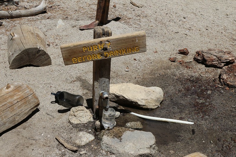
Eventually, we put our boots back on and continued down the trail to Round Valley. We wanted to see what the Spring looked like, since we’d heard about it being dry, about it working just fine, and also about it spurting water intermittently. The data from the Internet was useless, in other words. And that was why I carried an extra gallon of water the first day. But it turns out that I shouldn’t have bothered. It was running slow and steady, and the vandalism was that someone had finally torn off that extra piece of tubing that had been stealing the water away from the area. It was about time someone had the courage to remove that thing, or so I felt. At least now 99.9% of the water was sinking directly back into the water table right here near the spring. Maybe it would keep flowing longer this year. We can only hope.
Video of the Round Valley Spring flowing slowly but steadily
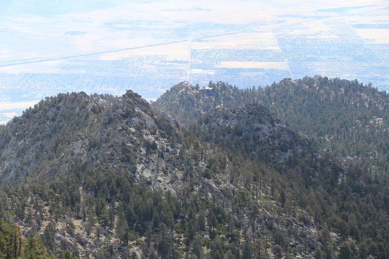
After that, it was merely a matter of hiking two more miles or so to the Tram. We’d been on this trail so many times that it barely registered in our memories, and I didn’t take very many pictures (since I’d already taken them in prior years). But this time we stopped for a photo-op when we came upon a good view of Yale Peak from below. And even Harvard Peak managed to peer down over Yale’s shoulder at us.
We stopped by the Long Valley Ranger Station on our way to the tram and handed in our camping permit. Technically, we had one night left on it, but we weren’t going to use it. Then we climbed the long cement path to the upper tram station. When we got there, they were announcing that the next tram down would leave in five minutes, which was just about perfect.
We talked with some of the other visitors, and they all wanted to know what we’d been doing up there with those big backpacks. So we told them, of course, but mostly about Round Valley being a great place to take a novice backpacker. We didn’t want to mention all that off-trail hiking we were doing. This was a bit too advanced.
And then, before we knew it, our ears were popping as the tram descended. The heat kept increasing, and we knew that it was over 100 degrees down there in the desert that day. And then we got out of the tram and headed down to the car, which was roasting in the sun. I opened the doors and turned on the AC. Then we changed out our shoes and socks and threw all the gear in the car. Next stop: Burgers and cold drinks in town. And that’s why we also love returning to civilization.
While we ate, we talked about the trip. This was our “shakedown” trip, after all. And it turned out that most everything was OK. We had a few items to repair, like zippers and velcro, and a couple of accessories to replace, but all in all, we were ready to get serious about some excellent backpacking opportunities this Summer.
For more photos and videos of our hike check out my Flickr Page
For a topographic map showing our GPS track see my Caltopo Page
